
Last week, I had the opportunity to go camping in Pennsylvania. It was a ton of fun, hanging out with my adult siblings, camping in the wilderness, and hiking mountains I’ve never even seen before. Our first hike was the Golden Eagle Trail in Tiadaghton State Forest. It’s the premier hike in the area, and for good reason. There are some steep climbs, but the views from the Raven’s Horn and a few other viewpoints are quite good. And the hike along Wolf Run is nothing short of idyllic. So if you’re in the area and are up to a 10.4 mile hike, go for it!
Quick Stats
(Affiliate links are present on this page.)
We were apparently the only hikers on the Golden Eagle Trail on a Friday in mid-August. At least, we didn’t see a single other person the entire time we were hiking – which I was not expecting. The trailhead shares the parking area with the Clark Farm Utceter Station and the Pine Creek Rail Trail (which seems to always be busy with hikers and cyclists).

The trail begins by climbing what appears to be an old road above Bonnel Run. The run didn’t have much water in it in mid-August, but the forest was still lush.

After 0.4 miles, reach the Golden Eagle Trail, though with no signs, you’d never know it (only one of the junctions is signed on this trail, but it’s usually not hard to tell where you are). Here you can turn left or right. Left will take you through the “boring” part first with the trail being moderate up, very steep up, moderate up, moderate down, steep up, steep down, moderate down. Right has more of the interesting things first and goes moderate up, steep up, steep down, moderate up, moderate down, very steep down, moderate down. I went right, and I’m not sorry I did – for one thing, the view from the Raven’s Horn was good in the morning, and for another thing, I got to see the interesting things earlier in the day when I was still fresh. Besides, climbing Wolf Run was more fun than I think it would be to climb down. But it’s obvious that most people go left.

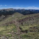
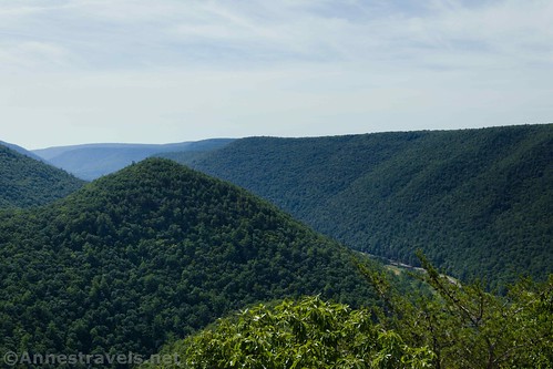
Turning right, the trail climbs steeply enough through the forest with occasional peek-a-boo views through the trees. Then the trail climbs more steeply to crest a part of the hill about mile 1.6. The trail turns steeply downhill to a viewpoint on left 0.1 miles later. It’s worth seeing; the view is mostly up the Wolf Run drainage.

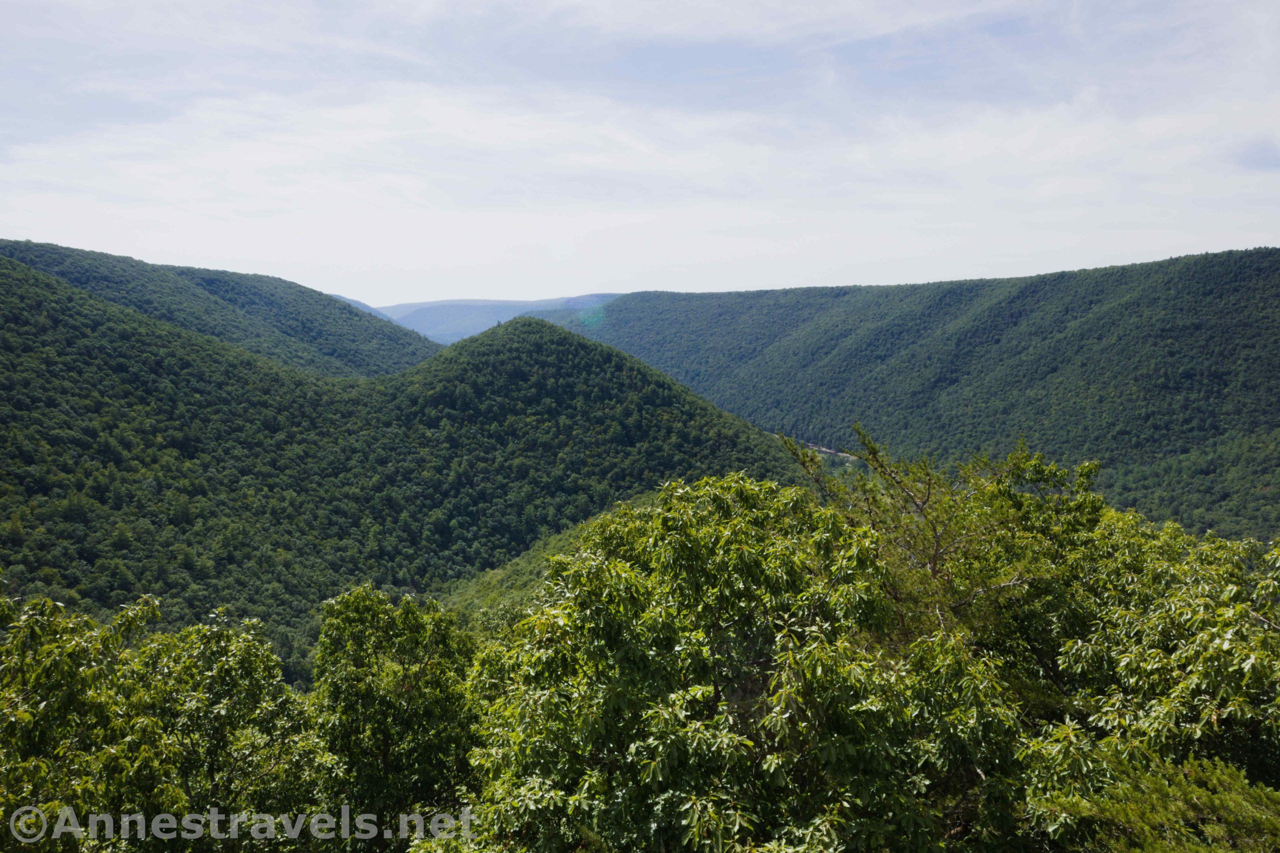
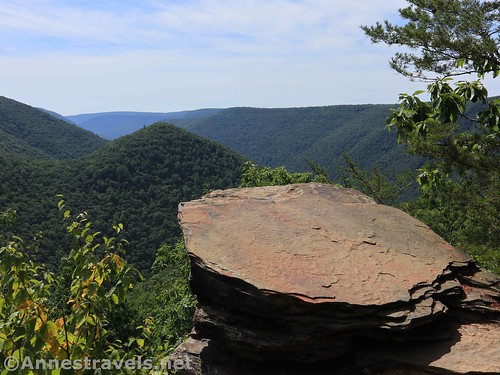
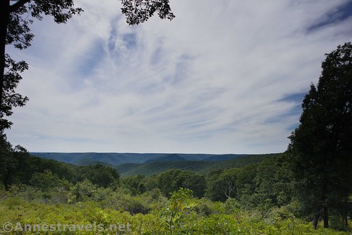
The Raven’s Horn is about a quarter mile beyond this viewpoint. This is the premier view on the hike, and I can see why. You can see Pine Creek, and there’s a cool little hill right in front of the viewpoint. The Raven’s Horn, itself, is a rock at the viewpoint. Be careful; I hear that rattlesnakes like to sun themselves here. We didn’t see any.
The trail beyond the Raven’s Horn continues to descend at an alarming rate. It finally stops its plunge when it meets the Wolf Run Trail. Turn left up the trail along Wolf Run.

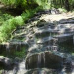
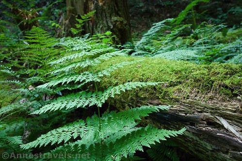
In mid-August, Wolf Run was more or less dry. It would be a lovely stream to walk beside (and occasionally cross) in the right season. As it was, it was still pretty idyllic, with lots of greenery and rock ledges.
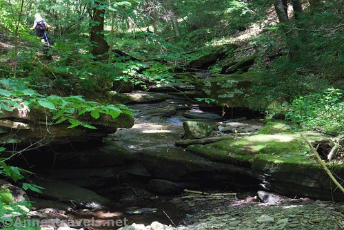
There were also a few small waterfalls, mostly water dripping down mossy ledges into little pools. These are likely from springs along the stream.

About 5 miles from the trailhead, Wolf Run begins to become more bed than stream and finally is just the low point of the valley. The trail climbs slightly more steeply up through the forest up to a junction to a viewpoint on left at almost mile 5.6. Views here extend out to the ridgeline across the valley. We were able to get a very weak Verizon signal here, but no Sprint.

About a half a mile beyond the viewpoint, the trail comes out on a grassy road. Turn right to walk down the grassy road almost 0.2 miles to the Beulahland Vista (it has a sign, gasp!) This is the secondary premier viewpoint on the hike. It’s mostly just fields and some hills – I didn’t think it compared very well to the Raven’s Horn, but it was quaint.

Keep walking down the road to where it splits at mile 6.5. Take a hard left turn; the (signed) Bonnel Run Vista is less than 0.05 miles later. A quarter mile beyond this vista, a trail crosses the road. There are signs here; you want to turn left on the trail marked, “The Saddle. G.E.T. to Bonnel Run.” (G.E.T. stands for Golden Eagle Trail and seems to be the local name for the path.)
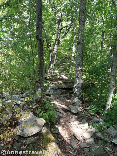
From here, the trail seems to fall off the edge of a cliff. It’s not that you can’t find the trail; it’s pretty easy to see where it goes. But you feel like you’re hiking down a cliff. The steepness reminded several of us of hiking the Face Trail outside of Grand Teton National Park. At the time I estimated we’d dropped about 300 feet in 0.3 miles.
But after those 0.3 miles, the trail evens out to a nice enough downward trek. It follows Bonnel Creek – which was even dryer than Wolf Run. The creek itself is much less interesting than Wolf Run, too, and apparently often doesn’t have water in it since the trail crosses it multiple times and even uses the streambed as the trail in places. So this is not exactly an exciting part of the trail.

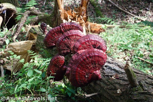
Still, we saw almost all of the wildlife we noted along the trail in the Bonnel Run drainage. My sister was stung by a yellowjacket, my brothers saw a bear, and we all watched a porcupine climb a tree. Not bad for wildlife!

We reached the end of the loop part of the hike at exactly 10.0 miles, turned right, and descended back down to the trailhead at exactly 10.4 miles.
Overall, the Golden Eagle Trail has very little in comparison to much of the views in the western US. In fact, parts of it reminded us of hiking the Cabinet Mountains Wilderness last summer, only without the streams and lakes. But for the eastern US, it’s a great long-ish trail with some good views and enough interest along the way to make it well worth the hike!
Round Trip Trail Length: 10.4 miles
Elevation Gain: 2,880ft. (721ft. to 2,170ft.)
Facilities: None. The closest bathrooms are north up the road at the Black Walnut Campground.
Fees: None
Trail Notes: Keep your eyes open for rattlesnakes. Hunting is allowed in the fall. Camping is not allowed along the trail. The streams would be best after some rain or in the spring. Although much of the trail was in damp environments, I didn’t see any poison ivy. The trail was named after a (rare for the area) Golden Eagle the surveyors saw while scouting the route.

Trail 
![]()
![]()
Road ![]()
Signs ![]()
![]()
![]()
Scenery ![]()
Would I go 100 miles out of my way for this? ![]()
Overall Rating: 
![]()

GPS Coordinates for the Golden Eagle Trail
Golden Eagle Trailhead: 41.4390500°, -077.5102667° (N41° 26.343′ W77° 30.616′ / 41°26’20.5800″, -077°30’36.9600″) (765ft. or 828ft.) (0.0) (end 10.40)
Golden Eagle Trail Junction: 41.4440000°, -077.5073500° (N41° 26.640′ W77° 30.441′ / 41°26’38.4000″, -077°30’26.4600″) (924ft. or 998ft.) (0.43) (return 10.00)
Top of the hill: 41.4401500°, -077.4956167° (N41° 26.409′ W77° 29.737′ / 41°26’24.5400″, -077°29’44.2200″) (1,774ft.) (1.64)
Junction to the viewpoint: 41.4386167°, -077.4950167° (N41° 26.317′ W77° 29.701′ / 41°26’19.0200″, -077°29’42.0600″) (1,631ft.) (1.77)
Viewpoint: 41.4387167°, -077.4948500° (N41° 26.323′ W77° 29.691′ / 41°26’19.3800″, -077°29’41.4600″) (1,619ft.) (1.80)

Raven’s Horn: 41.4379500°, -077.4948500° (N41° 26.277′ W77° 29.691′ / 41°26’16.6200″, -077°29’41.4600″) (1,600ft.) (1.89)
Trail Junction (turn left up Wolf Run): 41.4343000°, -077.4913667° (N41° 26.058′ W77° 29.482′ / 41°26’03.4800″, -077°29’28.9200″) (936ft.) (2.55)
Viewpoint junction: 41.4630000°, -077.4736333° (N41° 27.780′ W77° 28.418′ / 41°27’46.8000″, -077°28’25.0799″) (2,028ft.) (5.58)
Viewpoint: 41.4630833°, -077.4736833° (N41° 27.785′ W77° 28.421′ / 41°27’47.1000″, -077°28’25.2600″) (2,029ft.) (5.59)
Trail meets grassy road: 41.4687833°, -077.4743667° (N41° 28.127′ W77° 28.462′ / 41°28’07.6200″, -077°28’27.7200″) (2,195ft.) (6.12)

Beulahland Vista: 41.4704833°, -077.4723000° (N41° 28.229′ W77° 28.338′ / 41°28’13.7400″, -077°28’20.2800″) (2,205ft.) (6.29)
Grassy road split (turn left): 41.4729500°, -077.4733500° (N41° 28.377′ W77° 28.401′ / 41°28’22.6200″, -077°28’24.0600″) (2,168ft.) (6.51)
Bonnel Run Vista: 41.4729000°, -077.4738667° (N41° 28.374′ W77° 28.432′ / 41°28’22.4400″, -077°28’25.9200″) (2,159ft.) (6.54)
Leave the grassy road: 41.4741667°, -077.4776000° (N41° 28.450′ W77° 28.656′ / 41°28’27.0000″, -077°28’39.3600″) (2,038ft.) (6.78)

The gpx file for the Golden Eagle Trail can be downloaded – please note that this and the GPS Coordinates are for reference only and should not be used as a sole resource when hiking this trail.
Download GPX File size: 160.6 KB Downloaded 554 times
(Note: I do my best to ensure that all downloads, the webpage, etc. are virus-free and accurate; however, I cannot be held responsible for any damage that might result, including but not limited to loss of data, damages to hardware, harm to users, from use of files, information, etc. from this website. Thanks!)

Getting to the Golden Eagle Trailhead
From the north, from Wellsboro, PA, drive south on PA-287S (aka Central Avenue). After 11.7 miles, take a sharp right to stay on PA-287S and begin driving on State Route 414W. About 0.6 miles later, turn right onto State Route 414W for 18.6 miles. Park at the Clark Farm Boat Launch (on right) and then cross the road to the G.E.T. Trailhead.

From the south, from Williamsport, PA, drive west on US-220S for about 15 miles. Take Exit 120 for PA-44N toward Pine Creek; turn right onto PA-44N at the bottom of the exit ramp. After 12.3 miles, take a slight right onto State Route 414E. Drive 11.5 miles. Park at the Clark Farm Boat Launch (on left) and then cross the road to the G.E.T. Trailhead.

This Week’s Featured Product!
For more hikes in central Pennsylvania, check out this book. With 50 hikes to choose from, it’s a great resource if you’re planning to be in the area.