

Today I’d like to share with you a truly delightful bike trail in northwestern Pennsylvania: The Trail around Presque Isle just north of the city of Erie. You can customize your route a bit, but by going around most of the island, I did about 14 miles. There are plenty of ways to make it shorter while still seeing what the trail has to offer: Views of the waterfront in Presque Isle Bay/Erie, PA, the Commodore Perry Monument, beaches, Lake Erie, marshes and wildflowers, and the Presque Isle Lighthouse, among others. While I found it most alluring in the late afternoon/evening (sunset over Lake Erie, anyone?) it’s a great place for a hike, bike, rollerblade, stroll, or whatever other non-motorized recreation you want to use today!
Quick Stats
Note: Some of the links in this post are affiliate links. If you click one and purchase something, I may earn a small commission without an extra cost to you.

On our first visit, we stopped by Presque Isle en route to Cuyahoga Valley National Park, so we didn’t start until about 5pm on an August afternoon. That gave us time to bike around the island just about before dark (or it would have been about right if we hadn’t missed our turn, sat for far too long watching the sunset, etc.) We parked a short distance from the visitor center (there are multiple parking areas along the road; you just have to find one close to where you want to start).

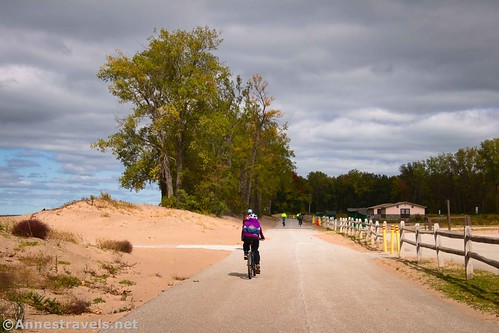
On our second visit, we parked at the first parking area we could find on a moody mid-day in October. We then proceeded to bike the “wrong” way around the loop (clockwise) – all of the arrows pointed the other direction, which gave us some pause on a section of one-way road when we were riding the wrong way!
But given the 20mph winds on our second visit, we wanted as much shelter as possible while biking into the wind. The northern/western side of the island is more protected by trees along the trail, so it only made sense to be going into the wind when we were in the shelter of the trees. (Typically, weather comes from the west, but for whatever reason, the wind was strongly from the east that day.)

Given the direction of the arrows on the path, I’ll tell about our ride as though we were traveling the correct way (counter-clockwise) around the peninsula that is Presque Isle State Park. A late-season bike ride in October on a cloudy early afternoon made the clockwise choice just fine, but on a busy weekend in the summer, you’ll probably want to go with the direction of traffic, aka counter-clockwise.

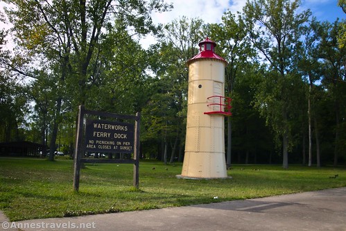
So therefore, starting just beyond the ranger station, we passed the Niagara Boat Launch and then came to the ferry dock after only 0.4 miles. They say a water taxi docks here from time to time, but I didn’t see any evidence of it.
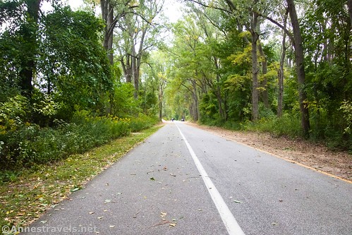
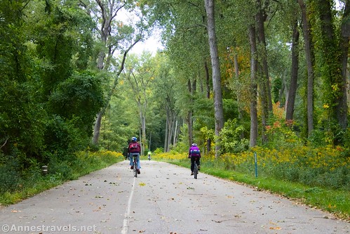
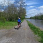
We continued up to a fishing area (“East Pier”) 2 miles further up the coast. The trail in this section is paved, separated from the roadway, and mostly easy to ride – some roots made it bumpy at times, but you should still be able to rollerblade on it if you want to.

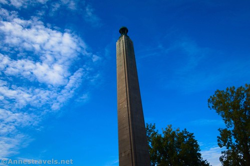
After East Pier, the trail follows its own trail up to the Perry Monument about 1.6 miles beyond the pier. The Perry Monument is well worth seeing.
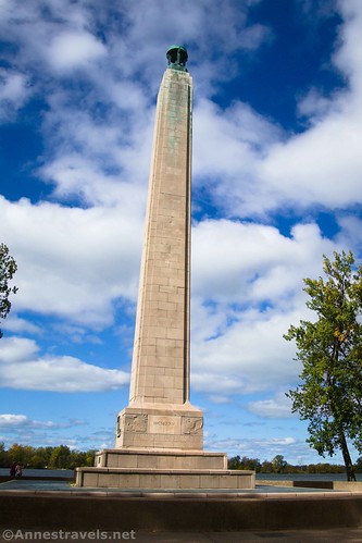
So are the views of the bay from near the monument.

Bike rentals are available near the monument, so chances are you’ll see more bikes in this section. There are also boat tours, restrooms, and more.
The monument honors Commodore Perry (full name: Commodore Oliver Hazard Perry), who was instrumental in capturing a British battleship near here during the War of 1812. It’s pretty peaceful now. Apparently, the top of the tower once had a beacon, but the flame has been out for many years.
The trail follows the road at this point to cross over a bridge and then circle Misery Bay. (Maybe I don’t want to know how it received its name?)

You’re in a wilder part of the island here, and it’s very nice. My only complaint is that you’re in a wide bike lane along the road instead of on a separate bike path. Keep a wary eye out for vehicles, but since there’s a low speed limit and most traffic seems to understand that there are cyclists around, it’s not as difficult to stay safe as it might be.

Also, keep your eyes open for the resident turkeys who are probably feeding between the road and the nearby swamps.

We turned right on a road that said it would take us out to the Coast Guard Station and the North Pier. I don’t really recommend it; for one thing, it’s not that exciting, and for another, there’s no bike trail – just a narrow road. If you do decide take the spur, you can ride 1 mile out through the woods, along a bay with houseboats, and finally to the “pier” and a lighthouse typical of many piers in the Great Lakes (in other words, not that exciting).
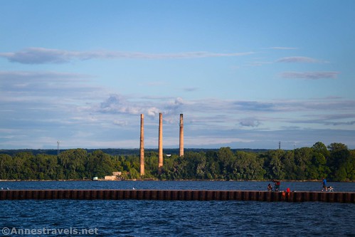
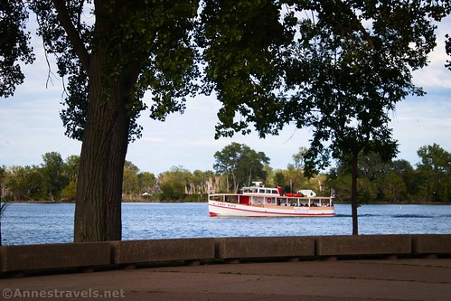
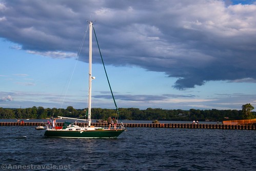
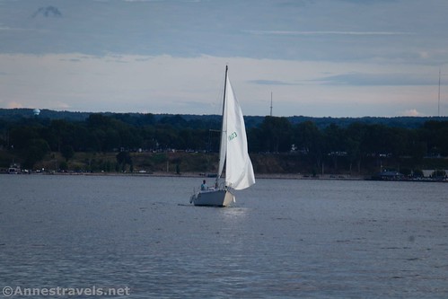
It looks good for fishing, and it was fun to watch the boats coming in on a Sunday evening.
The trail/road (mostly a very large bike lane) beyond the spur to the “lighthouse” was pretty quiet and peaceful. There isn’t much to see besides a few beach accesses and low coastal forest, with occasional views out to Lake Erie.

A road or two go off, but it’s not hard to figure out how to stay on the bike lane.

The next point of interest is the Presque Isle Lighthouse about 3.75 miles beyond the Perry Monument.
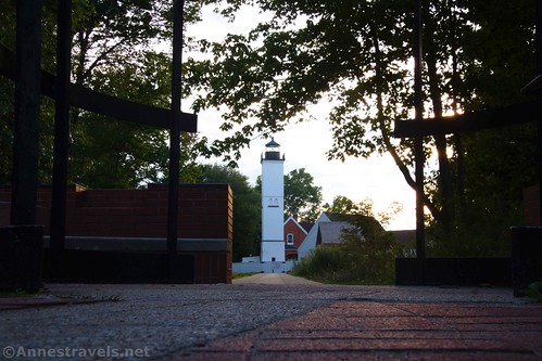
Signs describe the lighthouse and its history; some days you can go up the tower for a small fee. It was well beyond the time of closing, so we stayed outside the gate and took pictures on our first visit.

But on our second visit, the lighthouse grounds were open and free to walk around. We enjoyed seeing the outside of the structure.

A few signs explain the history of the lighthouse, but if you want to learn more, you’ll have to take the tour. Tickets are available in the gift shop which is just that – a gift shop. However, I was able to pick up a nice map of Presque Isle for free, and that turned out to be quite useful.

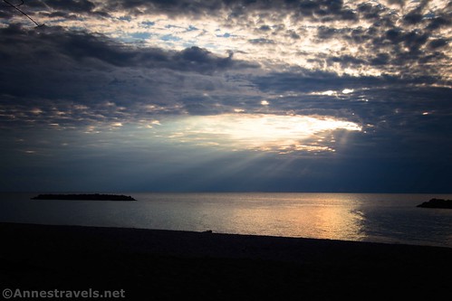
But back to our first visit, we continued on along the northern side of Presque Isle. The light was fading, so we stopped somewhere near Beach 8 to watch the sunset. The trail in this section alternates between being a trail separate from the road and an old road, with occasional stretches of the trail on top of the dunes.

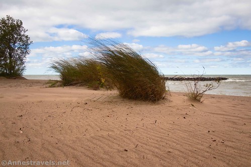
This part of the trail is quite nice with plenty of access to the beaches and occasional views. The area along Beach 8 is a trail section with especially good views down to Lake Erie.
The beach is rocky – other beaches are sandier (probably not naturally, but since people do swim when the beaches are open, I can’t blame them for wanting sand).
The sun over Lake Erie was beautiful.

By this time, it was getting dark, so we continued on our way. Unfortunately, we missed our turn and went all the way down to the Barracks Beach parking lot (between the two roads). From there, we went up to a parking area/boat launch where I tried my hand at some night photography (mostly with unsatisfactory results).
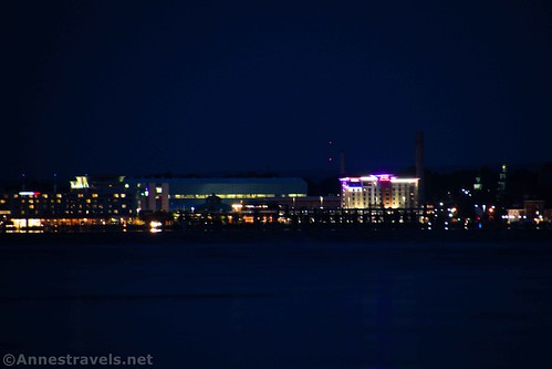
From there, it was a very dark ride behind the ranger station and then back to our van! I’m pretty sure the park ranger vehicle was watching us leave so they could close the gates, but it was a fantastic start to our trip and such a beautiful place to ride our bikes!

The only deviations from this route (besides doing it backward!) on our second visit were 1) we didn’t take the spur out to the Coast Guard Station, 2) we started at the very first parking area, and 3) we did the entire trail instead of taking a crossover at Barracks Beach. At the end of the day, my GPS said 14.25 miles, a group member’s bike odometer said 14.5 miles, and my GPS track on the computer is reading 13.8 miles (which is closer to what the official literature says!)
However long it is in reality, it’s a fantastic, mostly-flat ride that I’d do again in a heartbeat. In fact, it’s probably one of my favorite bike trails I’ve ridden in a very long time.
Round Trip Trail Length: 14.25 mile loop. Shorter options exist; see an official park map.
Elevation Gain: 256ft. (571ft. to 586ft.)
Facilities: Occasional restrooms, a few water spigots/drinking fountains, information center at the lighthouse, bike/kayak rentals, etc.
Fees: None unless you want to tour the lighthouse at $8/person for a 20 minute tour; must be 44” to climb the tower.

Trail Notes: There isn’t much in the way of a grade except when you go up and down off of the dunes and across a couple of bridges (in other words, not much to worry about). The entire path is paved. A few hiker-only trails cut through the marshes on the island, but since I was riding a bicycle, I didn’t check them out. The fall colors were just coming out on our second trip, making the entire island even more beautiful than it usually is.
Trail 
Road ![]()
Signs ![]()
Scenery ![]()
Would I go 100 miles out of my way for this?
Overall Rating: 

GPS Coordinates for Presque Isle
Beginning/end of 2nd ride (first parking area in the park): 42.1196353, -80.1492626 (42°07.17812′, -080°08.95576′ / 42°07’10.6871″, -080°08’57.3454″) (575ft.) (0.0/14.25)
Beginning of the 1st ride: 42.143251, -80.134314 (42°08.59506′, -080°08.05884′ / 42°08’35.7036″, -080°08’03.5304″) (576ft.) (0.0)
Ferry dock: 42.147707, -80.129677 (42°08.86242′, -080°07.78062′ / 42°08’51.7452″, -080°07’46.8372″) (573ft.) (0.4)

Fishing area: 42.152927, -80.110730 (42°09.17562′, -080°06.64380′ / 42°09’10.5372″, -080°06’38.6280″) (576ft.) (2.4)
Perry Monument: 42.154902, -80.089495 (42°09.29412′, -080°05.36970′ / 42°09’17.6472″, -080°05’22.1820″) (576ft.) (3.58)
Lighthouse: 42.165797, -80.114649 (42°09.94782′, -080°06.87894′ / 42°09’56.8692″, -080°06’52.7364″) (580ft.) (9.32)
End: 42.143184, -80.134544 (42°08.59104′, -080°08.07264′ / 42°08’35.4624″, -080°08’04.3584″) (575ft.) (14.66)

The gpx file for Presque Isle can be downloaded – please note that this and the GPS Coordinates are for reference only and should not be used as a sole resource when hiking this trail.
Download GPX File size: 100.2 KB Downloaded 417 times
(Note: I do my best to ensure that all downloads, the webpage, etc. are virus-free and accurate; however, I cannot be held responsible for any damage that might result, including but not limited to loss of data, damages to hardware, harm to users, from use of files, information, etc. from this website. Thanks!)

Getting to Presque Isle
From I-90, take Exit 22 onto I-79 North. After 6 miles, turn left onto Lincoln Avenue; take another left 0.2 miles later onto PA-5 Alt (W 8th Street). Drive 1.5 miles. Turn right onto PA-832N (Peninsula Drive). You’ll go down a hill and through a bit of a built-up-with-restaurants area just as you get onto Presque Isle (including driving underneath a roller coaster that spans the road). Continue on the road to whatever parking area you want to use to begin your ride.
Note: GPSes have multiple ways to get you to Presque Isle from the interstates. You’re welcome to follow those directions instead of these.

This Week’s Featured Product!
If you need inspiration for bike rides in Pennsylvania, look no further than this book about the rails to trails throughout the state! Seventy-two trails make their mark in this guide and offer so many options for exploring the Keystone State. Buy your copy here.

More Related Posts:
 Great Allegheny Passage: Salisbury Viaduct to the Mason-Dixon Line
 Genesee Riverway – Ontario Beach Park, Turning Point Park, & Maplewood Park
 Erie Canal: Meridian Center (Rochester) to San Souci Park (Brockport)
 The Big Bend Road in Letchworth
 The Overlook in Colton Point State Park
 Coyote Rocks Loop