
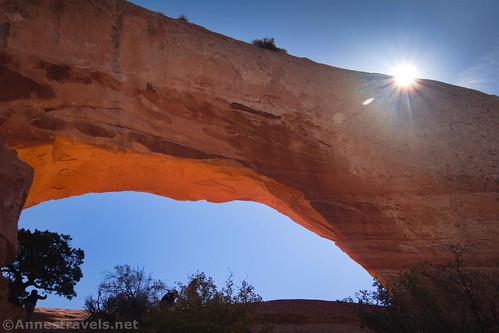
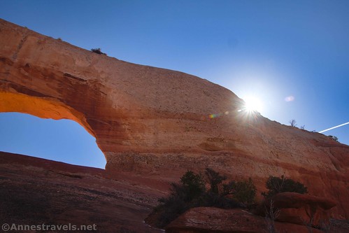
Who hasn’t seen Wilson Arch while driving US-191 south of Moab? You go through a slickrock canyon and then, bam! There’s the arch high up on the cliffs right beside the highway.
Quick Stats
Note: Some of the links in this post are affiliate links. If you click one and purchase something, I may earn a small commission without an extra cost to you.
To be honest, I’ve driven by it any number of times without stopping. (In the mid-2000s, I had a propensity for visiting Canyon Rims Recreation Area and the Needles District of Canyonlands.) But when one of my photographer friends posted about it on social media, I decided it was time correct that situation.
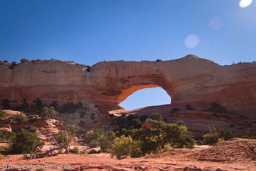
We pulled up to Wilson Arch about noon on a warm autumn afternoon, having successfully negotiated internet and grocery shopping in Moab, and en route to Miner Overlook and Anticline Overlook in Canyon Rims Recreation Area. (Some things don’t change, even with time…) The pullout on the arch side of the highway (left side if coming from Moab and right if heading for Moab) had plenty of space, so we took a parking place and headed for the arch.
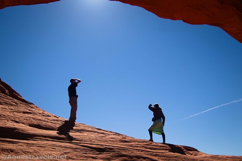
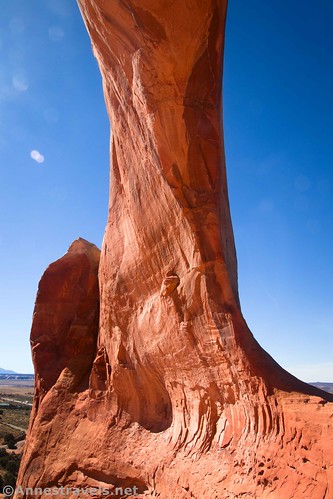
Several social trails zigzag through the area. I went pretty much straight up – which is the best way to get into the arch. It’s a Class 2 scramble most of the way with a Class 3 move near the arch, itself. (In case you’re not familiar with my scramble difficulty rating system, a Class 2 scramble means there’s no trail but you can stay upright on your own two feet. Class 3 means that you’ll be using both hands and feet for scrambling. Class 4 means you’d rather have a rope, but it’s not an absolute necessity, and Class 5 means it’s a technical rock climbing route with ropes required.)
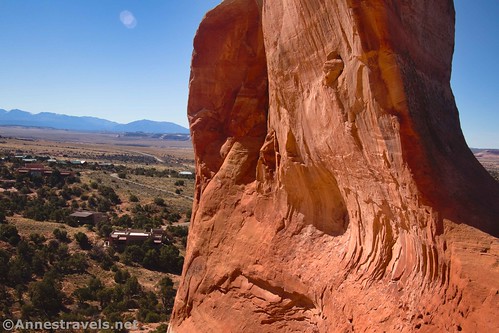
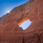
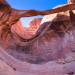
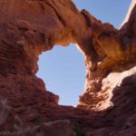
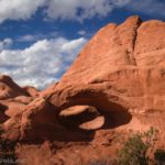
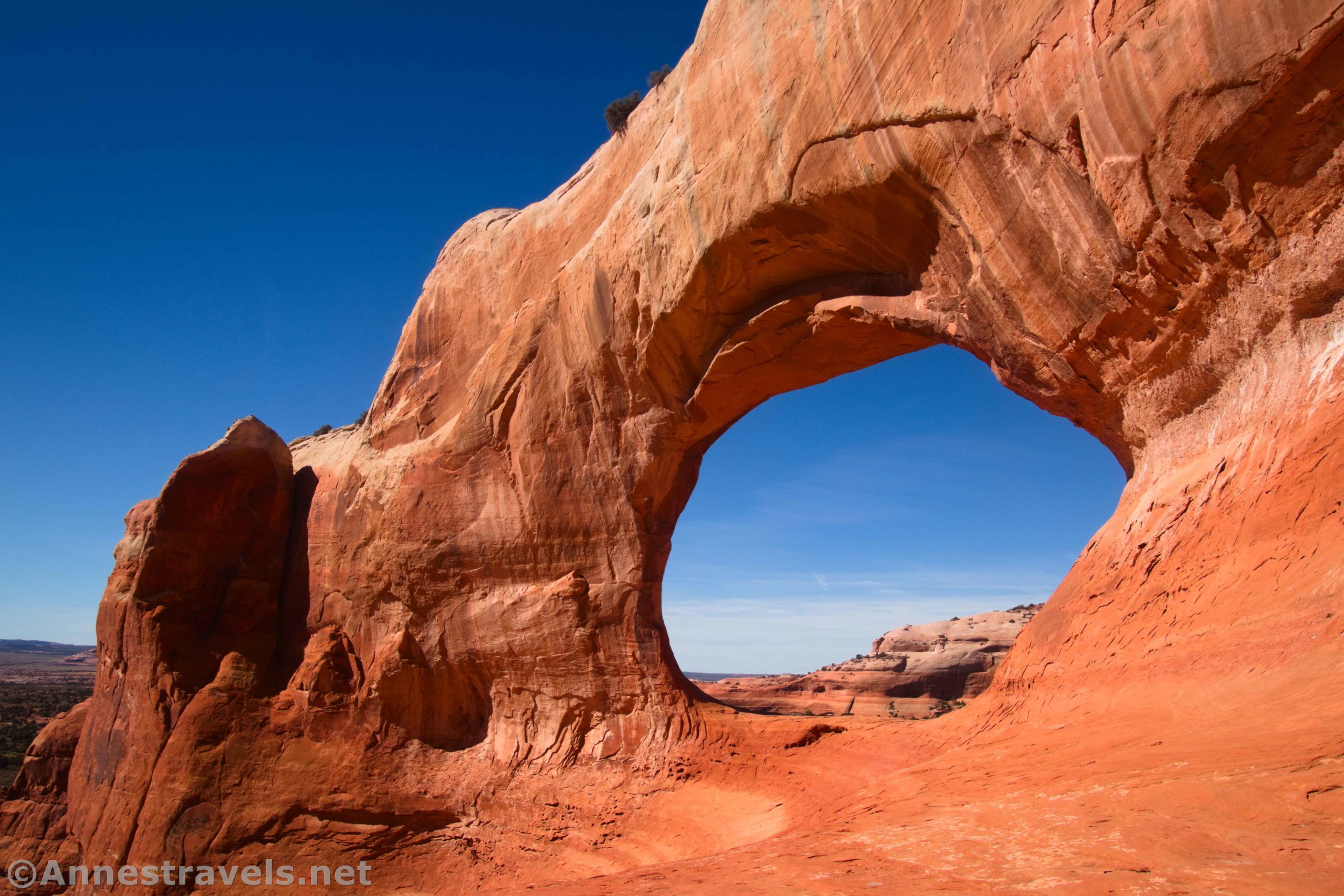
Views from the arch are both very nice and sort of sad. A housing development has gone in right behind the arch, but the views up the road toward Moab are sort of cool.

I scrambled around a bit and found that there was no easy (possibly no possible) route around to the back of the arch. So instead, we went straight through the arch to view it from the back. There was one somewhat sketchy part just after passing through the opening; otherwise, it was pretty easy (I was wearing sandals, not hiking boots).

We scrambled back down to the van, pulled out lunch, and continued on our way. It wasn’t a long stop (I’m sure we stayed longer than necessary, but we were having fun). It’s a great little break if you happen to be on your way along US-191!

Round Trip Trail Length: By scrambling up to the arch and back, I went 0.3 miles
Elevation Gain: 186ft. (6,058ft. to 6,196ft.)
Facilities: None
Fees: None
Trail Notes: There is no trail. You’re just scrambling up the well-trodden hillside with dirt and slickrock. There is no need to leave the parking area to see the arch unless you want to. Use care scrambling; you don’t really want to fall. The arch was named for Joe Wilson, a pioneer/rancher who had a cabin nearby. The arch is quite popular, especially during busy times of the year. I expect the arch is best lit in the afternoon.
Trail 
![]()
![]()
![]()
Road
Signs ![]()
![]()
![]()
![]()
Scenery ![]()
Would I go 100 miles out of my way for this? ![]()
Overall Rating: ![]()
![]()

GPS Coordinates for Wilson Arch
Trailhead/parking area: 38.2732440°, -109.3724850° (38°16.39464′, -109°22.34910′ / 38°16’23.6784″, -109°22’20.9460″) (6,080ft.) (0.0)
Wilson Arch: 38.2727840°, -109.3712560° (38°16.36704′, -109°22.27536′ / 38°16’22.0224″, -109°22’16.5216″) (6,232ft.) (0.12)
End: 38.2733440°, -109.3724370° (38°16.40064′, -109°22.34622′ / 38°16’24.0384″, -109°22’20.7732″) (6,079ft.) (0.31)
The gpx file for Wilson Arch can be downloaded – please note that this and the GPS Coordinates are for reference only and should not be used as a sole resource when hiking this trail.
Download GPX File size: 9.6 KB Downloaded 534 times
(Note: I do my best to ensure that all downloads, the webpage, etc. are virus-free and accurate; however, I cannot be held responsible for any damage that might result, including but not limited to loss of data, damages to hardware, harm to users, from use of files, information, etc. from this website. Thanks!)
Getting to Wilson Arch
From Moab, Utah, drive south on US-191S. The arch is on the left just after a slickrock cutting about 25 miles south of town. It’s also 3.2 miles south of where UT-46 goes off to the east. Pulloffs allow for parking off of the road.

From Monticello, Utah, drive north on US-191N. The arch is on the right about 28 miles north of town (14.3 miles north of where UT-211 goes off for the Needles District). Pulloffs allow for parking off of the road.

This Week’s Featured Product
Looking for more easy-to-access hikes and features around Moab? You’ll love this book! It covers 30 trails in the local national parks and on BLM/National Forest land, with arches, waterfalls, rock formations, vistas, and so much more. Buy your copy here!