
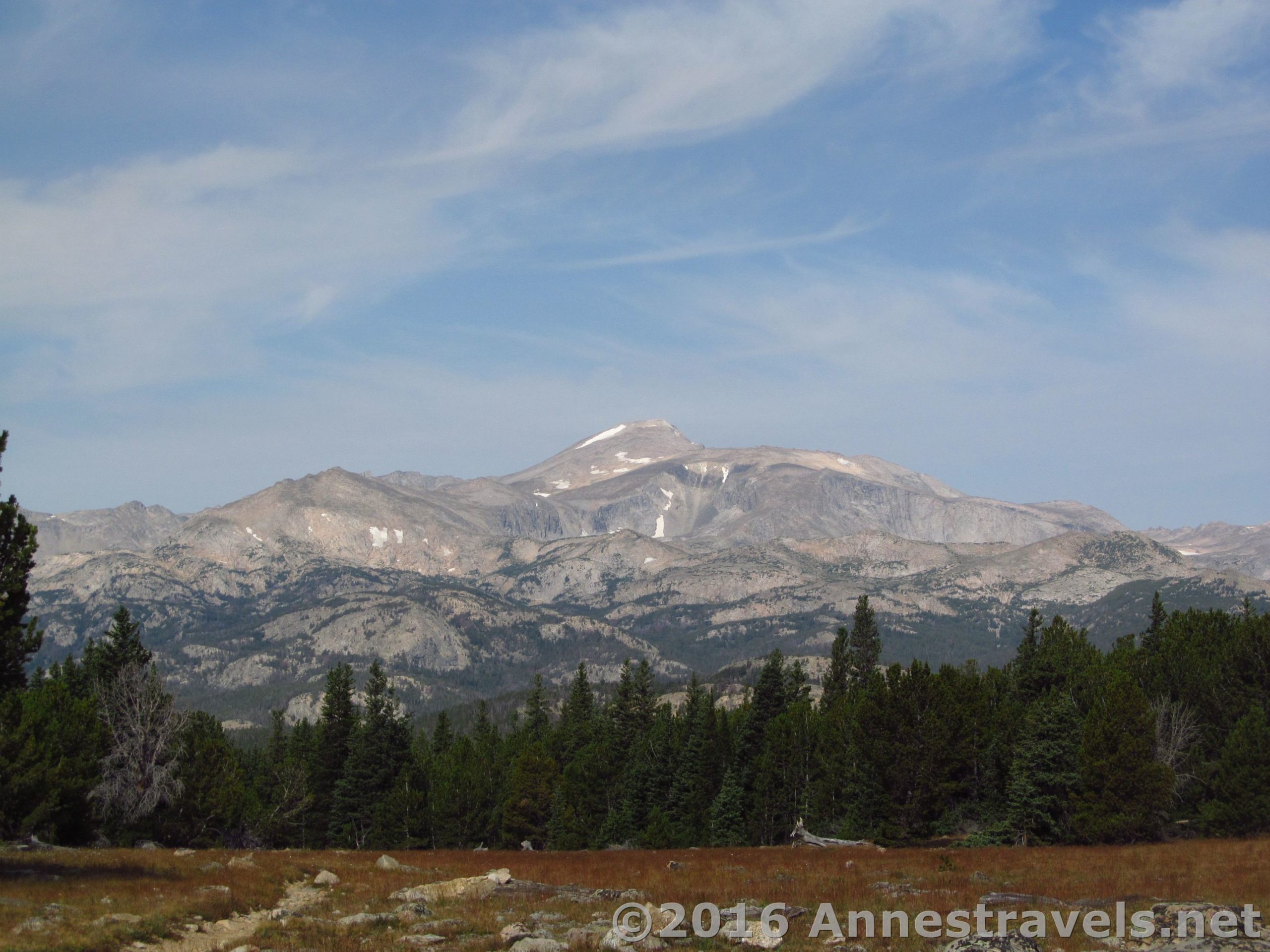
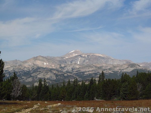
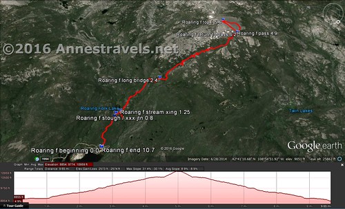
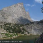
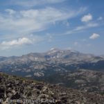
Stough Creek Pass, in the far south of the Wind River Range of Wyoming, is only known because it’s en route to the more famous Stough Creek Lake Basin. But the pass is certainly beautiful enough to be a destination unto its own: From this high point of the trail, Wind River Peak takes center stage, rising majestically over the peaceful basin below. It also happens to be (what I’d consider) one of the easier trails to dayhike in the Wind Rivers, and you can always scramble up Roaring Fork Mountain if you want to extend the trail a bit (and improve the view). As it is, it’s 9.1 miles RT to the pass with reasonable elevation gain and rewarding views. Need I say more?
Quick Stats
(Affiliate links are present on this page.)
We made the mistake of following our GPS to the trailhead – Louis Lake Road just west of South Pass City (mile upon mile of narrow, bumpy, twisting dirt roads) – instead of coming in from Lander (mostly a good, paved road). Still, we got to the trailhead in time to bunk down for the night, then made an early start in the morning. The trailhead is near the Worthen Meadow Reservoir, and there’s a nice campground and picnic area. I won’t say that after the heat of the hike we didn’t enjoy a quick dip in the very chilly reservoir 🙂

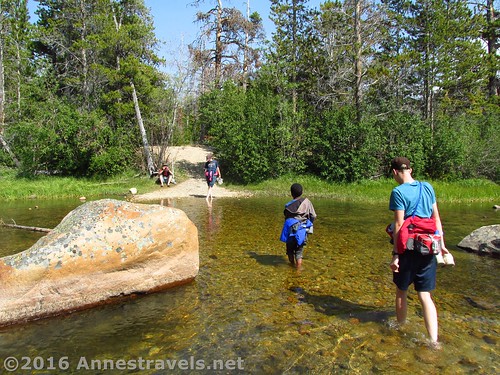
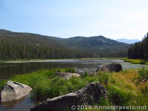
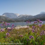
At any rate, the trail begins from the Worthington Meadows Reservoir trailhead (be sure to take the Stough Creek Basin Trailhead (uphill) not the Sheeps Bridge Trailhead (downhill near the restrooms and trailhead parking)). It immediately begins a slow ascent through the trees along what is obviously an old 4×4 road (no longer in use). Enter the Popo Agie Wilderness at 0.7 miles, then come to Roaring Fork Lake at 0.8 miles. As soon as the lake comes into view, turn right down to an unmarked stream crossing at the outlet of the lake. Cross here. The crossing wasn’t bad at all, except for being a bit cold (and a little rough on us tender-toes!). In mid-August, it was only halfway up to my knees and nowhere near as cold as most mountain lakes! And a 7am, that was really appreciated!
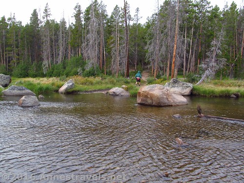
Technically, you could also walk downstream for about 0.25 miles to a beaver dam-like set of sticks over the stream and cross here, then come back upriver to the trail.
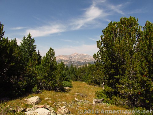
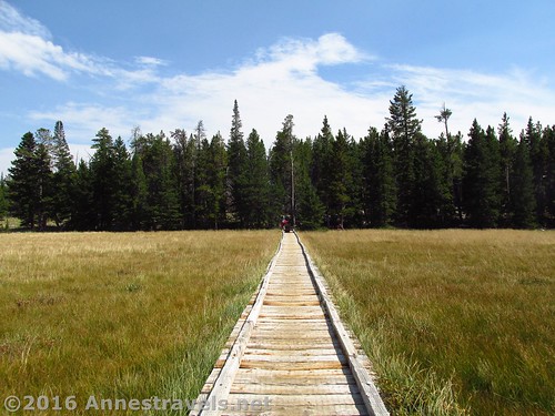
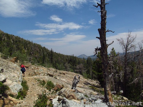
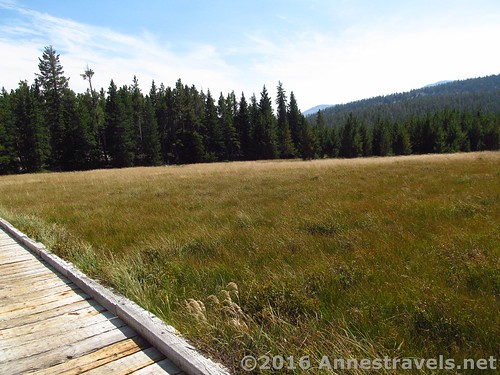
On the other side of the river, the trail begins to climb in earnest, but soon flattens out again. The trail was obviously made for horses, with bridges over the small streams and a long boardwalk at 2.1 miles. The trail is also gains elevation fairly slowly, making it much easier than the Teton hikes, where the trails seem to take pleasure in going straight up for miles on end! There was also plenty of evidence of horses, and we did meet a couple horse-parties along the way.
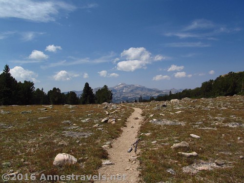
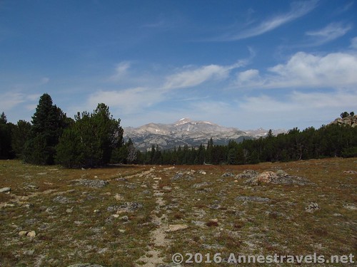
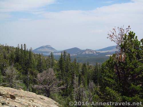
Finally, at 4.5 miles, the trail suddenly enters a meadow in the Stough Creek Saddle. All I could say when I entered it was, “Wow!!!” There has been almost no view up to this point, and suddenly, right ahead in all its splendor, is Wind River Peak. The view from here is totally spectacular, so it makes a good turn around point if you like trails or simply don’t want to go further.
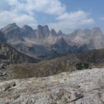
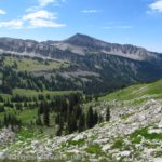
But of course, being me, I did want to go further – up Roaring Fork Mountain.
But that’s a post unto itself – so hang in there until next week!
Round Trip Length: 9.2 miles
Lowest Elevation (trailhead): 8,822 ft.
Highest Elevation (pass): 10,540 ft.
Net Elevation Change: 1,718 ft.
Facilities: Horse corral / hitching post and restroom at trailhead; water available in the picnic area, a short distance up the road. A campground is also located nearby.
Fees: None
Trail Notes: I found this trail quite a bit less demanding than most other hikes I did in Wyoming, including Table Mountain and the Alaska Basin Overlook in the Tetons and some of the trails surrounding the Green River Lakes and Cirque of Towers (but maybe length had something to do with the difficulty of the latter two?)

Trail 
![]()
![]()
Road ![]()
![]()
Signs ![]()
![]()
Scenery ![]()
Would I go 100 miles out of my way for this? ![]()
Overall Rating: 
![]()
Key GPS Coordinates for Stough Creek Pass
Trail Beginning: 42.69980N / -108.93205W (42° 41′ 59.28″ / -108° 55′ 55.38″) (8,822ft.) (0.0 – ended 10.4)
Enter Popo Agie Wilderness: 42.69980N / -108.93205W (42° 41′ 59.28″ / -108° 55′ 55.38″) (9,001ft.) (0.77)
Turn Right toward stream crossing: 42.69423N / -108.93934W (42° 41′ 39.2274″ / -108° 56′ 21.624″) (9,002ft.) (0.8)
Sream Crossing: 42.69413N / -108.94070W (42° 41′ 38.868″ / -108° 56′ 26.52″) (9,054ft.) (0.9)
Long Bridge: 42.69101N / -108.95544W (42° 41′ 27.6354″ / -108° 57′ 19.5834″) (9,422ft.) (2.1)
Stough Pass: 42.68982N / -108.98559W (42° 41′ 23.3514″ / -108° 59′ 8.124″) (10,540ft.) (4.6)
The gpx file for Stough Creek Pass and Roaring Fork Mountain can be downloaded – please note that this and the GPS Coordinates are for reference only and should not be used as a sole resource when hiking this trail.
Download File size: 302.8 KB Downloaded 747 times
(Note: I do my best to ensure that all downloads, the webpage, etc. are virus-free and accurate; however, I cannot be held responsible for any damage that might result, including but not limited to loss of data, damages to hardware, harm to users, from use of files, information, etc. from this website. Thanks!)
Getting to the Stough Creek Pass Trailhead
From Lander, WY, head south on WY-131 for about 9 or 10 miles. Continue straight onto Louis Lake Road for an additional 7.2 miles. About the time the pavement ends, turn right onto Forest Road 302 and drive 2 miles to the Worthen Meadow Reservoir. Continue about another 0.5 miles to the end of the road and the trailhead. The trail itself begins near the sign just about where the road meets the parking lot and is signed for Stough Creek Basin (don’t confuse this one with the other trail(s) that leave the parking area near the restroom).
It is possible to come up Louis Lake Road beginning just east of South Pass City, but I don’t recommend this route (very dusty, bumpy, and twisting – honest, it’s faster to go through Lander).
Zoom map out to browse nearby hikes & places of interest
This Week’s Featured Product!
Looking for even more trails in the Wind Rivers? This book is a great place to start, with a few dozen trails described in detail.

4 responses to “Day Hiking Stough Creek Pass”
[…] first 4.6 miles of the hike follow the Stough Creek Basin Trail to Stough Creek Pass. The view from the pass really is awesome. But I wanted to go further – to the top of Roaring […]
[…] to offer, so off we went to explore the Wind River Range, beginning with Roaring Fork Mountain (via Stough Creek Pass) in the far southern end of the […]
[…] Stough Creek Pass. In all actuality, Stough Creek Pass is just a saddle en route to the backpacker-haven Stough Creek Basin, but the views from the pass are so epic it’s hard not to stop and gawk. And at 9.2 miles RT and only moderate elevation gain, well, why not? […]
[…] of Wind River Peak from Stough Creek Pass, Wyoming, another top-performing post on social […]