

A few weeks ago, I posted about the Elephant Canyon Trail in the Needles District of Canyonlands National Park. It’s such a great hike with fantastic scenery. But for even better scenery – and to experience the Needles close up and personal – you can continue across the Elephant Canyon Wash and up the Chesler Park Trail into Chesler Park. To me this is one of the best hikes in Utah, so I highly recommend it if you can handle the sheer length of the trek (at least 6 miles, though 10 miles is better).
Quick Stats
Note: Some of the links in this post are affiliate links. If you click one and purchase something, I may earn a small commission without an extra cost to you.

You’ll start out at the Elephant Canyon Trailhead at the end of the 2WD portion of the Elephant Hill Road. Take the Elephant Canyon Trail to Elephant Canyon at mile 2.0. Then follow the sign toward Chesler Park and walk straight across the wash and up into the rocks.
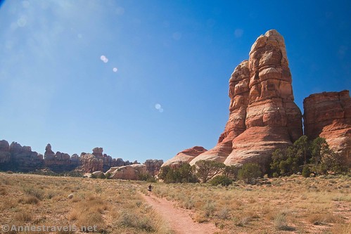
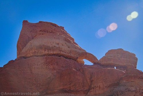
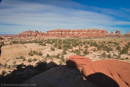
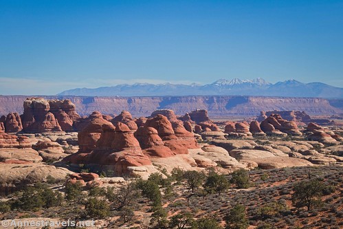
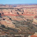
The trail rises between and across the rocks into a slightly higher portion of desert scrub. About 0.6 miles from Elephant Canyon, a rock on the right is (to me!) one of the most spectacular viewpoints on the hike (certainly one of the best up to this point). There’s no sign marking it, but it’s pretty easy to see.
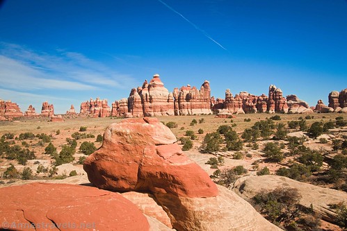
From the unofficial viewpoint, the trail heads for the Needles, proper. The trail to Devils Kitchen Campground strikes off to the right at mile 2.8. Turn left to continue toward Chesler Park.

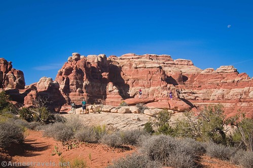
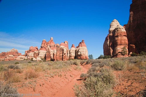
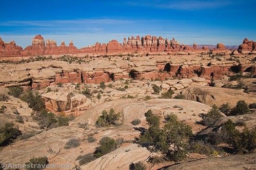
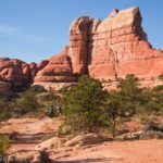
Shortly after the junction, the trail climbs steeply (it’s a bit of a Class 2+ scramble) between the Needles to enter Chesler Park. Be sure to look back as you climb – the views are crazy amazing!
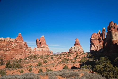
As soon as you enter Chesler Park, a small sign points left toward a viewpoint. It’s worth scrambling the short distance up onto the rocks to get views across Chesler Park and also back the way you came.

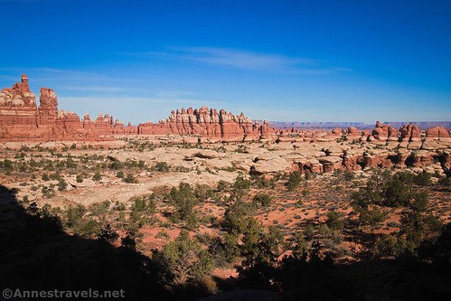
Continue into Chesler Park, which is really just a desert meadow, raised above the surrounding land, and ringed by the Needles and other rock formations. Chesler is not the only “park” in the Needles District; Virginia Park is just to the southeast. However, Chesler Park is a great substitute since Virginia Park is closed to entry except with a ranger. At mile 3.1, you’ll come to the sign that tells you you’re in Chesler Park and also points toward the Joint TH in both directions. The right trail (which is also signed for the Devils Kitchen Campground) is the trail used by hikers doing a loop around Chesler Park. For now, we want to turn left to continue along the eastern side of Chesler Park.
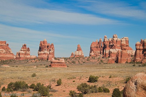
Chesler Park was used as grazing land for many years. It’s said that one of Buch Cassidy’s “Wild Bunch” gang would rustle cattle from Chesler Park and nearby areas and drive them across the Colorado River to “safety.” At this point, the park is an expanse of desert grasses and bushes with fantastic views in many different directions.
About a half a mile beyond the trail junction, a second viewpoint trail strikes off on the left. This is another great view down on the canyons and formations surrounding Chesler Park. We decided it was time to have an early lunch, comfortably seated on the rocks around the viewpoint. One important thing to remember about these viewpoints is that there’s no official end to the trails – so you can figure out for yourself how far you want to (and can) go.
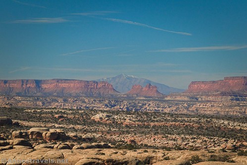
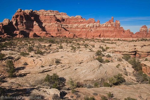
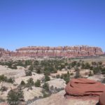
Lunch successfully negotiated, we hit the trail again. The section of trail that travels along the eastern edge of Chesler Park is absolutely beautiful. Besides the desert meadow, the spires rise up so tall and stately; any other hiker you meet is dwarfed by the sheer size of the monoliths. You also get close enough to some of the formations to really appreciate their grandeur.

At mile 4.25, you’ll come to the end of the Chesler Park Trail (at least technically). The Joints Trail stretches left toward Druid Arch and right toward the Joint Trailhead. To get to the Chesler Park Viewpoint, turn right signed as the Joint Trail.

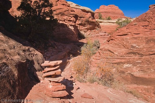
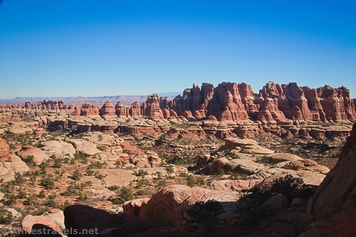
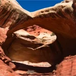
The path rambles southwest, still with great views of the spires. About mile 5, the trail drops into a sort of wash to a sign. The Joint Trail is to the right – over the edge of the cliff and down into The Joint (steps help you down into the slot canyon). The viewpoint goes straight ahead. We want the trail to the viewpoint.
The trail up to the viewpoint is a little difficult to follow. There are cairns in some places, but use your best judgment and look for the steps cut into the rock to get up on the slickrock that will take you up to the viewpoint.
The views up here are fantastic; so many spires and the Needles and Chesler Park and more. It’s long been a favorite of mine: a great place to hang out for a while. Of course, I usually fall for the temptation of exploring the slot canyons below instead of just taking in the view, but it’s all fun!
Note: If you want to continue on the circuit of Chesler Park, you’ll need to return to the viewpoint junction and descend into the Joint. It’s about 1.3 miles from here to the Joint Trailhead, and from there you can continue in a loop around to the west and north sides of Chesler Park for even more great views!
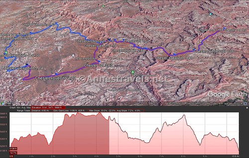
Round Trip Trail Length: About 10.2 miles out & back from the viewpoint. Doing the entire loop around Chesler Park, I ended at 11.9 miles.
Elevation Gain: 1,735ft. (5,141ft. to 5,668ft.)
Facilities: Primitive restroom and possibly a picnic table or two at the trailhead
Fees: $30/vehicle, valid 7 days. America the Beautiful National Park & Federal Lands Passes and Southeast Utah Parks Pass are also accepted

Trail Notes: Parking is limited at the trailhead. I recommend getting there before 9am to secure your parking place. A small scramble is required to get into the park. None of us had any trouble with it, but it’s best to be forewarned. If you like slot canyons at all, I highly recommend checking out the Joint even if you are planning an out-and-back – the Joint has several side-joints that are super fun to explore.
Trail 
![]()
![]()
Road ![]()
Signs
Scenery
Would I go 100 miles out of my way for this?
Overall Rating: 

GPS Coordinates for the Elephant Canyon Trail
TH: 38.141565,-109.827322 (38°08.49390′, -109°49.63932′ / 38°08’29.6340″, -109°49’38.3592″) (5,118ft.) (0.0)
Durid Arch Trail Junction (aka Elephant Canyon): 38.123523,-109.839955 (38°07.41138′, -109°50.39730′ / 38°07’24.6828″, -109°50’23.8380″) (5,212ft.) (2.04)
Viewpoint (unmarked, on right): 38.122044,-109.846130 (38°07.32264′, -109°50.76780′ / 38°07’19.3584″, -109°50’46.0680″) (5,461ft.) (2.61)
Devils Kitchen Campground Junction: 38.120792,-109.847872 (38°07.24752′, -109°50.87232′ / 38°07’14.8512″, -109°50’52.3392″) (5,506ft.) (2.78)
Viewpoint (entrance to Chesler Park): 38.119759,-109.848945 (38°07.18554′, -109°50.93670′ / 38°07’11.1324″, -109°50’56.2020″) (5,637ft.) (2.94)
Chesler Park Circuit Junction: 38.118081,-109.849806 (38°07.08486′, -109°50.98836′ / 38°07’05.0916″, -109°50’59.3016″) (5,598ft.) (3.14)
Viewpoint (overlook of canyons & more): 38.113570,-109.844868 (38°06.81420′, -109°50.69208′ / 38°06’48.8520″, -109°50’41.5248″) (5,668ft.) (3.63)
Shortcut to Druid Arch (Joint Trail Junction): 38.106455,-109.849491 (38°06.38730′, -109°50.96946′ / 38°06’23.2380″, -109°50’58.1676″) (5,635ft.) (4.23)
Viewpoint junction (just above The Joint): 38.104551,-109.857597 (38°06.27306′, -109°51.45582′ / 38°06’16.3836″, -109°51’27.3492″) (5,566ft.) (5.03)
The gpx file for Chesler Park can be downloaded – please note that this and the GPS Coordinates are for reference only and should not be used as a sole resource when hiking this trail.
Download GPX File size: 132.0 KB Downloaded 467 times
The gpx file for my entire trek around Chesler Park can also be downloaded.
Download GPX File size: 216.2 KB Downloaded 572 times
Getting to the Elephant Hill Trailhead
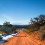
From US-191, turn onto Utah Hwy 211. This turn is 40 miles south of Moab and 14 miles north of Monticello; it is very well-marked, but easy to miss after driving a very long way from Moab through some bland if starkly beautiful scenery. From US 191, it’s about 34 miles to the visitor center and entrance station – but you’ll have plenty to look at along the way, including a very pretty canyon, rock formations, and Newspaper Rock. Pay your entrance fee (or flash your park pass) and then continue driving along the main road. After 2.8 miles, turn left towards Squaw Flat Campground. Keep right 0.2 miles later, when the left fork enters the campground. Bear right again a very short time later. (If you come to the end of the road within the next mile, you’ll know you went the wrong way). From here, the road is not exactly paved, although it is still in good condition and should be accessible by lower clearance, 2WD vehicles (I’ve done it in a Toyota Camry). Check at the visitor center for updated road information. About 3 miles from where you didn’t go to the Squaw Flat Campground, you will come to the parking area. The road continues, but it’s only for serious 4×4 vehicles (no ATVs allowed) with a permit. I watched a few jeeps trying to ascend the hill the road climbs right next to the parking area, and it’s nothing I’d want to try!
This Week’s Featured Product!
The “best” is always hard to pin down, but Rod Martinez has tried to give you the best-of-the-best in terms of hiking in Canyonlands National Park. The book covers about 20 hikes in the Island in the Sky and Needles districts of the park.

6 responses to “The Wonders of Chesler Park”
[…] en route to Chesler Park, Canyonlands National Park, […]
[…] in Chesler Park, Needles District of Canyonlands National Park, […]
[…] Rims, and Corona Arch are all well worth repeating for their scenic beauty. Also on this list is Chesler Park – I’ve now done it three times, and I’d happily go hike it again. It’s one of those […]
[…] you’re curious, it’s about 3 hours to drive between Island in the Sky and the Needles) to hike Chesler Park (via Elephant Canyon and around by the Joints Trail to loop back around Chesler Park). We’ve […]
[…] 10, 2022 10 Best & Collections, All Hikes & Attractions, Hikes & Trails Hiking in Chesler Park, Canyonlands National […]
[…] along the cutoff trail between the Druid Arch Trail and Chesler Park in Canyonlands National Park, […]