
If you’re looking for an easy hike with a long, scenic drive on a dirt road to get there, the Big Pocket Overlooks to Cathedral Point is a good option. Located near the trailhead for Upper Salt Creek just outside of the Needles District of Canyonlands, you’re actually walking on a road for almost the entirety of the hike. But since the road is 4×4 only and not exactly popular, and the views are quite nice, I can easily recommend it if you happen to be in the area.
Quick Stats
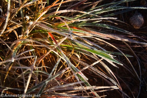
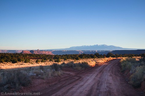
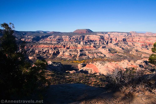
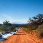
I hiked the Big Pocket Overlooks Road in the very early morning – so early, the sun was barely over the nearby hills, and the grass was still frosty!
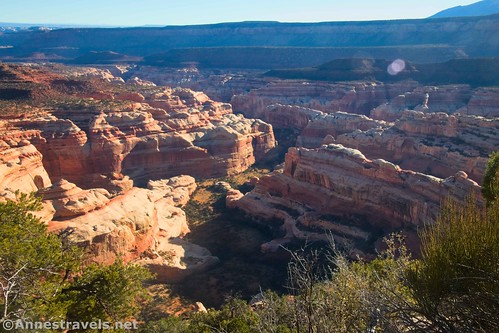
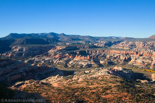
The good news was that the sun was at golden hour, just touching down into the canyons and making them glow. The bad news was that some of the canyons were in deep shadows, and the La Sal Mountains were still hazy and backlit. I suppose you can’t have it both ways unless you hike it twice, since the overlooks are on the east and west sides of the arm of the mesa.
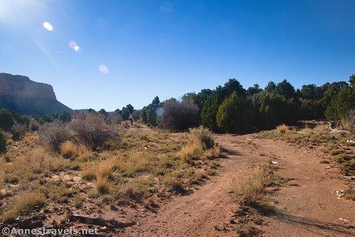
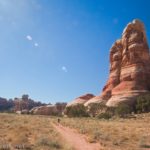
Start by hiking northwest up the Big Pocket Overlooks Road (just north of the trailhead for Upper Salt Creek – in fact, you’ll probably want to park at Upper Salt Creek TH and walk the 0.6 miles to the road from there).
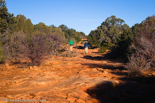
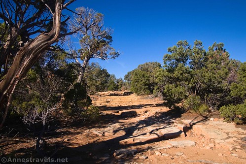
Almost a quarter mile from the beginning of the road, it splits. You’ll be doing it as a loop, so it doesn’t matter which way you go, although most people go left first (including us). (If you’re driving, definitely go left so that you don’t meet someone going the other way on a narrow section of road.) The road is generally rocky with a few ledges.
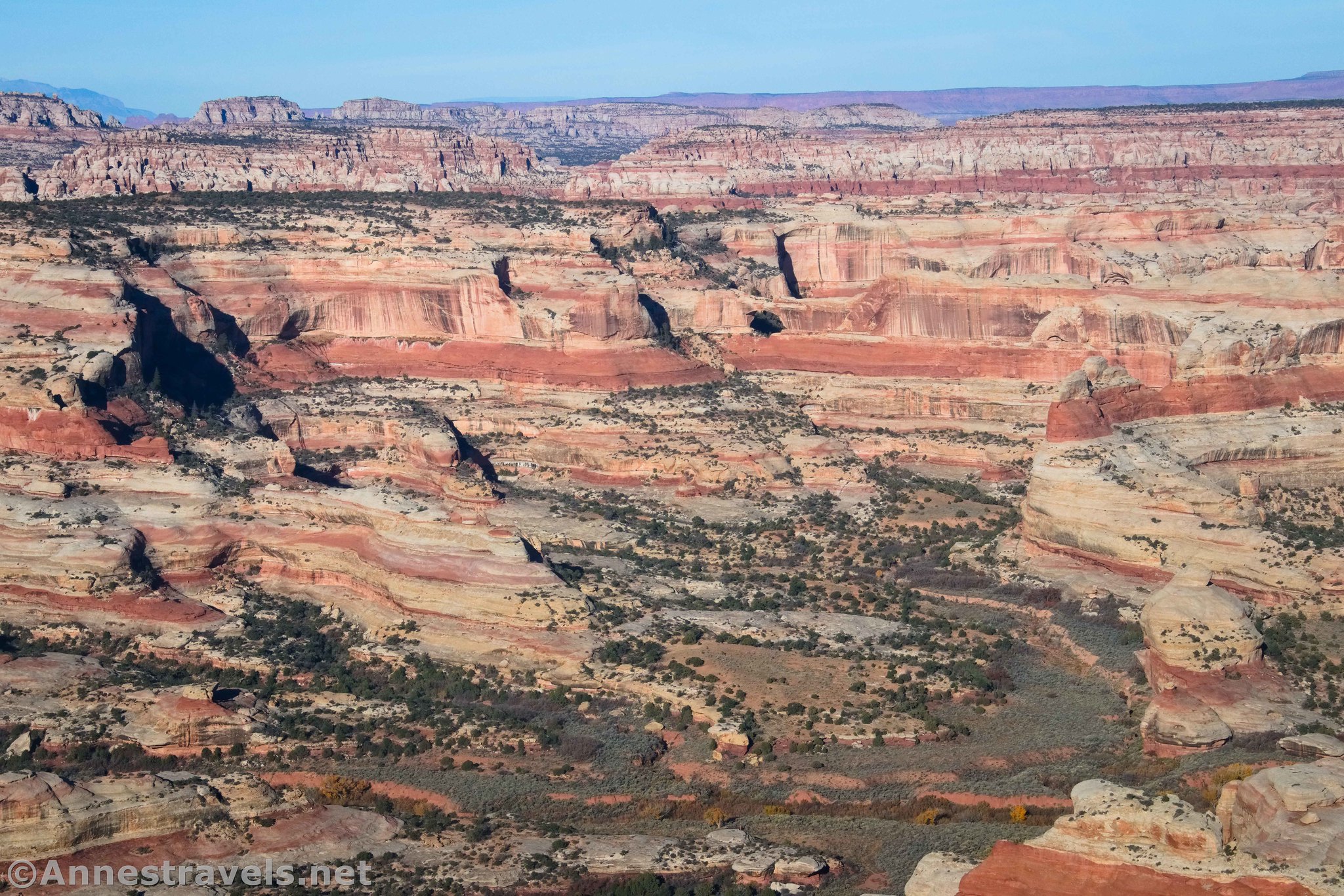
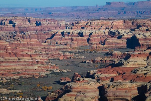
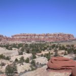
The first viewpoint is on the left a mile beyond the split. It’s a nice view down on Salt Creek – the views are better over it than inside of it, I’m afraid.
Viewpoint 2 is only 0.7 miles later, also on the left. Again, it looks down into the Salt Creek drainage.
Viewpoint 3 is also on the left, 0.2 miles beyond Viewpoint 2. The view is of… Salt Creek!
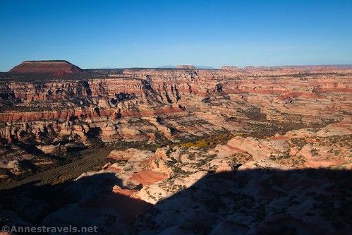
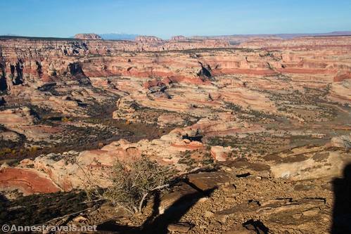
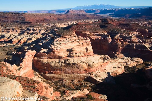
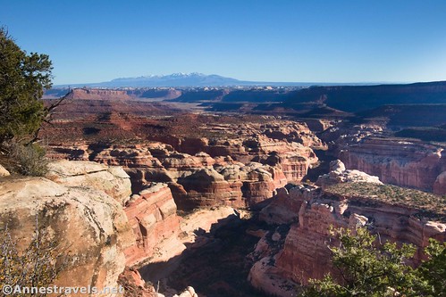
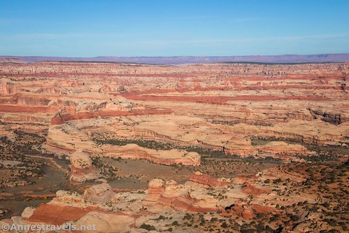
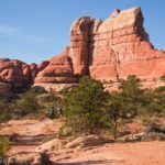
The best viewpoint is Viewpoint 4, located 2.3 miles from the beginning of the road (0.2 miles beyond the last viewpoint). This is Cathedral Point and the official Big Pocket Overlook, at the tip of the mesa (in fact, the road turns sharply to the right at this point). I scrambled out on the rocks for a better view.
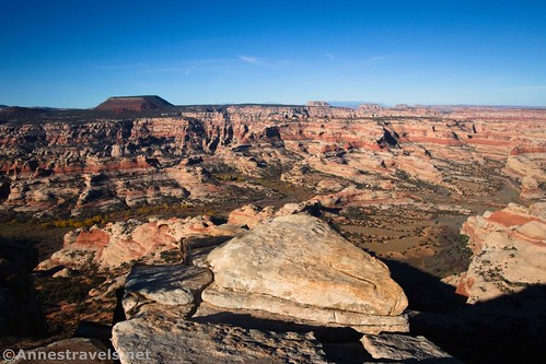
While this is the best view of the Salt Creek Drainage that you’ve seen up to this point, you also get some nice views down into Big Pocket (a sidecanyon off of Salt Creek).
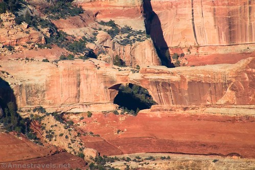
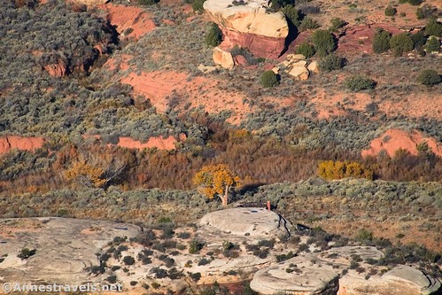
Be sure to look across the canyon at Kirk Arch. Kirk Cabin is also visible beside its lone cottonwood. If you know where to look, you can also see Wedding Ring Arch below the viewpoint on the near side of the canyon.
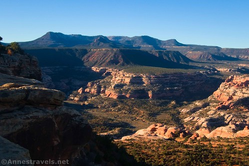
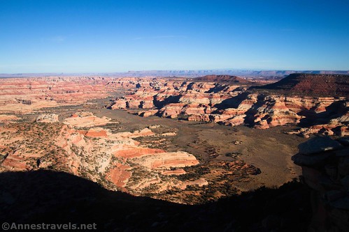
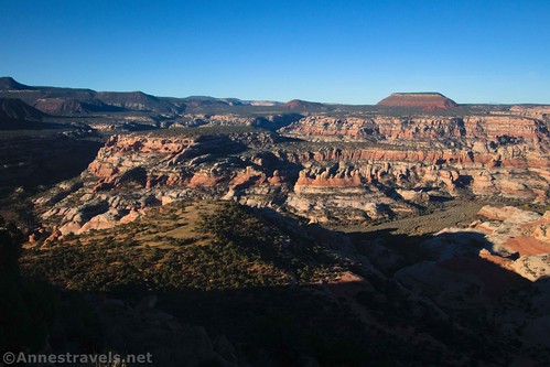
The road keeps going along the north end of the mesa and then back down the other side. Keep walking to the next viewpoint, 0.3 miles beyond Cathedral Point. You’ll begin getting views to the east, including of the La Sal Mountains.
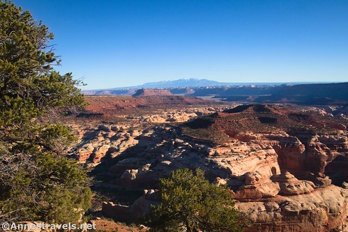
There are also nice views down into Lavender Canyon, including the headwall that separates Lavender Canyon from Big Pocket.
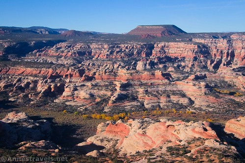
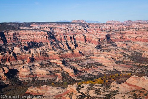
Viewpoints 6 and 7, at miles 3.0 and 3.5, have similar views of the La Sal Mountains and Lavender Canyon. The road on this side of the mesa is narrower and seems to be more overshadowed by trees.
I enjoyed Viewpoint 8. It’s mostly just looking down into Lavender Canyon, but I’m pretty sure I spotted Cleft Arch!

From here, it’s just a quarter mile walk back to where the road split. Turn left to return to the main road.
Overall, I can’t say that the Big Pocket Overlooks is worth the drive on its own (it’s a long way from the pavement!) But if you’re bored, or if you happen to be in the area for other reasons (say, traveling out to Beef Basin or hiking Upper Salt Creek Canyon), Big Pocket Overlooks is a lovely, easy hike with fantastic views!
Round Trip Trail Length: 4.9 miles
Elevation Gain: GoogleEarth tells me that it’s 735ft. elevation gain; that’s far over the actual gain. I’d say it’s closer to 385ft. on the outside. (7,065ft. to 7,198ft.)
Facilities: None
Fees: None (you’re technically still in Bear Ears National Monument here, not Canyonlands National Park)
Trail Notes: The trail is drivable with 4×4 and a little know-how. It’s rocky and has some steps, so take your time. There are a few primitive campsites in the area, especially just beyond the Upper Salt Creek Trailhead. The viewpoints are not marked and have no railings. You’re really on your own out here!
Trail 
![]()
![]()
Road ![]()
![]()
Signs ![]()
![]()
![]()
![]()
Scenery
Would I go 100 miles out of my way for this? ![]()
Overall Rating: ![]()
![]()

GPS Coordinates for Big Pocket Overlooks
TH: 37.958081,-109.702649 (37°57.48486′, -109°42.15894′ / 37°57’29.0916″, -109°42’09.5364″) (7,089ft.) (0.0)
Road Junction: 37.959959,-109.705115 (37°57.59754′, -109°42.30690′ / 37°57’35.8524″, -109°42’18.4140″) (7,074ft.) (0.21)
Viewpoint 1: 37.970449,-109.718161 (37°58.22694′, -109°43.08966′ / 37°58’13.6164″, -109°43’05.3796″) (7,159ft.) (1.26)
Viewpoint 2: 37.976209,-109.722076 (37°58.57254′, -109°43.32456′ / 37°58’34.3524″, -109°43’19.4736″) (7,156ft.) (1.96)
Viewpoint 3: 37.977774,-109.723591 (37°58.66644′, -109°43.41546′ / 37°58’39.9864″, -109°43’24.9276″) (7,159ft.) (2.16)
Viewpoint 4 (best): 37.979473,-109.724222 (37°58.76838′, -109°43.45332′ / 37°58’46.1028″, -109°43’27.1992″) (7,152ft.) (2.31)
Viewpoint 5: 37.979503,-109.719662 (37°58.77018′, -109°43.17972′ / 37°58’46.2108″, -109°43’10.7832″) (7,128ft.) (2.63)
Viewpoint 6: 37.976260,-109.717302 (37°58.57560′, -109°43.03812′ / 37°58’34.5360″, -109°43’02.2872″) (7,104ft.) (3.01)
Viewpoint 7: 37.970940,-109.715788 (37°58.25640′, -109°42.94728′ / 37°58’15.3840″, -109°42’56.8368″) (7,119ft.) (3.50)
Viewpoint 8: 37.966035,-109.710298 (37°57.96210′, -109°42.61788′ / 37°57’57.7260″, -109°42’37.0728″) (7,076ft.) (4.14)
Return to the Road Junction: 37.963940,-109.710389 (37°57.83640′, -109°42.62334′ / 37°57’50.1840″, -109°42’37.4004″) (7,100ft.) (4.32)
End: 37.958087,-109.702638 (37°57.48522′, -109°42.15828′ / 37°57’29.1132″, -109°42’09.4968″) (7,089ft.) (4.95)
The gpx file for the Big Pocket Overlooks can be downloaded – please note that this and the GPS Coordinates are for reference only and should not be used as a sole resource when hiking this trail.
Download GPX File size: 59.6 KB Downloaded 330 times
(Note: I do my best to ensure that all downloads, the webpage, etc. are virus-free and accurate; however, I cannot be held responsible for any damage that might result, including but not limited to loss of data, damages to hardware, harm to users, from use of files, information, etc. from this website. Thanks!)
Getting to the Big Pocket Overlooks
From US-191 39 miles south of Moab, Utah (or 14.4 miles north of Monticello), turn onto UT-211 (signed for Canyonlands National Park and Newspaper Rock). Drive 20.2 miles to a somewhat unassuming dirt road on the left. No sign marks the junction, but there are three ways to find it: 1) it has a cattle guard (not that helpful; many of the sideroads have cattle guards), 2) it’s right after passing a sign with some of the park rules (I think that’s what it’s about; I’m usually driving in after dark), and 3) there is a primitive restroom almost as soon as you leave the pavement (a signboard is near the restrooms). There may also be signs about Beef Basin or Elk Mountain; however, I believe these signs have not been up in a while.
Stay on the main dirt road (gravel at this point) as it crosses a wash (sometimes with water in it – I broke ice on my last visit and was grateful for high clearance!). If you can pass this obstacle, you’re probably good to go to get to the Upper Salt Creek Trailhead.

Follow the road as it winds past buttes, canyon walls, sideroads, campsites, and generally beautiful scenery. In general, the road is typically in reasonable repair (I did it in a Toyota Camry) but does have washboard. Use caution when the road crosses small washes on corners; these can be harmful to a low-clearance undercarriage).
At long last, 16.7 miles from the pavement, pass by a sideroad on your right. This is the Big Pockets Overlooks Road. You made it! You can continue another 0.6 miles to the Upper Salt Creek Trailhead or, if you can do so safely, you can park along the road.

Today’s Featured Product!
You never know quite what kind of adventures you’ll find in this book, from easy strolls to true 4×4 trails. There’s so much information and great adventures for all skill levels, including hikes and roads you probably didn’t know about before. Buy your copy here!


Pingback: Sneak Peek: A Trip to Utah’s Arches & Canyons! – Anne's Travels