If you’re looking for a classic hike (with quite a bit of elevation gain) in Cuyahoga Valley National Park, you might be interested in the path to Blue Hen Falls. The waterfall is a favorite with families, couples, singles, and friends for a not-too-difficult hike with a nice reward at the end. Along the way, you get to enjoy a quiet forest.
Quick Stats
Up until 2022, the waterfall was accessed via a short trail from a parking area deep in the trees. However, changes to the structure of the trail mean that you now have to park down at the Boston Mills Visitor Center – and then climb the hill you used to be able to drive up. But it’s still a pretty falls, especially in the spring (more water) and fall (colorful leaves).
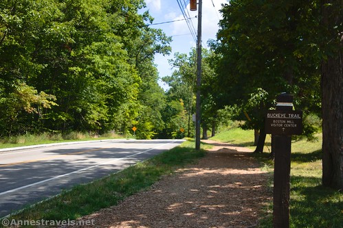
Start at the Boston Mills Visitor Center. Walk east (that’s walking so that the big highway bridge is on your left – the railroad tracks should be behind you) to cross Riverview Road. On the other side, pick up the Buckeye Trail heading into the woods (there are signposts – don’t cross Boston Mills Road yet).
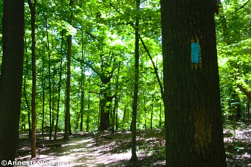
The path ascends steeply through the forest – follow the blue blazes, though honestly, it’s hard to get lost. After cresting the hill, the trail plummets into another valley before returning to its former ascending glory. After what feels like quite some time, the trail emerges from the trees to tiptoe demurely beside (safely far enough away, thankfully) Boston Mills Road. About 0.9 miles from where you picked up the Buckeye Trail, cross the road via the crosswalk.
I had an advantage in that one of my group members wanted to take a nap while I was hiking to the waterfall, so he dropped me off where the trail crosses the road (and then returned to the visitor center for his well-earned snooze; we’d had a very busy morning and were in for a real hike in the later afternoon). Near here is where the old road entered the trees to take cars to the old parking area. Now, after the crosswalk, the trail continues to parallel Boston Mills Road (only inside the trees) for a short distance before turning right on the old road, which will dump you out in the old parking area. (All of these junctions are well-marked.)
Finding the old parking area was a little eerie. There was the signboard at the far end of the tiny lot (you couldn’t have fit more than about 6 cars in here; it’s no wonder they needed more parking!) And over on the side was the sign marking a parking spot as reserved for rangers. It’s all still here; it’s just not used anymore. Crazy!
Soon after leaving the parking area, the path (which is now cracked asphalt like it was once paved) begins to travel downhill. About a tenth of a mile from the parking area, you’ll come to a junction with the Buckeye Trail. Continue right at this junction.
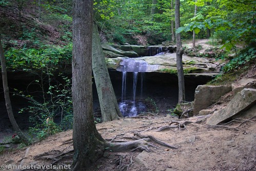
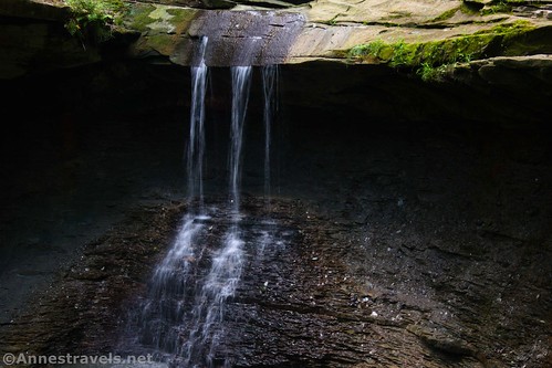
A little over 200ft. beyond this junction, you’ll come to Blue Hen Falls. There are several different viewing areas, mostly from above.
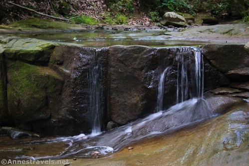
Be sure to look above Blue Hen Falls, too, as there are a couple of nice mini-waterfalls.
I did scramble down to river level. I don’t really recommend this, as it’s slippery and a fall could be very painful (or even break bones). However, since there were no signs and plenty of people had already scrambled down, I followed suit.
One word about courtesy here: A group of young ladies and their dogs were enjoying the falls. Nothing wrong with that. But they (and especially the dogs) were in the stream or on the opposite bank, close to the falls. I had a very difficult time photographing the falls because they kept showing up in the frame. I’m virtually certain they had no idea the trouble they were causing the rest of us. But if you can, take your turn at the falls and then back up enough to allow others the opportunity to photograph it without getting your mug, too.
When you’ve taken all the slow-shutter-speed photos possible, retrace your steps to the trailhead. It’s definitely not as dramatic or easy to access as Brandywine Falls, but if you need a trail in Cuyahoga Valley, this one has a great payoff!
Round Trip Trail Length: 2.6 miles
Elevation Gain: 689ft. (670ft. to 907ft.)
Facilities: Restrooms and visitor services at the trailhead (Boston Mills Visitor Center)
Fees: None
Trail Notes: The ups and downs make this trail more difficult than it appears. However, it’s still quite popular with families (watch the little ones by the roads). The trail is mostly shaded. The falls are nicest when they have a reasonable flow; in the middle of August, the flow was ok but not great. Blue Hen Falls is about 15ft. tall but it looks like more due to the almost straight drop.
Trail 


Road 


Signs 


Scenery 


Would I go 100 miles out of my way for this? 


Overall Rating: 


GPS Coordinates for Blue Hen Falls
(Note that I did this as a track from the falls back to the visitor center, so everything is backwards, including the GPX file and map below.)
Falls overlook: 41.2588080°, -081.5727620° (41°15.52848′, -081°34.36572′ / 41°15’31.7088″, -081°34’21.9432″) (819ft.) (0.0)
Buckeye Trail Junction: 41.2585430°, -081.5733690° (41°15.51258′, -081°34.40214′ / 41°15’30.7548″, -081°34’24.1284″) (826ft.) (245ft.)
Old parking area: 41.2572420°, -081.5725660° (41°15.43452′, -081°34.35396′ / 41°15’26.0712″, -081°34’21.2376″) (889ft.) (0.18)
Trail junction: 41.2567650°, -081.5725640° (41°15.40590′, -081°34.35384′ / 41°15’24.3540″, -081°34’21.2304″) (892ft.) (0.22)
Road crossing: 41.2571800°, -081.5701050° (41°15.43080′, -081°34.20630′ / 41°15’25.8480″, -081°34’12.3780″) (904ft.) (0.38)
Trail at the junction of the roads: 41.2622710°, -081.5612890° (41°15.73626′, -081°33.67734′ / 41°15’44.1756″, -081°33’40.6404″) (669ft.) (1.26)
The gpx file for Blue Hen Falls can be downloaded – please note that this and the GPS Coordinates are for reference only and should not be used as a sole resource when hiking this trail.
Download GPX File size: 18.6 KB Downloaded 106 times
(Note: I do my best to ensure that all downloads, the webpage, etc. are virus-free and accurate; however, I cannot be held responsible for any damage that might result, including but not limited to loss of data, damages to hardware, harm to users, from use of files, information, etc. from this website. Thanks!)
Getting to Blue Hen Falls
From I-271, take Exit 12 to OH-303 and Richfield/Peninsula. Turn right (whether you’re coming from I-271N or I-271S, it’s still a right) on OH-303E and then take a very quick left onto Stine Road. After 1.6 miles, turn left onto Riverview Road for a mile, then turn right into the parking lot for the Boston Mills Visitor Center.
Today’s Featured Product!
Have you ever wished you could talk to the people who created the trails so you could get their opinion on the best-of-the-best hikes to take in any given park? This is the guide for you! The park’s volunteer force has put together a guide to every trail in Cuyahoga Valley National Park. Buy your copy here!















Pingback: Trip Report: Cuyahoga Valley & New River Gorge – Anne's Travels