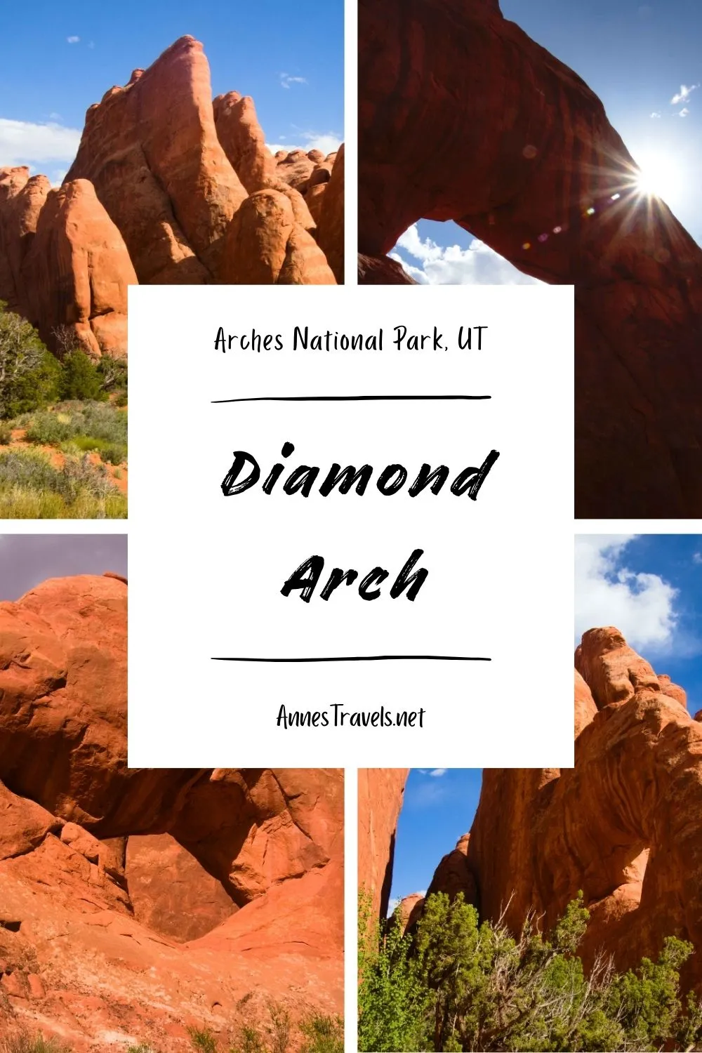
There are over 2,000 named arches in Arches National Park, so it’s not surprising that more than a few don’t have trails to them. Some are in the backcountry or in difficult-to-access places, but others are quite accessible. Diamond Arch is one of the latter variety – it’s less than half a mile off the road near the Devils Garden Campground, and the terrain between the road and the arch is mostly easy hiking in washes, but it’s hidden between some fins and isn’t marked, so finding the arch without knowing it’s there is definitely a challenge. While Diamond Arch isn’t the biggest or most impressive arch you’ll find in the park, it is fun if you happen to be in the area and have already seen most of the major crowd pleasers.
Quick Stats
This post contains affiliate links. If you click a link and purchase something, I may receive a small commission. Thank you for supporting Anne’s Travels!

There is one caveat to this hike: You have to picnic to do it. The parking area is for picnickers only. I left a couple people in my group making supper, so that worked out just fine for me. But be aware that the rangers may be looking for vehicles illegally parked in the picnic area if the regular Devils Garden Parking Area is overcrowded and no one is at the picnic tables in the picnic area.
And now – on to Diamond Arch!
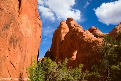
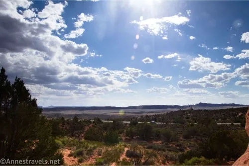
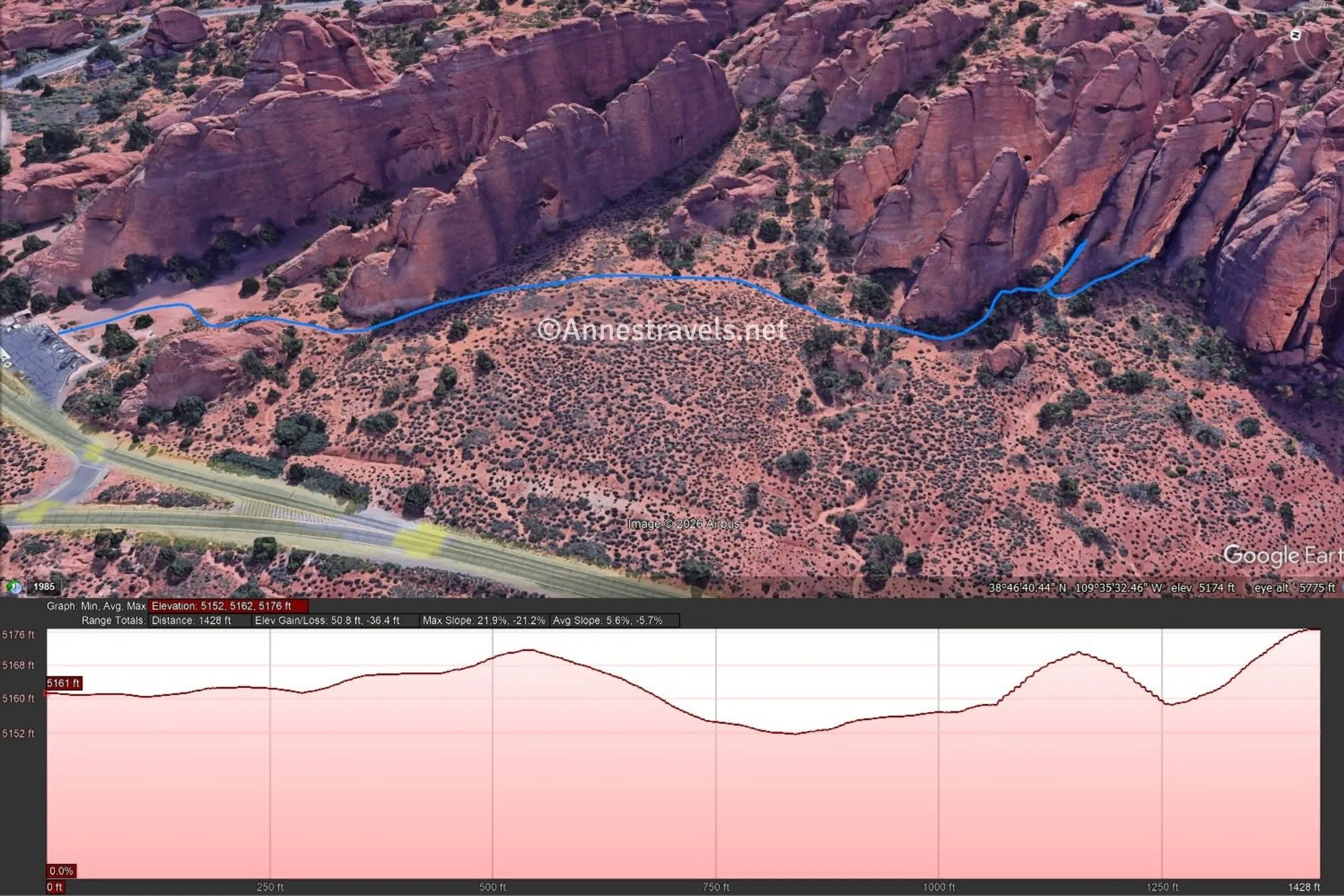
0.0 Devils Garden Picnic Area (5,195ft.). Begin at the first (southernmost) of the two picnic areas, near the vault toilet. Walk through the picnic area, heading for the large fin to the right of the picnic area. Before you reach this fin, turn right (west) to follow one of the social trails to pass between the end of the fin and a slickrock dome and into the sandhills. Do your best to stay on preestablished trails through these sandhills, heading generally south and a little east (aka straight and a little right with the fin on your left). The trail should eventually drop you into a wash that runs along the northwest side of a cluster of fins. Diamond Arch is in one of these fins – basically, the first fin that is set further back than the others. Head for the left side of this fin. (38.779391°, -109.592904°)
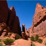
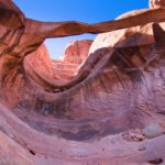
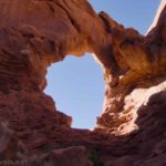
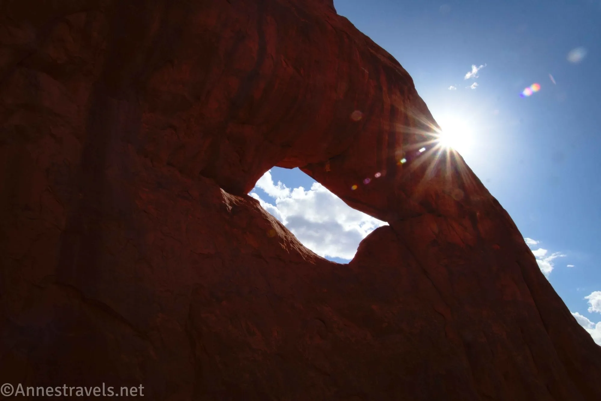
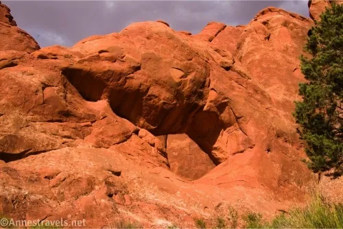
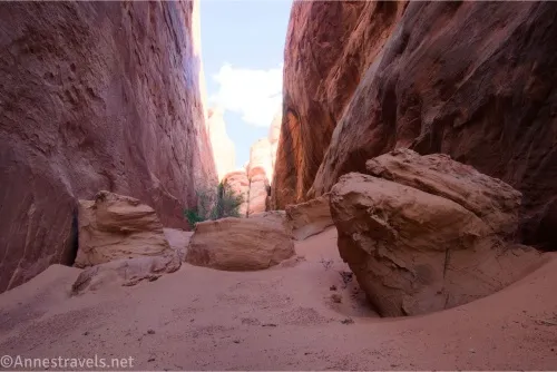
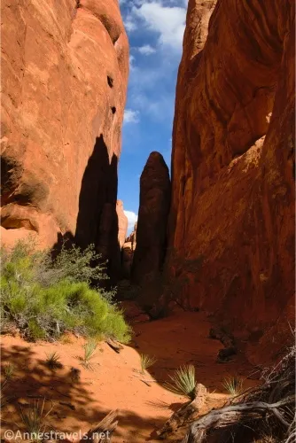
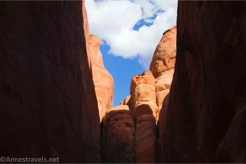
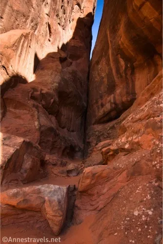
0.25 North side of Diamond Arch (5,230ft.). This is in a fun, sandy little slot with great views up at Diamond Arch. To get to the south side, simply walk around the fin – this route is more choked with trees, but you should be able to stay in the wash (and therefore leave no trace) with some ducking under the juniper branches. (38.776802°, -109.591688°)
0.35 South side of Diamond Arch (4,230ft.). While the slot on the south side isn’t as interesting, it’s an easy scramble up into Diamond Arch from this side – which looked impossible from the north side! Retrace your steps to the picnic area, remembering to stay on social trails and in washes and not step on the biological soil crust as you hike. (38.776657°, -109.591793°)
Round Trip Trail Length: I went 0.8 miles
Elevation Gain: 85ft. (5,152ft. to 5,176ft.)
Facilities: Picnic area and primitive restrooms at the trailhead; campground (with water at the restroom) nearby
Fees: $30/vehicle, valid 7 days. America the Beautiful National Parks & Federal Public Lands Passes and Southeast Utah Parks Passes are accepted.
Trail Notes: There is no trail; you’ll be wayfinding across the desert for the entirety of this hike. Remember to not step on the biological soil crust and don’t make new trails – stay on established trails or (better yet) in washes. You do need to be picnicking in some capacity to use the parking area (the larger parking area for Devils Garden can become so crowded that people try to park in the picnic area instead, thus the rule), so keep that in mind. If you have kids who love sand, the north side of the arch would make an amazing (and cool!) playground for an hour or two (though I don’t know how you’d picnic at the same time… hmmm). Diamond Arch can also be briefly seen on the Main Park Road shortly before the split for Devils Garden – however, because it’s a red rock hole with red rock behind it, it can be hard to spot unless you know exactly where it is.
Trail 
![]()
![]()
![]()
![]()
Road ![]()
Signs ![]()
![]()
![]()
![]()
Scenery ![]()
![]()
Would I go 100 miles out of my way for this? ![]()
![]()
![]()
Overall Rating: ![]()
![]()
![]()
GPS Coordinates for Diamond Arch
Beginning (Devils Garden Picnic Area): 38.7794680°, -109.5928570° (38°46.76808′, -109°35.57142′ / 38°46’46.0848″, -109°35’34.2852″) (5,196ft.) (0.0)
East side of Diamond Arch: 38.7768450°, -109.5917310° (38°46.61070′, -109°35.50386′ / 38°46’36.6420″, -109°35’30.2316″) (5,202ft.) (0.23)
West side of Diamond Arch: 38.7767730°, -109.5920530° (38°46.60638′, -109°35.52318′ / 38°46’36.3828″, -109°35’31.3908″) (5,195ft.) (0.35)
End (Devils Garden Picnic Area): 38.7794410°, -109.5928720° (38°46.76646′, -109°35.57232′ / 38°46’45.9876″, -109°35’34.3392″) (5,196ft.) (0.82)
The gpx file for Diamond Arch can be downloaded – please note that this and the GPS Coordinates are for reference only and should not be used as a sole resource when hiking this trail.
Download GPX File size: 11.0 KB Downloaded 205 times
(Note: I do my best to ensure that all downloads, the webpage, etc. are virus-free and accurate; however, I cannot be held responsible for any damage that might result, including but not limited to loss of data, damages to hardware, harm to users, from use of files, information, etc. from this website. Thanks!)
Getting to the Diamond Arch Trailhead
From the Arches National Park Visitor Center, drive 17.2 miles – this will be just after the road splits to be a one-way road as it approaches Devils Garden. After the split, take the first right into a parking area for picnickers only.
Discover More Hikes in Arches National Park
Explore some of the best hikes in Arches National Park in this Falcon Guide. Buy your copy here!