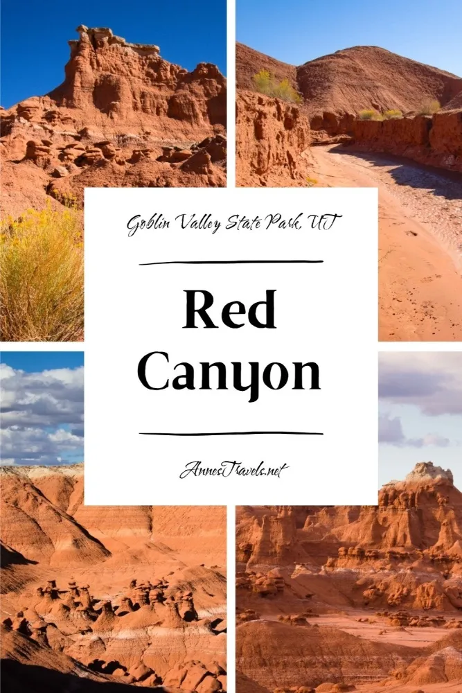
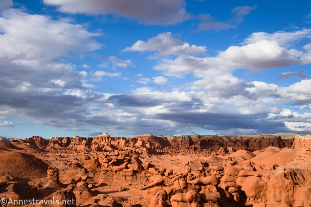
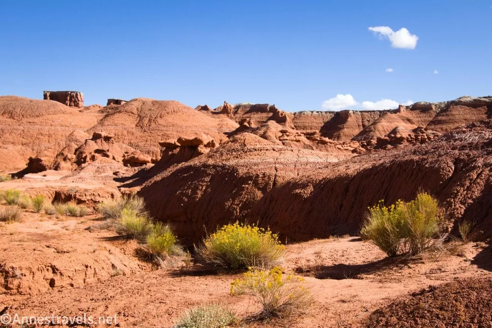
When I visited Goblin Valley State Park, I figured we might as well hike as many of the official trails as reasonable/possible, especially in the area around Valley 1, Valley 2, and Valley 3. Caramel Canyon to the Goblin’s Lair wasn’t hard and was definitely fun, so in the afternoon, we started down the Red Canyon Trail. Now, the “trail” to Red Canyon is really just a route with just enough signage to get you hiking but not enough to keep you hiking or get you the end of the route. We managed it, and while it’s not the most scenic or exciting of the hikes in Goblin Valley (for sure), it’s also not too hard, and we found some nice formations and visited Valley 3 along the way. (Note that the route to Red Canyon is also the shortcut route aka only reasonable route to Valley 3 – and that is great Goblin Valley hike!)
Quick Stats
This post contains affiliate links. If you click the link and purchase something, I may get a small commission. There is no extra cost for you.
I did a little bit of exploring along the way, in part because I didn’t understand what the hike was supposed to be (I figured with all of the good signage at the beginning, there would be good signage all the way to the end… no such luck). So sometimes I would climb out of the wash in hopes of finding a trail or cutting a gooseneck of the wash. Most of the exploring outside of the wash area happened on the way back, when I took a long detour through Valley 3.
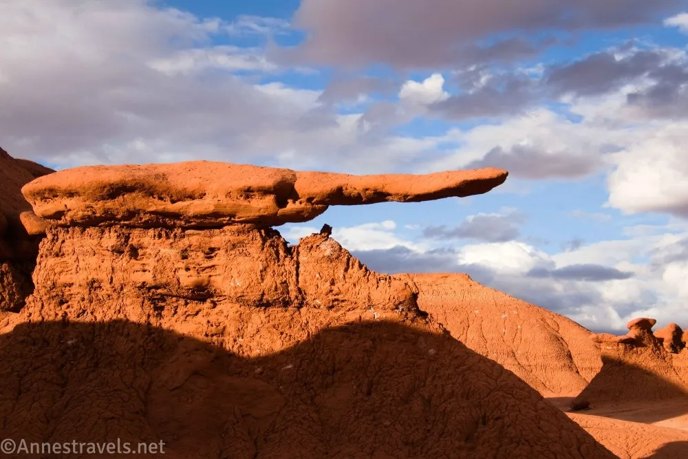
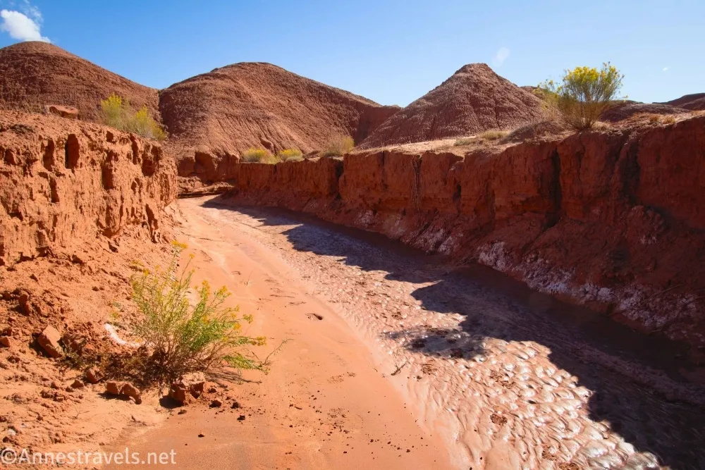
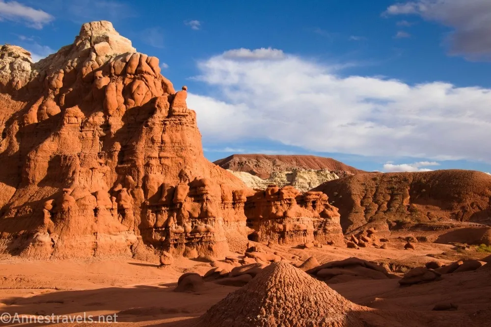
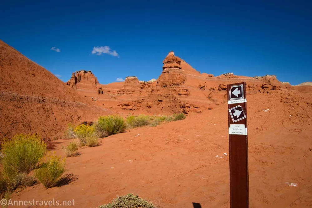
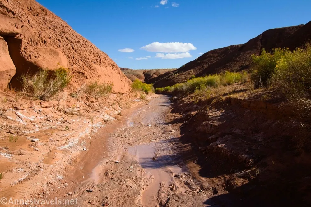
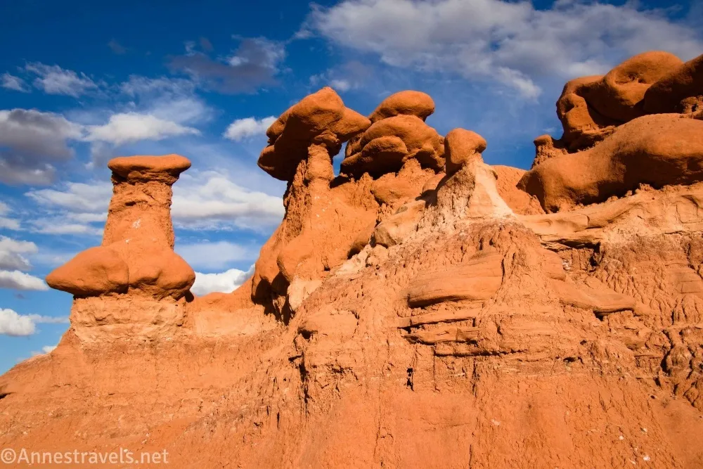
0.0 Red Canyon Trailhead (4,964ft.). The trailhead is located at the far right (when facing Goblin Valley) end of the parking area, which is the opposite side of the parking area than the Caramel Canyon Trailhead. A sign points toward Red Canyon – you might want to take a picture to commemorate the part of the trail that has signage. Actually, the sign says Red Canyon is a “primitive route” and also says, in the small print, “There is no maintained trails in the park’s backcountry. Route finding skills or handheld GPS units are recommended.” They’re right! Follow the trail as it travels southward with Valley 1 on your left. Eventually, the route will drop into the wash. There is one more sign – after this, you’re on your own. Thankfully, since you’re mostly just following the wash, it’s hard to get lost. The sign with an arrow pointing left toward Observation Point and right toward Valley 3, Red Canyon, and Park Boundary – I found this sign more confusing than helpful, but hey, it’s a sign! There isn’t much in the way of views, and it takes a while for the canyon to become red, but the trek isn’t too difficult for the most part. There are sometimes views, especially to the cliffs on the right which are quite pretty as well as a few red buttes and rock formations along the wash. (38.5638400°, -110.7036850°)
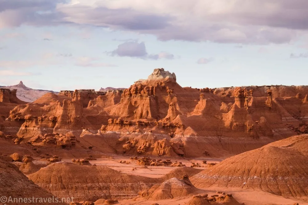
2.0 Valley 3 Sign (4,842ft.). Thinking that we should be seeing signs (after all, this is an official route in Goblin Valley State Park), we scrambled up and found the sign for Valley 3. You’re welcome to explore if you wish, which we did on our way back, or you can continue downcanyon, which is what this guide does for the moment. (38.5453610°, -110.7077820°)
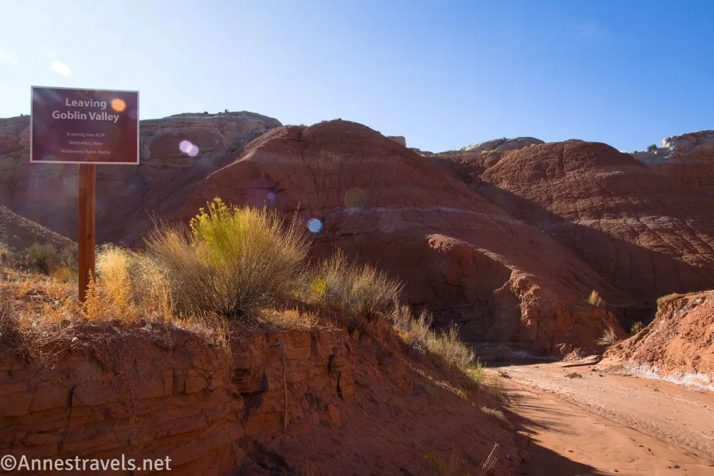
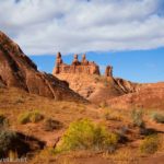
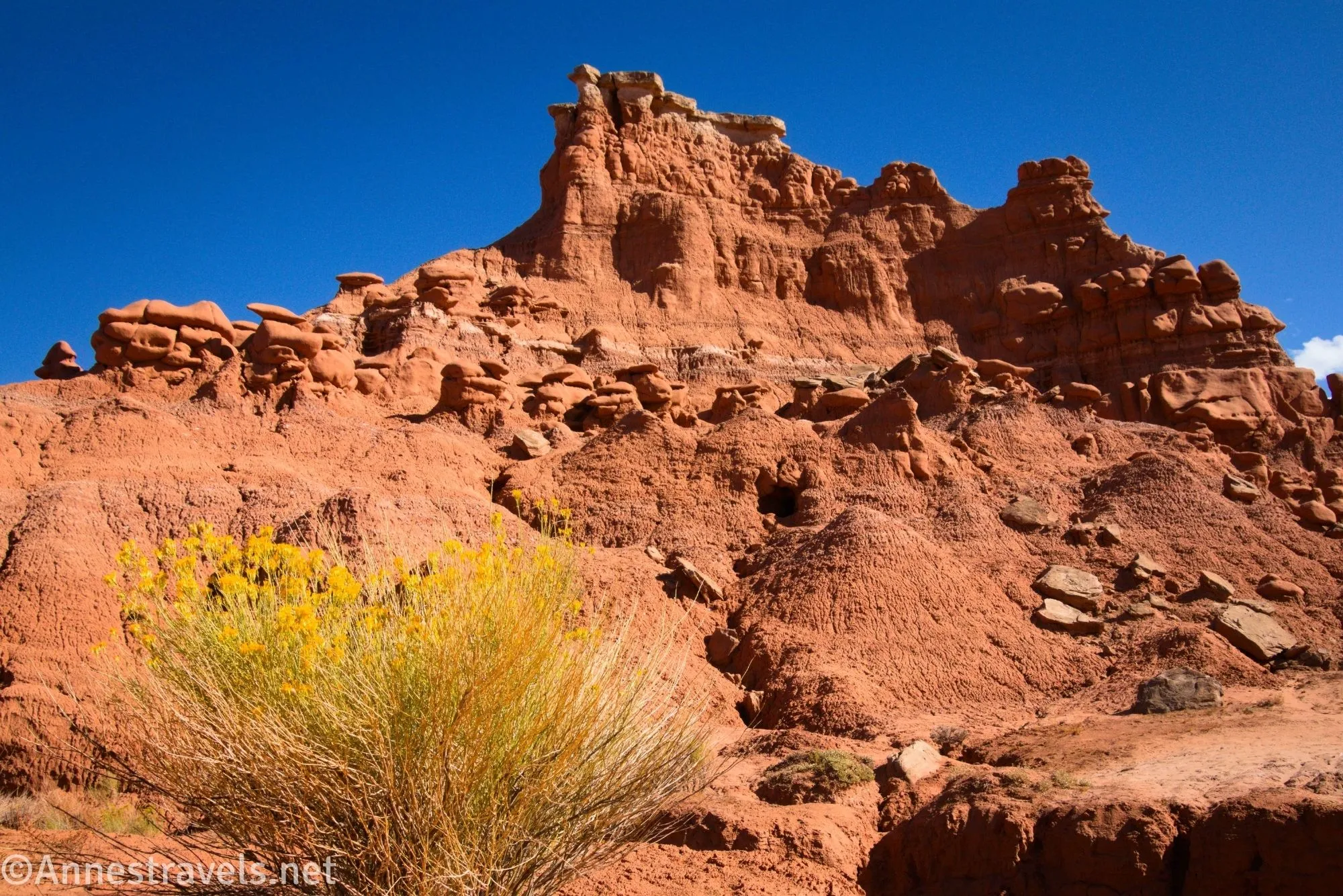
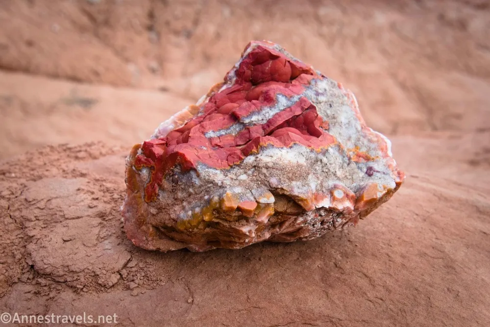
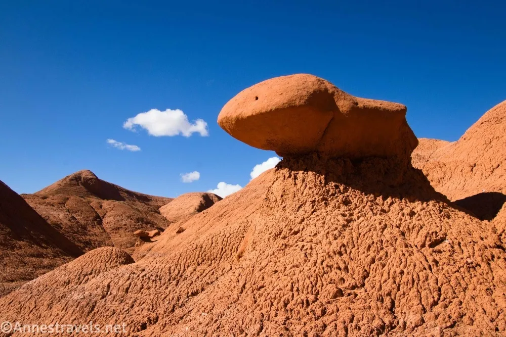
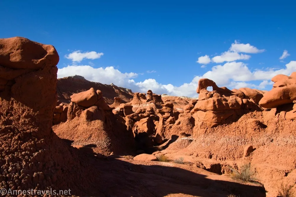
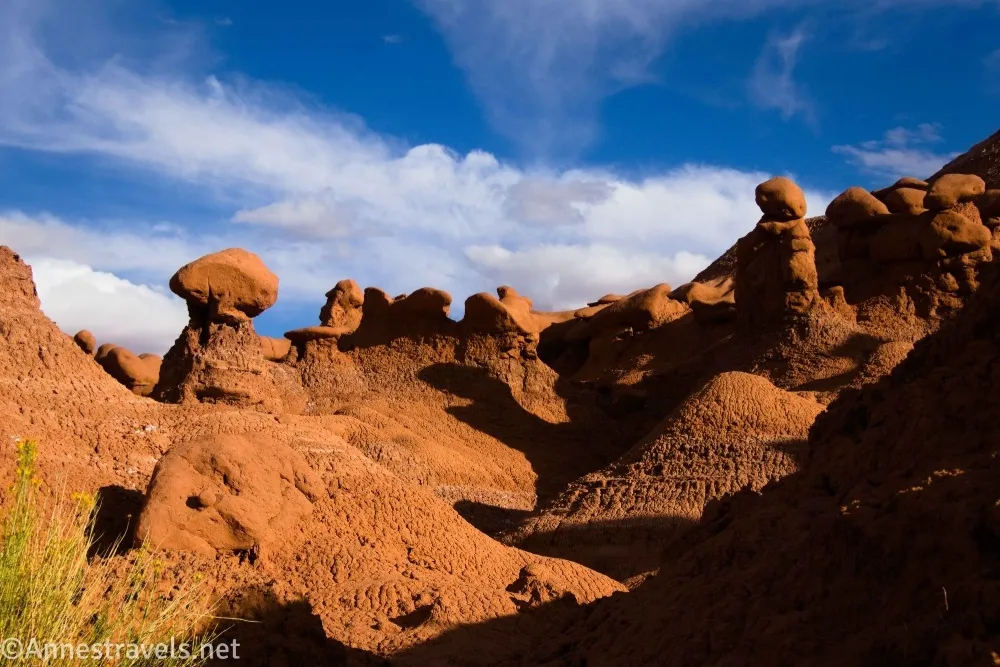
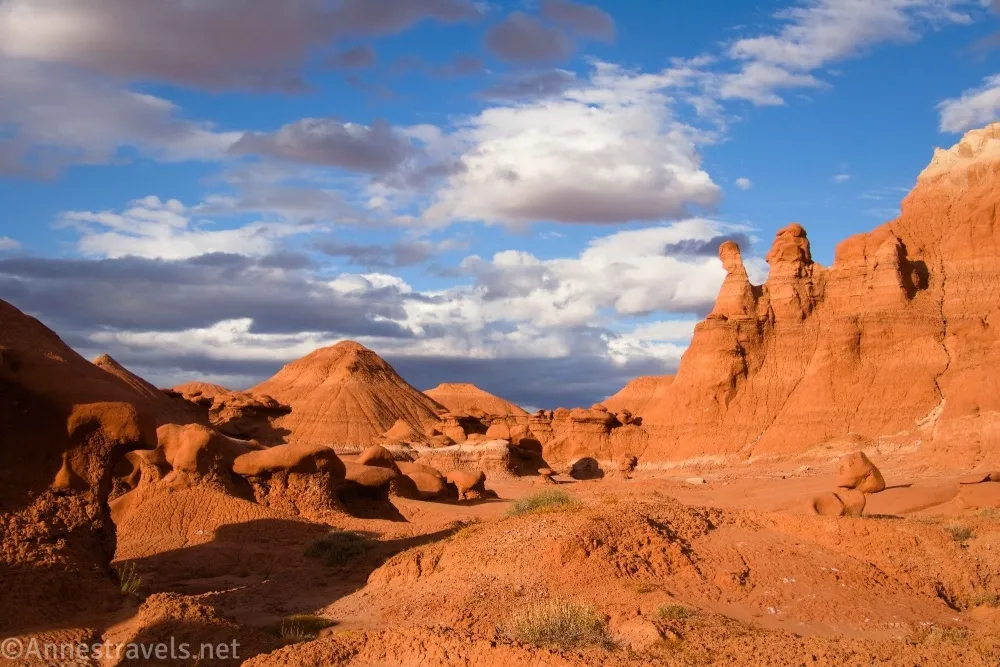
2.5 Exit Goblin Valley State Park; Enter Big Wild Horse Mesa Wilderness (4,833ft.). This is the official end of the trail (not that there’s been a trail in probably a mile and a half), but the wash keeps going, so you’re welcome to keep hiking. We went down to a side wash on the right. In this area, we found some neat little goblin formations. And then, in part due to the late hour, we started back up the canyon, turning right out of the wash to get into Valley 3 (we also visited Valley 3 the next day). (38.5426480°, -110.7116850°)

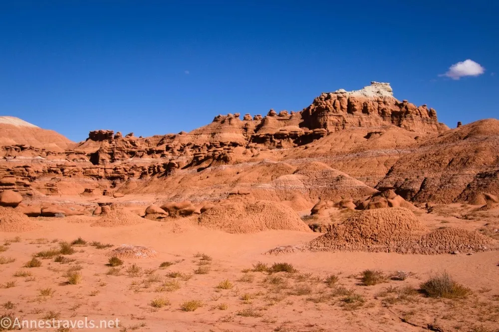
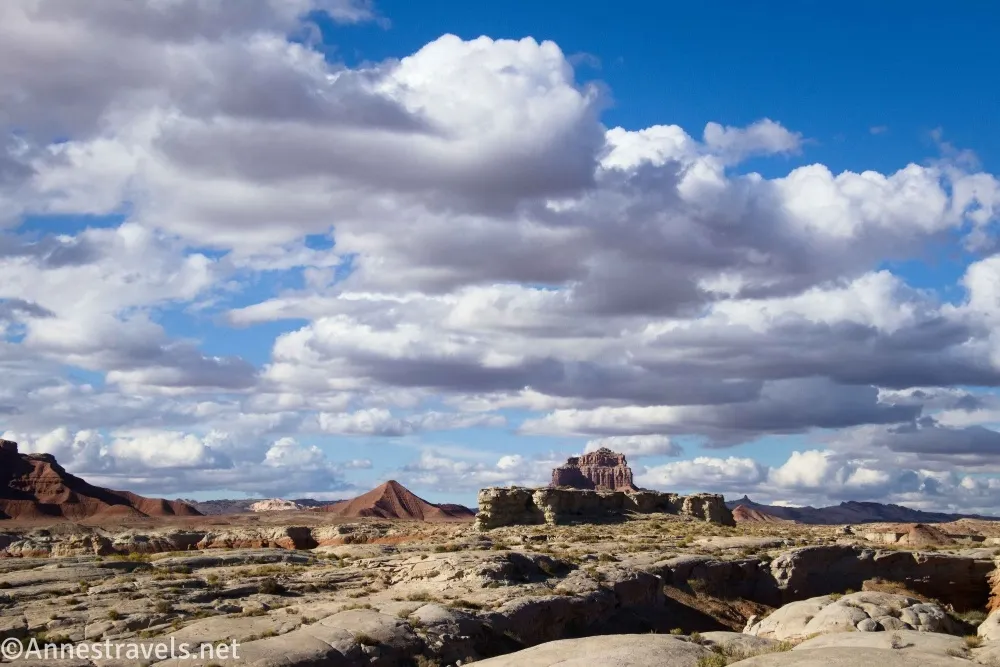
3.6 Valley 3 area (4,878ft.). We wandered around the valley for a while, heading generally east, then north after exploring some formations to the second sign for Valley 3 (which officially marks the valley). (38.5461690°, -110.7056820°)
4.7 Second Valley 3 sign (4,882ft.). As I said above, this sign actually marks Valley 3. What we should have done was to turn left to follow the wash southwest to the first Valley 3 sign and then drop back into Red Canyon. But that would have been quite a bit of backtracking in the wrong direction. So we headed across the hills, straight-ish back toward Red Canyon. The problem is that there are several badland hills in the way, and there’s no way around them. So, you’ve been warned.. (38.5497500°, -110.7024710°)
5.1 Return to defined trail-ish (4,883ft.). At any rate, there is a bit of a trail here, though it disappears again. Keep walking upcanyon – if you miss where the trail begins once again to take you up to the trailhead, the wash will eventually take you up into Valley 1, and from there, it’s easy enough to get back the parking area. (38.5511890°, -110.7055400°)
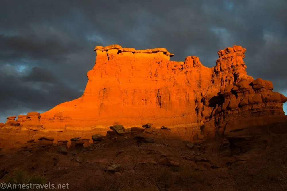
6.0 End at the Red Canyon Trailhead (4,964ft.). If you come back late, enjoy sunset from the overlook – it’s beautiful! (38.5639160°, -110.7037090°)
I wouldn’t choose Red Canyon as the best hike in Goblin Valley State Park, but it has two pros in its favor: 1) it’s the fastest and easiest way to Valley 3, and 2) it’s great for when you’ve hiked all the other trails in Goblin Valley!
Round Trip Trail Length: I went 6 miles, but I also explored a lot. You could get away with 4-5 miles, probably, if you stayed in the wash.
Elevation Gain: 688ft. (4,957ft. to 4,816) – this included some unnecessary scrambling/elevation gain, which probably added 100-200ft. of gain
Facilities: Restrooms and picnic tables at the trailhead
Fees: $20 per vehicle, valid until 10pm on the day after you purchase the pass. I made good use of it and purchased at 8:30am – so I spent two full days in the park! Utah State Park Passes are accepted (only available to Utah residents). National Park Passes and other federally-issued passes are NOT accepted.
Trail Notes: I don’t need to detail here the lack of signage after about half a mile of walking. In general, you can just follow the wash, though that’s not always the easiest to do, especially early on. I do recommend continuing a short distance beyond the state park boundary to see the rock formations. With different timing, I might have gone further to see what there was to see; it seemed the wash would take us to some nice views around the San Rafael Swell. Do be wary of quicksand, especially after rain.
Trail 
![]()
![]()
![]()
![]()
Road
Signs ![]()
![]()
![]()
![]()
Scenery ![]()
![]()
Would I go 100 miles out of my way for this? ![]()
![]()
![]()
Overall Rating: 
![]()
![]()
GPS Coordinates for Red Canyon in Goblin Valley
TH: 38.5638400°, -110.7036850° (38°33.83040′, -110°42.22110′ / 38°33’49.8240″, -110°42’13.2660″) (4,964ft.) (0.0)
Valley 3 sign: 38.5453610°, -110.7077820° (38°32.72166′, -110°42.46692′ / 38°32’43.2996″, -110°42’28.0152″) (4,842ft.) (2.01)
Leave Goblin Valley State Park; enter Big Wild Horse Mesa Wilderness: 38.5426480°, -110.7116850° (38°32.55888′, -110°42.70110′ / 38°32’33.5328″, -110°42’42.0660″) (4,833ft.) (2.51)
Valley 3-ish: 38.5461690°, -110.7056820° (38°32.77014′, -110°42.34092′ / 38°32’46.2084″, -110°42’20.4552″) (4,878ft.) (3.61)
Valley 3 sign: 38.5497500°, -110.7024710° (38°32.98500′, -110°42.14826′ / 38°32’59.1000″, -110°42’08.8956″) (4,882ft.) (4.73)
Return to trail: 38.5511890°, -110.7055400° (38°33.07134′, -110°42.33240′ / 38°33’04.2804″, -110°42’19.9440″) (4,883ft.) (5.07)
End: 38.5639160°, -110.7037090° (38°33.83496′, -110°42.22254′ / 38°33’50.0976″, -110°42’13.3524″) (4,964ft.) (6.02)
The gpx file for Red Canyon can be downloaded – please note that this and the GPS Coordinates are for reference only and should not be used as a sole resource when hiking this trail.
Download GPX File size: 138.7 KB Downloaded 137 times
(Note: I do my best to ensure that all downloads, the webpage, etc. are virus-free and accurate; however, I cannot be held responsible for any damage that might result, including but not limited to loss of data, damages to hardware, harm to users, from use of files, information, etc. from this website. Thanks!)
Getting to Red Canyon Trailhead
From the Goblin Valley State Park Entrance Station, drive south for 0.5 miles. Turn left, following the sign for the Valley of Goblins. The road will end in a parking area 0.7 miles later. The trailhead is on the far right end of the parking lot near the restrooms (not the vault toilets, which are at the opposite end of the parking area).
If you also need to get to the entrance station: From I-70, take Exit 149 to UT-24. Turn south and drive 24.2 miles (this turn is on the left, 13.3 miles north of Hanksville, if you’re coming from the south). The junction will be signed for Goblin Valley State Park. Drive 5.2 miles, then turn left (stay on the paved road) for 6.4 miles to the entrance station.

More Hikes in Goblin Valley and Vicinity
Hike some of the best trails in Utah, from national parks and classic paths to places like Coral Pink Sand Dunes and Goblin Valley State Park. Buy your copy here.