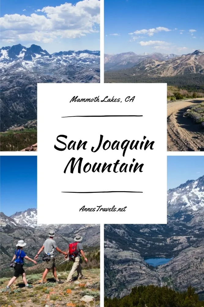
San Joaquin Mountain may very well be one of the most beautiful hikes in the High Sierra. (Maybe I’m pushing it, because there are a lot of gorgeous hikes in the region… so let’s say the most beautiful hike near Mammoth Lakes, California – and given that there are quite a few hikes in Mammoth, we’ll just say that this is a good one with a lot of pain but a whole lot more gain!) Beginning at Minaret Vista, the route (it’s not always a trail) uses a rough 4×4 road to ascend a lovely meadow, then works its way along a trailless, meadowed ridgeline with spectacular views to the nearby mountains as well as alpine lakes. I really don’t think I’m overselling it – if you love top-of-the-world feelings and great alpine views (and you don’t mind no trail), you’ll love this hike!
Quick Stats
This post contains affiliate links. If you click the link and purchase something, I may get a small commission. There is no extra cost for you.
There are a few variations to hiking San Joaquin Mountain. First, the 4×4 San Joaquin Ridge Road is beautiful enough on its own to be a great hike – with no need to go off-trail. Second, if you have 4×4 and know how to use it, you can drive to the end of the road and hike from there, cutting the distance by 2.4 miles in each direction (4.8 miles shorter overall). The ridgeline without the trail is a little rocky in places, but it’s never worse than easy Class 2. And since you’re following the ridge, it’s pretty hard to get lost.
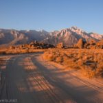
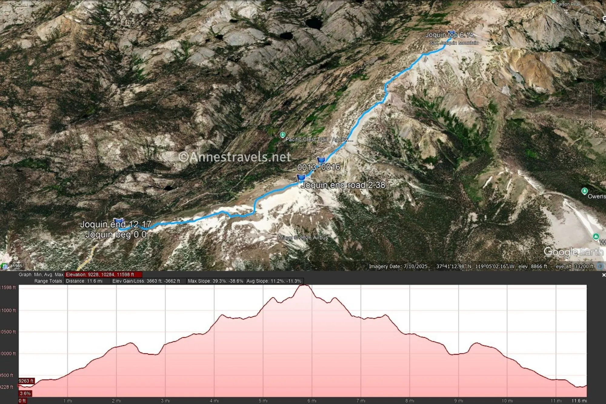
0.0 Minaret Vista Trailhead (9,256ft.). Walk right (behind the restrooms) to the picnic table. Keep following the trail downhill until it meets the dirt road. (37.6566780°, -119.0612720°)
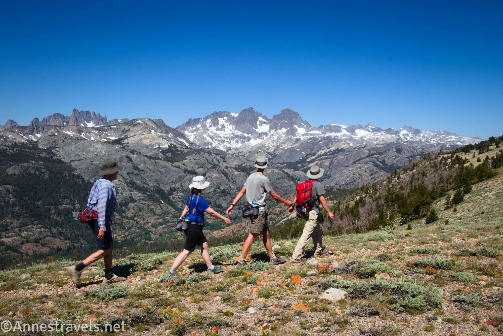
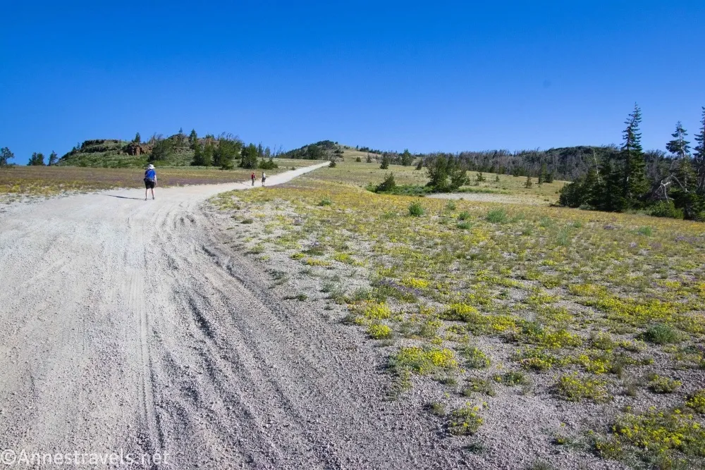
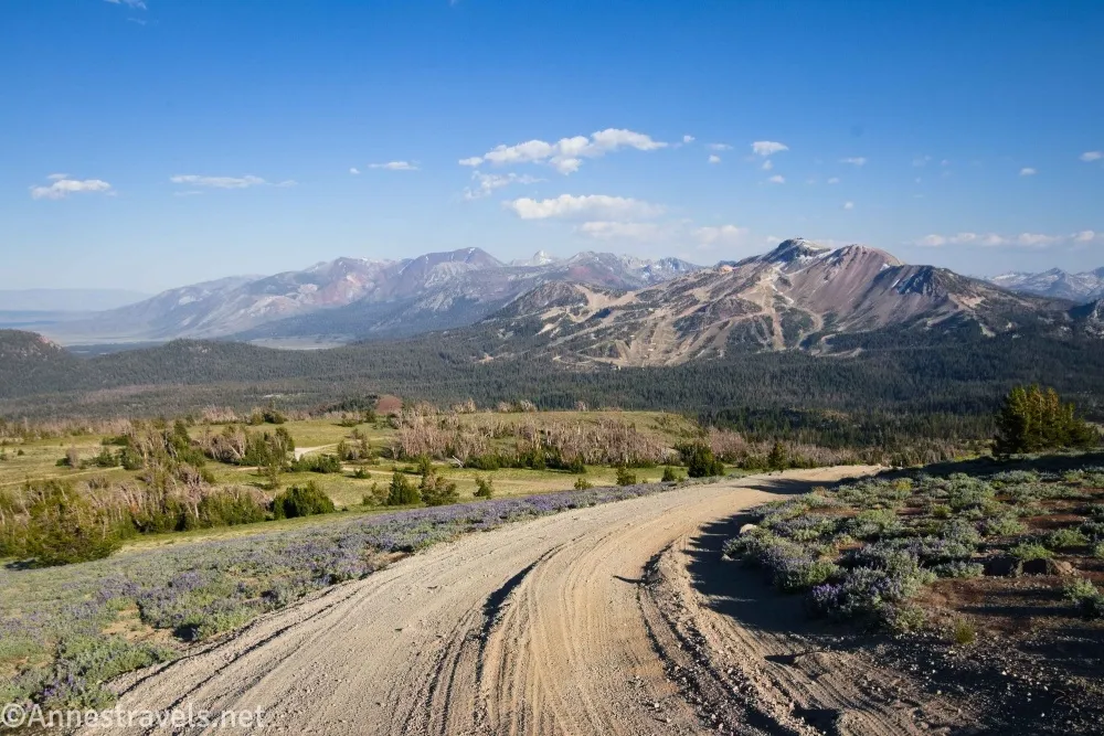
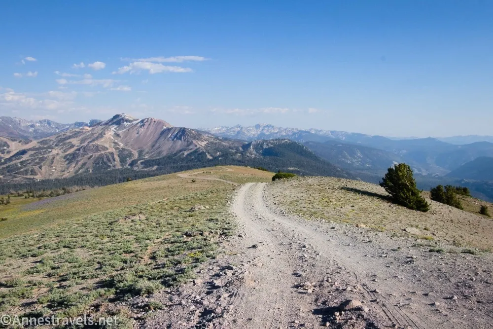
0.1 Meet the San Joaquin Ridge Road (9,229ft.). You may meet the road in a slightly different place, but you’ll want to take stock of where the junction is (it’s unmarked) so you remember where to turn on your way back. Turn left on the road and begin a mostly upward trek. Shortly after meeting the road, it passes through a dense copse of trees – the road in this section was very bad with deep ruts, convincing me there was no chance I could get my van up here. I did see a few pickup trucks, jeeps, and possibly an SUV later in the day, but from the ruts, I would have thought it would have been more suited to a side by side or ATV. (37.6575940°, -119.0604380°)
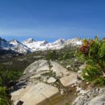
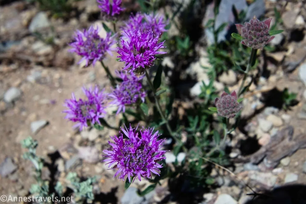
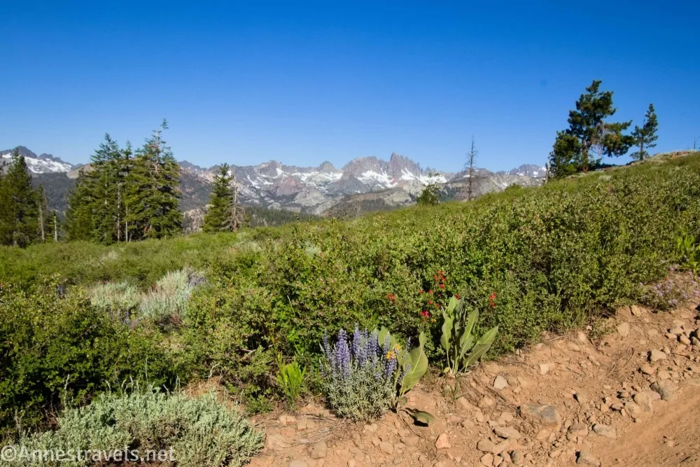
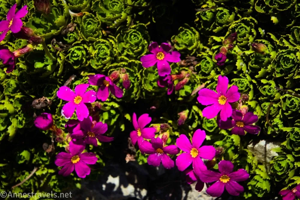
(I broke the narrative here so I could put in an extra picture…) Fairly quickly after this, the road breaks out of the trees and you’re in for a treat – or at least, you’ll be in heaven if you love meadows and mountains as much as I do! The road is steep, but on your breath-breaks, you get to look left to the High Sierra (Ansel Adams Wilderness around the Minarets). In early July, the meadows had a few nice wildflowers, but it appeared that there would be more later in the season.
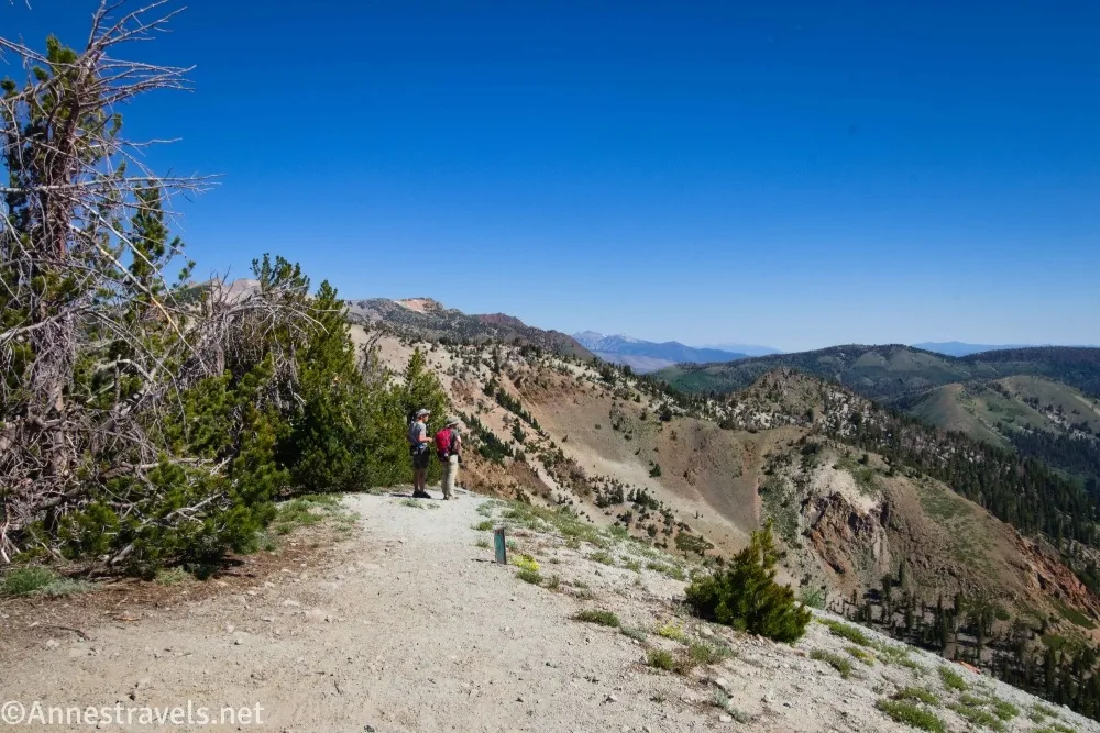
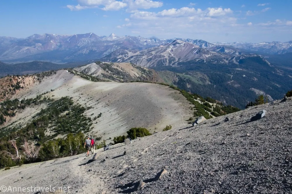
2.4 End of road; enter Owens River Headwaters Wilderness (10,221ft.). Actually, the wilderness is on the right side of the ridge and the Ansel Adams Wilderness is on the left. There is a very small parking area at the end of the road, then a very steep social trail continues down along the ridgeline. Follow the path down to the pass. (37.6849770°, -119.0655270°)

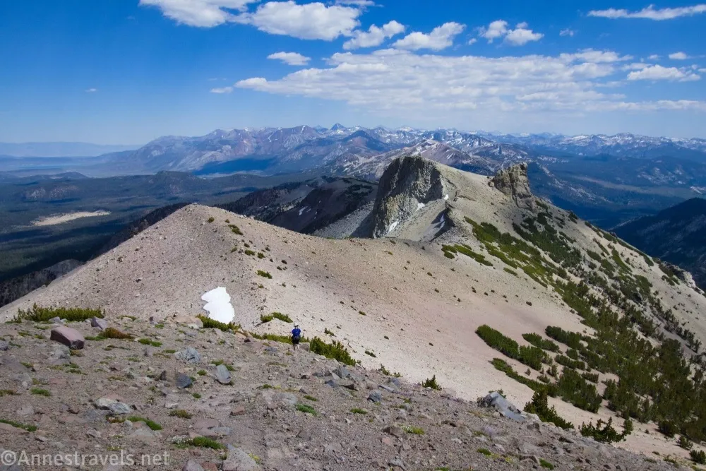
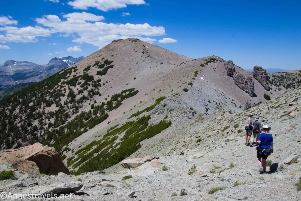
2.8 Deadman Pass (9,975ft.). This is just a pretty meadow area in a saddle. The path fades after the pass, but you can continue along the top of the ridgeline (or pass below the false summits, especially the Two Teets about mile 5.3 (37.7118220°, -119.1003530°)). The walking is neither easy nor difficult as the top of the ridge is usually either short grasses or talus. Class 2 scrambling (not even the remotest need to use your hands in most places) is required when the talus becomes large. You might also find a trail occasionally. (37.6895790°, -119.0716290°)
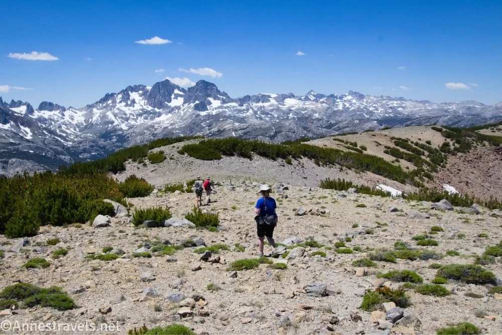
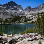
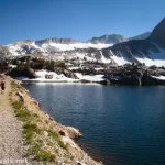
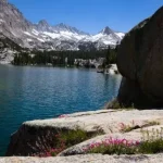
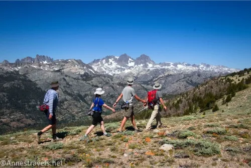
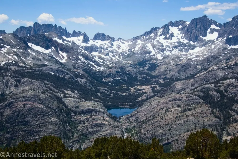
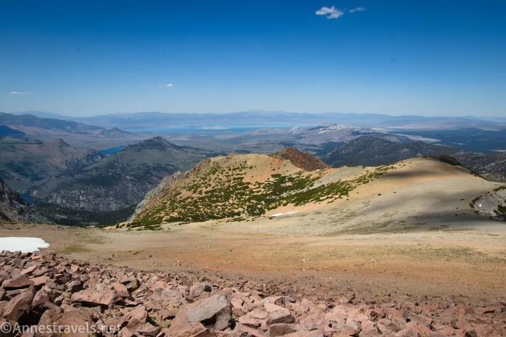
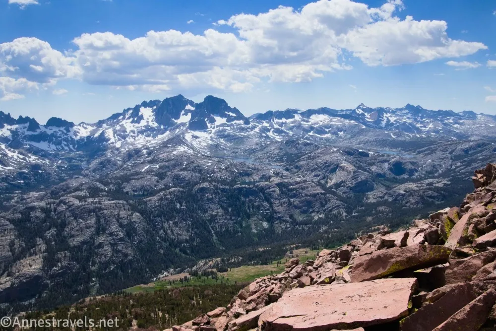
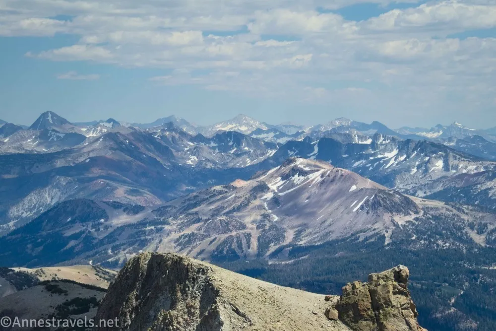
(Once again, a stuff-the-post-with-pictures break…) All along the ridge are the most beautiful views. Besides the High Sierra ridgeline with the Minarets, you also can see into the valley to the left (including Rosalie Lake, Shadow Lake, Clarice Lake, Garnet Lake, and Thousand Island Lake along the John Muir Trail). It’s just gorgeous! Don’t forget to look right into the valley, too, which also as nice views. Anywhere you stop along the ridgeline would be worth the hike, but I pressed on to the summit of San Joaquin Mountain. This was a definite and conscience decision because the ridgeline undulates. About the time we reached the Two Teats, we were like, do we really want to go down to go back up?? But we decided to keep going!
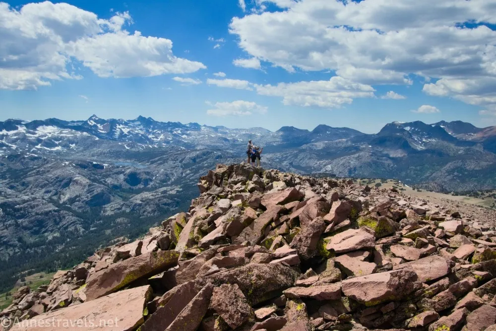
6.1 Summit of San Joaquin Mountain (11,570ft.). This is the high point of the ridge as well as where the ridge suddenly begins steeply descending. Views are just as stunning as from the rest of the ridge. Maybe a little better. Take a rest and enjoy the views before retracing your steps to Minaret Vista! (37.7190540°, -119.1060890°)
Round Trip Route Length: I went 12.2 miles. It felt like slightly more because of the elevation.
Elevation Gain: 3,663ft. (9,226ft. to 11,598ft.)
Facilities: Pit toilets and a couple of picnic tables at Minaret Vista.
Fees: None
Trail Notes: There are three difficult things about this hike: 1) The elevation (I’m not used to hiking above 10,000ft. most of the time!), 2) the steepness (mostly on the road) and 3) the sheer length. I loved the ridge part of the hike, but it did seem to go on for a very long time. Minaret Vista has very little parking, especially compared to the number of people who want to descend on it for sunset! I literally could not drive my van down the road because thirty or more cars squeezed themselves onto the narrow shoulder, people were walking the road, and – worst – someone parked in the middle of the road. (Yes, in the middle of the road. There were a lot of angry tourists all trapped on the access road and a lot more angry tourists who were missing sunset because they couldn’t get to the vista because there was a car parked in the middle of the road…)
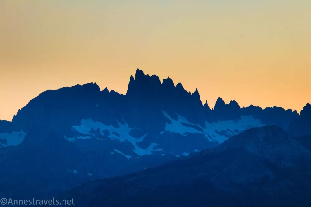
The Minarets are definitely the most beautiful in the morning, as they’re silhouetted by the sun in the evening. Don’t try this hike if a thunderstorm is expected, as the ridgeline is completely exposed. I was surprised at the lack of large rocks with a view at the summit of San Joaquin Mountain, but we continued a short distance along the ridgeline and found some good ones for resting while eating a snack and enjoying the view.
Trail 
![]()
![]()
![]()
Road ![]()
Signs ![]()
![]()
![]()
![]()
Scenery
Would I go 100 miles out of my way for this?
Overall Rating: 
![]()
GPS Coordinates for the San Joaquin Mountain Trail
Minaret Vista TH: 37.6566780°, -119.0612720° (37°39.40068′, -119°03.67632′ / 37°39’24.0408″, -119°03’40.5792″) (9,256ft.) (0.0)
Meet San Joaquin Ridge Road: 37.6575940°, -119.0604380° (37°39.45564′, -119°03.62628′ / 37°39’27.3384″, -119°03’37.5768″) (9,229ft.) (0.1)
End of Road; enter Owens River Headwaters Wilderness (Ansel Adams Wilderness just to south/west): 37.6849770°, -119.0655270° (37°41.09862′, -119°03.93162′ / 37°41’05.9172″, -119°03’55.8972″) (10,221ft.) (2.38)
Deadman Pass: 37.6895790°, -119.0716290° (37°41.37474′, -119°04.29774′ / 37°41’22.4844″, -119°04’17.8644″) (9,975ft.) (2.8)
Passing below the Two Teats: 37.7118220°, -119.1003530° (37°42.70932′, -119°06.02118′ / 37°42’42.5592″, -119°06’01.2708″) (11,287ft.) (5.3)
Top of San Joaquin Mountain: 37.7190540°, -119.1060890° (37°43.14324′, -119°06.36534′ / 37°43’08.5944″, -119°06’21.9204″) (11,570ft.) (6.14)
End (restroom): 37.6566840°, -119.0611040° (37°39.40104′, -119°03.66624′ / 37°39’24.0624″, -119°03’39.9744″) (9,256ft.) (12.17)
The gpx file for San Joaquin Mountain can be downloaded – please note that this and the GPS Coordinates are for reference only and should not be used as a sole resource when hiking this trail.
Download GPX File size: 168.2 KB Downloaded 36 times
(Note: I do my best to ensure that all downloads, the webpage, etc. are virus-free and accurate; however, I cannot be held responsible for any damage that might result, including but not limited to loss of data, damages to hardware, harm to users, from use of files, information, etc. from this website. Thanks!)
Getting to Minaret Summit (San Joaquin Mountain Trailhead)
From US-395, take Exit 263 for Mammoth Lakes; turn toward Mammoth Lakes. Travel through the town for about 3.6 miles from the highway, then take a right onto CA-203W/Minaret Road. After 5.4 miles, turn right toward Minaret Summit (this paved road is on the right just before the entrance station for Devils Postpile National Monument). The San Joaquin Jeep Road will be on the right a short distance later; ignore it and continue about a quarter mile to the Minaret Vista parking area.
Explore around Mammoth Lake
Explore the area around Mammoth Lakes, including trails and scenic drives, with this classic guide. Buy your copy here!