
I heard about the wonders of McCloud Falls from a social media friend who used to live in the area. His pictures were lovely, and it was said to be a great local swimming hole. Now, I’m well aware that local swimming holes can mean all kinds of things, but the pictures looked like it wasn’t too sketchy, and the reviews seemed all right, so when I had an afternoon in the Redding, CA, area, I gladly drove up to McCloud Falls, about an hour and a half north via I-5.
Quick Stats
This post may contain affiliate links. I earn a small commission if you click a link with which I’m an affiliate. There is never an extra cost for you.
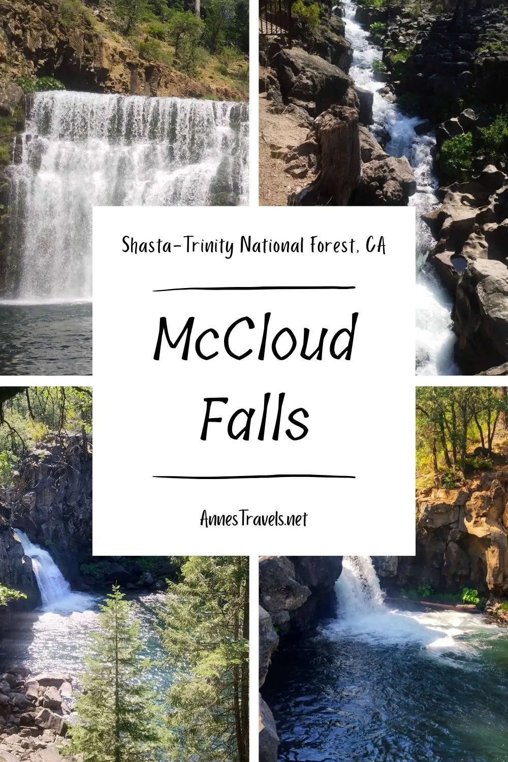
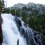
We parked at the Lower Falls, hiked to the Upper Falls, swam below Middle Falls along the way, and finally ended with a quick dip above Lower Falls. I was surprised at how much the area reminded me of Letchworth State Park in New York – the Upper Falls was interesting but not huge as it tumbles at angles on top of itself, the Middle Falls is massive and wide, and the Lower Falls is impressive but narrow and hard to see. (Actually, the only one of the falls that bears resemblance is the Middle Falls and the Middle Falls, which are remarkably similar with the McCloud Falls version being slightly smaller, but Letchworth also has at-angles Upper Falls and a hard-to-see Lower Falls).
And the people? Well, some of them could have been “swimming hole types,” but in general, everyone was just really nice! We were all there for a relaxing afternoon, so we ignored one another and enjoyed ourselves in proper bathing attire.
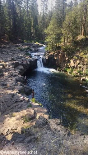
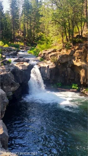
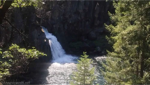
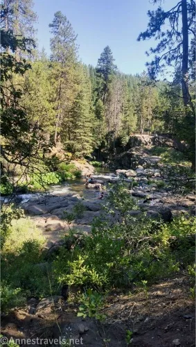
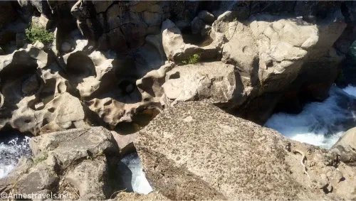
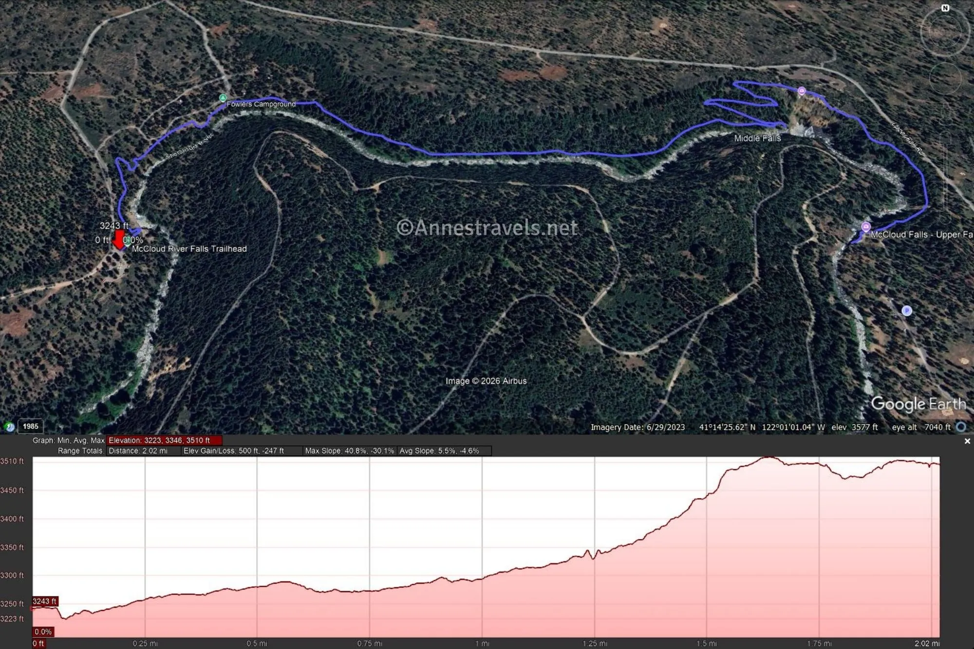
0.0 Lower Falls Trailhead (3,243ft.). There is a picnic area near the trailhead. Descend to the falls area or follow the trail to the overlook on the right. There are virtually no signs, so it’s a little confusing, but if you look around the falls area, you’ll eventually find the Lower Falls. Remember, the height of the water will determine how close you can get to it – if the water is swift, don’t try swimming. The Lower Falls area is where the families tend to hang out, as it’s the easiest to access in terms of getting to the water. However, the water isn’t very deep in its many channels through the rock (which are pretty neat, by the way), so it’s not the real swimming hole. A few kids were cliff-jumping near the Lower Falls when we came back, but I didn’t try it. If you stay to the left of the creek, a trail will become more defined and take you up to Middle Falls after passing below the campground. (41.2405450°, -122.0250550°)
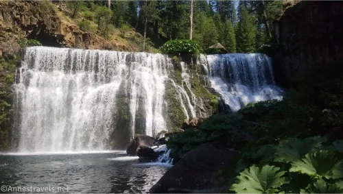
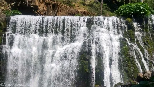
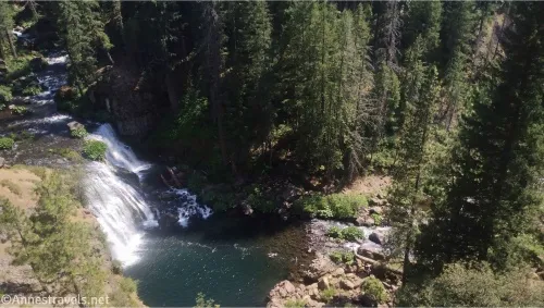
1.25 Middle Falls swimming hole (3,330ft.). It’s hard to see Middle Falls from above, but a sketchy trail on the right does lead down to the base of the falls, which is the most popular swimming hole. This trail isn’t for the faint of heart. It’s exceedingly steep, slippery, and narrow. And I was trying to hike it in water shoes! If you can make it down, you’re treated to the true swimming hole, complete with gorgeous views of Middle Falls (especially if you rock-hop, log-hop, or swim out to the middle of the river). We spent a few minutes swimming (the water was cold!) before scrambling back up to the main path to Upper Falls. The path parallels the road in this area, so there will likely be some traffic noise. (41.2434720°, -122.0094500°)
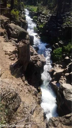
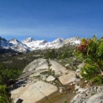
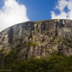
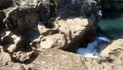
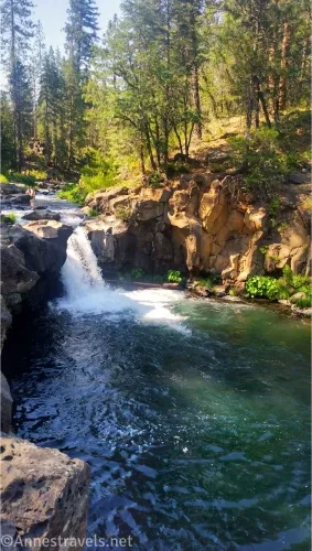
2.1 Upper Falls Area (3,483ft.). In some ways, the Upper Falls is the most interesting of the three waterfalls, but it’s also the hardest to see, as it’s in a volcanic canyon. It’s still really neat as it jostles its way through deep channels in the rocks. There are several viewpoints to explore near the falls. Retrace your steps to the Lower Falls – unless you brought along a shuttle vehicle! (41.2403310°, -122.0090670°)
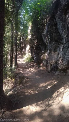
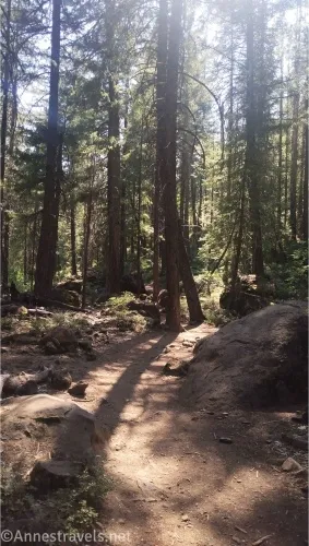
Note: There are parking areas for each of the falls, so you can drive between the viewpoints if you want. Much of the trail is in the woods, but there are still some areas of sun, at least in the middle of the day.
Round Trip Trail Length: 4.1 miles out & back
Elevation Gain: 747ft. (3,223ft. to 3,510ft.)
Facilities: Vault toilet and picnic tables at the Lower Falls; camping along the trail
Fees: None
Trail Notes: The trail gains significant elevation, but it’s not too bad, even on a warm day, due to the elevation making the area cooler than the nearby lowlands (think Redding… it always seems to be about 110F with 98% humidity when I visit). Bathing suits (or at least clothing) are required. The path passes below the campground in one place, so it could be a little more private. I think the trail was once paved as there is still asphalt in many places, but I wouldn’t try a stroller on this route. There are parking areas for all three falls (I think) if you’d rather drive than hike between the overlooks.
Trail 
![]()
Road ![]()
Signs ![]()
![]()
![]()
Scenery ![]()
![]()
![]()
Would I go 100 miles out of my way for this? ![]()
![]()
Overall Rating: ![]()
![]()
GPS Coordinates for McCloud Falls
TH: 41.2405450°, -122.0250550° (41°14.43270′, -122°01.50330′ / 41°14’25.9620″, -122°01’30.1980″) (3,243ft.) (0.0)
Lower Falls Overlook area: 41.2410650°, -122.0248060° (41°14.46390′, -122°01.48836′ / 41°14’27.8340″, -122°01’29.3016″) (3,243ft.) (215ft.)
Middle Falls swimming hole: 41.2434720°, -122.0094500° (41°14.60832′, -122°00.56700′ / 41°14’36.4992″, -122°00’34.0200″) (3,330ft.) (1.25)
Middle Falls Overlook: 41.2438010°, -122.0088010° (41°14.62806′, -122°00.52806′ / 41°14’37.6836″, -122°00’31.6836″) (3,503ft.) (1.6)
Upper Falls area: 41.2403310°, -122.0090670° (41°14.41986′, -122°00.54402′ / 41°14’25.1916″, -122°00’32.6412″) (3,483ft.) (2.1)
There are some other junctions along the way; you mostly just want to stay right on your way upstream (closer to rather than further from the river)
The gpx file for McCloud Falls can be downloaded – please note that this and the GPS Coordinates are for reference only and should not be used as a sole resource when hiking this trail.
Download GPX File size: 17.2 KB Downloaded 213 times
(Note: I do my best to ensure that all downloads, the webpage, etc. are virus-free and accurate; however, I cannot be held responsible for any damage that might result, including but not limited to loss of data, damages to hardware, harm to users, from use of files, information, etc. from this website. Thanks!)
Getting to McCloud Falls
Take I-5 North to Exit 736. Merge onto CA-89 toward McCloud; drive 15.2 miles where a sign on the left says, “Fowlers and Lower Falls.” Turn right. After 0.7 miles, turn right, then turn left after another 0.4 miles. After 0.2 miles, the parking area will be on your left.
More Trails near McCloud Falls
Want the not-so-long, not-so-hard trails in Northern California? This book covers 80 of the best hikes that fit these conditions! Buy your copy here.