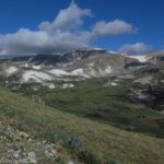
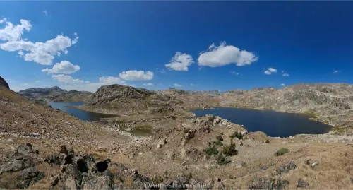
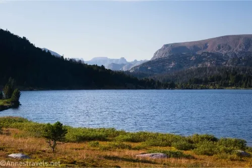
Island Lake is considered one of the premier places to hike along the Beartooth Highway. From the parking area, you can access such gorgeous destinations as walking around Island Lake, Beauty Lake, Becker Lake, and/or hiking all of the way out to Jasper Lake. I took in a lot of fabulous scenery between Island Lake and Jasper Lake, though I didn’t quite make it all of the way down to the final lake (I was already pushing time quite a bit, but the scenery was so stunning that I went on and on and on…) No matter how far you hike, you’ll be treated to gorgeous views, pristine alpine lakes, peaceful meadows, and much more!
Quick Stats
This site contains affiliate links. If you click one of these links and make a purchase, I may receive a small commission. There is no extra cost to you.
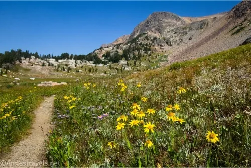
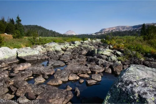
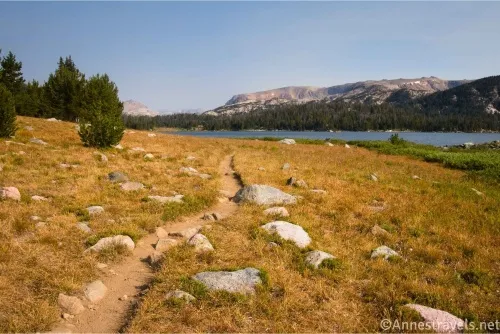
One of the fun things about this hike is that you start in Wyoming and end up in Montana somewhere between Becker Lake and Albino Lake. The other fun thing is that the views start right at the trailhead and never really let up except for a few short stints in the trees. Once past Becker Lake, the scenery around the trail is all meadows and rocks with towering mountains high above. My favorite kind of scenery for miles upon miles – now that’s a great hike!
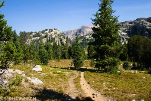
0.0 Island Lake Hiker’s Parking Area (9,565ft.). There are two places to park – first, there are a few parking spaces down near the boat launch. This will cut 0.2 miles each way off your hike, but parking there is very limited. I opted to park in the more shaded hiker’s parking lot, so that’s where my mileage starts. Take the well-defined trail by the sign kiosk down to the boat launch. (44.9419540°, -109.5357140°)
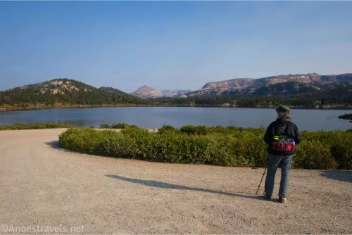
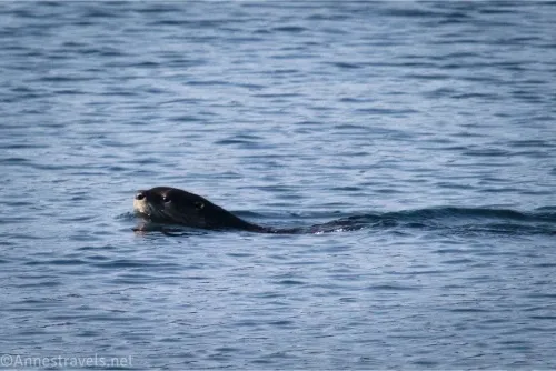
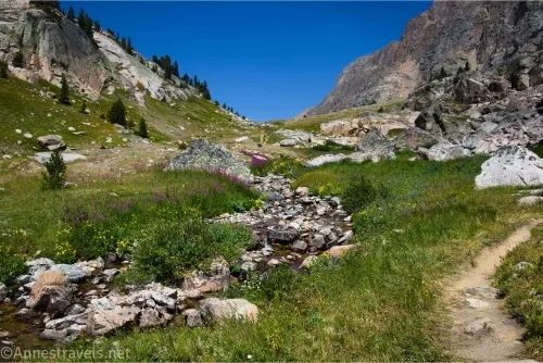
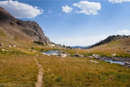
0.2 Boat Launch by Island Lake (9,539ft.). There are two ways to go around Island Lake. The more popular route goes left (clockwise) and is 0.2 miles shorter than my route. I opted to do the less popular route first and turned right (counterclockwise) on a trail that dropped to cross the Island Lake Outlet – I was able to rock-hop and keep my feet (mostly) dry in late August. From here, the faint trail worked its way through meadows along the lakeshore, becoming vaguer until it was almost invisible on the eastern shore. However, it’s hard to get lost, as all you have to do is keep the lakeshore on your left. Things get a little tricky about halfway up the lake, but keep going, and you’ll eventually pick up the trail again near the head of the lake. I visited on a very peaceful morning, and as I walked along the shore, some ripples in the water caught my eye – otters! In the wild! How cool is that?!? The path curves north (right) away from the lake to cross Island Lake’s inlet quite a distance upstream from the lake. This crossing is an easy rock hop on giant boulders. Almost immediately after the crossing, pick up the Island Lake Trail. (44.9426650°, -109.5385750°)
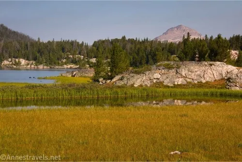
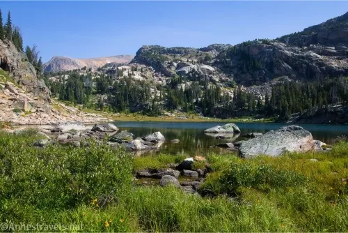
1.6 Meet the Island Lake Trail (9,545ft.). Turn right to continue up to Night Lake, only a short distance away. Pass a few more lakes before the Becker Lake Trail Junction. All of these lakes are lovely and well worth seeing even if you don’t want to go all of the way to Becker Lake and beyond. (44.9531600°, -109.5467010°)
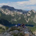
3.45 Becker Lake Trail Junction (9,659ft.). This junction is very obvious but unmarked in a copse of trees. If you go too far, you will find a sign pointing right toward Becker Lake – but the route where the sign points is not the most used one, and I’m not sure whether or not it’s hikable. If you really go too far, you descend to Beauty Lake (a worthy destination unto itself; I’d finally get there the next day, though from a different trailhead). Turn right at the unmarked trail junction on the well-troddon trail that descends to another lake (apparently unnamed). The path splits near here, with one trail going left along a part of the lakeshore and the other going straight to cross the outlet and continue along the shore of the unnamed lake into a rock scramble. Take your time to scramble over the rocks and pick up the trail on the other side as it rambles steeply up to a pass and then down the other side and eventually to the Becker Lake Spur – I found this uphill to be the hardest part of the entire hike because it’s very steep and the trail looks like a well-worn but unengineered social path. Take a breather or two along the way, especially if you’re only two days out from living at 300ft. above sea level like me! (44.9734980°, -109.5642040°)
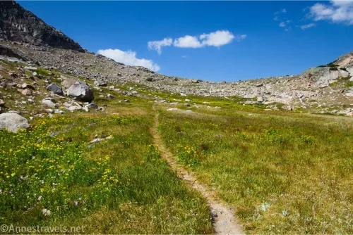
4.6 Becker Lake Spur on left (9,757ft.). If you only want to go as far as Becker Lake, this is your turnoff to descend to the lake – though the lake extends for a long distance northward, and there are several more places where you could access the lake and be farther from other hikers and campers. (It seems most backpackers come out to Becker Lake, so it can get congested at times). We decided to stay on the higher trail and head for Albino Lake. While the trail has been a mix of meadows and forests up until now, the trees more or less vanish at this point and you’ll be walking in meadows for the remainder of the hike. The path continues to work its way upward, eventually passing above the upper part of Becker Lake before truly beginning its meadow climb toward Albino Lake. Just before arriving at Albino Lake, the trail will seem to go straight, but you actually want to turn left to cross the lake’s outlet to pick up one of a few social trails along the south end of the lake. (44.9870050°, -109.5653100°)
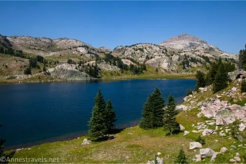
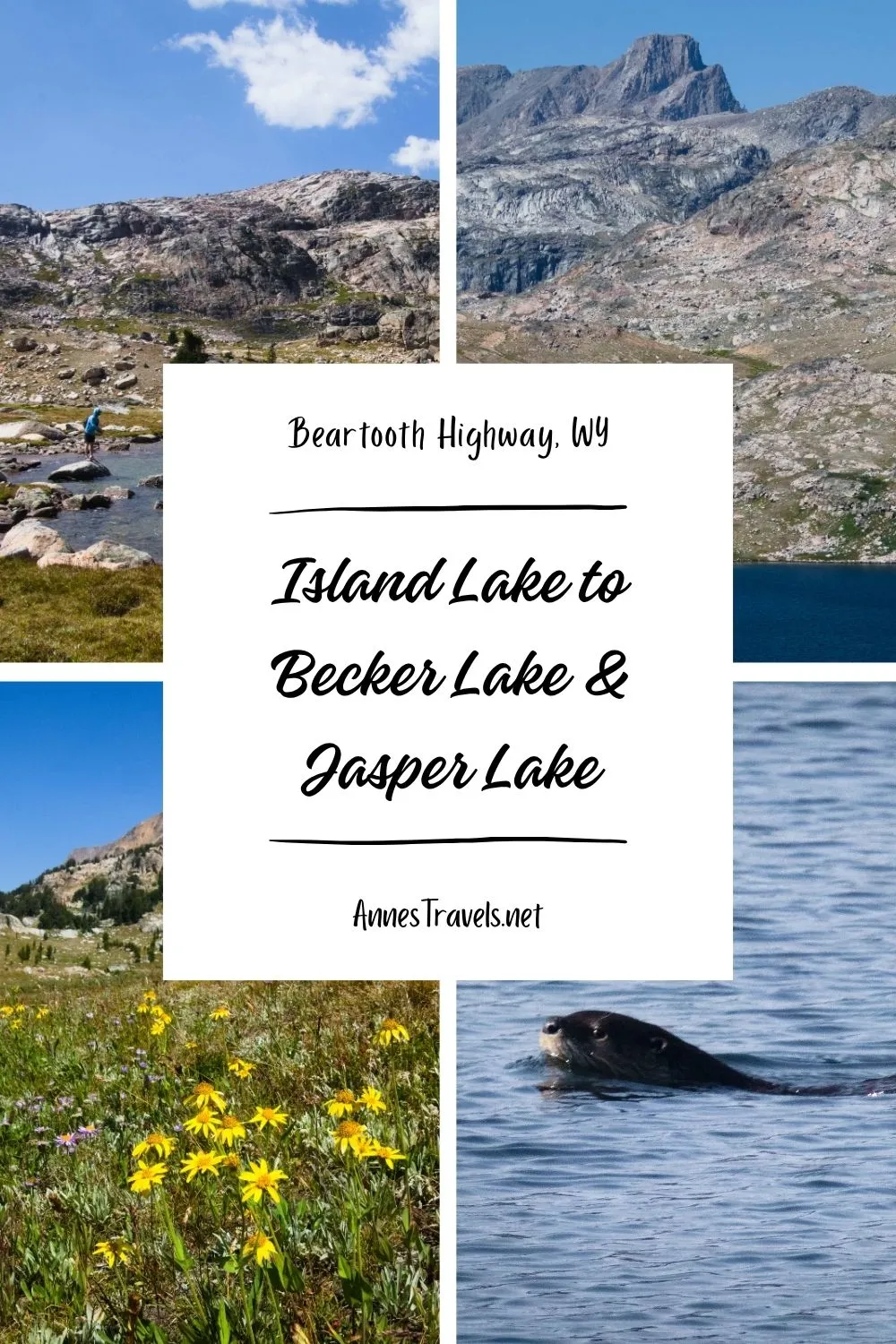
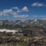
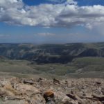
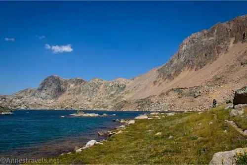
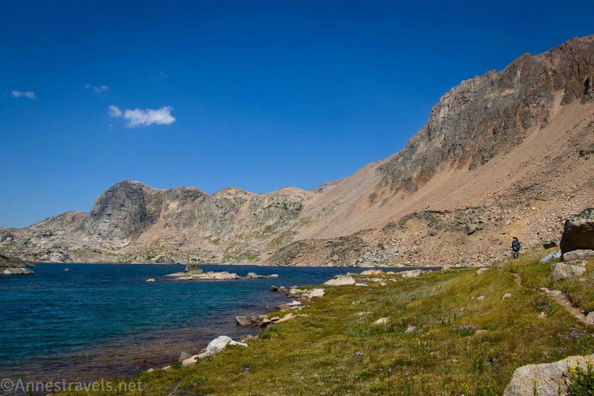
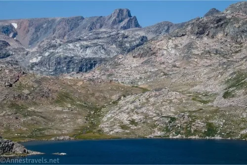
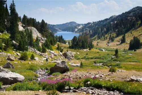
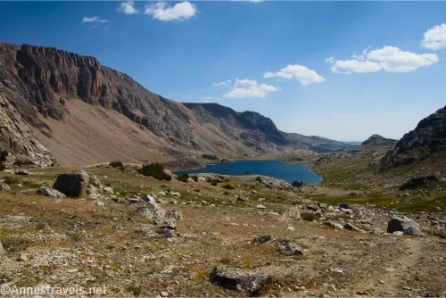
6.7 Albino Lake (10,004ft.). Views are spectacular, especially from the foot of the lake and as you walk north along the lakeshore. This is a great turnaround spot, but I decided to push daylight (and mileage, and energy, and not-quite-in-shape-yet ability) and continue up to Jasper Lake. The path works its way mostly on a level surface (if very much a classic lakeside trail on the steep edge of the hillside) to the end of Albino Lake, then rises not terribly steeply up to the pass separating this valley from the next. Along the way, it scrambles through some rocks, but it’s not too difficult. On the other side of the pass, Jasper Lake comes into view, with Amber Lake to the left. Wow!! (45.0113480°, -109.5758760°)
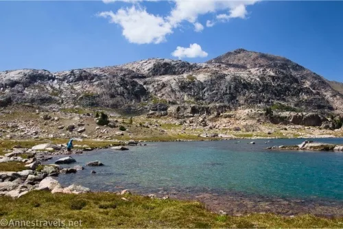
8.4 Jasper Lake Viewpoint (10,265ft.). I continued down the other side of the pass to a viewpoint overlooking Jasper Lake and Amber Lake. Incredible! This really was the crowning touch of an absolutely gorgeous hike! Feel free to descend another 0.2 miles to the lake if desired before retracing your steps to the trailhead (though we did go on the more popular trail along the west shore of Island Lake on our way back – and I highly recommend it; it’s a much easier trail to hike and follow than on the east side of Island Lake!) (45.0241070°, -109.5918610°)
Round Trip Trail Length: I went basically 16 miles, though there are many ways to make this trail shorter without giving up (too much) spectacular scenery. For example, you could circle Island Lake for a 2.8 mile hike, or go to Becker Lake for a 9-ish mile round trip route, or go to Albino Lake for a 13.4 miles trek – or you can stop wherever you please along the way, because the scenery is good enough to be fantastic no matter how far you hike!
Elevation Gain: 2,122ft. (9,519ft. to 10,332ft.)
Facilities: Water and primitive restrooms at the campground at the trailhead. There is also one picnic table near the boat ramp, but no sidewalk goes to it, so be ready to tramp across a rocky meadow to get to it.
Fees: None
Trail Notes: This is an extremely long trail to do as a day hike. I did it, but it was a very long day and we were extremely tired by the end (it might not have helped that we were on our second long hike after a five-month break, and we weren’t even close to acclimated to the elevation yet). Stopping at Becker Lake, hiking only partway up to Albino Lake, or turning around at Albino Lake are all great ways to make the hike shorter. Be wary of afternoon thundershowers, as there is little to no cover up here. Most people hiking the trail seemed to be backpacking and fishing – a fishing license is required (Wyoming and Montana have separate licenses, and the state line is somewhere between Becker and Albino lakes), and while no permit is currently required to camp along the trail, wilderness regulations do apply (like camping 200ft. from water, etc.).
Trail 
![]()
![]()
Road ![]()
Signs ![]()
![]()
Scenery
Would I go 100 miles out of my way for this?
Overall Rating: ![]()
GPS Coordinates for Island Lake to Jasper Lake
TH: 44.9419540°, -109.5357140° (44°56.51724′, -109°32.14284′ / 44°56’31.0344″, -109°32’08.5704″) (9,565ft.) (0.0)
Upper parking (boat launch parking area): 44.9426650°, -109.5385750° (44°56.55990′, -109°32.31450′ / 44°56’33.5940″, -109°32’18.8700″) (9,539ft.) (0.16)
Cross stream: 44.9519810°, -109.5374280° (44°57.11886′, -109°32.24568′ / 44°57’07.1316″, -109°32’14.7408″) (9,524ft.) (1.04)
Meet Trail: 44.9531600°, -109.5467010° (44°57.18960′, -109°32.80206′ / 44°57’11.3760″, -109°32’48.1236″) (9,545ft.) (1.64)
Becker Lake Junction: 44.9734980°, -109.5642040° (44°58.40988′, -109°33.85224′ / 44°58’24.5928″, -109°33’51.1344″) (9,659ft.) (3.45)
Trail down to Becker Lake: 44.9870050°, -109.5653100° (44°59.22030′, -109°33.91860′ / 44°59’13.2180″, -109°33’55.1160″) (9,757ft.) (4.56)
End of Becker Lake: 44.9985300°, -109.5700710° (44°59.91180′, -109°34.20426′ / 44°59’54.7080″, -109°34’12.2556″) (9,700ft.) (5.61)
Albino Lake: 45.0113480°, -109.5758760° (45°00.68088′, -109°34.55256′ / 45°00’40.8528″, -109°34’33.1536″) (10,004ft.) (6.69)
Jasper Lake/Gold Lake Overlook: 45.0241070°, -109.5918610° (45°01.44642′, -109°35.51166′ / 45°01’26.7852″, -109°35’30.6996″) (10,265ft.) (8.42)
Cross stream: 44.9430000°, -109.5414150° (44°56.58000′, -109°32.48490′ / 44°56’34.8000″, -109°32’29.0940″) (9,523ft.) (15.77)
End: 44.9419430°, -109.5357710° (44°56.51658′, -109°32.14626′ / 44°56’30.9948″, -109°32’08.7756″) (9,565ft.) (15.96)
The gpx file for Island Lake to Jasper Lake can be downloaded – please note that this and the GPS Coordinates are for reference only and should not be used as a sole resource when hiking this trail.
Download GPX File size: 413.3 KB Downloaded 183 times
(Note: I do my best to ensure that all downloads, the webpage, etc. are virus-free and accurate; however, I cannot be held responsible for any damage that might result, including but not limited to loss of data, damages to hardware, harm to users, from use of files, information, etc. from this website. Thanks!)
Getting to the Island Lake Trailhead
From Red Lodge, Montana, take US-212 (the Beartooth Highway) south and west toward Yellowstone National Park and Cooke City. After 38.1 miles, turn right onto an unassuming gravel road well-marked for Island Lake Recreation Area. To get to the hiker’s parking area (where I parked), drive 0.2 miles, then take the first right and drive to the end of the road (trailers should park here). To get to the boat launch area, stay on the main gravel road as it passes the restrooms on the left and the trash bins on the right. Take the sharp right turn near the water pump (yes, one of those old green pumps) to travel downhill to the boat launch area – you’ll probably see people parking along the road (be careful of the no parking signed areas), though there are only a few official parking spaces above the boat launch.
From Cooke City, drive US-212 (the Beartooth Highway) east toward Red Lodge. After 25.8 miles, turn left onto an unassuming gravel road well-marked for Island Lake Recreation Area. Follow the directions (above) to your preferred parking area.

More Hikes on the Beartooth Highway
Explore more spectacular scenery along the Beartooth Highway and vicinity with this guide. It covers day hikes, multi-day hikes, lakes, waterfalls, mountains, and more. Buy your copy here.