

The Old Fall River Road in Rocky Mountain National Park isn’t open much of the year. In fact, of the five times I’ve visited the park, it’s only been open once to car travel. However, when it is open, it can be a fun hike, as well as a nice drive. The road is one-way (uphill), but the best views are coming down, and certainly not while driving (how can you keep your eyes on the road and the scenery at the same time?). So, I was very excited when I got to hike the top two miles of the road on my last visit to Rocky Mountain. The views were awesome, and the grade wasn’t bad for hiking. My only regret was that it wasn’t a sunny day, and sun would have make the views sparkle even more!
(Affiliate links are present on this page.)
The Old Fall River Road can be driven (usually from the 4th of July through September or October) by starting near Endovalley west of the Fall River Visitor Center. I’ve never actually done this section of the road, but as it’s below the treeline, it probably doesn’t offer quite as good views as the Trail Ridge Road. The Old Fall River Road ends at the Alpine Visitor Center, near the summit of the Trail Ridge Road, and that’s where I started my exploration of the road.

The road ends (and my hike began) behind the Trail Ridge Shop building. Go over towards the Alpine Ridge Trail (closed at the moment…they told us it was closed for the summer of 2010; now they say it’s closed for the summer of 2011…and it doesn’t look like they’ve done one thing to it since I was there in 2010!). However, instead of going up the trail, turn right behind the gift shop and walk down the road. It will become more and more apparent that this is the right way to go the farther you walk.
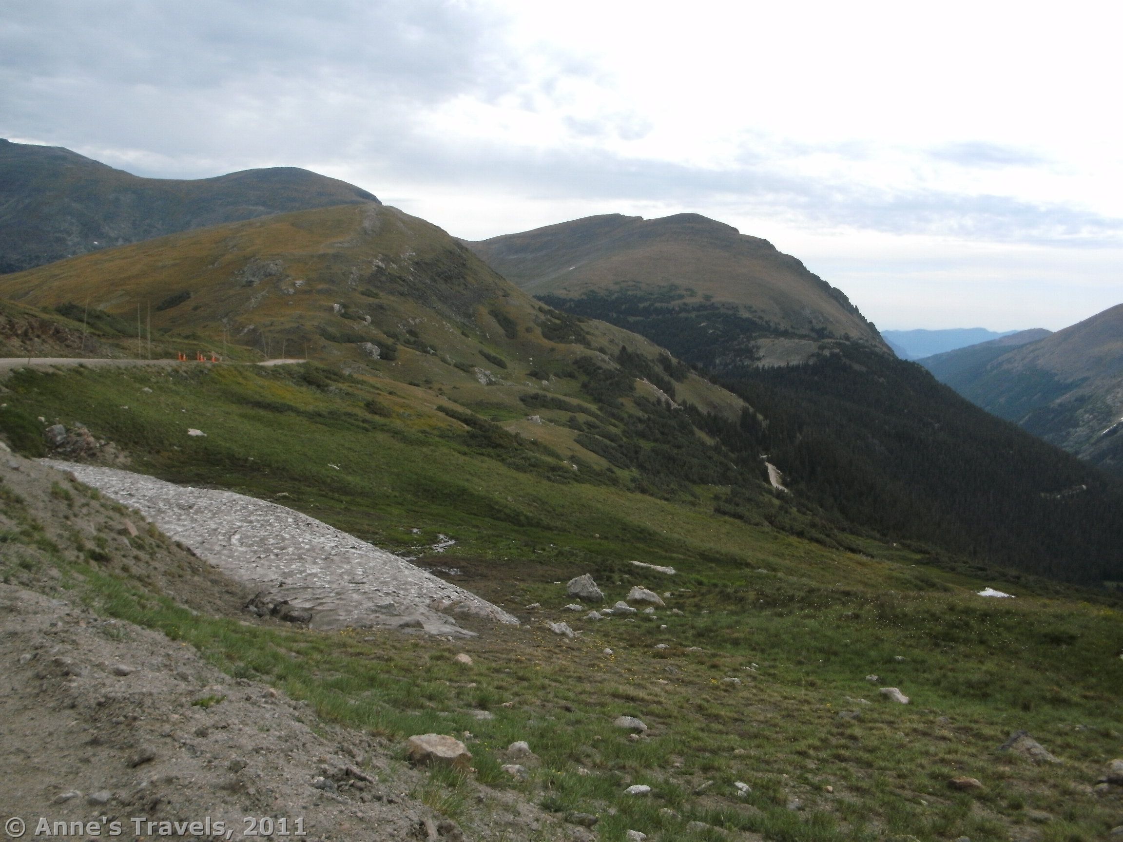
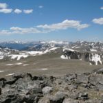
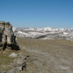
Before too long, you will come out from behind the building to glorious views of the valley below. As you continue down the road, the views will get better, at least until the first big curve. The road itself is paved for a short distance, then becomes a kind of hardpacked sand/gravel. It is amazingly not dusty, although if cars pass you, there will likely be some dust. A passenger car could easily do this section of road (I saw many), although I also saw plenty of jeeps, trucks, and minivans as well. It isn’t too steep, although there is enough grade to make you think twice of going too far downhill. After all, you have to climb back up it!

The road descends for a bit, and then goes around a large S curve. You’ve probably seen the best of the views, but press on. Keep walking downward, perhaps stopping to climb up on some of the social trail that lead up to viewpoints. (Most of these are located on or before the S curve). Be sure to look back up to the ridge: you will be able to see the visitor center as well as where the Trail Ridge Road is and the ridge that has the Toll Ridge Memorial (Tundra Communities Trail). These views will continue to about 2 miles down the road, when it enters the trees. Little red signs show how far you have walked; you probably only want to go to the number “7” marker (the number “9” marker, which is near the top of the road, was missing when I hiked it). You can keep walking as far as you want, but I would guess that most of the rest of the road is below the treeline, with limited to non-existent views. I only went about 0.25 miles further.

Return by the way you came. Although it is a steep grade, we found that we could keep walking without having to puff and pant—you are at 11,000+ feet up here, which can make you breathe harder than if you were at a lower elevation. Let’s just say that many trails I’ve been on have been steeper than this. Beyond the lack of steepness, the road is a smooth walking surface (except for the washboard, which would only bother a driver). All that to say, the walk back up could be more difficult than it is.
Although it’s only 4 miles round trip, this little walk would be a nice diversion from driving the Trail Ridge Road…and a good way to get out and experience Rocky Mountain National Park. Just be sure to get an early start in the summer: most afternoons the sky clouds over between 1 and 3pm and then thunderstorms develop quickly. It is best to be down off of the mountains by noon if at all possible.
Round Trip Length: 4 miles
Fees: $20 fee for entering Rocky Mountain National Park, valid 7 days. Interagency, Senior, Access, and Rocky Mountain Annual Passes also accepted.
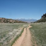
Trail 
![]()
Road
Signs ![]()
![]()
![]()
![]()
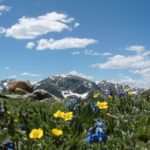
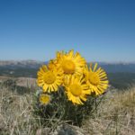
Scenery
Would I go 100 miles out of my way for this? ![]()
![]()
Overall Rating: 
![]()
This Week’s Featured Product!
This book covers some of the best views in Colorado! Check it out on Amazon.
One response to “Top of the Old Fall River Road”
[…] this, the trail probably will not be open to hikers this summer, unless the park allows hikers to walk down from the Alpine Visitor Center to the trailhead – adding 2 miles(3.2 km) each direction to the hike. Recent research leads me to believe that […]