
Well, I just got back from another cross-continent trip! This one was cooked up by a few of my fellow adventurers. “Let’s go to the Wind River Range!” they said (if in not so many words). “We haven’t been in ten years, and we’ve always wanted to go back. Maybe we’ll have better weather this time!” They were referring to the general haze of smoke that often covers Wyoming, and especially the Wind River Range, in August. “The farther from August you can get,” friends told me, “the more likely you won’t have smoke in the air.” This is likely true, but going before August means unprecedented swarms of mosquitoes, and after August, you’re courting the idea of snow showers. So we prayed hard and planned our trip for the first week of September.
This post may contain affiliate links. There is no extra cost to you.
I drove out in the van (gotta get the mobile hotel out there somehow!), promising to pick my companions up at the airport on the appointed day. But since I could swing the time off, I decided to explore the Beartooth Mountains on the Montana/Wyoming border before miraculously appearing at the airport pickup sidewalk at just the right moment. We’ve driven the Beartooth Highway a few times, including famously after 9/11, when our van with its New York license plate got its own police escort across the pass (aka we were trailed by the police across the continent). But we’ve never successfully found many trails along the highway. AllTrails to the rescue!
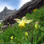
Our first hike was up to Glacier Lake. It wasn’t such a hard hike, but it seemed crazy difficult for us lowlanders!
The next day, we took the trail from Island Lake to Becker Lake… and then to Albino Lake… and then to Jasper and Amber Lakes. (Actually, we didn’t quite make it to Jasper because we were already on a trajectory to hike 16 miles, and we figured we had a good enough view from above.)
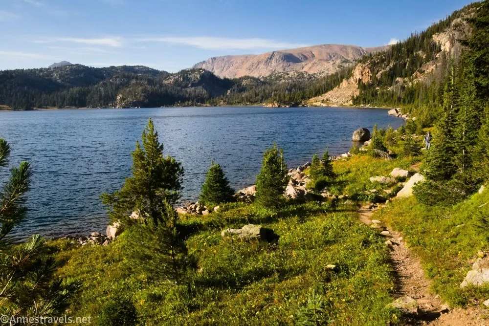
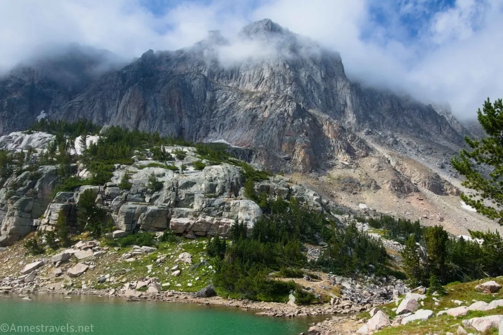
Our original plan was to hike to Beauty Lake, but since we hadn’t made it there, we figured we’d do it the next day via a trail from Beartooth Lake. We went up a gorgeous canyon, climbed to the top of Clay Butte (or at least the top of one of its arms), and finally did make it to Beauty Lake at Golden Hour.
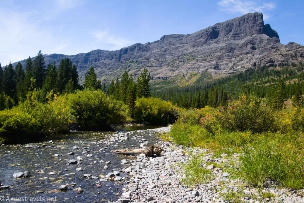
We drove down into Cooke City and found the visitor center had free WiFi (yay for Starlink!) Which was a good thing since we pretty much didn’t have cell service on the Beartooth Highway! It turned out this was our last sunny day, so we hopped down into Yellowstone National Park to hike the Pebble Creek Trail. The first part was crazy steep, but the meadows were well worth the effort.
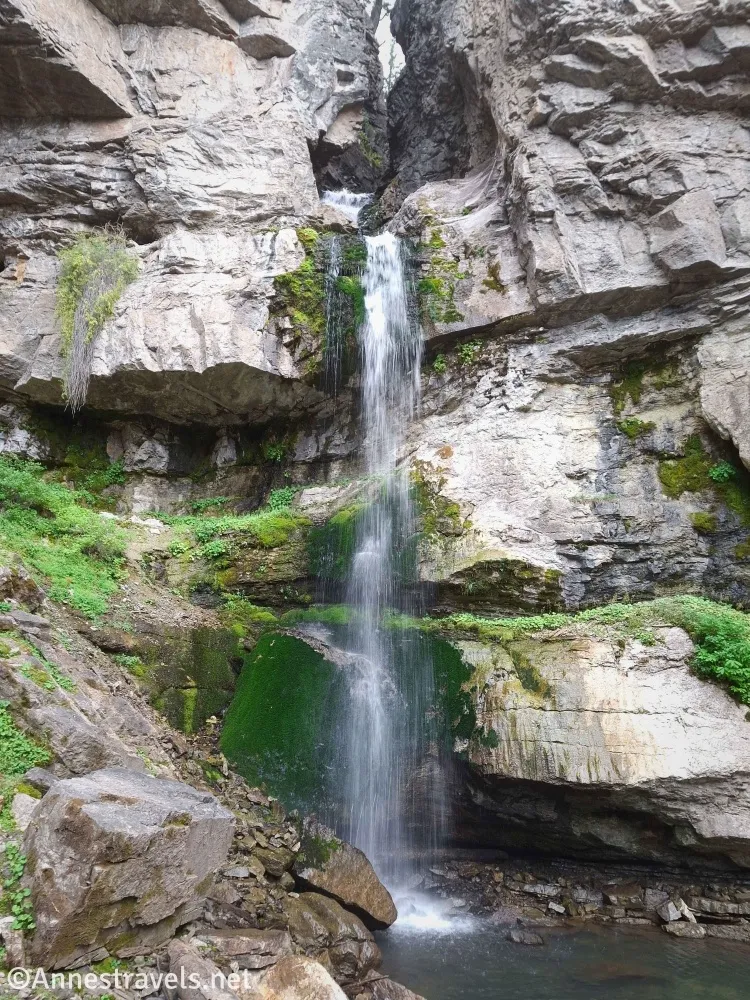
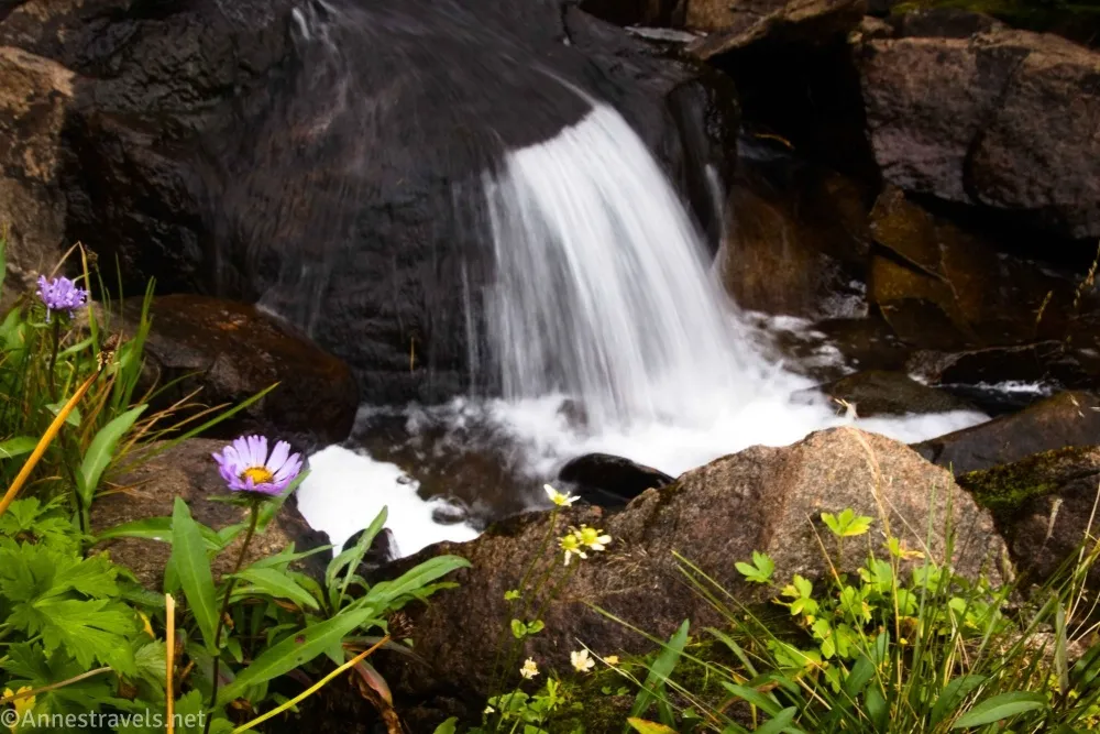
We also hiked up to see Bridal Falls.
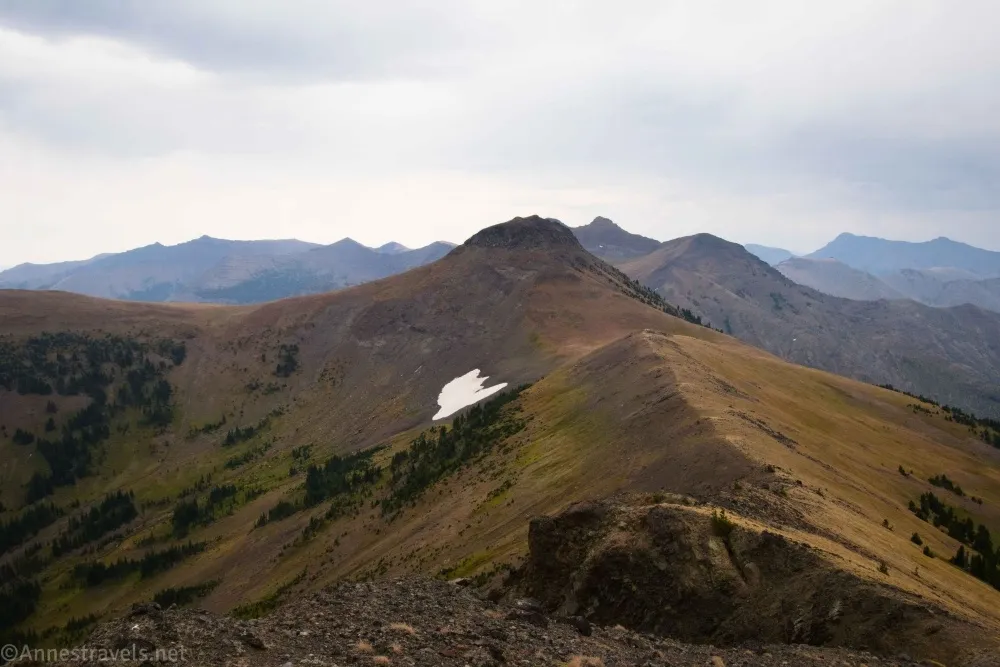
The next day wasn’t raining, so we drove up a one-lane dirt road from Cooke City to hike Republic Pass on the border of Yellowstone National Park. The weather also wasn’t great, but the views were awesome. Two of us climbed in two different directions along the ridgeline for even better views.
The hike around Tibbs Butte had great reviews, so I decided to hike it despite the forecasted rain. We never got wet, though it did sprinkle a few times during the day. Our hike began with a bit of a bang when a black bear jumped out of the bushes along the trail in a gully and ran up the hillside! My camera didn’t do the bear justice (just a lot of blur with a black smudge in the middle), but it was a very nice specimen that couldn’t decide if it wanted to have nothing to do with us or to watch us for a minute curiously. It eventually disappeared, and we hurriedly left the gully!
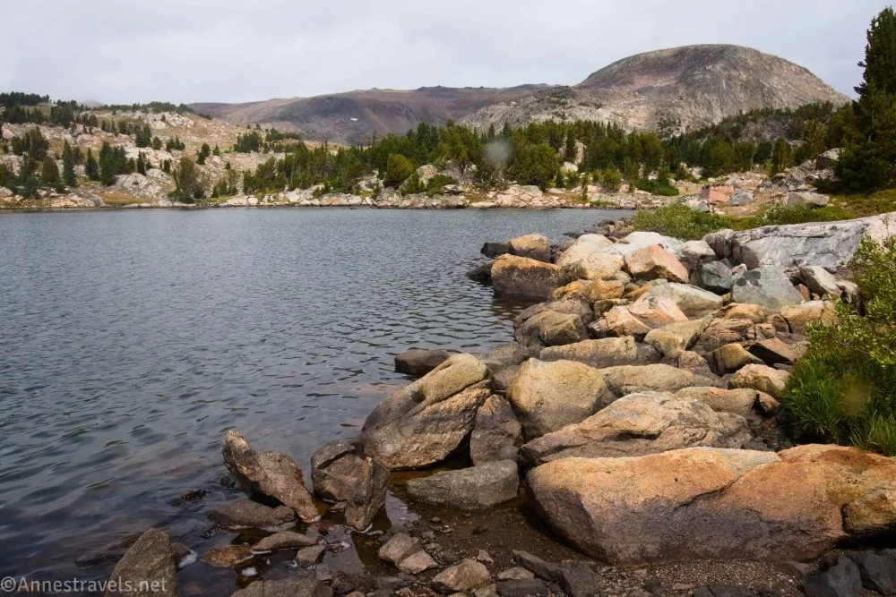
We had one more day on the Beartooth Highway, and it was the rainiest of all (of course, that was the day I forgot the raincoats… at least we all had our semi-waterproof jackets). Snyder Lake was absolutely beautiful, even more so because we could freely walk beyond the lake and up into the mountains. It was all meadows and white rocks to several more lakes. Gorgeous!
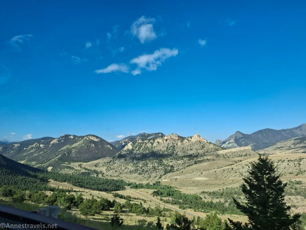
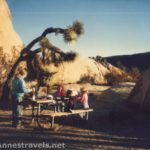
The sun reappeared, but I’d promised to be at the airport, so off we went on the Chief Joseph Scenic Byway to Thermopolis (love those free hot springs and showers in Hot Springs State Park!) and through Wind River Canyon. Yes, I made it to the airport on time! (In fact, too early… how is one supposed to draw up just at exactly the right second if one is too early? Answer: You take a nap until your adventure companions text that they’re on the ground and heading for the exit!)
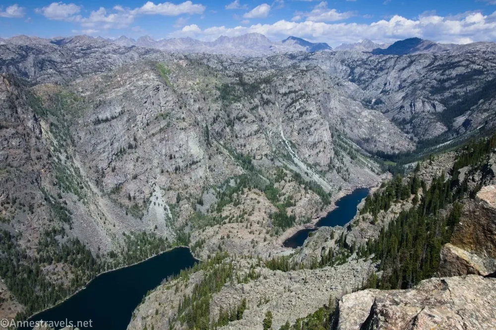
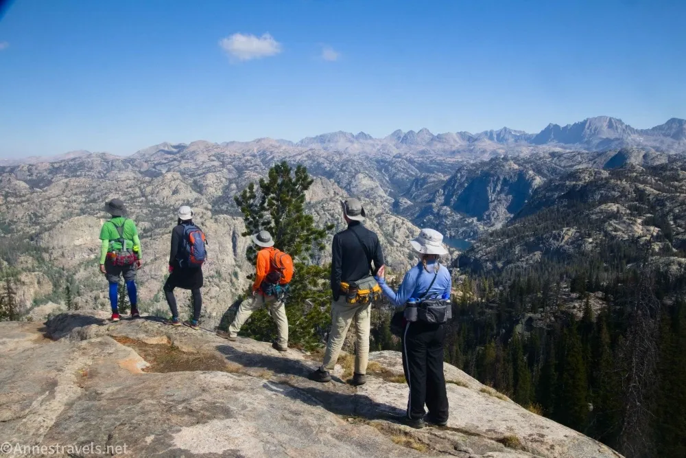
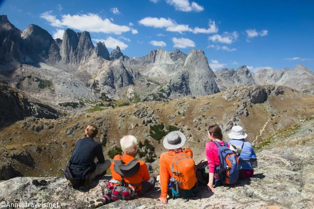
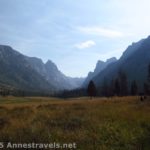
Back in the Wind River Range, we headed out on a short hike to a viewpoint suggested to me by a full-time traveler friend. The trail wasn’t marked, and I’m not 100% sure it’s official, but the path is well-beaten up to the Sacred Rim. And what a view! Easily a top-ten kind of hike!
The smoke wasn’t even too bad. We’d been watching the smoke map and knew it wasn’t terrible, but you also don’t know the exact conditions until you arrive. We ended up with five basically smoke-free days, one horribly smoky day (thankfully, it didn’t matter in terms of views), and one day that was smoky but livable. Given that we started in August, I’d call five smoke-free days a miracle.
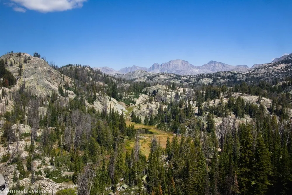
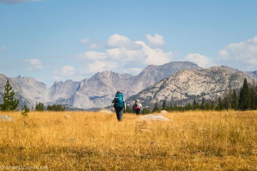
The next day, we took the Pole Creek Trail up to Photographer’s Point (one of the most famous day hikes in the Winds). It was crowded, mostly with backpackers on a Labor Day fling. (Then again, we were on a Labor Day week fling, so I can’t really blame them.) The trail was easy enough that we decided to hike a bit further. We stopped at a viewpoint before heading back to the trailhead.
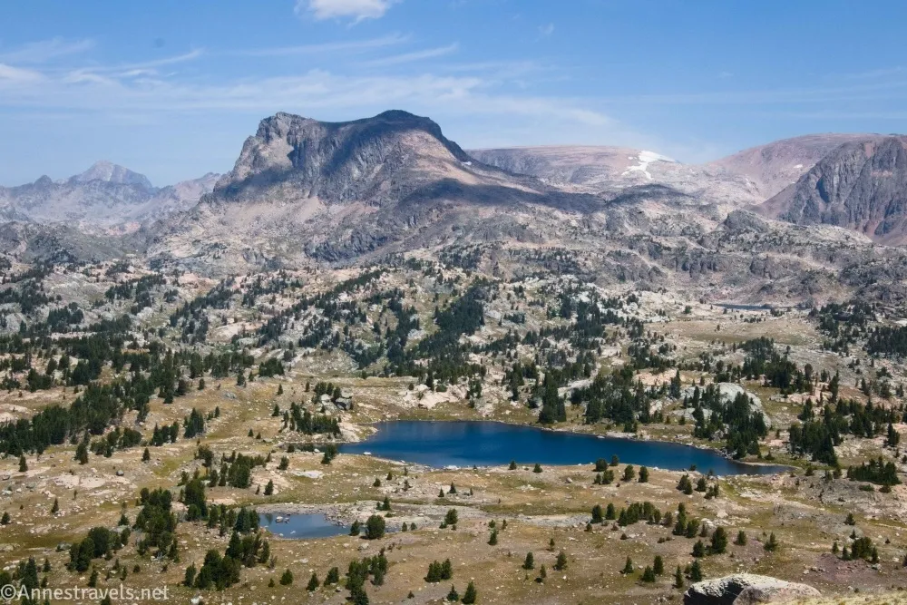
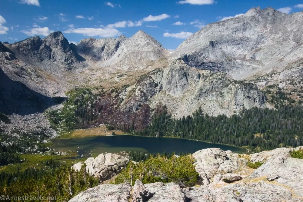
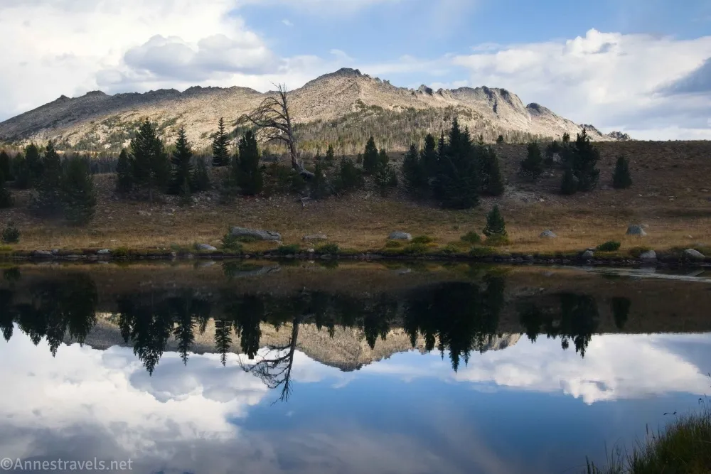
After the Pole Creek crowds, we figured we didn’t really want to drive down to Big Sandy for Labor Day. So instead, we went just north of Pole Creek to a ridgewalk that eventually took us to Glimpse Lake. We’ve now made a new descriptive definition – “Oh, it was an ‘average’ kind of lake” – but the views from the ridge were stunning. Plus, the aspens were just beginning to turn, which added a lovely ambiance to the hike.
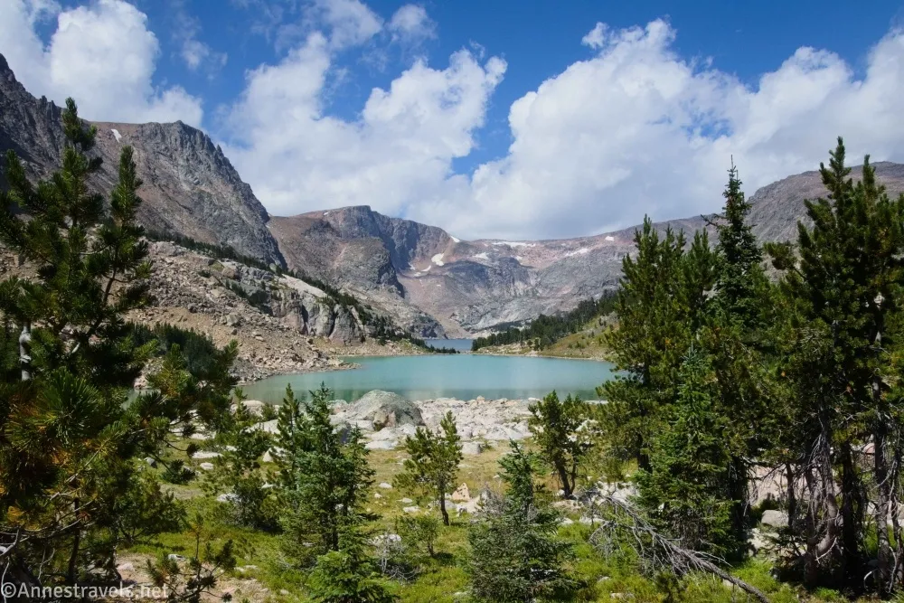
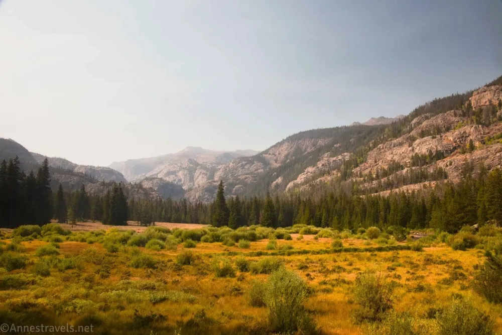
We’d have loved to go up to Green River Lakes – in fact, it was on my list of places to visit – but the Dollar Lake Fire was burning and effectively closing off access. Undaunted, we headed south to Big Sandy. Our first hike was up to Dad’s Lake and Marm’s Lake, and while all that was beautiful (if rainy), the best part was climbing a tricky hill to see the mountains beyond.
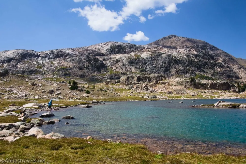
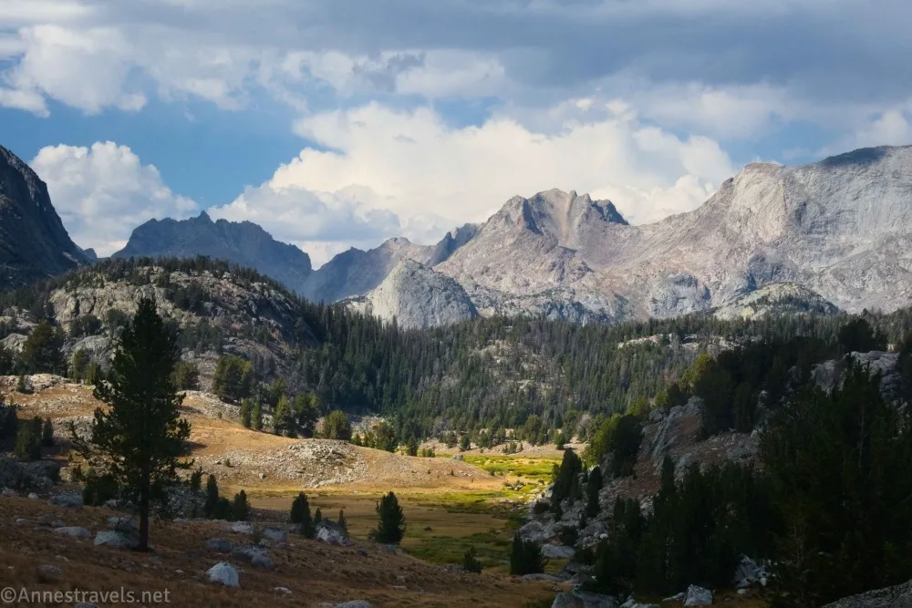
The next day, I planned to hike up to Deep Lake. But after presenting the idea to my adventure companions and offering other options, they voted to hike up to the Cirque of Towers (we’d done it ten years ago, and while absolutely gorgeous, it was a pretty smoky day). So off we went. I was right that 13 miles, 13 miles, 17 miles, and 19 miles four days in a row was a bad idea, but besides moving a bit slowly over those 19 miles, we did quite well! And the views? Superb!
People told us, “I’ve hiked this route any number of times, and the Cirque never gets better than this.” As in, there simply wasn’t any smoke! We got up to where we turned around last time and decided to continue to the pass and then up a nearby mountain. So I haven’t been down to Lonesome Lake, but I’ve seen all its glories from above!
We were very tired after all that hiking (more than 62 miles in four days!), so we drove around to the east side of the mountains and hiked up to the swimming hole at Popo Agie Falls. It was both beautiful and fun! The only issue was that it was terribly smoky. We’d noticed on our hike out the evening before that the moon suddenly turned copper-colored. I suppose the wind shifted and carried the smoke south to where we were hiking.
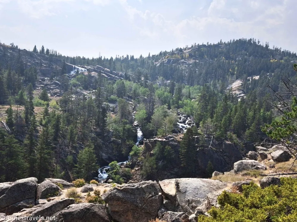
As we drove north from Lander that night, we could see the edge of the smoke cloud. We drove out from under it and on to the Bomber Basin Trailhead for our final hike in the Winds. I’ve long wanted to do Whiskey Mountain, but the smoke was still visible enough at breakfast, so we decided to hike up to Bomber Basin instead. It was a fantastic trail even with the hazy skies, with a little bit of everything: Forests, rock formations, desert scrub, aspens, babbling brooks, a waterfall (albeit not via the trail to the waterfall, from which the falls was invisible), alpine meadows, mountains, and an absolutely lovely expanse of grass at the “end” of the hike (the trail continued, but we were pushing daylight). I so want to go back and hike it again!
And that’s a wrap for the first half of the trip! I’ll post about our further adventures (in Utah!) in another post!
More hikes in Wyoming
Here’s a book I put together with hikes in Wyoming! It mostly covers Yellowstone, Grand Teton, and the Wind Rivers, as well as a couple of hikes in the Snowy Range. Buy your copy here.


Pingback: Sneak Peek: The Wasatch and the Uintas! – Anne's Travels