

Spearfish is located in far western South Dakota. However, few of the people who go to Spearfish travel south to drive through Spearfish Canyon, a truly beautiful spot that really doesn’t resemble most people’s vision of this state. It reminds me of some areas of Colorado, with its shear walls, tumbling river, and occasional waterfalls. I gather the fishing may be good in this area, as well, although I’ve never given it a shot. However, the canyon is also great for driving through, and for stopping at a few of the waterfalls that cascade through/into the canyon.
(Affiliate links are present on this page.)

To get to the canyon, exit I-90 in Spearfish, South Dakota. If you’re coming from the west, take exit 12, and turn right onto E Jackson Blvd, heading towards the heart of Spearfish. Then turn left onto Main St (US-14 Scenic), and drive east for a short while. Not too much later, US-14 will turn right onto Spearfish Canyon Highway; turn onto this road. If you’re coming from the east, take exit 14 off of I-90. Turn left under the bridge, then take an almost immediate right turn onto E Colorado Blvd. Follow this road for a short ways until US-14 Scenic goes off on the left down Spearfish Canyon Road. Turn left on this road.
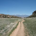
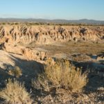
About 9 miles from I-90, the canyon begins. When you were on the highway, the terrain was fairly flat and grassy, and pretty much looked like South Dakota. Not so in Spearfish Canyon! This place could almost be Colorado, except that there aren’t any mountains above the canyon walls. I suppose SD really is quite near CO, but I, at least, don’t normally think of the two as being very similar.

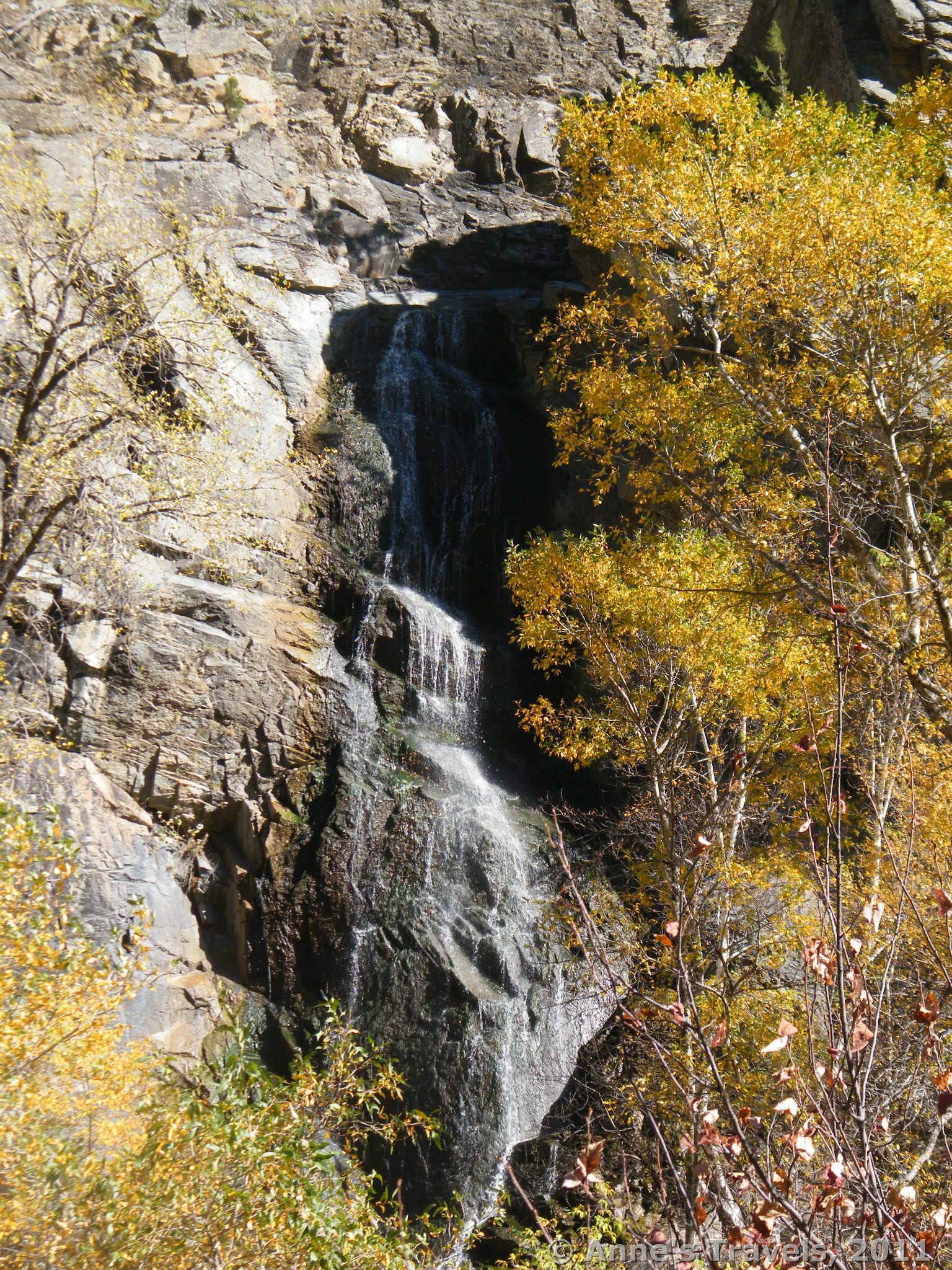
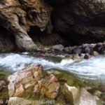
The first real attraction you will come to (11 miles from I-90) is Bridal Veil Falls. This is just along the side of the road, across the river (Spearfish Creek) on the opposite canyon wall. You can see it from the road, as well: many motorists slow down in this area to take a peak at the falls as they drive by. However, if you would rather not be a road hazard, there is a parking area on the side of the road away from the river. Here you can get a nice view of the falls. This isn’t enough for some people, though, so they cross the road (carefully—there’s quite a bit of traffic in this area) and scramble down the eroded bank to the river below. From this point, you can hardly see the falls at all because of the trees and brush in the way. From the road, this partially obscured the falls, but here you basically can’t see the falls at all. So, some adventurous visitors cross the stream on a line of precarious stepping-stones and follow a little stream up to the base of the waterfall itself. (Yes, I did this—that’s how I know what it’s like!)

There is a fairly large pool at the base of the waterfall, as a concrete dam was built across the little stream that flows from the base of the waterfall to the river below. I found this area quite pretty in early October, as the yellow leaves were falling into the stream, making it look quite like fall. In May, however, the leaves aren’t even on the trees yet, so there are no leaves obscuring the view of the falls from the road. You can also get almost to the base of the falls, and get fairly good pictures of the falls themselves. There is also a trail that looks like to goes up to the top of the waterfall; however, several members of my group tried it, and ended up getting very lost before they found their way back down. Where it actually goes, I don’t know, but the top of the falls isn’t it!

Get back in your vehicle and keep driving south. This part of the canyon distantly reminds me of Colorado. You almost expect to see a fly-fisherman in Spearfish Creek, or to get a glimpse of a snow-capped peak above the canyon walls. After driving a little while more (about 7 miles), you will come to the junction with Forest Road 222. Turn right onto this road. Apparently there are two Forest Road 222’s; you will want the second one of these. There are several lodges and hotels in this area, so it’s sort of a tourist-trap, although it’s not as bad as some tourist-traps I’ve been in (don’t think Gatlinburg, TN out here!). Not far down this road (less than a ½ mile) is a dirt parking area where you can park to take the short walk to Roughneck Falls. Supposedly, this is one of the nicest places in the canyon; I personally prefer Bridal Veil Falls (probably because there are fewer people at Bridal Veil than Roughneck). The trail is not well-marked; just take the trail back towards the hotels, and you will eventually find the bridge and boardwalk that will take you to the falls. This was under construction when I visited several years ago, so we didn’t get as close to the falls as we might have.

There are more attractions along the Spearfish Highway, but for whatever reason I’ve never visited them. However, if you’re looking for a place to go for a drive in South Dakota that looks like you might be in Colorado…well, this is defiantly the place for you!
Fees: None
Trail 
![]()
Road
Signs ![]()
![]()
![]()
Scenery ![]()
Overall Rating: ![]()
This Week’s Featured Product
Check out more than 50 hikes in the Black Hills in this guide!
3 responses to “Colorado in South Dakota: Spearfish Canyon”
[…] Bridal Veil Falls / Roughlock Falls, Spearfish Canyon, South Dakota. These two waterfalls, just down the road from each other, are beautiful. Roughlock has a short trail to some overlooks, while Bridal Veil is just along the side of the road – which doesn’t keep some tourists and locals from scrambling down the bank, crossing the river, and standing at the bottom of the falls! Certainly less than 1 mile RT […]
[…] Bridal Veil Falls near Spearfish, South Dakota […]
[…] California because the weather was so bad in New Mexico, and another time ending up in Wyoming and South Dakota because the weather wasn’t cooperating on Mt. Baker – another time we literally ended up […]