
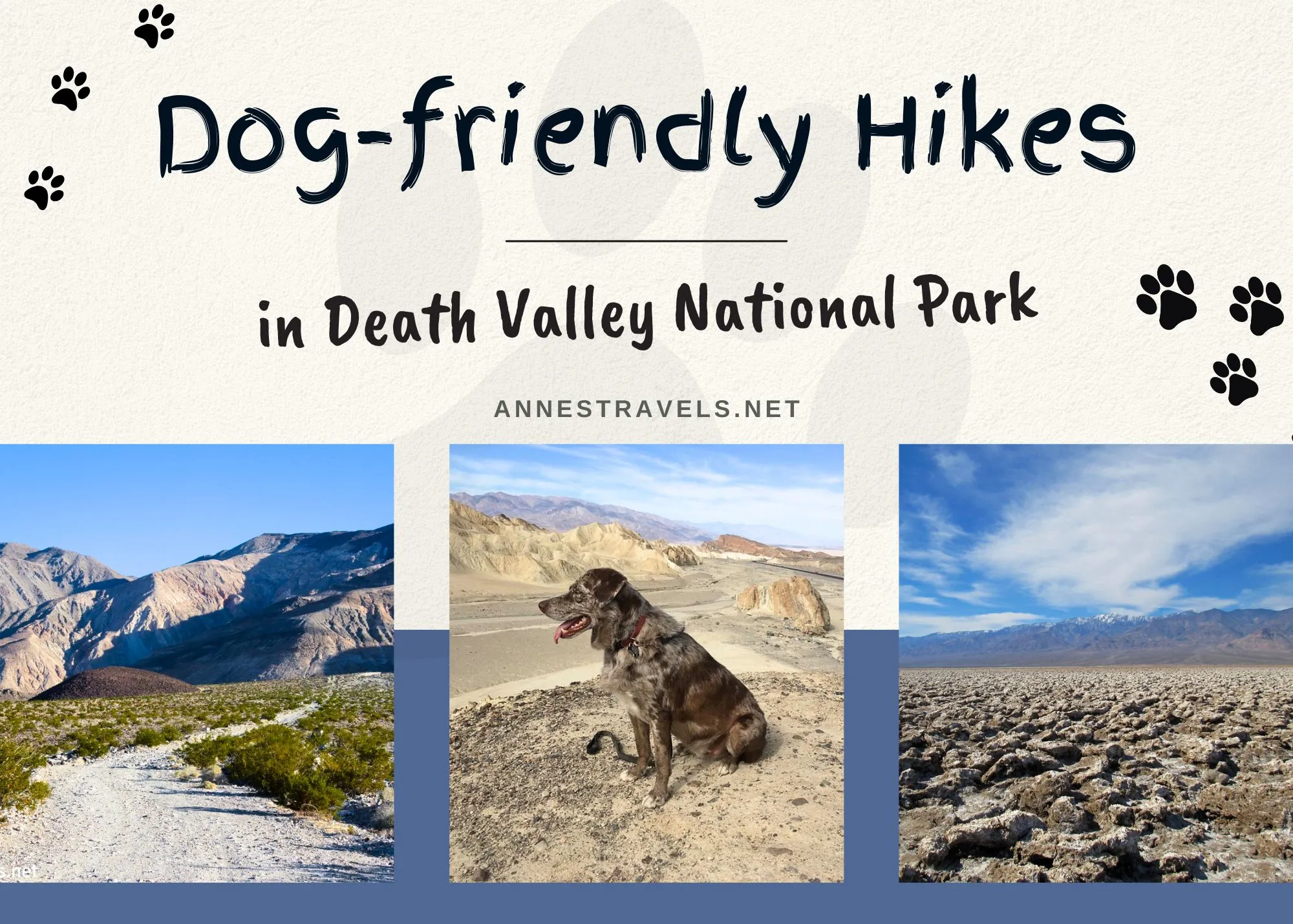
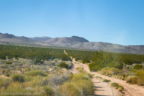
Did you know that you can hike in Death Valley National Park with your dog? Not on trails – that’s strictly forbidden – but there are many miles of dirt road where dogs are allowed with their humans on a leash (yes, the humans are on the leash… from the dog’s point of view). Before you say “I don’t like road walking,” hear me out. Many of Death Valley’s dirt roads are extremely scenic – as good as any trail. And many are also not very busy, especially during the week when the kids are in school. So if you want to take your pet to the park for a hike, it is possible and even enjoyable – with great views and historic ruins along the way.
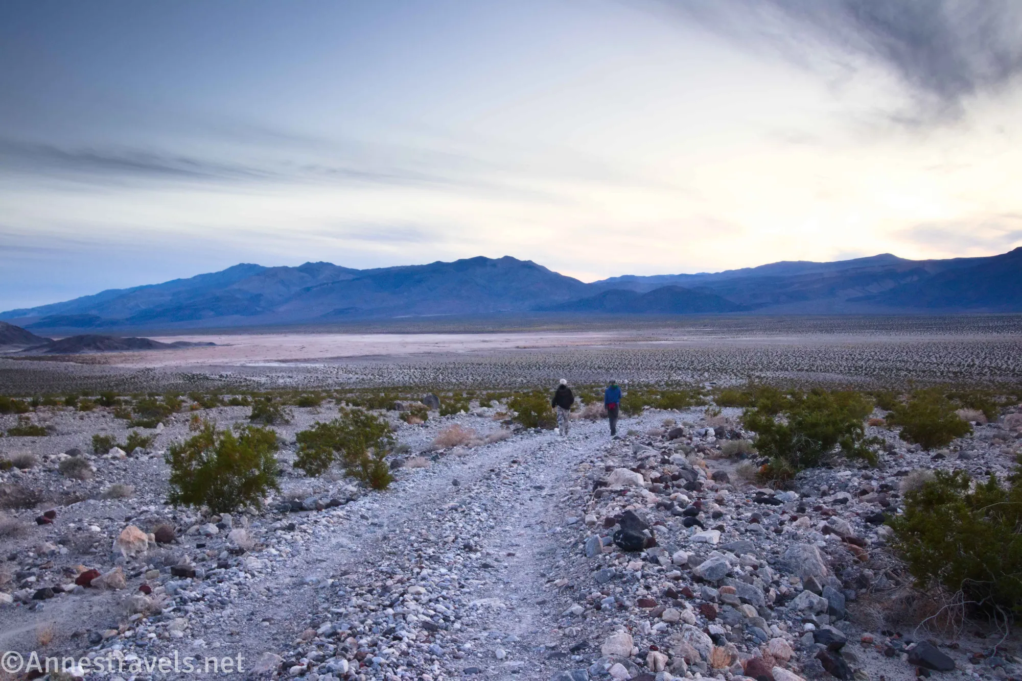
Dogs are not allowed on any trails, but they are allowed any place a vehicle is allowed to go – in parking lots, campgrounds, and on roads. The paved roads in Death Valley rarely have a reasonable shoulder for walking, so it’s not recommended to hike on the busier paved roads in the park. But dirt roads tend to be quieter and better suited to hiking in general.
One quick note. The terrain in Death Valley is challenging for dogs. Rocks are hot in the sun and also quite sharp, and there tend to be critters and plants that like to bite. So use reasonable caution and be sure to protect your pet – and don’t forget to bring water for them as well as for yourself.
A second quick note. I’ve given typical vehicle conditions for some of the roads in case you want to drive part of the road and then hike. Always check with the visitor center for current conditions before attempting to drive a road, as “typical” conditions can change quickly and vary significantly. You may also want to check the status of roads on the official NPS site. Usually, even when a road is “closed” it can be walked with a pet (the page should tell you if any road is closed to foot traffic as well as vehicles – for example, as of the time of this writing, the Scotty’s Castle Road is closed to all traffic, including hikers).
A third quick note (because apparently I didn’t plan these notes very well). Summer in Death Valley is April-October. Try to avoid hiking in the park during these months if at all possible due to the extreme heat.
Now, for the trails!
A few of my favorite dog-friendly hikes in Death Valley
Drive as much of the high-clearance required road as you want, or hike it. Views are excellent of the Cottonwood Mountains, Argus Range, Lake Hill, and Panamint Dunes. Beyond the Panamint Dunes parking pulloff (the end of the non-4×4 road), the views get even better as the road rises into the mountains toward the Big 4 Mine – walking from the pulloff to the end of the road and back is a nearly 3-mile trek.
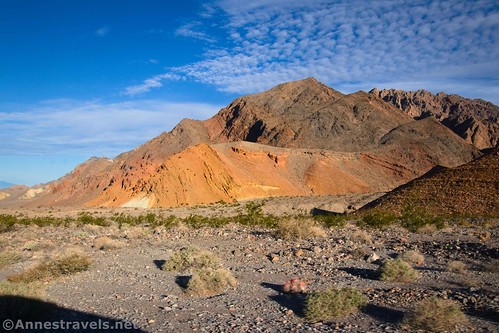
The upper part of the road offers beautiful views of both the Funeral Range and across the valley to the Black Mountains. The Hole, itself, is a neat destination. Low clearance and usually make it to Hole in the Wall, and the road beyond the Hole makes a great 4.8 mile RT hike. Note that the road tends to busier than some others in the park in terms of vehicle traffic.
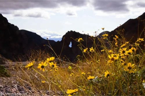
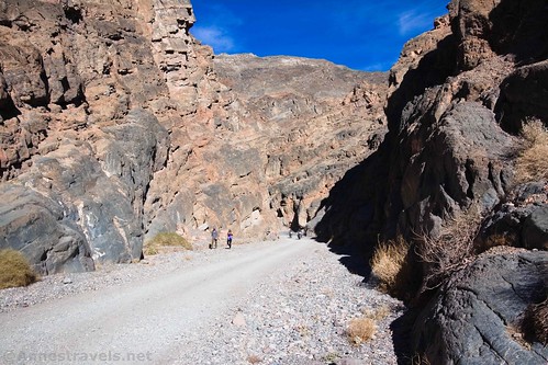
For a beautiful and fun hike, Echo Canyon is pretty awesome! The road (which can often handle low-clearance vehicles until the mouth of the canyon) has some great views back across the valley to the Black Mountains, then the canyon is pretty impressive (just be careful of vehicle traffic, which is significant). The mouth of the canyon to Eye of the Needle Arch and back is a 4.5 mile hike. You can also extend your hike by going up to the Inyo Mine and/or hiking part of the Lee’s Camp Road.
Hike up a canyon narrows on the Titus Canyon Road – and you get to choose how far you want to go! Most people hike up the road from the Fall Canyon Parking Area (the link above), but you can take your pet for a hike anywhere along the road. (Note that the road has been closed to vehicles since 2023, but it is open for foot traffic, and I expect it will open up again for vehicles in the future.)
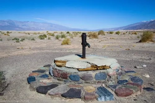
The well, itself, isn’t all that exciting, but the views are! Between the Grapevine Mountains and the Mesquite Sand Dunes, it’s a beautiful hike (and quite drivable, even with low clearance). The entire road (RT) is 1.5 miles.
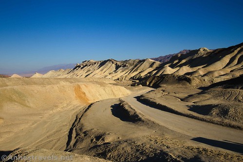
While this road tends to have quite a few drivers (and it’s 2WD-friendly), the scenery is amazing, especially in the early morning or late afternoon/evening, with views of so many colorful badlands. It can be walked as a 2.75 mile shuttle hike or 5.5 miles RT.
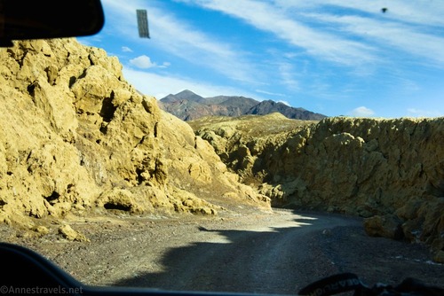
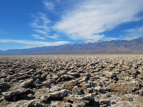
Located next to the Harmony Borax Works (which is not a dog-welcome trail), the road has good views across the salt flats to the Panamint Mountains before entering the yellow walls of the canyon. It can be completed as a 1.3 mile shuttle walk or a 2.6 mile RT hike. Again, there will likely be some traffic, but it’s typically not overrun.
Lippincott Mine Road (Lead King Mine)
The road is rough enough that it’s not a known destination, and it has some fun mine ruins and great views, especially down on the Racetrack. The trouble for hikers is getting to the Homestake Dry Camp (which is the trailhead) – you’ll either need to drive the Racetrack Road or take the Lippincott Road from Saline Valley Road. RT distance (staying on the roads) is about 3 miles.
Other dog-friendly hikes in Death Valley

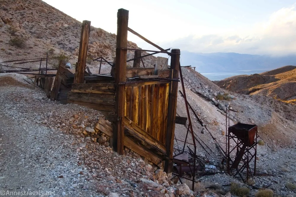
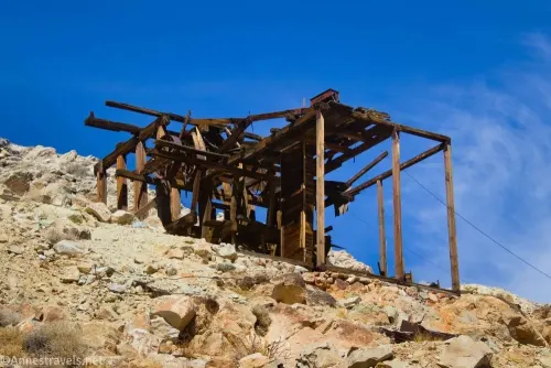
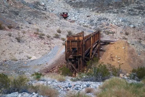
A road with only moderate traffic on a busy day, there are views and mining ruins to explore. If you only have high clearance (no 4×4), you can hike from the turnoff to Monarch Canyon to the first of the ruins and back for an 8.6 mile trek.
To get to this hike, you’ll need to take the Racetrack Road (high clearance required) to the Hunter Mountain Road (high clearance usually ok, 4×4 appreciated) or simply the Hunter Mountain Road from South Pass (4×4 required). The mine road is rugged but short and leads to a well-preserved mining area.
I’d consider this road to be too busy and short for an enjoyable hike, but others seem to love walking it with their dogs. The neat thing is the views across Death Valley and the salt crystals along the road. The road is 1.3 miles long or 2.6 miles RT.

At 10 miles long (one way), this road is a bit longer than most people want to walk in a day! Those who can drive it or trail-run it are rewarded with the ruins around an old mine.

The West Side Road is usually accessible by a high clearance, 2WD vehicle, and it leads to many 4×4-required roads. The only ones I’ll mention here are the Warm Springs Road (10 miles one way to the Warm Springs Camp), the Queen of Sheba Mine Road (7.6 miles RT), Galena Canyon Road (10.8 miles RT), Hanaupah Canyon Road (16.2 miles RT, but the initial climb up the alluvial fan has good enough views to be a good option even if you don’t want to hike the entire road), and Trail Canyon Road (again, 21 miles RT is too long for an average hike, but the views from the alluvial fan are good). The West Side Road, itself, has nice views across Death Valley and a few short spur roads or pulloffs to sites of historical interest.
Yet again, this is a hike that requires driving the Racetrack Road to get to the trailhead. At 1.5 miles RT, though, it’s a short trail to quite a few old mine ruins. The road itself requires serious 4×4 skills, so hiking is more comfortable than driving it.

The real draw of Aguereberry Point is the view at the end. It requires high clearance, or you can hike it, with the total distance being 12.8 miles.
Greenwater Valley Road and sideroads
The Greenwater Valley Road is too long for much hiking, though it’s also sparsely enough traveled to make a good hike (the scenery doesn’t change too much along the way). But if you’re trying to stretch your legs and have the high clearance (no 4×4) required to drive part or all of the road, you can walk part of the (even less traveled) sideroads: Furnace Townsite Road, Greenwater Townsite Road North, Greenwater Townsite Road South, Gold Valley Road, and Deadman Pass Road.

Lippincott Road (sometimes called the Lippincott Mine Road, though from what I can tell it gets close to, but doesn’t go to, the mine)
The road is known as one of the most dangerous and exciting in Death Valley – for a vehicle – but it’s perfect for hiking! Views are great, too, though the road is a total of 7 miles one way between the Saline Valley Road and Racetrack Road (both of which require high clearance at a minimum).
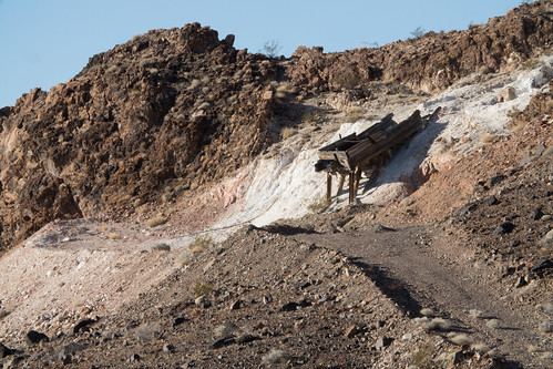
The views don’t change much, but the end of the road has some nice mine ruins. The road is 4×4 required, but the ruins are only a 10.8 mile RT hike from pavement.
The final 2 miles or so of the road are too rough for most vehicles – but they make a great place to hike if you like pinyon pine woodlands and occasional views.
If you have any other pet-friendly hikes in Death Valley, let me know in the comments!
More hikes and roads in Death Valley
This is the premier guide to off-the-beaten-path in Death Valley – including some really great dirt roads. Buy your copy here.

More Related Posts:
 Death Valley Road Trip Hiking Itineraries!
 Best Day Hikes in Death Valley National Park
 Sneak Peak: Petrified Forest, Southern Utah, and Death Valley!
 Death Valley, Grand Canyon, Canyonlands… and a Lot of Off-Trail Adventures!
 The Best Hikes in Big Bend
 The Best Hikes for Kids in Death Valley National Park!