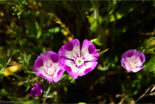
Did you know that you don’t need a timed entry ticket to visit Hetch Hetchy in Yosemite National Park? The access road is located just outside of the entry gates to the park, proper, so no timed entry ticket is required (the regular entry fee is still charged at the Hetch Hetchy Entrance). However, only three official day hikes (less than 12 miles RT) leave from the area – Lookout Point, Poopenaut Valley, and Wapama Falls. Three more (13 miles, 13-16 miles, and 29 miles) are considered day hikes – Rancheria Falls, Smith Peak, and Laurel/Vernon/Rancheria Loop. The most popular trail by far in Hetch Hetchy is Wapama Falls, which is where I hiked on a very warm (101F) summer day. However, you’re not allowed to go swimming (the reservoir is a water supply, after all), so the abundance of water wasn’t exactly refreshing… but the waterfall and the views were nice!
Quick Stats
This post contains affiliate links. Clicking on them and purchasing an item supports me without any extra cost to you.
I tried for an early start, but that didn’t work out so well, and I didn’t get on the trail until after 9am. The Wapama Falls Trailhead was filling up but still had a couple dozen parking spaces left. By the time we came back in the early afternoon, there were only half a dozen or so spaces open – and I’m pretty sure it’s because people had already left.
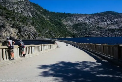
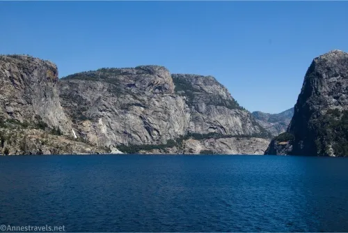
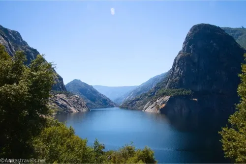
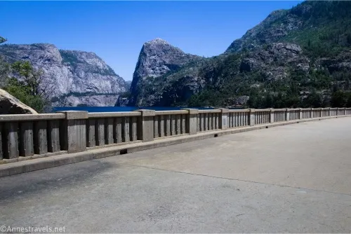
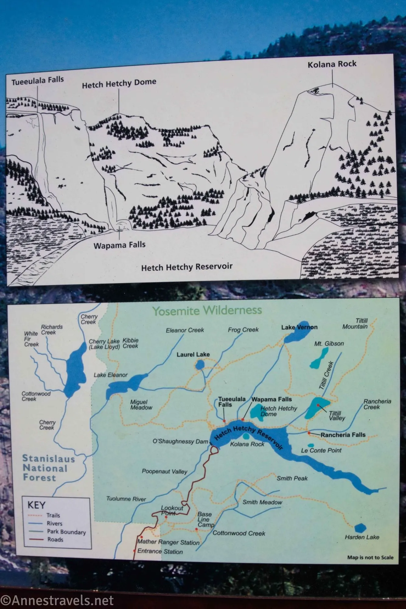
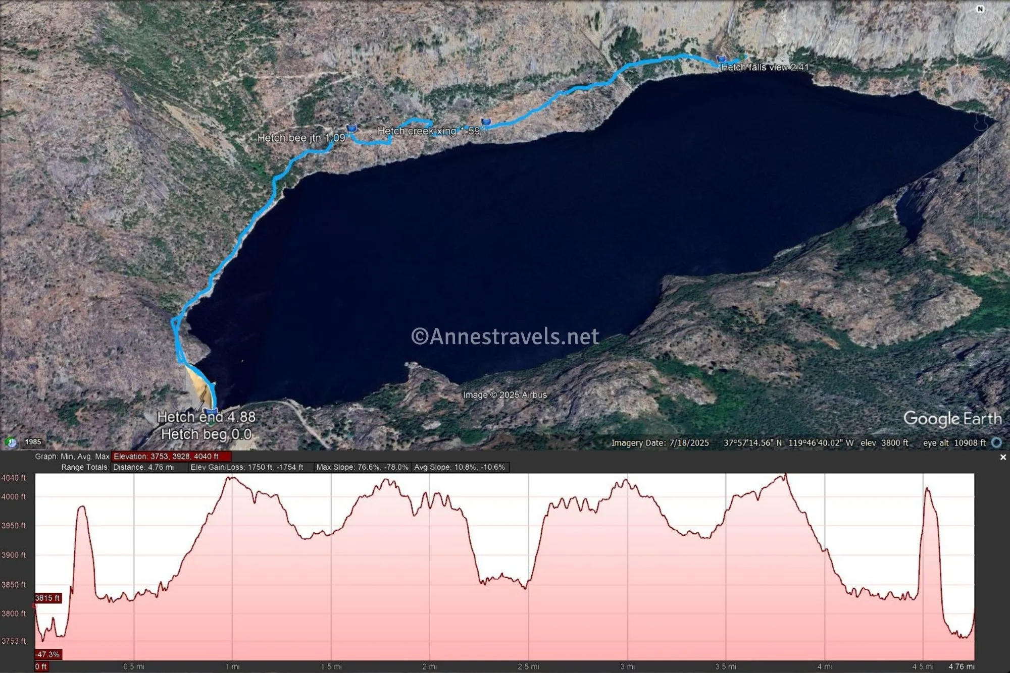
To hike the Wapama Falls Trail, from the parking along the road, walk downhill to the Hetch Hetchy Dam (O’Shaughnessy Dam). Walk across the dam – there are quite a few signs about the history of the area, building the dam, etc. There are also excellent views out across the Hetch Hetchy Reservoir, including to Wapama Falls, Hetch Hetchy Dome (on the left side of the reservoir), and Kolana Rock (on the right side of the reservoir). At the right time of year (spring), Tueeulala Falls is also visible to the left of Wapama Falls. Note that the water level will vary depending on the time of year, etc. – it must have been pretty high when I visited.
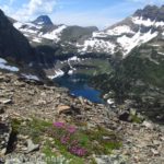
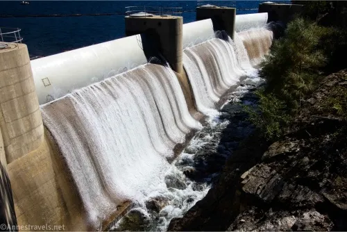
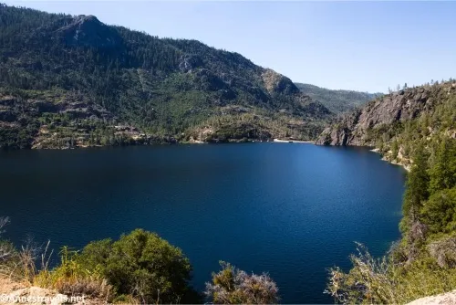
Don’t be so dazzled by the reservoir that you forget to look over the other side! Hetch Hetchy Valley is scenic, and you can even see waterfalls where the dam lets out water.
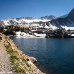
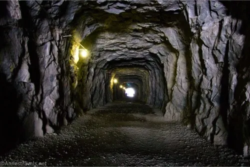
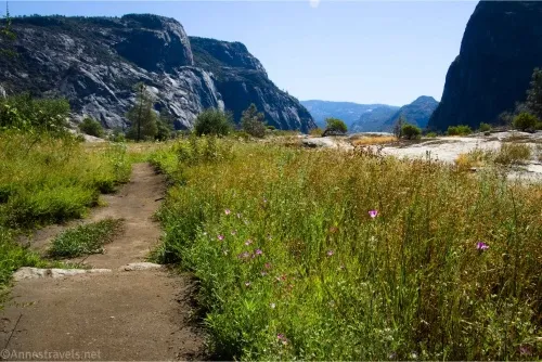
A tunnel was built as part of the dam construction process, and it’s a great pathway for hikers and is lit inside. On the other side of the tunnel, continue right-ish to follow the trail that more or less parallels the lakeshore. Views are reasonable, though often peek-a-boo of the reservoir and the surrounding mountains.
After a mile, come to a trail sign saying Beehive, Laurel Lake, and Vernon Lake are to the left. Tiltill Valley, Pleasant Valley, Glen Aulin, Yosemite Valley, Rancheria Creek, and Wapama Falls are to the right. Turn right and keep walking. By this point, the day was really heating up and so were the crowds. It still wasn’t close to Yosemite Valley standards, but there were plenty of people passing us on the trail.
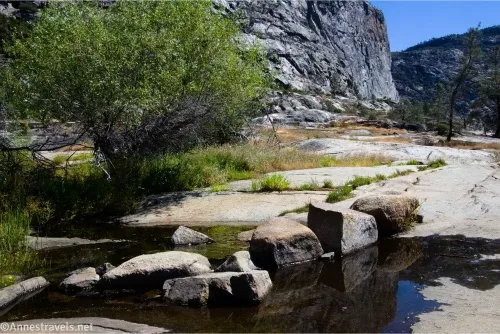
About half a mile beyond the signs, cross a small creek. It was mostly dry at 4th of July, but I could see how it would have several channels in spring or any time of high flow. Tueeulala Falls would be on your left – if it were flowing! I gather it’s quite seasonal. At the right time of year (spring), you may end up crossing several streams along the trail that I didn’t see.
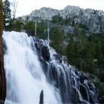
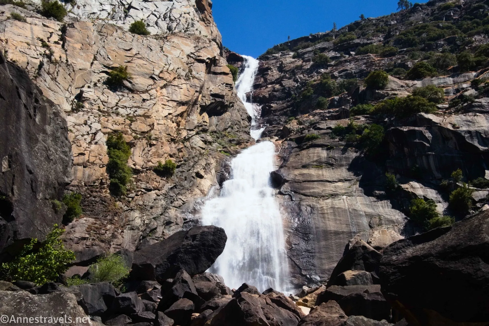
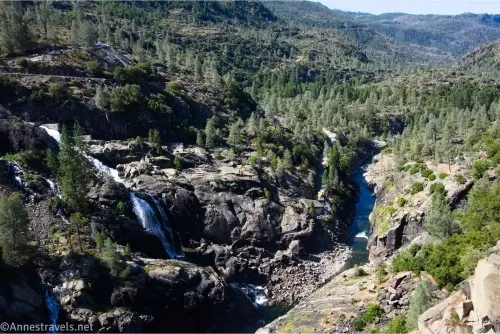
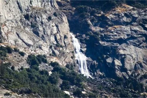
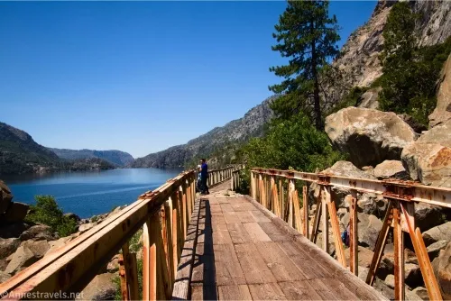
The trail crosses a flat rock area and then enters the forest briefly before coming to a bridge. You’re almost there! The bridge (and the bridges beyond) will take you to a few views of Wapama Falls about mile 2.4.
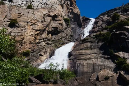
I highly recommend continuing to the end of the bridges, as there are various views of the falls and also some good views of the lake, especially across to the dome of Kolana Rock.
And that’s it! Retrace your steps to the parking area… or continue along the trail to Tiltill Valley or Rancheria Falls!
Round Trip Trail Length: I went 4.9 miles
Elevation Gain: 1,434ft. (3,753ft. to 4,040ft.)
Facilities: None at the trailhead. Restrooms and a few picnic tables are available at the ranger station.
Fees: $35/vehicle, valid 7 days. America the Beautiful National Parks & Federal Public Lands Passes and Yosemite Annual Passes are accepted in lieu of the entry fee.
Trail Notes: The hike to Wapama Falls is fairly easy compared to many hikes in Yosemite. However, it’s a lot harder on a warm day. Visiting in spring would be optimal for the most water on the falls, but if there is water running over the bridges, do not attempt to cross them (I could see where the bridge’s railings had been torn away by high spring snowmelt). In the summer, the sun is far in the south, and since the trail is on the north shore, the views across the reservoir is not the best for photography – and you’re on a south-facing slope, so it’s pretty hot. Remember, swimming and wading are not allowed in or near the lake. Hetch Hetchy is nowhere near as crowded as much of Yosemite, but you’ll still probably see quite a few other people.
Trail 
![]()
![]()
Road ![]()
Signs ![]()
Scenery ![]()
Would I go 100 miles out of my way for this? ![]()
Overall Rating: ![]()
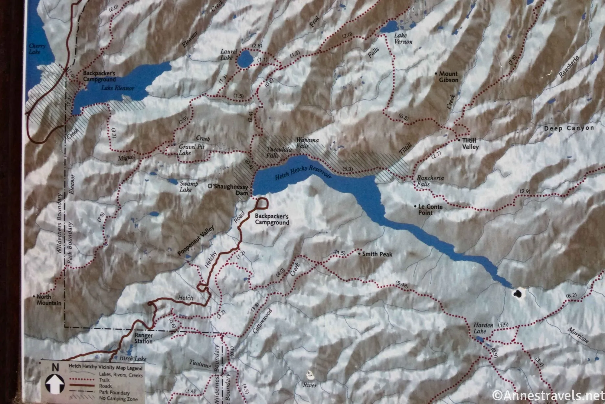
GPS Coordinates for Hetch Hetchy to Wapama Falls
TH (Dam): 37.9464990°, -119.7875320° (37°56.78994′, -119°47.25192′ / 37°56’47.3964″, -119°47’15.1152″) (3,791ft.) (0.0)
Bee Junction: 37.9579830°, -119.7846330° (37°57.47898′, -119°47.07798′ / 37°57’28.7388″, -119°47’04.6788″) (4,039ft.) (1.09)
Creek crossing: 37.9587620°, -119.7786560° (37°57.52572′, -119°46.71936′ / 37°57’31.5432″, -119°46’43.1616″) (3,936ft.) (1.59)
Falls view: 37.9632150°, -119.7668480° (37°57.79290′, -119°46.01088′ / 37°57’47.5740″, -119°46’00.6528″) (3,861ft.) (2.41)
End: 37.9465160°, -119.7875340° (37°56.79096′, -119°47.25204′ / 37°56’47.4576″, -119°47’15.1224″) (3,782ft.) (4.88)
The gpx file for Hetch Hetchy to Wapama Falls can be downloaded – please note that this and the GPS Coordinates are for reference only and should not be used as a sole resource when hiking this trail.
Download GPX File size: 64.3 KB Downloaded 289 times
(Note: I do my best to ensure that all downloads, the webpage, etc. are virus-free and accurate; however, I cannot be held responsible for any damage that might result, including but not limited to loss of data, damages to hardware, harm to users, from use of files, information, etc. from this website. Thanks!)
Getting to Hetch Hetchy
It’s hard to explain, so the best I can do is to give you GPS coordinates to plug into your GPS (be sure to download the map before leaving civilization – there’s not much cell service at or anywhere near the Hetch Hetchy Road). The trailhead is at approximately 37.9464990°, -119.7875320°. Park in one of the spaces provided along the road beyond the dam and then hike back to the trailhead.
The drive to Hetch Hetchy from Yosemite Valley is approximately 1.5 hours. Driving from Modesto (the closest large town) is 2.5+ hours, from Sacramento, about 3.5 hours, and from San Francisco, 4+ hours.
For some of the very best scenery in Yosemite…
Complete with the author’s top 5 hikes in various categories – not to mention the best hikes in Yosemite overall – this is a fantastic hiking guide to the park’s natural wonders. Buy your copy here.