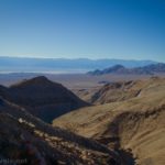
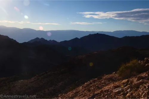
Back in late 2023, we unexpectedly ended up in Death Valley National Park for the second time in two weeks. (I know, how can you unexpectedly end up in a national park diagonally across the country from where you live… well… we did.) As a last adventure, we chose to drive up the Echo Canyon Road. I’m so glad we did! Not only was the road very scenic, but the Inyo Mine (at the end of the well-traveled part of the road) was the perfect way to end our trip! The mine area was so much fun to explore and included many old buildings, ore bins, machinery, and more!
Quick Stats
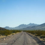
To get to the Inyo Mine, you’ll need a high-clearance vehicle. Whether or not you’ll need 4×4 depends on how recently the NPS has graded the road. With the new camping regulations, the road is usually in better shape, and I was able to drive up the road a second time in March 2025 with less issue than the first time (the initial drive had just enough deep gravel to make me nervous). If you’re not sure, ask for road conditions at the visitor center.
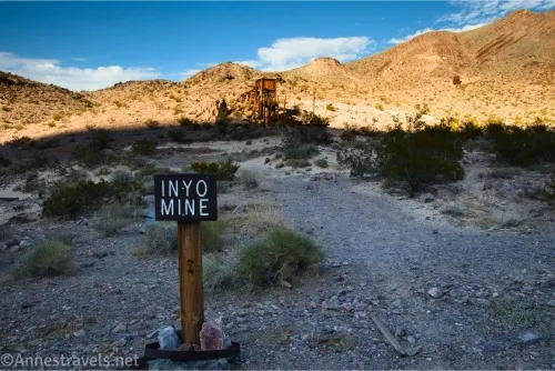
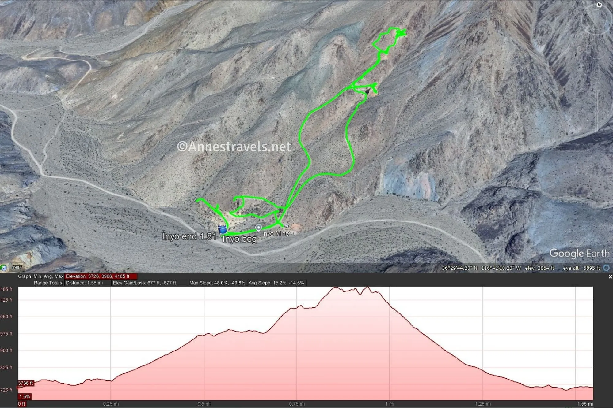
0.0 Inyo Mine Parking Area (3,748ft.). A sign marks the parking area, but there is no trail around the Inyo Mine. Instead, you’re free to follow pre-established paths or simply scramble around the hillside with the various old buildings and structures. (36.493434, -116.703867)
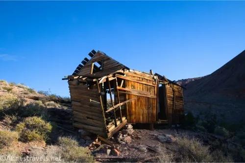
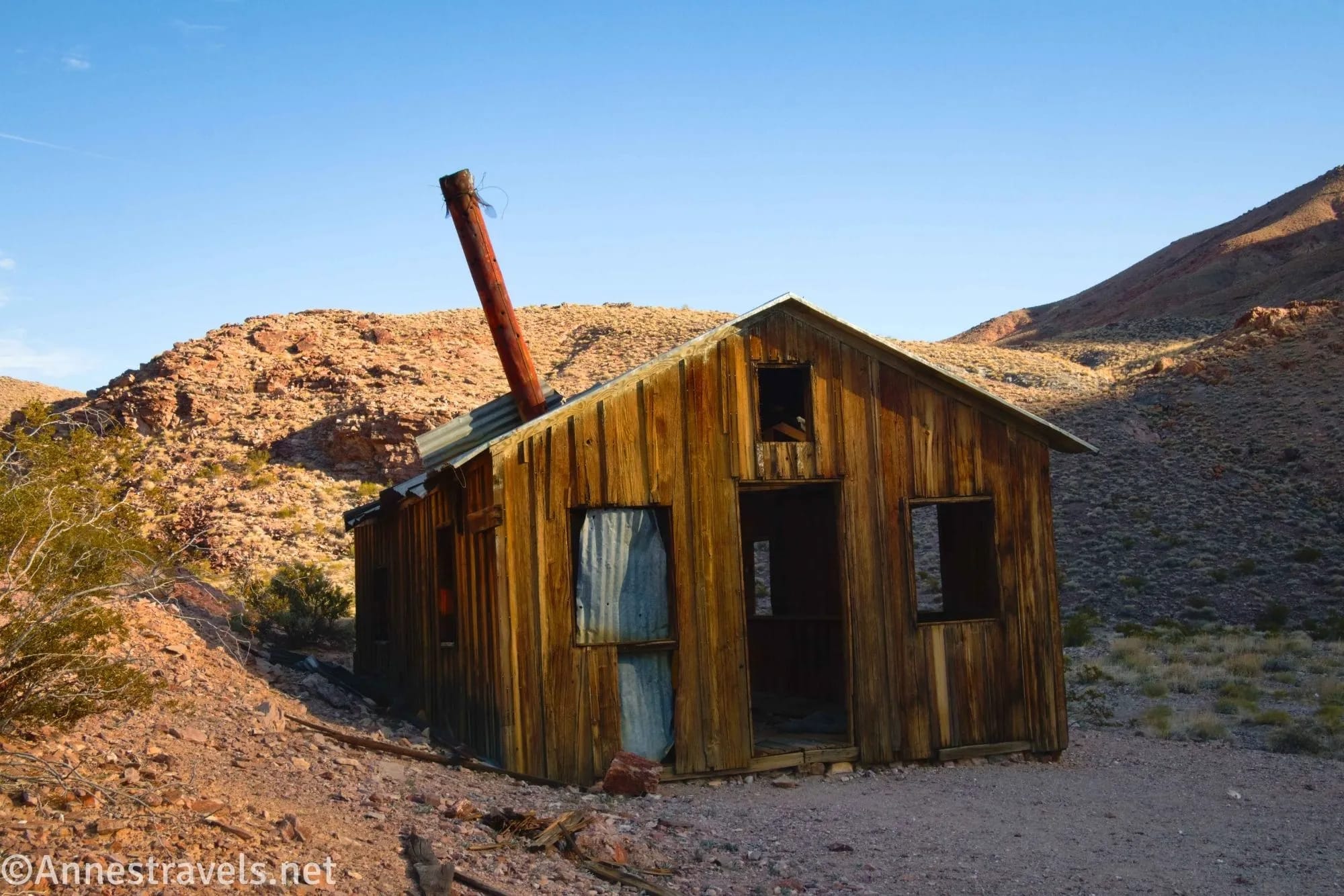
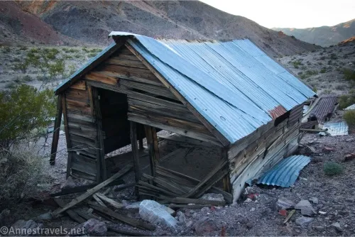
Not too far from the parking area are two cabins (to the right). I raced over there first, as I could see that the sun was quickly moving them into shadow! (36.493713°, -116.702834°)
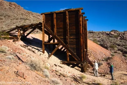
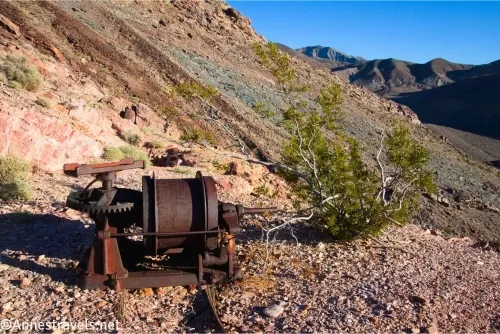
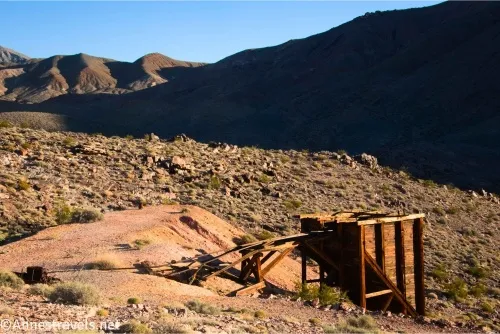
Even closer to the parking area is an ore loading bin (straight ahead). This area also had some old machinery. (36.493931°, -116.703527°)
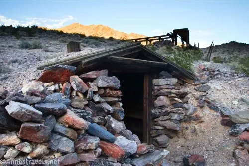
To the left (which is where I ended), there are some old ruins and a cabin set into the hillside. (36.494063°, -116.704634°)
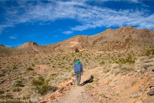
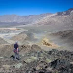
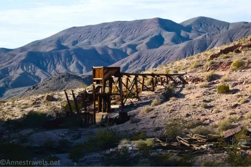
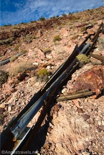
I followed an old road up to a huge ore bin and a ruined rock cabin higher up the hillside. Above the ore bin is a mine shaft and the end road. (36.496816°, -116.701627°)
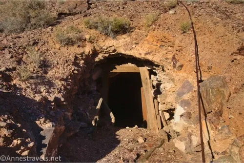
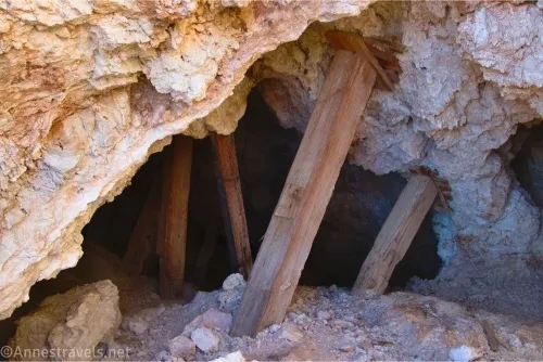
However, I could see more things higher on the hillside, so I followed a questionable social path to the right, then climbed a very sketchy watercourse up to a couple more mine shafts. Stay out of the mines, as they are very unstable.
From here, you can explore more if you wish. Old mine trails and roads crisscross the mountains between the Echo Canyon Road and the Lee’s Camp Road (short wheelbase 4×4 only). There are old prospects, mine shafts, and probably more ore bins, if areal maps are anything to go by. However, we were running out of daylight, and we had to start for home (it takes me 3 days of driving to get to or from Death Valley!), so we made tracks back to pavement!
The Inyo Mine was the first mine to be developed in this part of the Funeral Mountains. However, poor timing and possibly mismanagement made it never profitable, despite being mined on and off from the early 1900s until the early 1940s.
Round Trip Trail Length: I went 1.8 miles; your mileage will vary.
Elevation Gain: I went 677ft. (3,726ft. to 4,185ft.)
Facilities: None
Fees: $30/vehicle, valid 7 days. America the Beautiful National Parks & Federal Public Lands Passes and Death Valley Annual Passes are accepted.
Trail Notes: There is no official trail. Use care while walking around; what paths and roads exist tend to be sketchy at best. Leave everything – and I do mean everything – exactly as you found it. I’ve heard that the mine area is actually private property, though I can’t substantiate that claim, so use more than normal care to make sure not to deface or disrupt things here. Do not enter any mine shafts, as they are unstable and may contain deadly gases. Be wary of potentially harmful items lying around. With all of these warnings said, the area is exceedingly interesting if you love old mines!
Trail 
![]()
![]()
![]()
Road ![]()
![]()
![]()
![]()
Signs ![]()
![]()
![]()
Scenery ![]()
![]()
Would I go 100 miles out of my way for this? ![]()
Overall Rating: 
![]()
![]()
GPS Coordinates for the Inyo Mine
TH: 36.4934310°, -116.7038780° (36°29.60586’, -116°42.23268’ / 36°29’36.3516″, -116°42’13.9608″) (3,748ft.) (0.0)
End: 36.4934800°, -116.7039040° (36°29.60880’, -116°42.23424’ / 36°29’36.5280″, -116°42’14.0544″) (3,748ft.) (1.81)
The gpx file for my adventures around the Inyo Mine can be downloaded – please note that this and the GPS Coordinates are for reference only and should not be used as a sole resource when hiking this trail.
Download GPX File size: 50.8 KB Downloaded 0 times
(Note: I do my best to ensure that all downloads, the webpage, etc. are virus-free and accurate; however, I cannot be held responsible for any damage that might result, including but not limited to loss of data, damages to hardware, harm to users, from use of files, information, etc. from this website. Thanks!)
Getting to the Inyo Mine Trailhead
From the Furnace Creek Visitor Center, turn right toward Las Vegas and the Badwater Road. After 3.4 miles, turn left onto the Echo Canyon Road. (The Echo Canyon Road is also 1.4 miles west of Zabriskie Point.) Drive up the Echo Canyon Road, staying right when the Lee’s Camp Road (toward Amargosa) goes off after 9 miles. Half a mile beyond the road junction, the parking area for the Inyo Mine is on the left. The road becomes noticeably less traveled after the mine.
Off the Beaten Path in Death Valley
Learn about the mines in Death Valley – and how to find them – along with many other hikes in the park. This is considered the very best hiking guide to Death Valley if you want to go beyond the tourist sites. Buy your copy here.