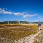
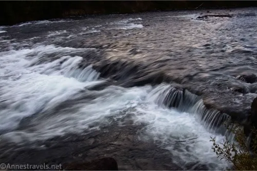
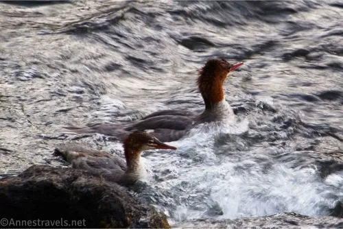
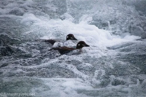
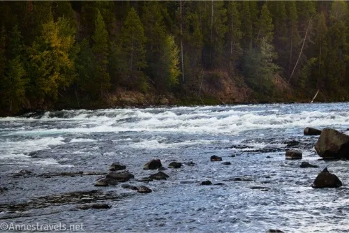
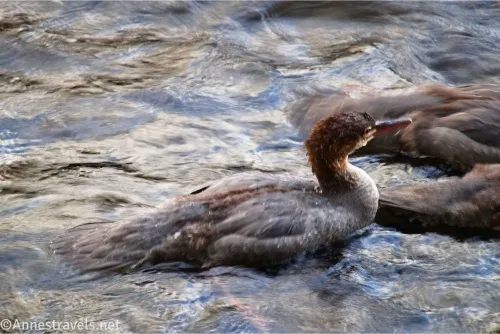
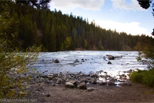
An overlooked little gem in central Yellowstone National Park is the LeHardy Rapids. The hiking is easy (just a little boardwalk), and while the rapids aren’t spectacular, they are pretty. The real attraction, though, are the multiple varieties of ducks that often swim in the river in this area. If you love birds or photography, LeHardy Rapids are a must-stop while traveling between Canyon and Fishing Bridge in Yellowstone!
Quick Stats
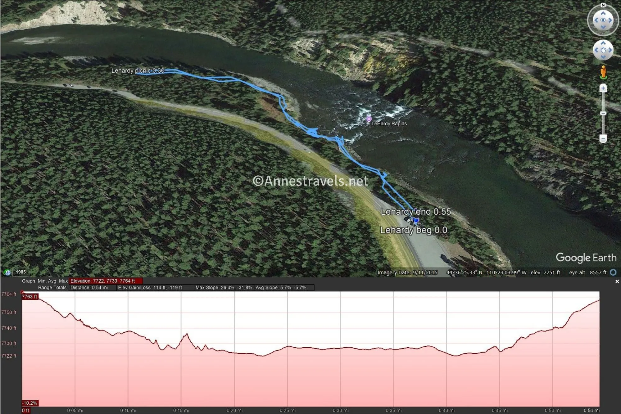
Most people park in the upper lot, but you can also park in the LeHardy Picnic Area. I walked between the two lots; most of the excitement (including the boardwalk) is closer to the upper lot, but the lower part of the trail is peaceful. I’ll describe the trail as though you parked in the upper lot.
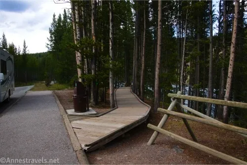
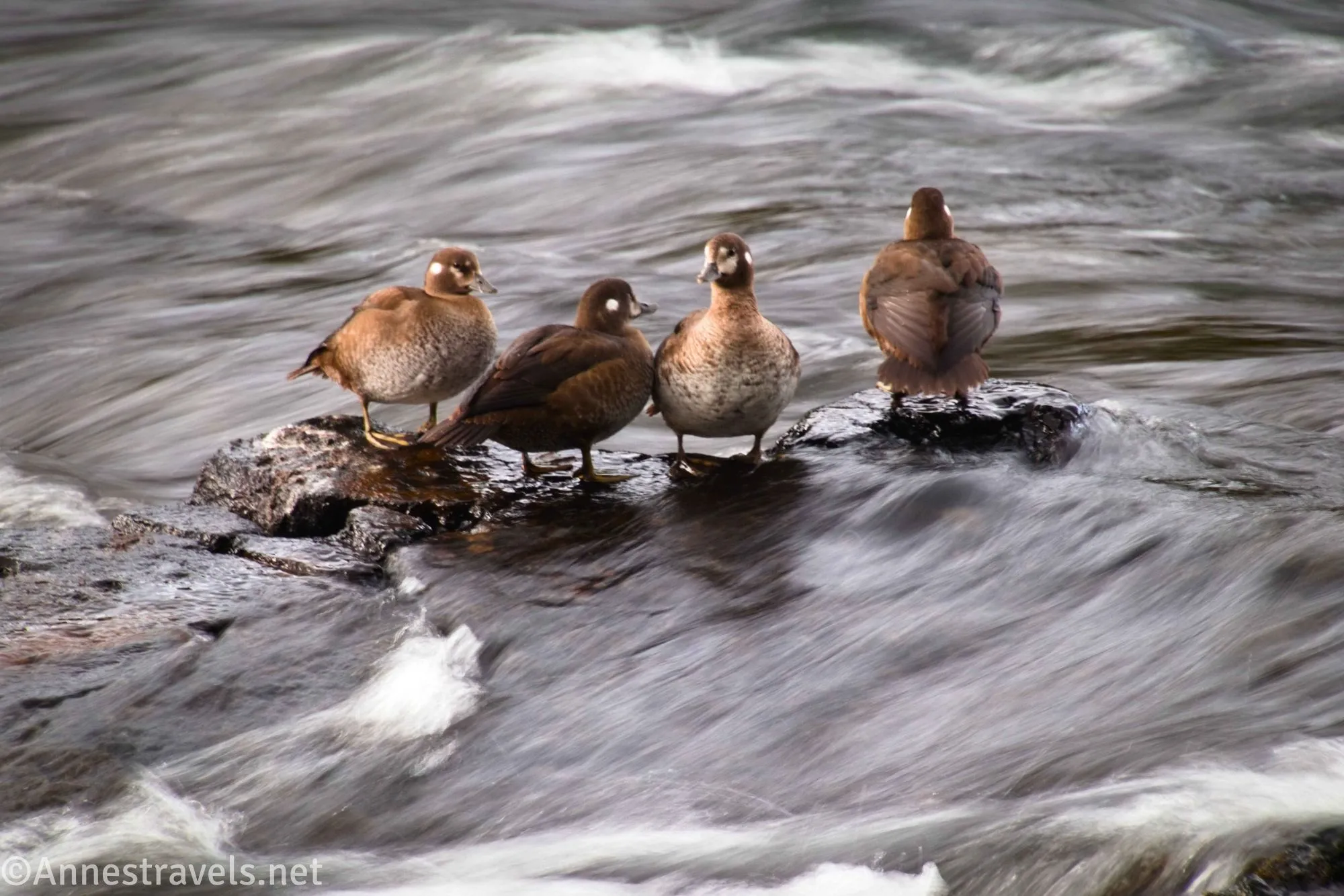
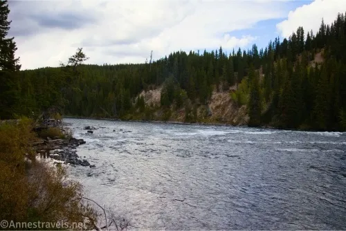
0.0 LeHardy Rapids Trailhead (7,769ft.). Follow the boardwalk as it heads for the edge of the Yellowstone River. After about 400ft. (approx. 44.607026°, -110.384175°), a series of observation platforms allows you to see the rapids. In June and July, cutthroat trout migrating in the river leap up the rapids. I visited in the fall, so I didn’t see any trout, but I sure did see ducks! Some say the LeHardy Rapids have the best viewing of harlequin ducks in the world. Whether this is true or not, I saw several harlequin ducks, a few mergansers, and possibly some mallards. Don’t discount the lower viewing areas, too, as the ducks seem to hang out in the water below the rapids. After enjoying the ducks and rapids, if you want a slightly longer adventure, you can keep walking downhill at the end of the boardwalk (about mile 0.15) along the trail on the bank of the river. (44.606238°,-110.383586°)
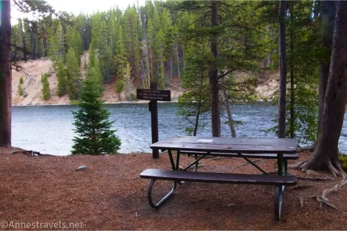
0.3 LeHardy Picnic Area Trailhead (7,732ft.). This is an alternate parking area and has a few picnic tables in the woods between the pavement and the river. Retrace your steps to the trailhead where you left your car. (44.607797°, -110.386914°)
Round Trip Trail Length: 0.15 to 0.6 miles
Elevation Gain: 1About 50ft. (7,722ft. to 7,764ft.)
Facilities: None
Fees: $35/vehicle, valid 7 days. America the Beautiful National Parks and Federal Public Lands Passes and Yellowstone Annual Passes are accepted.
Trail Notes: This is a great, easy trail for children or those who don’t want to walk very far. I saw quite a few people with long (not huge) lenses taking pictures of the ducks. One guy and I shared our delight of owning zoom lenses and photo vests along the boardwalk. The ducks are the real draw of the hike; I gather they’re quite common from spring through fall. No fishing is allowed in or near the rapids
Trail 
Road
Signs ![]()
![]()
![]()
![]()
Scenery ![]()
![]()
![]()
Would I go 100 miles out of my way for this? ![]()
![]()
![]()
Overall Rating: ![]()
![]()
GPS Coordinates for LeHardy Rapids
TH: 44.6061510°, -110.3836240° (44°36.36906′, -110°23.01744′ / 44°36’22.1436″, -110°23’01.0464″) (7,770ft.) (0.0)
Picnic Area: 44.6080450°, -110.3864960° (44°36.48270′, -110°23.18976′ / 44°36’28.9620″, -110°23’11.3856″) (7,727ft.) (0.30)
End: 44.6062380°, -110.3835860° (44°36.37428′, -110°23.01516′ / 44°36’22.4568″, -110°23’00.9096″) (7,768ft.) (0.55)
The gpx file for LeHardy Rapids can be downloaded – please note that this and the GPS Coordinates are for reference only and should not be used as a sole resource when hiking this trail.
Download GPX File size: 13.5 KB Downloaded 33 times
(Note: I do my best to ensure that all downloads, the webpage, etc. are virus-free and accurate; however, I cannot be held responsible for any damage that might result, including but not limited to loss of data, damages to hardware, harm to users, from use of files, information, etc. from this website. Thanks!)
Getting to the LeHardy Rapids Parking Area
From Canyon Junction, head south (toward Fishing Bridge and West Thumb) on the main park road. After 12.5 miles, turn left into the for LeHardy Rapids. If the lot is full (unlikely but possible, there is a second pulloff below the rapids (Lehardy Picnic Area) a short distance back toward Canyon.
From Fishing Bridge, drive north (toward Canyon) on the main park road. After 2.9 miles, the pulloff for LeHardy Rapids will be on the right. If the lot is full (unlikely but possible), there is a second pulloff below the rapids (LeHardy Picnic Area) a short distance up the road.
The Not-So-Long Trails in Yellowstone
Explore more of the shorter trails in Yellowstone National Park with this guide! It covers almost 30 hikes within the park to waterfalls, lakes, views, geothermal areas, and more. Buy your copy here.