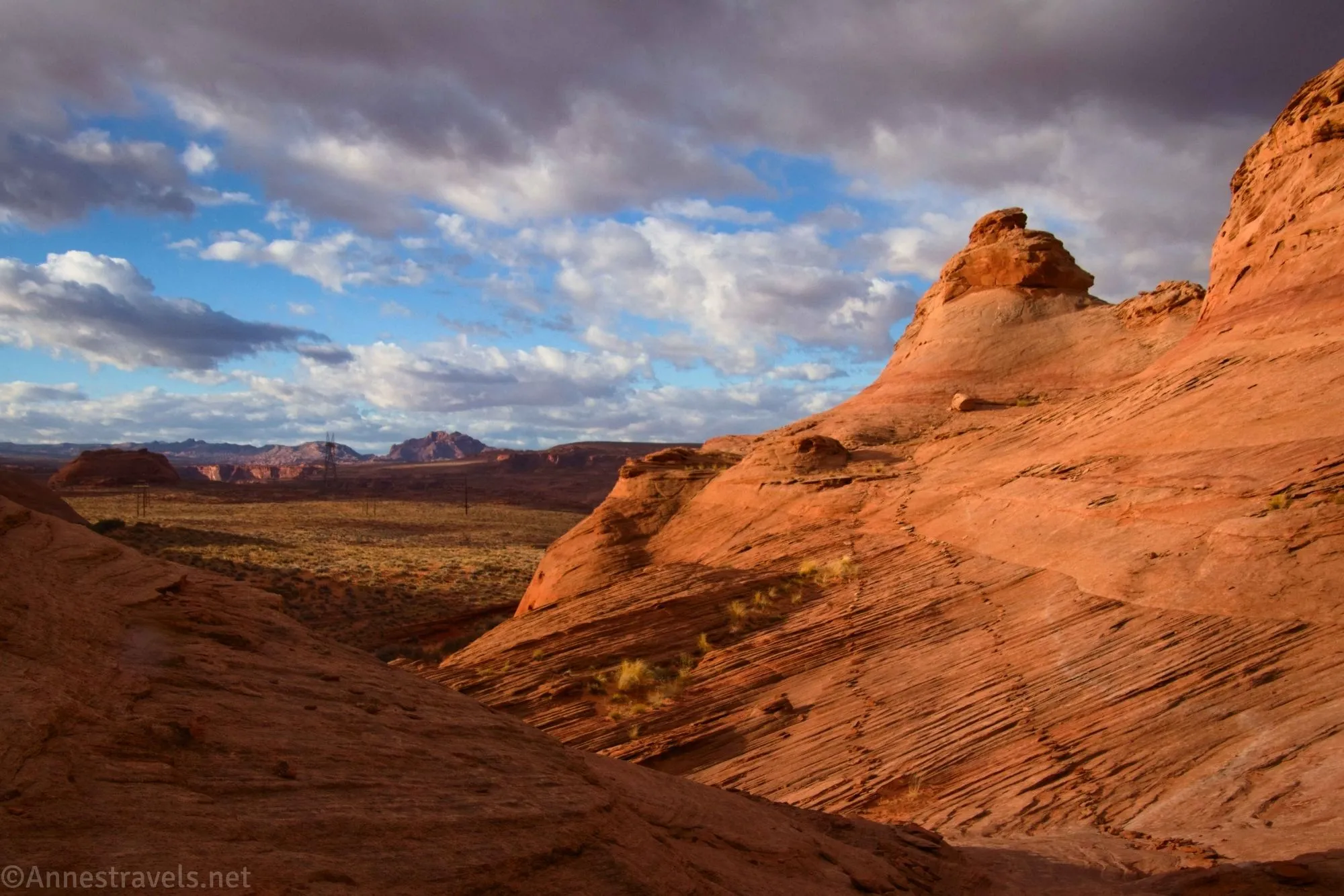
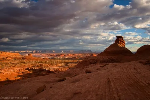
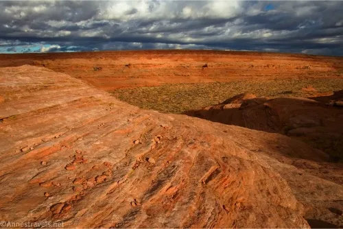
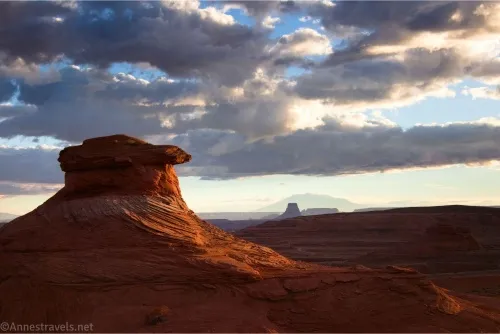
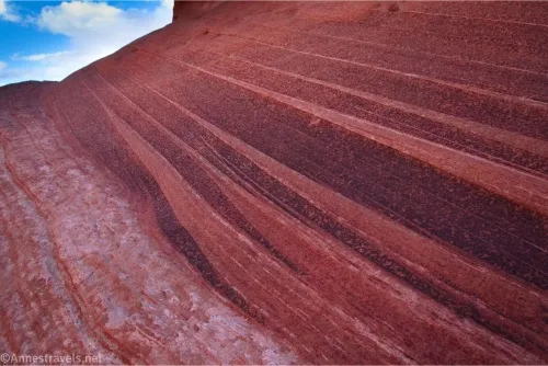
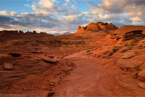
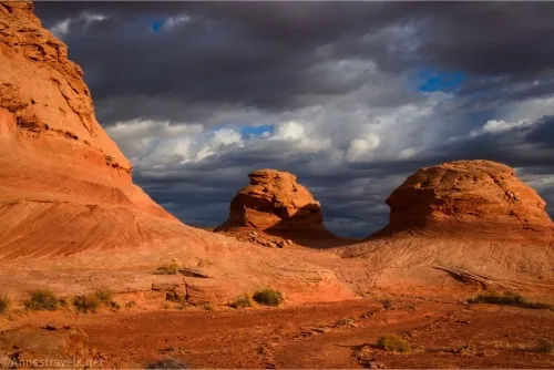
I went to the Beehive Trail outside of Page, Arizona, because someone online called it the “New Wave.” It was billed as a place where you can see formations like the famous Wave, only you don’t need a permit. Well, I’ve never been to the real Wave, but I’ll have to assume it’s more exciting than the Beehive Trail. The latter is very nice, even worth seeing, and I really enjoyed visiting early on a moody morning in November, but I can’t imagine anyone getting a permit to see it. There is one area with “wave”-like lines in the rocks, but the real draw is the surrounding scenery and rock formations. If you happen to have a half hour just north of the Lake Powell dam, strap on your camera and set off to have fun with the rock formations, leading lines, and views – you’ll be glad you did!
Quick Stats
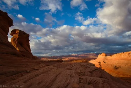
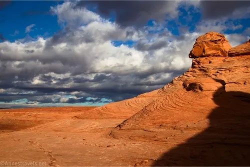
I highly recommend visiting either in the early morning or late afternoon/evening. By 10am, the lighting is such that the rocks begin to wash out and look a lot less pretty. You’ll still get some good views, it just won’t be as good for photography.
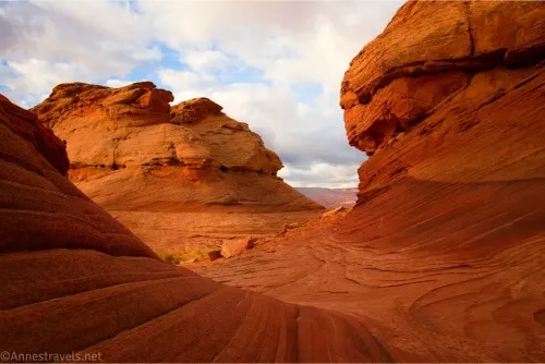
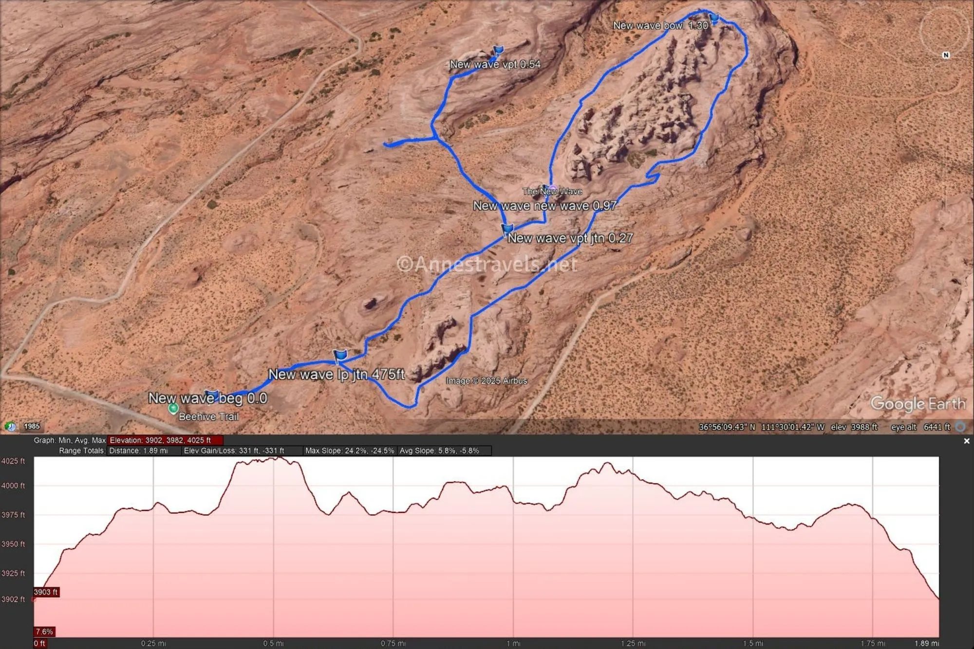
Follow the path from the trailhead, staying between the lines of rocks and following the cairns. At the split of the loop, I went left. This is the side of the loop with the New Wave, the best viewpoint, and more developed trail. The other side of the loop is more rugged and often quieter, but it also has some nice rock formations.
From here, the route goes across slickrock to another junction. Turning left here will take you up to a viewpoint, while the right fork is the loop and will take you to the New Wave.
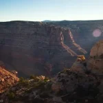
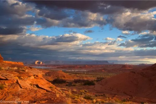
I turned left to the viewpoint, though to be honest, I got confused with the trail. The route descends into a valley then ascends a slickrock dome on the other side. Where exactly the viewpoint is located is hard to say. I walked right up and between two formations. On the other side of the formations was some very nice views to the south. Then I came back and walked to what would have been the left for a short distance.
While I was up at the viewpoint, I saw the rest of my group walk right by the junction and continue around the regular loop (I had run ahead to catch the morning light while they finished up at the van). I was pretty sure they had no clue where I was, and that they’d start to worry as soon as they got around the loop and didn’t find me. So I high-tailed it back to the main loop.
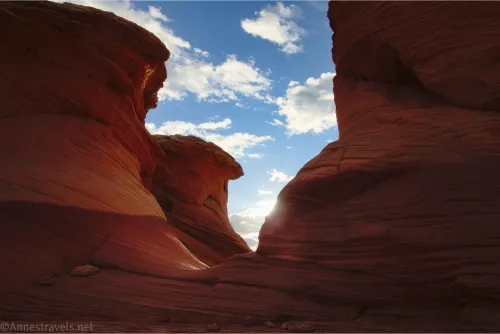
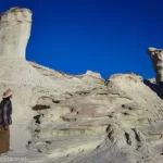
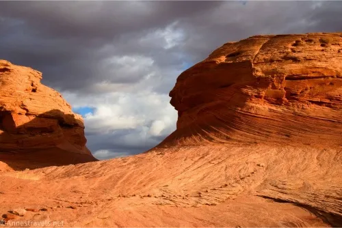
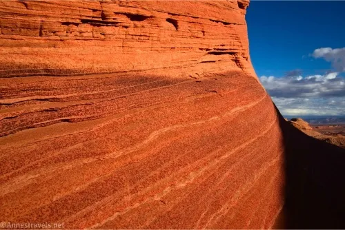
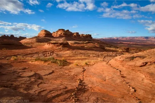
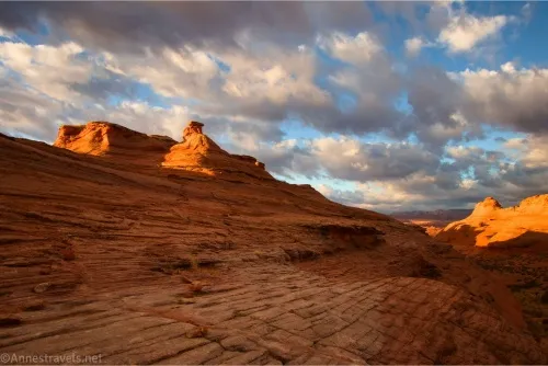
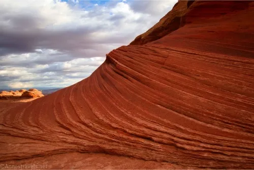
Only 300ft. beyond the turnoff for the viewpoint, the path rises to pass between two rock towers. This is the New Wave. At first, it doesn’t look very impressive, but if you wander around and get at the right angle, the lines become clearer, and it’s actually pretty neat!
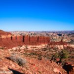
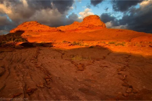
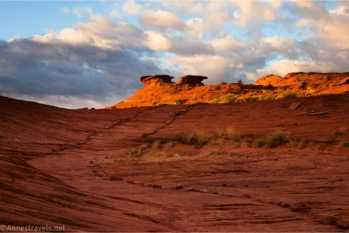
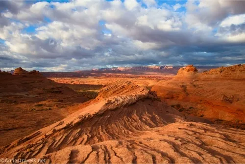
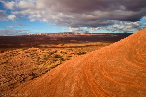
The cairns continue along the slickrock beyond the New Wave with great views to the rock formations across the next valley. The path finally turns right to go around the end of the butte you’re circling. At the far end is a pretty bowl in the slickrock.
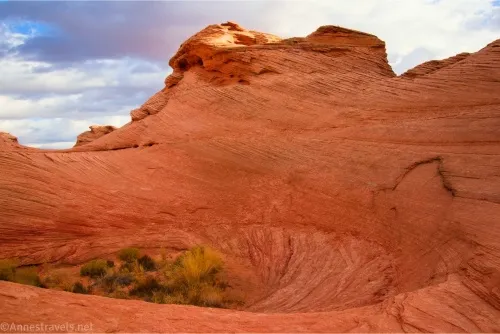
From here, the route gets a bit more rugged. Follow the cairns closely; you’ll be scrambling (Class 2) over and around the slickrock. The views are still good, just not quite as exciting as the eastern side of the loop, as much as there are rock formations overhead on the right. I returned to the loop junction about mile 1.8 (it would be about 1.3 miles without going to the viewpoint); from there, it’s a quick 500ft. back to the parking area!
Only by then I’d finally caught up with my group (sort of) and they’d missed where the New Wave was at, so we hiked back up to the New Wave for a few more pictures before returning to the van.
Round Trip Trail Length: I went 2.0 miles
Elevation Gain: 331ft. (3,902ft. to 4,025ft.)
Facilities: Campground at the trailhead
Fees: $30/vehicle to enter Glen Canyon National Recreation Area; America the Beautiful National Parks & Federal Lands passes and Glen Canyon Annual Passes are accepted.
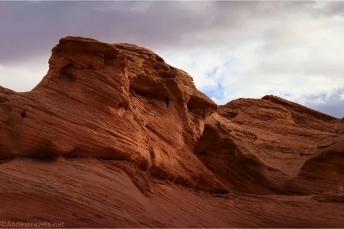
Trail Notes: Wear good, grippy shoes and be ready to scramble. While none of the scrambling is hard (it’s only Class 2), there are some steep inclines, mostly so you’re walking on an uneven surface. Also be ready to wayfind as the trail isn’t always obvious (but it’s also pretty hard to get lost in most places thanks to the park people placing rocks to mark the trail – don’t mess with these). I was blessed with incredible lighting for this trail as the morning stormclouds broke up and shone golden-hour light on the formations. We were the only people on the trail for the first 30-60 minutes, then it quickly became popular with families, couples, and people holding big cameras.
Trail 
![]()
![]()
Road ![]()
Signs ![]()
![]()
Scenery
Would I go 100 miles out of my way for this? ![]()
Overall Rating: ![]()
GPS Coordinates for the Beehive Trail and the New Wave
TH: 36.9378110°, -111.4971520° (36°56.26866′, -111°29.82912′ / 36°56’16.1196″, -111°29’49.7472″) (3,902ft.) (0.0)
Loop junction: 36.9375290°, -111.4985970° (36°56.25174′, -111°29.91582′ / 36°56’15.1044″, -111°29’54.9492″) (3,945ft.) (475ft.)
Viewpoint junction: 36.9362050°, -111.5006400° (36°56.17230′, -111°30.03840′ / 36°56’10.3380″, -111°30’02.3040″) (3,975ft.) (0.27)
Viewpoint: 36.9334950°, -111.5007510° (36°56.00970′, -111°30.04506′ / 36°56’00.5820″, -111°30’02.7036″) (4,024ft.) (0.54)
New Wave: 36.9357530°, -111.5012200° (36°56.14518′, -111°30.07320′ / 36°56’08.7108″, -111°30’04.3920″) (4,001ft.) (0.97)
Bowl: 36.9330460°, -111.5041870° (36°55.98276′, -111°30.25122′ / 36°55’58.9656″, -111°30’15.0732″) (4,023ft.) (1.30)
End: 36.9378080°, -111.4971390° (36°56.26848′, -111°29.82834′ / 36°56’16.1088″, -111°29’49.7004″) (3,902ft.) (2.05)
The gpx file for the Beehive Trail can be downloaded – please note that this and the GPS Coordinates are for reference only and should not be used as a sole resource when hiking this trail.
Download GPX File size: 40.9 KB Downloaded 202 times
(Note: I do my best to ensure that all downloads, the webpage, etc. are virus-free and accurate; however, I cannot be held responsible for any damage that might result, including but not limited to loss of data, damages to hardware, harm to users, from use of files, information, etc. from this website. Thanks!)
Getting to the Beehive Trailhead
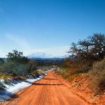
From Page, AZ, head north on S Lake Powell Blvd to merge onto US-89N toward the Glen Canyon Dam. Drive for 1.7 miles, then turn left onto an unmarked road that ends at the Beehive Campground. Park before the campground – a sign for the Beehive Trail is nearby.
From Kanab, UT, head east on US-89 for 70.6 miles. Just beyond the sign that says, “Glen Canyon Dam Carl Hayden Welcome Center ½ mile,” turn right onto an unmarked road that ends at the Beehive Campground. Park before the campground – a sign for the Beehive Trail is nearby.
More Hikes in the Area
This guide covers hiking in much of the area surrounding Page, AZ, including national parks, off-the-beaten-path treks, hidden gems, famous scenery, and much more. Buy your copy here.