

It’s hard for me to unreservedly recommend the North Rim of the Grand Canyon. I know people who love it, and I know others who appreciate the older-national-park experience (like all the parks used to be when I started traveling in the 1990s). But I miss the sweeping views offered at the South Rim viewpoints – especially the views to all the “temples” of the North Rim. But if you happen to end up on the North Rim, I highly recommend two overlooks not far from parking lots – Point Imperial and Cape Royal.
Quick Stats
(Affiliate links are present on this page.)
Both viewpoints are located along a spur road off the main park road. Point Imperial is at the end of the road to the north, and Cape Royal is at the end of the road to the south. So you’ll be driving the entire spur road to see both viewpoints.

If you only have time for one? I’d personally go for Cape Royal. But if you’re really short on time, go for Point Imperial because it’s a shorter drive off the main park road.
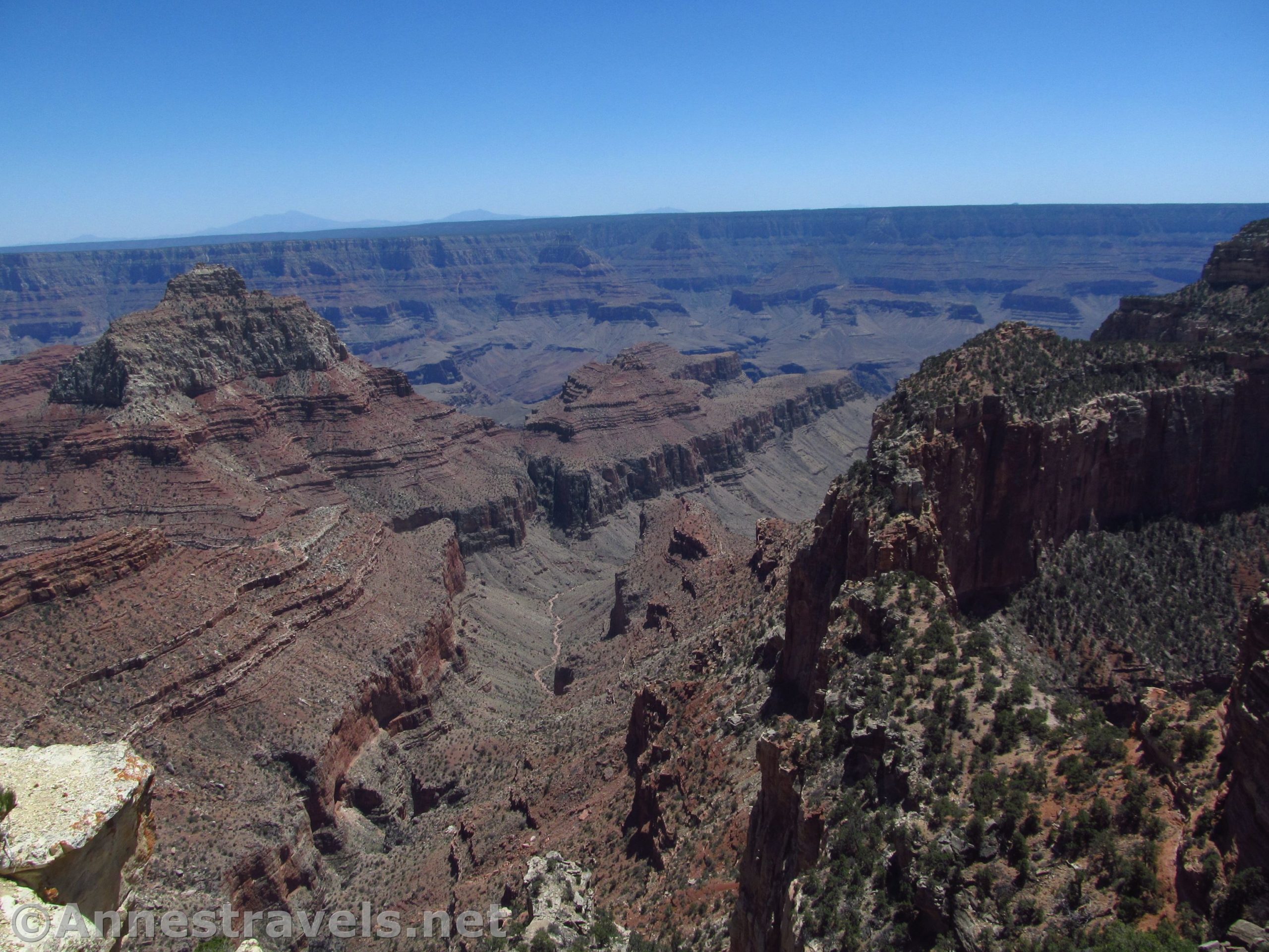
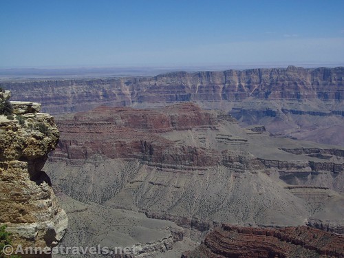
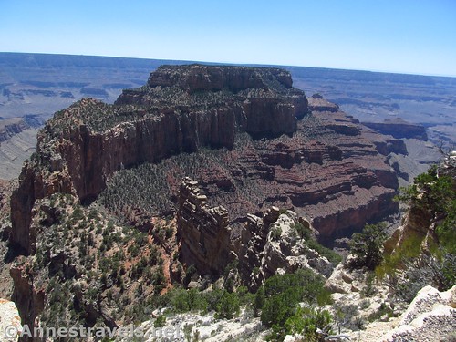
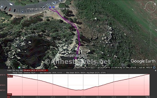
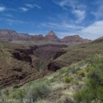
We did the short path (stairway, really) to Point Imperial after hiking a short distance on the Ken Patrick Trail (a worthy hike in its own right). The path descends a set of stairs from the parking area to the viewpoint on a rock fin that protrudes from the side of the canyon. This is considered the highest viewpoint in the park, despite the fact that the parking area is about 50ft. higher than the viewpoint.

The views are mostly of Point Imperial, but there are a few others into the nearby side canyons and out to a few “temples”. You can also see across the canyon to the flatlands of the South Rim on a clear day.

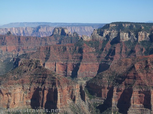
Enjoy the view, then return to your vehicle (or hike a portion of the Ken Patrick Trail) and drive down the road to Cape Royal. The road is narrow and very winding. I highly recommend stopping at the pulloff for the Cliff Spring Trail (trail on right, pulloff on left) for a view to the Angels Window shortly before the end of the road.

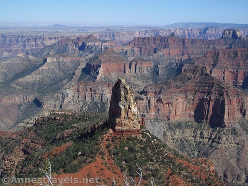
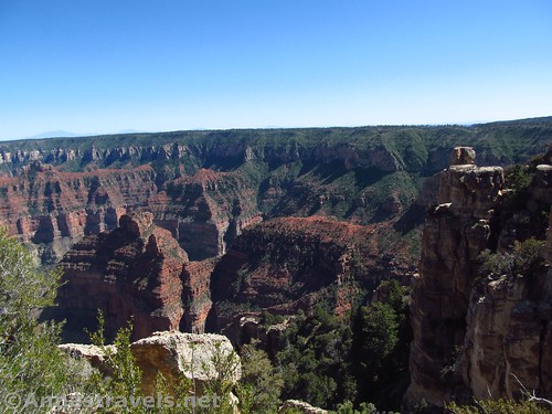
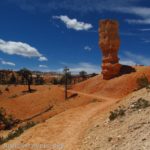
The trail to Point Royal is longer than the trail to Point Imperial, but it’s also more interesting. The path winds through scrub on a paved path, then, almost a quarter mile from the trailhead, the trail splits. Turn left for the short path to stand on top of the Angels Window.

Many people don’t walk out on the narrow rock bridge that connects the rocky outcrop to the canyon wall. And I don’t blame them. But there are guard railings, and even one of my group members who hates heights made it without issue. The views are pretty good of a nearby rocky ridge extending out into the canyon and over to the South Rim. You can even see the Colorado River if you look carefully.

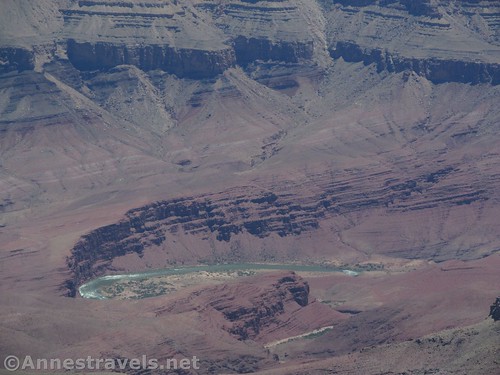
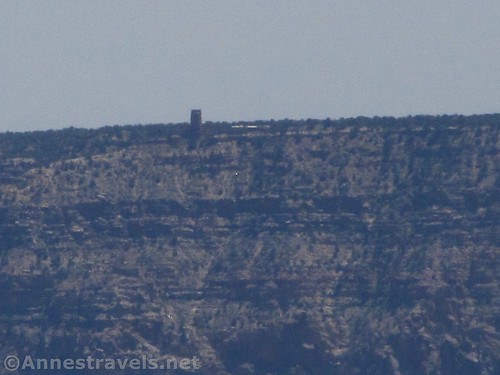
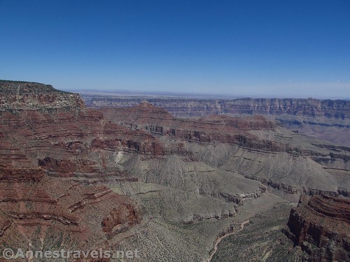
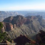
Back on the main trail, the path is a little rougher 0.25 miles out to Cape Royal (but nothing all that difficult). The views here are of various ridges of rock, the Colorado River, and the South Rim. If you know where to look, you can see the Desert View tower.
Retrace your steps (minus the Angels Window spur) for an approximately 1.1 mile walk.
So those are two of the most accessible, most beautiful hikes/walks to viewpoints on the North Rim of the Grand Canyon! On the way back, you can stop at the Wahalla Ruins to see the remains of an ancient American settlement, hike out to Cape Final for more great views of the Grand Canyon, or stop at the Roosevelt Point Overlook for a slightly more wooded experience.

Total Trail Lengths: About 500ft. for Point Imperial; about 1.1 miles for Cape Royal
Elevation Gain: About 50ft. for Point Imperial; about 1,161ft. .for Cape Royal – though that seems a bit steep for my memory of the hike!
Facilities: Picnic tables at Point Imperial. Primitive restrooms at both Point Imperial and Cape Royal.
Fees: $35/vehicle, valid 7 days. National Park & Federal Recreational Lands Passes and Grand Canyon Annual Pass are accepted.
Trail Notes: I personally prefer the views from Cape Royal, but both are very nice as North Rim views go. The Cape Final Trail may lead to even better views but I didn’t have time to hike out there on this visit.

Trail 
![]()
Road ![]()
Signs ![]()
Scenery ![]()
Would I go 100 miles out of my way for this? ![]()
Overall Rating: ![]()
GPS Coordinates for Point Imperial
Trailhead: 36.2790240°, -111.9782620° (36°16.74144′, -111°58.69572′ / 36°16’44.4864″, -111°58’41.7432″) (8,805ft.)
Viewpoint: 36.2789740°, -111.9776590° (36°16.73844′, -111°58.65954′ / 36°16’44.3064″, -111°58’39.5724″) (8,743ft.)
GPS Coordinates for Cape Royal
Trailhead: 36.1222333°, -111.9494333° (N36° 07.334′ W111° 56.966′ / 36°07’20.0400″, -111°56’57.9600″) (7,965ft.) (0.0) (end 1.16)
Trail Junction: 36.1195500°, -111.9479000° (N36° 07.173′ W111° 56.874′ / 36°07’10.3800″, -111°56’52.4400″) (7,866ft.) (0.23)
Angels Window: 36.1199833°, -111.9467167° (N36° 07.199′ W111° 56.803′ / 36°07’11.9400″, -111°56’48.1800″) (7,858ft.) (0.33)
Cape Royal: 36.1172333°, -111.9487833° (N36° 07.034′ W111° 56.927′ / 36°07’02.0400″, -111°56’55.6200″) (7,839ft.) (0.64)

The gpx files for Point Imperial and Cape Royal can be downloaded – please note that this and the GPS Coordinates are for reference only and should not be used as a sole resource when hiking this trail.
Point Imperial
Download GPX File size: 5.0 KB Downloaded 406 times
Cape Royal
Download GPX File size: 26.5 KB Downloaded 440 times
(Note: I do my best to ensure that all downloads, the webpage, etc. are virus-free and accurate; however, I cannot be held responsible for any damage that might result, including but not limited to loss of data, damages to hardware, harm to users, from use of files, information, etc. from this website. Thanks!)

Getting to Point Imperial
From the North Rim Entrance Station, continue south for 9.6 miles. Turn left on the road marked for Point Imperial and Cape Royal. After 5.4 miles, turn left toward Point Imperial (not right toward Cape Royal). Drive 2.7 miles to the end of the road at the Point Imperial Viewpoint.
From the North Rim Visitor Center, drive north 3 miles. Turn right on the road marked for Point Imperial and Cape Royal. After 5.4 miles, turn left toward Point Imperial (not right toward Cape Royal). Drive 2.7 miles to the end of the road at the Point Imperial Viewpoint.

Getting to Cape Royal
From the Point Imperial/Cape Royal Junction, turn right following signs for Cape Royal. Drive 14.3 miles to the end of the road in a large, dusty parking lot.
From Point Imperial, drive 17 miles to the end of the road at Cape Royal, staying left when the road back to the visitor center and park entrance turns right after 2.7 miles.

Zoom map out to browse nearby hikes & places of interest
This Week’s Featured Product!
Want even more trails on the North Rim of the Grand Canyon? This book specifically covers several trails in the North Rim region of the park.

One response to “Grand Canyon Viewpoints: Point Imperial & Cape Royal”
[…] And since we were there, we figured we might as well walk out to the Point Imperial Overlook. […]