

I read about a 2 mile trail – round trip – to the bottom of the Grand Canyon. The pictures were epic. The trail didn’t even look that steep. The only thing standing between me and the trail was a 75+ mile drive on dirt roads. And we’ve driven dirt roads before, right?
I did the best research I could online, and there wasn’t much information, besides a few 4×4 forum posts. The best answer I could get about whether or not I actually needed 4×4 was someone on TripAdvisor who said, “Take it slow and you should be fine.”
Ok, great. We should be fine. But do you have any idea what a van can actually do?
Well, it didn’t turn out as well as we wished. You really do need 4×4, and you totally couldn’t do it without high clearance. We got about 4 miles from the end of the road in our high-clearance, 2×4 van and finally decided we couldn’t go any further. But that’s getting ahead of the story.
We drove down from the area around Mt. Trumbull very, very early on a morning in early June (high clearance is all you need around here in dry weather – you might even be able to do it in a rugged car with average clearance). We hoped to get to the trailhead and take our hike before the heat of the day set in about 10am.
Take a left next to the Mt. Trumbull Schoolhouse (straight if you’re coming from St. George) following the sign for the Whitmore Trail and the Bar 10 Ranch. (36.411823, -113.325372)
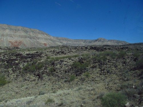
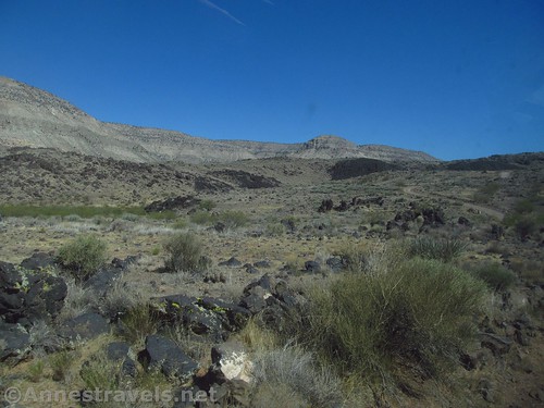
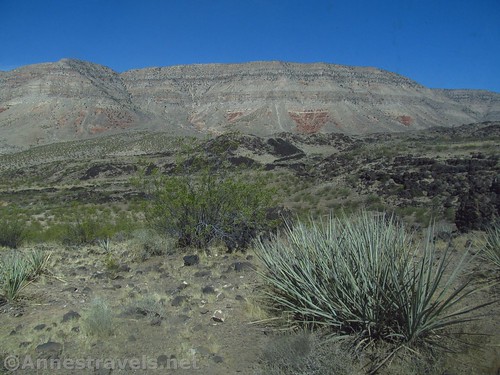
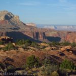
The road from here begins to head downhill. The quality of the road is still fairly decent – not much worse than the road south from Fedonia toward Tuweep (before the ranger station) – the downhills on west-facing and south-facing slopes seem to be the worst, but that could have just been my interpretation of it since we were going faster on the way back out. The good news is that (baring GPS directions, which are usually wrong) the road isn’t hard to follow and there really aren’t confusing turns or side-roads – major junctions are well-marked, and you won’t be confused by minor junctions.
The road slowly degrades in quality the closer it gets to the Bar 10 Ranch (ranch driveway is at 36.275839, -113.233634; veer right to stay on the road). A gate marks the ranch; open the gate, drive through, and then close the gate behind you. A sign requests travelers (who aren’t guests) to not trespass or hunt and to simply drive through (“Thru traffic and invited guests only”). There are also lines about surveillance and the right to refuse access, but it seems these are mostly so they can kick someone out if they aren’t respecting property rights. If you just drive through, you should be fine. The one complication is that there is no sign telling you when you’ve left private land and reentered BLM land.
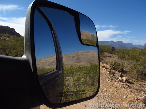
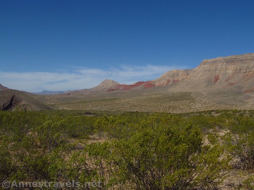
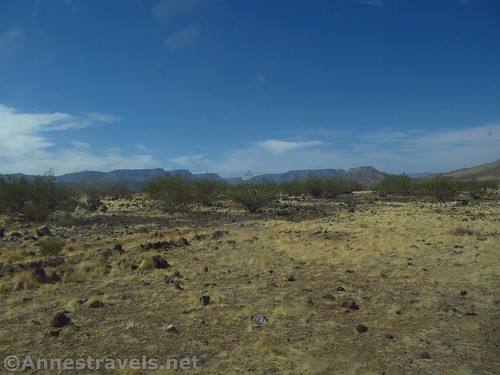
Keep driving past the airstrip and up the hill beyond. You are now very much on the Whitmore Trail and there is nothing but road, rock, and desert between you and the Grand Canyon.
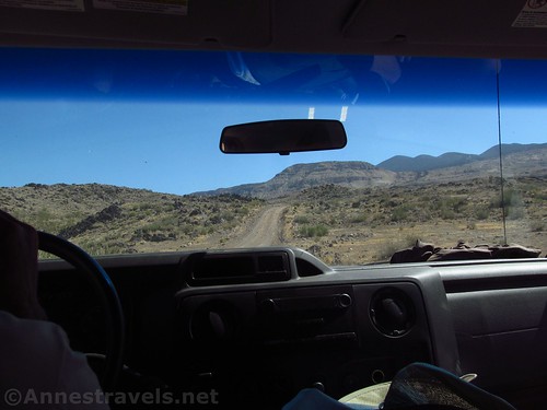
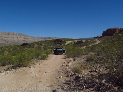
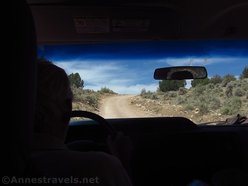
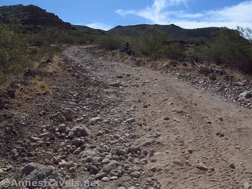
It was after this hill that we began to encounter problems. It’s not that it’s a technical drive – most of it’s not – but a base Ford 150 van was never made for sharp rocks and occasional deep potholes. It wasn’t long before half the group was out of the van building the road in places (mostly just filling in potholes so we could get through). But we pressed on.
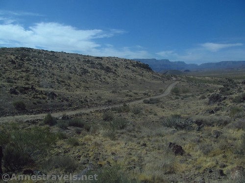
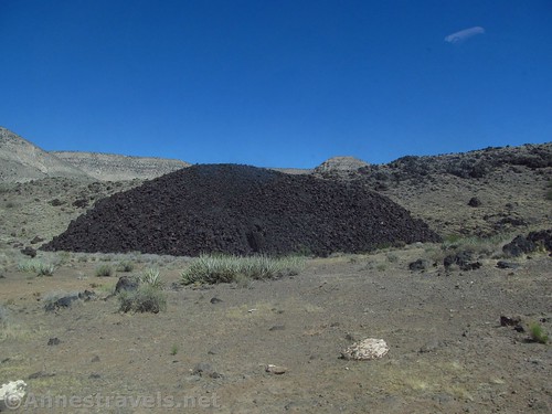
We entered an old lava flow and the road quality degraded even more. (Time for more road building!) Somehow we made it through to another section of white road (the black lava road is rougher than the white-colored rocks that make up other sections of the road). We rumbled on, passing the marked junction for Paw’s Pocket (Pa’s (I think the w is missing) Pocket Four-wheel Drive Routes) (junction at 36.230176, -113.231667; follow the sign straight for the Whitmore Trail (River Overlook)).
Part of the problem is that there is no place to turn around. So if you get to a point you don’t want to go up or down, there’s not much choice except to back up until you get somewhere that’s wide enough for an n-point turn.
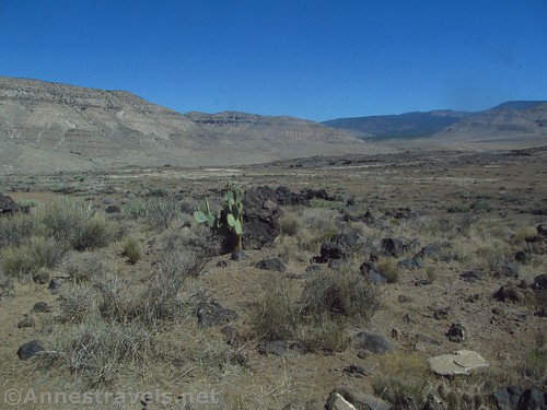
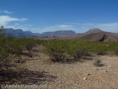
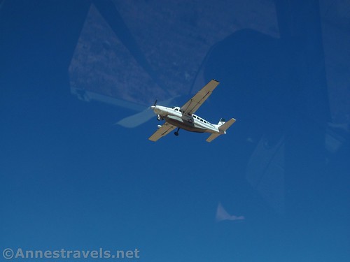
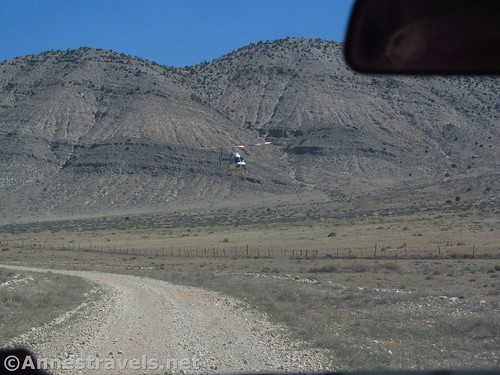
At last, a little less than 5 miles from the end of the road, just after crossing a wash into a land of mesquite bushes, and just before a long stretch of white road ascending a hill, we found a place that was possible to turn the van around. We didn’t; we actually left it sitting in the middle of the road and went ahead to scout out the route (we hadn’t seen another soul all morning except a helicopter that buzzed us every 15 to 20 minutes). Of one thing we all agreed: we didn’t want to drive further. It wasn’t that much worse than what we had already encountered, but we still didn’t want to drive it, or another five miles of it.
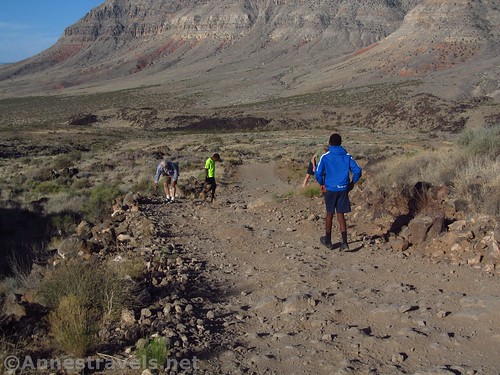
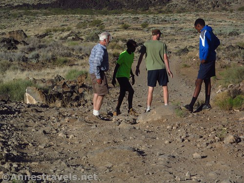
If it had been cooler, we would have simply parked the van in the wide part of the road, packed up our gear, and walked to the end of the road and then down to the Colorado River – about 12 miles RT. But it was too hot. And no one wanted to wait for evening, when it would (hopefully) be cooler. So we ate cold cereal right there in the middle of the road (living on Eastern Time means that an early lunch might be at 8:30am) and retraced our steps back to the Mt. Trumbull Schoolhouse.
The miracle is that we didn’t get a flat tire either on the way in or the way out!
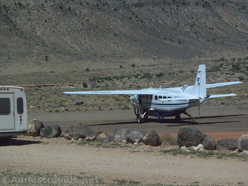
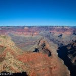
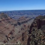
If you can actually make it to the end of the road, you’ll find one more section of black road (volcanic). The end of the road (sometimes referred to as the Whitmore Overlook or the “River Overlook”) is a “popular” lunch spot for people with jeeps; the trail to the bottom begins at the overlook at about 36.152511,-113.204488 and ends 1.1 miles and 920ft. of descent later near the Colorado River in the area of 36.151948, -113.198714. More information can be found here, although I’d say it will take you a bit more than 3 hours to drive in from Tuweep 🙂
Total Distance: The road is almost 25 miles from the Mt. Trumbull Schoolhouse to the Whitmore Overlook. From there, the trail is 2.2 miles (total) to the Colorado River and back.
Regulations: Stay on the road in private land. On the road – private as well as BLM – all vehicles must have valid license plates and proof of highway insurance (stickers and non-highway plates don’t cut it – this area is not for ORVing or ATVing). You’d have this on any normal vehicle, but not all off-road vehicles do – and I’m pretty sure I saw someone turning in some ORVers who weren’t highway legal on my way out of Toroweap a couple days later (they take this seriously). No bikes, dogs, or vehicles are allowed on the trail to the river, though I haven’t seen a word about bikers on the road, so I’d guess that would be ok – for example, leaving the vehicle at the schoolhouse and biking in from there. Don’t say I said you could do it, though 🙂
Facilities: Bar 10 Ranch for ranch guests. There is a primitive restroom at the Mount Trumbull Schoolhouse along with a couple picnic tables.
Fees: None
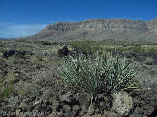
Trail Notes: This would be a great low-intensity jeep ride, and the trail at the end sounds awesome! We “met” one of the Bar 10 Ranch owners on our way back out (his ATV was in the middle of the road) and he seemed like a really nice guy. Don’t try this in the summer, because despite the north rim of the Grand Canyon being in the low 80s, it was at least 100F in Whitmore Canyon – at 9am. And it wasn’t even July. Be wary of monsoon rains in July and August (or rain anytime), which will make the road impassible. Note that the Whitmore Trail is extremely remote and without cell reception – come with everything necessary for a self-rescue.
Road 
![]()
![]()
![]()
![]()
Signs ![]()
Scenery ![]()
Interest ![]()
![]()
Ease of access / walking ![]()
![]()
![]()
Would I go 100 miles out of my way for this? ![]()
![]()
Overall Rating: ![]()
![]()
Getting to the Whitmore Trail
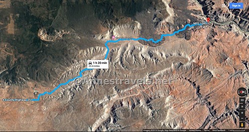
From St. George, drive south on I-15. Take Exit 2 toward UT-7; stay in the left lane on the exit to stay left to cross the bridge and then continue straight on UT-7 West. After 3.1 miles, take the exit (on right) toward River Road. Turn right at the end of the exit ramp to immediately cross the state line into Arizona. The road becomes dirt. Drive south about 38.5 miles, staying right when a road to a radio tower diverges left after about 14.3 miles. Stay right for another 8.1 miles and stay right again for another 3.1 miles to the Mt. Trumbull Schoolhouse.
From a more easterly direction, take the road to Toroweap southward (the road is along AZ-389 and is 5.1 miles east of the road to Pipe Springs National Monument and 8.3 miles from the US-89A / AZ-389 junction in Fredonia). Drive south toward Toroweap about 27 miles (take it slow, about 30mph or less, to avoid flat tires). Right about the national monument boarder, turn right onto another road, following the sign for the Whitmore Trail, Mt. Trumbull, etc. (This turn may be 18 miles later than the 27 miles – follow the signs!) After about 3 miles, a road will go off on the left to the Nampoweap Petroglyphs. Continue another 15 miles or so to the Mount Trumbull Schoolhouse (don’t confuse Mount Trumbull with the Mount Trumbull Schoolhouse – you’ll pass the trailhead for the mountain high up the in mountains before descending back down to the schoolhouse in the next valley).
From the Mount Trumbull Schoolhouse, turn south (left if coming from the Toroweap area, straight if coming from St. George) and follow the road. The Bar 10 Ranch is in about 13 miles, the Whitmore Overlook, about 23.5 miles.

Getting to the Mt. Trumbull Schoolhouse, high clearance is helpful at times. Beyond the schoolhouse, 4×4 is highly recommended.
Zoom map out to browse nearby hikes & places of interest
This Week’s Featured Product!
Looking for even more trails in the Grand Canyon? This guide suggests more hikes in both the more popular and less-visited areas of the park.


One response to “Driving (Part of) the Whitmore Trail”
[…] to visit the Grand Canyon very much, so we ended up in the Toroweap area. I had read about the Whitmore Trail, and how it was only a 2 mile round trip trail to the river. That sounded great. But the road […]