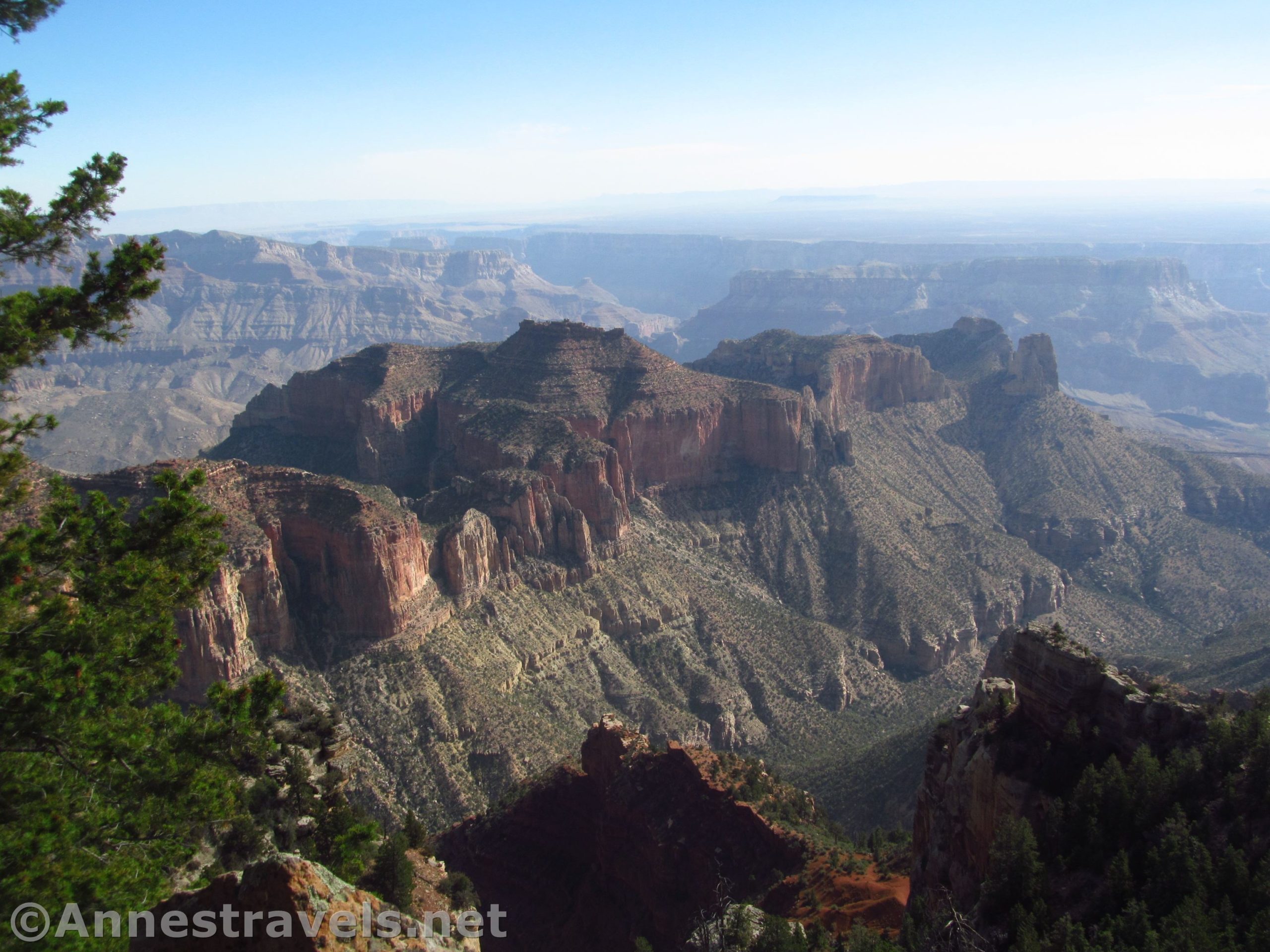

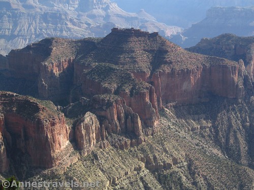
After our great success at Honan Point, a trailless trek through the forest of the North Rim of the Grand Canyon to fantastic views, we decided to try out another trailless trek on the North Rim, this one ending us at Atoko Point. It sounded cool; great views, just in a different place. On our way out of the park the evening before, we even located the tiny pulloff south of Roosevelt Point. Overall, it was a more difficult hike than the one to Honan Point (more underbrush = more bushwacking), and the views weren’t as good, plus it was a very hazy morning. But since it was only 3.25 miles RT, at least we didn’t spend a ton of time on it. On a clearer day, it would be worth the trek in the afternoon, just realize that it’s not the jaw-dropping views of Honan Point.
Quick Stats
(Affiliate links are present on this page.)
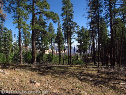
From the tiny pulloff (space for 1-2 cars), cross the road and head up the hill into the forest. You want to head generally east and not too far north until after you have dipped into a large ravine. Stay away from the sheer edges to the north!
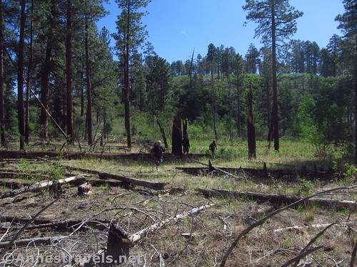
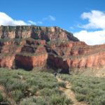
The walking is often hampered by fallen trees. Once you cross the ravine (not that hard), your bigger problem is bushes and general brush. My GPS track is a little squiggly as I tried to go around thickets and piles of windfall. My guess is that a fire came through here a number of years ago and the brush grew up in place of the dead trees.
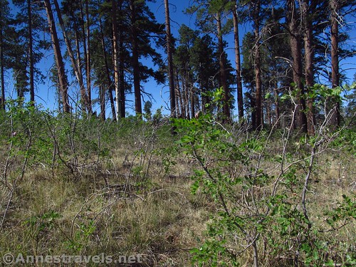
There are some social trails (a few of them deer trails), but you’re probably best off just heading generally northeast, then north. A GPS is helpful in knowing where you’re heading, but don’t let it take you into a dangerous situation. You’re on the edge of a canyon here!

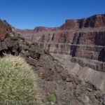
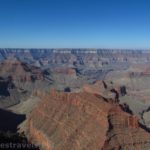
After the ravine, begin heading northeast. The geography itself will begin to push you northward eventually. At long last, if you’re in the right place, you’ll find yourself walking across a meadow with forests on either side, then walking out on a point into the Grand Canyon. At the place where you would wish for a nice flat rock to sit on and take in the view, the ground becomes broken-up rocks. I might have explored this area more, but 1) it was a long way down, 2) the rocks were more sheer than I liked, and 3) the wind was blowing and it was freezing! Who knew Arizona could be so cold in June?

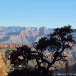
We sat around and looked out at the view for a while. Unfortunately, it was a bit hazy that day. The views here would be better in the afternoon, too, and I was visiting in the very early morning.

Once we decided the view wasn’t going to get much better quickly, we headed back the way we’d come. Overall, if you can only choose one, go for Honan Point over Atoko Point. But if you’re looking for a fun little bushwack adventure that leaves the crowds far behind, Atoko Point is a great place to do it!

Round Trip Trail Length: I ended at 3.20 miles
Elevation Gain: 727ft. (8,221ft. to 8,437ft.)
Facilities: None
Fees: $35/vehicle/week. Federal Recreational Lands & National Parks Passes and Grand Canyon Annual Passes accepted.
Trail Notes: You’ll want previous experience bushwacking and way-finding for this hike. Use care next to the edges, which sometimes are very sudden – one moment you’re in the forest, the next, you could be over the edge!

Trail 
![]()
![]()
![]()
![]()
Road ![]()
Signs ![]()
![]()
![]()
![]()
Scenery ![]()
Would I go 100 miles out of my way for this? ![]()
Overall Rating: ![]()
![]()
GPS Coordinates for Atoko Point
Beginning: 36.200824°, -111.949606° (N36°12.04944′, W111°56.97636′ / 36°12’02.9664″, -111°56’58.5816″) (6,097ft.) (0.0) (end 3.20)
Atoko Point: 36.2116500°, -111.9335167° (N36° 12.699′ W111° 56.011′ / 36°12’41.9400″, -111°56’00.6600″) (8,373ft.) (1.60)

The gpx file for Atoko Point can be downloaded – please note that this and the GPS Coordinates are for reference only and should not be used as a sole resource when hiking this trail.
File size: 67.3 KB Downloaded 0 times
(Note: I do my best to ensure that all downloads, the webpage, etc. are virus-free and accurate; however, I cannot be held responsible for any damage that might result, including but not limited to loss of data, damages to hardware, harm to users, from use of files, information, etc. from this website. Thanks!)

Getting to Atoko Point
From the North Rim Visitor Center, drive north (back toward the park entrance). After 3 miles, turn right, following signs for Point Imperial and Cape Royal. After 5.4 miles, turn right again, again following signs for Cape Royal. Drive 7.8 miles to an unmarked, very small gravel pullout on the right (west) side of the road. The pullout is 1.5 miles south of the Point Roosevelt Pullout.

From the North Rim Entrance Station, continue driving south. After 9.6 miles, turn left, following the sign for Point Imperial and Cape Royal. After 5.4 miles, turn right again, again following signs for Cape Royal. Drive 7.8 miles to an unmarked, very small gravel pullout on the right (west) side of the road. The pullout is 1.5 miles south of the Point Roosevelt Pullout.

Zoom map out to browse nearby hikes & places of interest
This Week’s Featured Product!
For a trail guide to the North Rim of the Grand Canyon, this book is hard to beat. It lists most of the trails within the main part of the park, plus several down the dirt roads to the west.