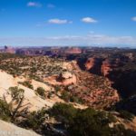
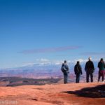
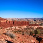
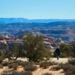
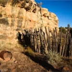
My most recent hike in the Maze District (well, near the Maze District) was up Rock Canyon to the Sewing Machine Needle. The route isn’t marked, and it is just slightly difficult, because there’s only one place I know about in Rock Canyon where you can safely (and fairly easily) climb up to the mesa above. There are great views most of the way, so if you don’t mind a rugged hike without a trail, this is a nice way to spend a day. Plus, if you’re into rock climbing, the Sewing Machine Needles is (not very) popular climb because it’s outside of most of the strictly regulated areas – read more about climbing the Sewing Machine Needle here.
Quick Stats
This post contains affiliate links. If you click on one of these links and purchase something, I may receive a small commission with no extra cost to you.

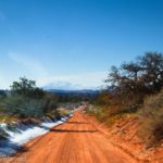
The trailhead for the hike up Rock Canyon to the Sewing Machine Needle is along the Waterhole Flat Road, which is an incredible and beautiful experience unto itself but requires a higher clearance vehicle (4×4 not required in dry weather). The route to the Sewing Machine Needle is usually only attempted by rock climbers – I don’t rock climb, so that part was a loss for me. I’ll talk about my experience as though the hike is the destination unto itself.

0.0 Water tank along the Waterhole Flat Road (4,964ft.). This is just before the road dips down to cross a (yet another) fork of Rock Canyon. Walk down the road to the wash and turn left (east) upcanyon (it would be hard to turn downcanyon as it fairly quickly ends in a dryfall). The canyon is wide and fairly uninteresting other than the towering walls. I hiked up the main fork to its end before coming back downcanyon to the exit point (aka where you can climb up to the mesa). (38.5639270°, -110.7038240°)

1.7 Head-ish of Rock Canyon (5,135ft.). A balancing rock is in this area, and the wide canyon has become a not-very-narrow but very rocky area that is hard to climb. Retrace your steps downcanyon to near where a sidecanyon goes off on the right (while walking downcanyon) – don’t turn up this canyon, but if you look below this junction on the right side of the canyon, you’ll see a jumbled mess of rockfall that creates a natural ramp up to the mesatop. Walk to the bottom of the ramp (approx. 37.9536340°, -110.2961210°) and start scrambling. The rockfall seems to have a light social path up it, though it’s probably an animal trail. At any rate, while it’s steep and not particularly fun to climb, the scrambling is never much more than easy Class 3 (use your hands and feet but no need for ropes). (37.9572640°, -110.2811880°)

3.2 Top of the ramp (5,289ft.). It’s hard to describe the route from here except to say that you turn right and head in the general direction of the Sewing Machine Needle. Some of it was across grass, we crossed a road, and eventually, we followed a wash almost up to the rocks below the needle. (Gotta follow LNT!) (37.9541580°, -110.2992050°)

5.25 Rock below the Sewing Machine Needle (5,525ft.). This was as far as we went, because at this point, the Needle was getting less spectacular because we were too close to it. Rock climbers can go farther to get to the base of the Sewing Machine Needle. When you’ve finished enjoying the view, retrace your steps back down to Rock Canyon and your vehicle. (37.9675830°, -110.2778320°)

Round Trip Trail Length: I went 8.4 miles
Elevation Gain: 1,392ft. (4,879ft. to 5,786ft.)

Facilities: None
Fees: None

Trail Notes: There is no trail on any of this hike, though there are a few vague animal trails in one place and another, and you can often follow washes. Be ready to self-rescue; the likelihood of someone coming along here is almost nil. As I mentioned above, you’ll want high clearance to get to the trailhead. My favorite part along the road is the formation we call the “Chocolate Bars” – they’re beautiful, especially in the afternoon light or when there is snow on the Henry Mountains.

Trail 

Road
Signs
Scenery
Would I go 100 miles out of my way for this?
Overall Rating: 

GPS Coordinates for the Sewing Machine Needle via Rock Canyon
TH: 37.9491610°, -110.3019070° (37°56.94966′, -110°18.11442′ / 37°56’56.9796″, -110°18’06.8652″) (4,906ft.) (0.0)
Balancing Rock (top of Rock Canyon): 37.9572640°, -110.2811880° (37°57.43584′, -110°16.87128′ / 37°57’26.1504″, -110°16’52.2768″) (5,135ft.) (1.67)

Top of the chute: 37.9541580°, -110.2992050° (37°57.24948′, -110°17.95230′ / 37°57’14.9688″, -110°17’57.1380″) (5,289ft.) (3.18)
Turn around beneath the Sewing Machine: 37.9675830°, -110.2778320° (37°58.05498′, -110°16.66992′ / 37°58’03.2988″, -110°16’40.1952″) (5,786ft.) (5.28)

Cross road: 37.9637150°, -110.2810330° (37°57.82290′, -110°16.86198′ / 37°57’49.3740″, -110°16’51.7188″) (5,525ft.) (5.80)
Turn into wash (out of the sidewash up to the chute): 37.9536340°, -110.2961210° (37°57.21804′, -110°17.76726′ / 37°57’13.0824″, -110°17’46.0356″) (4,988ft.) (7.63)
End: 37.9491610°, -110.3019070° (37°56.94966′, -110°18.11442′ / 37°56’56.9796″, -110°18’06.8652″) (4,906ft.) (8.41)

The gpx file for Rock Canyon to the Sewing Machine Needle can be downloaded – please note that this and the GPS Coordinates are for reference only and should not be used as a sole resource when hiking this trail.
Download GPX File size: 156.2 KB Downloaded 42 times
(Note: I do my best to ensure that all downloads, the webpage, etc. are virus-free and accurate; however, I cannot be held responsible for any damage that might result, including but not limited to loss of data, damages to hardware, harm to users, from use of files, information, etc. from this website. Thanks!)

Getting to the Sewing Machine Needle Trailhead
From Hanksville, Utah, head south on US-95S. After 46.5 miles, 1.2 miles after crossing the bridge over the Dirty Devil River Canyon, the Waterhole Flat Road is unmarked on the left. (If you cross the bridge over the Colorado River, turn around and retrace your wheels 1.0 mile back to the unmarked road on the right).
From Blanding, Utah, drive south on US-191S. After 3.9 miles, turn right onto US-95N for 74.9 miles. The unmarked Waterhole Flat Road will be on the right 1.0 mile after crossing the bridge over the Colorado River (2.1 miles north of the turnoff for Hite).
Take the Waterhole Flat Road for 8.0 miles to a water tank on the left – a tenth of a mile down the road is a wash. Park near the tank and walk to the wash.

Interactive Trail Map
Browse Nearby Hikes
This Week’s Featured Product
Explore the wilds of Canyonlands National Park with this guide, which goes beyond the popular trails to the dirt roads and lesser-visited areas of the park. Buy your copy here.