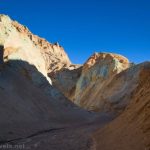
I had high hopes for Slit Canyon. And to be fair, the first part of the hike was gorgeous with scenery not typically experienced on the more famous trails in Death Valley National Park. However, the canyon itself wasn’t as exciting as I had anticipated. Still, if you want a deserted hike in the “main” part of Death Valley, or you just love slot canyons (or you’re looking to conquer Undertaker Canyon), it’s worthwhile enough – just not as pretty or as long as I’d been led to believe. See the pictures and decide for yourself if my expectations were too high, and it’s actually quite a nice hike!
Quick Stats
This site contains affiliate links. If you click one of these links and make a purchase, I may receive a small commission. There is no extra cost to you.
Park near Hole in the Wall on Hole in the Wall Road. How much space there is to park will depend on recent storms. When I visited in November 2023, the only safe place to park was in or near the final campsite (I believe it’s Campsite 6) in Hole in the Wall. Road conditions will vary depending on how recently it has been graded, but 2WD can often make it up as far as Hole in the Wall.
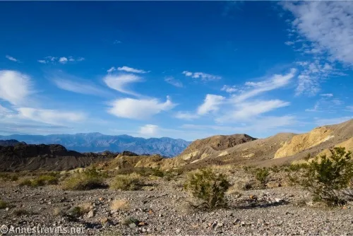
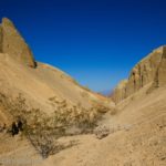
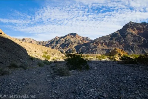
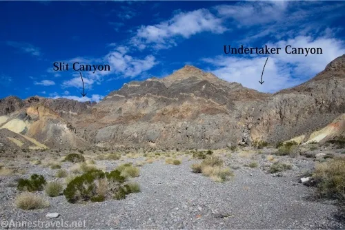
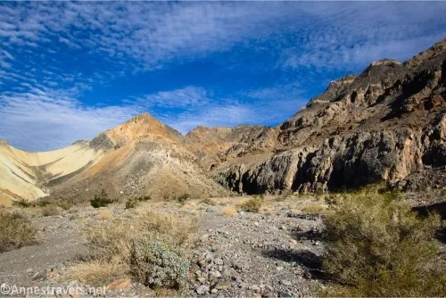
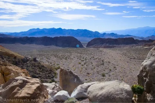
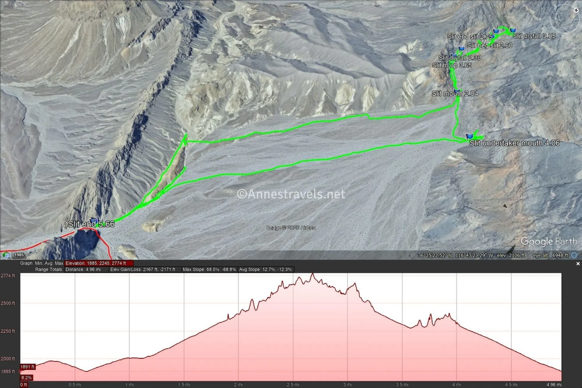
0.0 Slit Canyon Trailhead (Hole in the Wall) (1,943ft.). The trailhead is not marked, so just head from Hole in the Wall up the wash toward the mountains. Stay left-ish and don’t bother climbing up onto the higher berm in the middle of the wash. Be sure to look back down the wash, as the views to the area around Zabriskie Point and the Black Mountains are quite nice. You can probably see the mouth of Undertaker Canyon on the right, but if you stay sufficiently left (with easier walking when I did it), you won’t pass very close to it. The tread near the mouth of Slit Canyon is rocky, but it quickly becomes smoother once you’re in the canyon. (36.4149280°, -116.7238680°)
1.1 Mouth of Slit Canyon (2,372ft.). The canyon eventually narrows down to the mouth. For the first quarter mile, the canyon is fairly uninteresting. (36.4292050°, -116.7193460°)
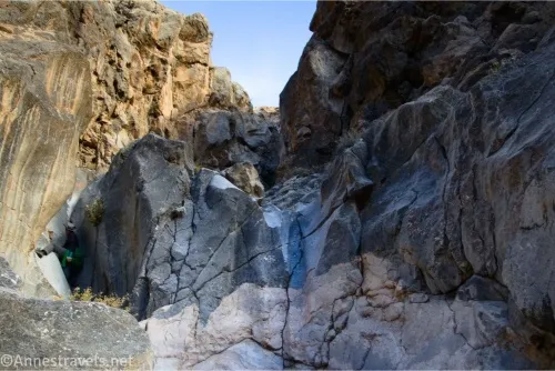
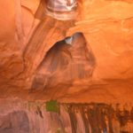
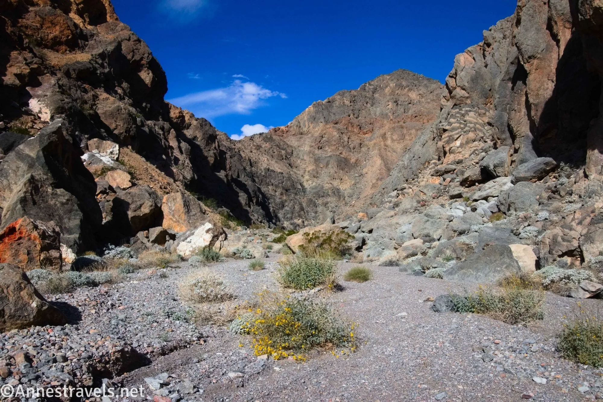
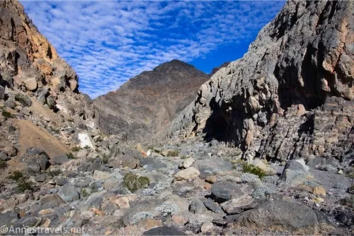
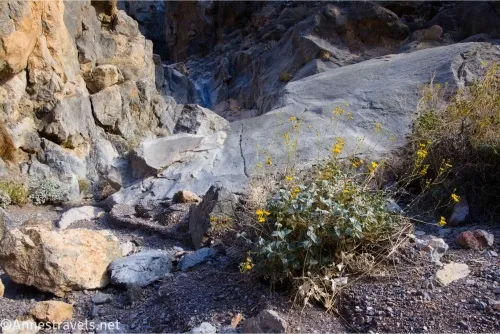
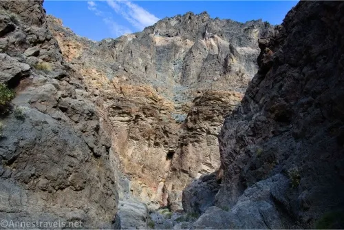
1.3 First impassable dryfall (2,580ft.). This dryfall wasn’t something we wanted to climb, and even if you got up it, there are two more impassible dryfalls right above this one. To continue up Slit Canyon, backtrack just slightly to a lightly cairned social trail on what would have been the right as you were walking upcanyon. The tread is mostly scree, but it’s not too slippery if you’re careful to follow a good route (aka where others have gone before – there is a light trail). The path drops you back into the canyon above the final dryfall in this section. Take note of this route so you can find it on the way back downcanyon. Walk back downcanyon to see the top of the dryfall, which is impressive. Above this, the canyon is narrower and prettier than the lower part of the canyon with a few small scrambles. (36.4315530°, -116.7215020°)
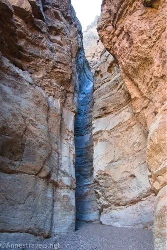
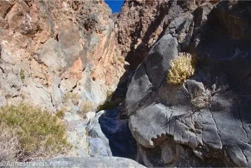
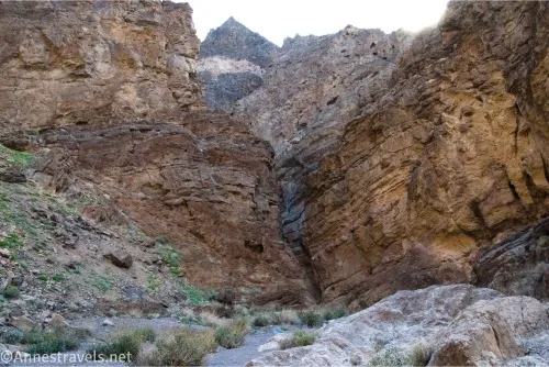
1.6 Beginning of The Slit (2,694ft.). Slit Canyon is named for a narrow, straight section of slot, and it begins when you arrive at a chokestone. The chokestone can be scrambled up or around. The Slit, itself, is only about 0.15 miles long and ends at a 10ft. dryfall. I was able to climb this dryfall with some creative scrambling and grippy shoes, but neither of my companions was able to follow me up. The canyon beyond the end of The Slit is a little wider but also a little pretty and definitely has rugged walls. (36.4329390°, -116.7209050°)
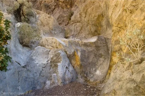
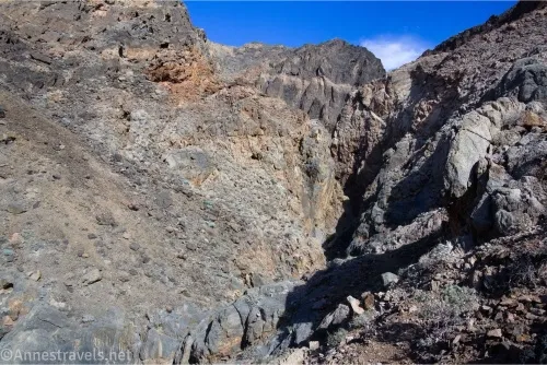
2.0 Impassible 50ft. Dryfall (2,748ft.). Upward travel ends here in a pretty grotto. I’ve heard that there may be a bypass downcanyon on the left (when traveling upcanyon), but given that I was alone, I didn’t want to try anything too sketchy. Retrace your steps down to the mouth of Slit Canyon, where (if you want) you can go over and also explore Undertaker Canyon. (36.4334600°, -116.7201410°)
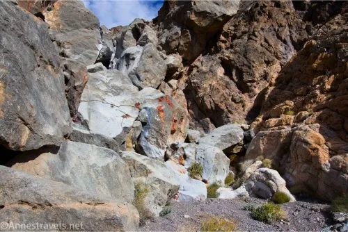
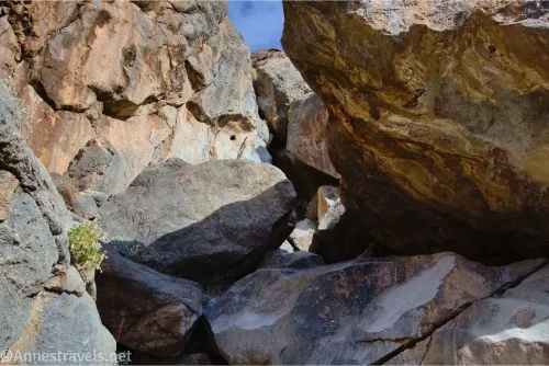
3.0 Mouth of Undertaker Canyon (2,361ft.). The mouth is marked by a huge jumble of rocks; these must be negotiated to enter the canyon. I believe I could have gotten through with some Class 4 scrambling, but my intrepid scrambling companion had an injury that kept him from doing much (any?) real scrambling, so we called it a day and walked back down to the van. I hear that if you can get past the rocks (you might need a rope plus rock climbing and chimneying skills), you can hike through a short set of narrows, walk a mile to a wash split, turn right, and go another quarter mile to the high but unique Widowmaker Falls (Death Valley does have interesting names!) (36.4274820°, -116.7168450°)
Round Trip Trail Length: To the end of the Slit is 3.5 miles RT; I ended up hiking about 4.6 miles (actually, I added another mile beyond that when I and my companions missed each other in the wash and we walked in circles looking for one another for what felt like an hour at least).
Elevation Gain: 2,171ft. (1,885ft. to 2,774ft.)
Facilities: Primitive camping along Hole in the Wall Road; permit required.
Fees: $30/vehicle, valid 7 days. America the Beautiful National Parks & Federal Public Lands Passes and Death Valley Annual Passes are accepted.
Trail Notes: Up to the first dryfall, it’s really a walk in the park. Up to the end of the Slit, there’s nothing more difficult than a Class 2 scramble (if you do it right). However, you should be willing and able to wayfind and not get lost in the desert. Undertaker Canyon has a series of about 5 obstacles in the rock scramble, so don’t think it’s easy! If you want more theoretical information about Undertaker Canyon, I have a post here.
Trail 
![]()
![]()
![]()
![]()
Road ![]()
![]()
Signs ![]()
![]()
![]()
![]()
Scenery ![]()
Would I go 100 miles out of my way for this? ![]()
![]()
Overall Rating: 
![]()
![]()
GPS Coordinates for Slit Canyon and Undertaker Canyon
Slit TH: 36.4149280°, -116.7238680° (36°24.89568′, -116°43.43208′ / 36°24’53.7408″, -116°43’25.9248″) (1,943ft.) (0.0)
Mouth of Slit Canyon: 36.4292050°, -116.7193460° (36°25.75230′, -116°43.16076′ / 36°25’45.1380″, -116°43’09.6456″) (2,372ft.) (2.04) (Note: All mileages are approximately 1.0 miles less than written)
First dryfall: 36.4315530°, -116.7215020° (36°25.89318′, -116°43.29012′ / 36°25’53.5908″, -116°43’17.4072″) (2,580ft.) (2.30)
Begin slit: 36.4329390°, -116.7209050° (36°25.97634′, -116°43.25430′ / 36°25’58.5804″, -116°43’15.2580″) (2,694ft.) (2.60)
End of slit: 36.4332540°, -116.7209540° (36°25.99524′, -116°43.25724′ / 36°25’59.7144″, -116°43’15.4344″) (2,724ft.) (2.75)
Dryfall: 36.4334600°, -116.7201410° (36°26.00760′, -116°43.20846′ / 36°26’00.4560″, -116°43’12.5076″) (2,748ft.) (3.05)
Trail up below first dryfall: 36.4309520°, -116.7213980° (36°25.85712′, -116°43.28388′ / 36°25’51.4272″, -116°43’17.0328″) (2,467ft.) (3.65)
Mouth of Undertaker Canyon: 36.4274820°, -116.7168450° (36°25.64892′, -116°43.01070′ / 36°25’38.9352″, -116°43’00.6420″) (2,361ft.) (4.06)
End: 36.4148630°, -116.7238290° (36°24.89178′, -116°43.42974′ / 36°24’53.5068″, -116°43’25.7844″) (1,925ft.) (5.66)
The gpx file for Slit Canyon can be downloaded – please note that this and the GPS Coordinates are for reference only and should not be used as a sole resource when hiking this trail.
Download GPX File size: 132.4 KB Downloaded 30 times
(Note: I do my best to ensure that all downloads, the webpage, etc. are virus-free and accurate; however, I cannot be held responsible for any damage that might result, including but not limited to loss of data, damages to hardware, harm to users, from use of files, information, etc. from this website. Thanks!)
Getting to the Slit Canyon Trailhead
You can follow the directions here for Hole in the Wall Road up to the Hole in the Wall.
Or from the Furnace Creek Visitor Center, drive 6.7 miles on CA-190 East (toward Las Vegas). Turn left on the Hole in the Wall Road and drive 3.6 miles to the hole in the wall. Park out of the way of traffic.
The Hole in the Wall Road is also 23.5 miles west of Death Valley Junction and 0.9 miles west of the exit for 20 Mule Team Scenic Drive (and 0.7 miles east of the entrance for 20 Mule Team Scenic Drive).
Go off the Beaten Path!
Go off the beaten path with this guide to Death Valley National Park. The author covers almost 300 different roads, trails, routes, and other destinations across the park. Buy your copy here.