
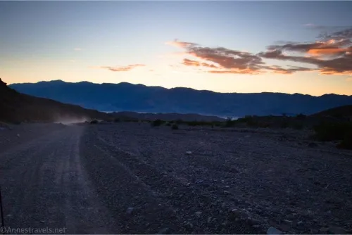
Echo Canyon Road may be one of the most popular 4×4 roads in Death Valley (outside of the Racetrack Road). It certainly is convenient and beautiful and offers great views, an arch, and a little bit of adventure. In recent years, with the change in camping restrictions, the NPS has been doing a better job of keeping it graded, meaning the road is often accessible to 2WD vehicles. That said, 4×4 is still encouraged, and while you might get low clearance up here, I was just as happy for high clearance, especially beyond the Inyo Mine.
Quick Stats
Back in 2023, the very last thing I did in Death Valley was to drive the Echo Canyon Road up to the Inyo Mine. It was such a fun adventure, though I was biting my knuckles in the canyon section due to some deep gravel (thank goodness my driver has a fair bit of experience in tackling 4×4 roads with a 2WD vehicle!) In early 2025, I asked my online contacts about road conditions, and they all assured me it would still be just fine for my van. So the very first thing I did in Death Valley this year was to drive up the Echo Canyon Road! Only this time, instead of stopping at the mine, I headed all of the way to the turnaround at the end. In this post, I’ll describe the road from beginning to end, catching the Inyo Mine another day (I have so many pictures; it’s definitely worth a post in its own right!)
The Echo Canyon Road leaves CA-190 about 1.4 miles northwest of Zabriskie Point. A sign at the beginning tells you that camping is allowed by permit only (these permits are available at Recreation.gov and cost $10). Camping is only allowed in the designated sites.
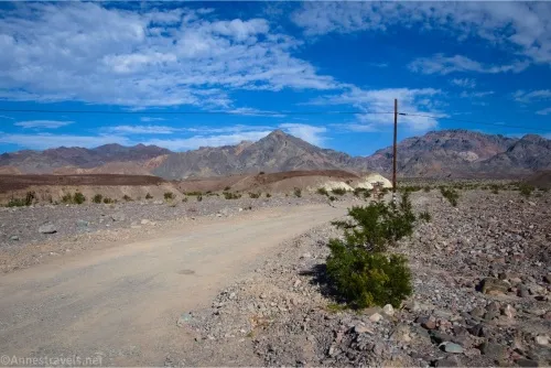
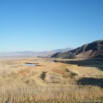
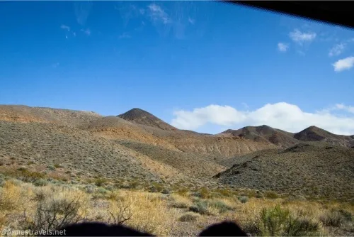
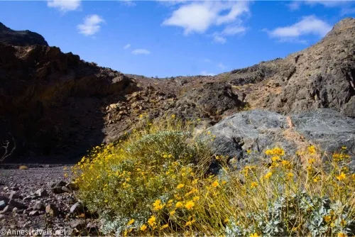
The road begins in good condition, wandering in a fairly straight line up the Echo Canyon moraine. Hills block the view early on, but these obstructions fairly quickly give way to great views to the Funeral Mountains (ahead) and back down the moraine (behind) to the Black Mountains.
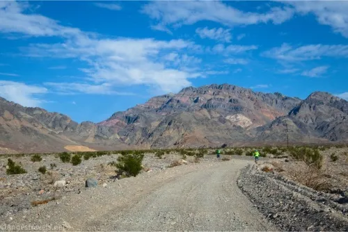
You’ll pass several campsites along the way. These can be helpful, as the road is narrow, and passing other vehicles often poses a challenge (I met several while I was driving up the road on a sunny afternoon in March – thankfully, most of them were 4×4 and didn’t mind getting way over into the gravel (not off the road) to allow my full-size van through). Of course, you shouldn’t enter a site if someone is there!
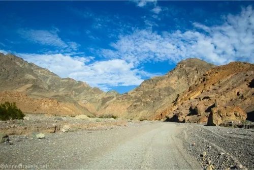
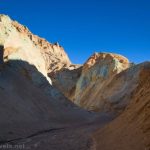
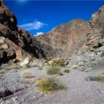
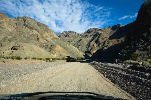
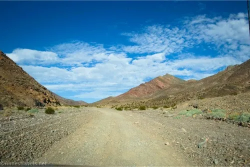
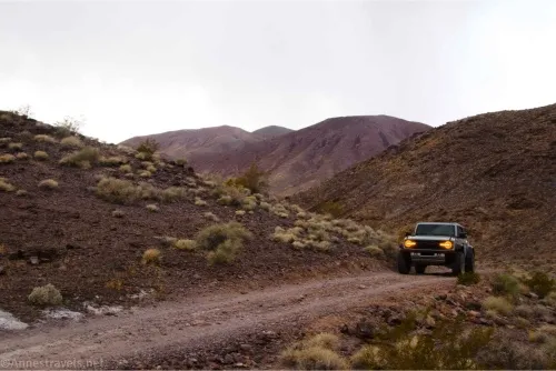
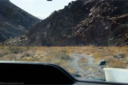
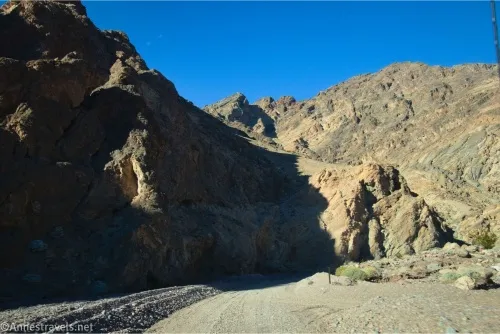
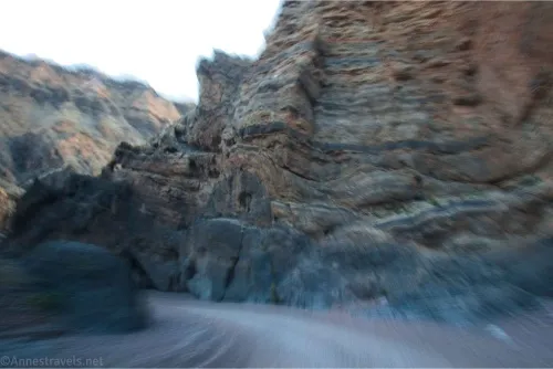
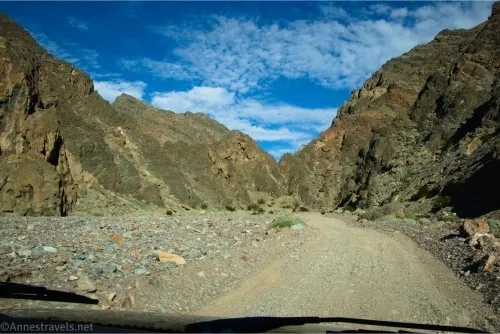
After 3.4 miles, the road enters Echo Canyon proper. This is the best part of the drive and also probably the most difficult! The canyon is narrow and winding, and the gravel on the road can be deep in places. It reminds me a little of Titus Canyon, only the rocky walls are brown and jagged instead of smooth and gray.
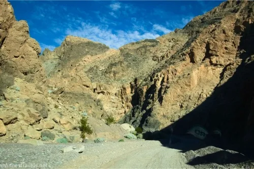
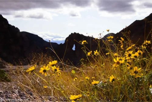
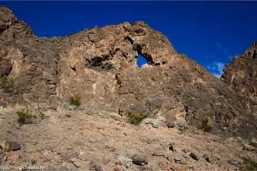
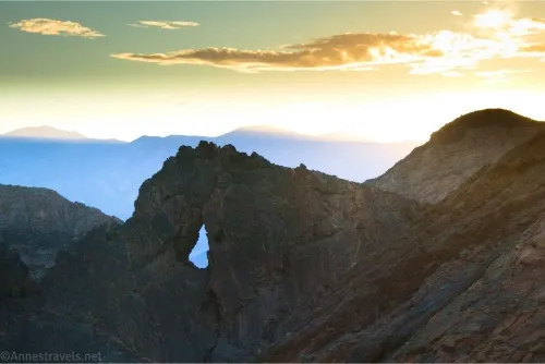
My favorite feature is Eye of the Needle Arch, about 1.3 miles beyond the canyon entrance. It’s hard to see from the up-canyon side, but if you look back after passing it, it’s very obvious.
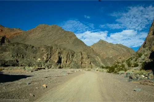
The road continues to ascend, twisting and turning with the whims of the canyon, passing the last few campsites before the walls begin to grow shorter. While the narrower canyon is more spectacular, this section is beautiful in its own right.
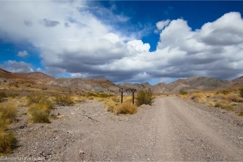
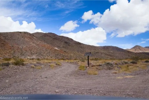
Three miles beyond Eye of the Needle Arch, a sign informs travelers that the Inyo Mine is 1.7 miles away to the right and the Amargosa Turn Off is 1.3 miles to the right. It seems a little strange, especially as there is no other visible roads in this area, let alone a road going left. In actuality, the road to the Schwab Townsite used to go left here, but it’s pretty much invisible at this point.
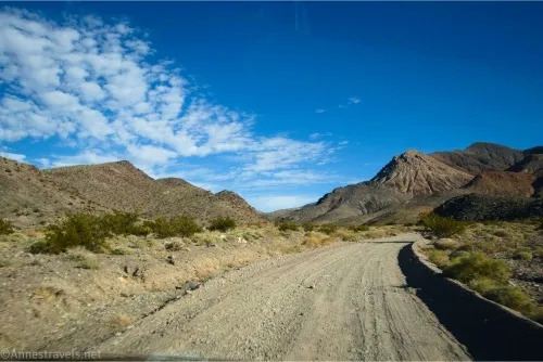
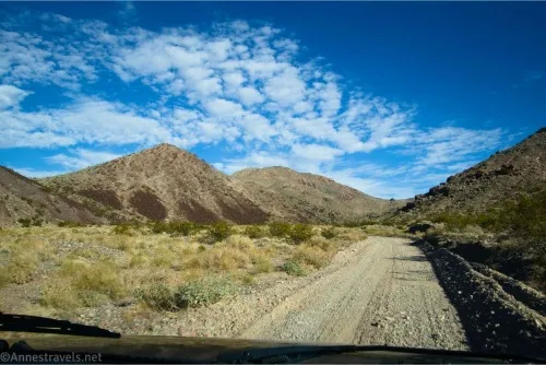
Drive another 1.3 miles through some very nice scenery, including some color on the hills. You’re still going up the canyon, but it’s wide in this area, so it doesn’t seem much like the lower narrows.
The road splits at a sign saying that Amargosa Valley is 15 miles to the left, High-Clearance-Short Wheel-Base-4×4-Advised! They’re serious about this! The Lee’s Camp Road out to Amargosa is a just fine road – except for two places where even experienced 4×4 enthusiasts can get into trouble. Body damage is expected, and a short wheelbase is the only way you’ll get through. Most people who drive it are on motorcycles, and even this can be dangerous due to the rough and rocky terrain.
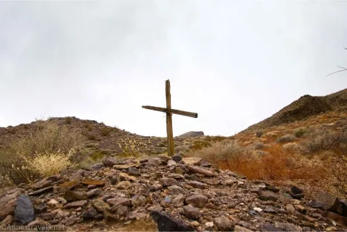
On my most recent visit, I did walk up the road a short distance. The Lee’s Camp Road almost immediately passes an old grave (on the left) with an old mine area on the right.
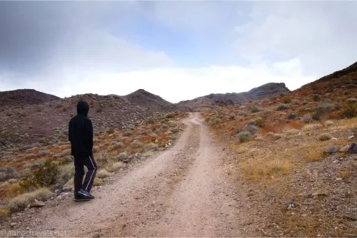
It rises steeply to the top of a hill (with a place to turn around at the pass) and then descends via a long switchback into the canyon below.
After that, I can only tell you what I’ve heard: The road winds by several old mining areas before reaching the first difficult section (steps and boulders requiring a lift kit) about 3 miles from the turnoff from the Echo Canyon Road. The road then passes through narrows and more mining areas before the second difficult section about mile 6.6 (extremely narrow and technical; spotters are advised). Life gets easier after this until the road finally drops you out on NV-373 (aka CA-127 further south) in Amargosa Valley about mile 18.2.
But back to the Echo Canyon Road, you definitely want to turn right here for the half mile up to the Inyo Mine on the left.
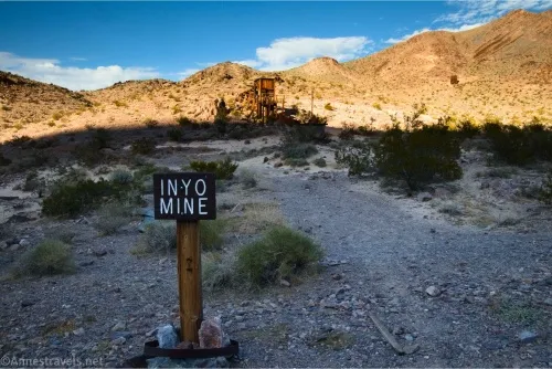
The Inyo Mine is a fascinating place to explore. Remember to leave everything as you found it, and don’t enter any mine shafts! I’ll talk more about it in a future post.
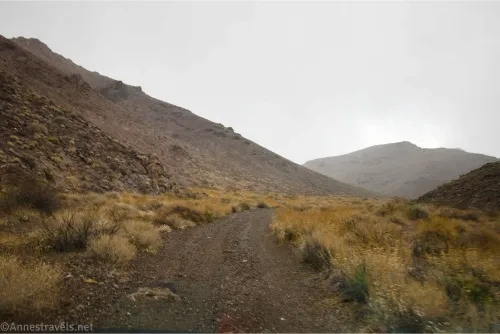
The Echo Canyon Road does continue beyond the Inyo Mine. However, most people stop here. And if you don’t have high clearance, you definitely should turn around. If you are feeling brave about entering the Unknown (or maybe just the Less Traveled), keep driving up Echo Canyon. The roadbed is hardpacked rocks; go slow and try to avoid the ones that stick out of the ground.
After 1.4 miles (beyond the mine), you’ll come to a small turnaround at the top of Echo Canyon. A sign nearby says no vehicles are allowed beyond this point – which isn’t surprising, since the turnaround is in a narrow part of the canyon just below where the canyon becomes even narrower!
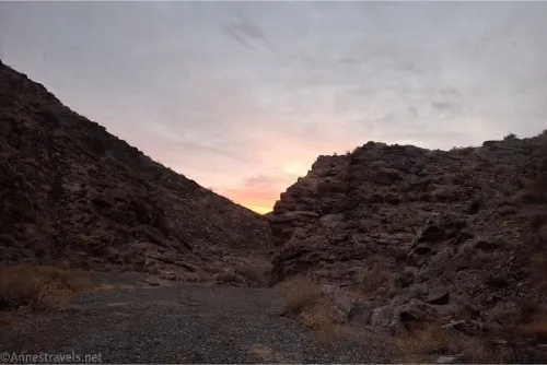
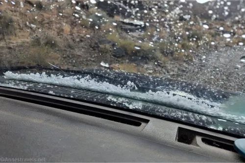
And that’s the Echo Canyon Road! From here, you can decide if you want to retrace your steps, stop somewhere along the way to explore (just remember to park out of the way of traffic), or hike up the rest of Echo Canyon to the Echo Canyon Overlook. (A misnomer as it looks over the Amargosa Valley, but I won’t quibble about semantics with a view this good!) Actually, as soon as I arrived, the sky let loose with snow and hail, but at least now I can say that I’ve been snowed upon in Death Valley before I went back down…
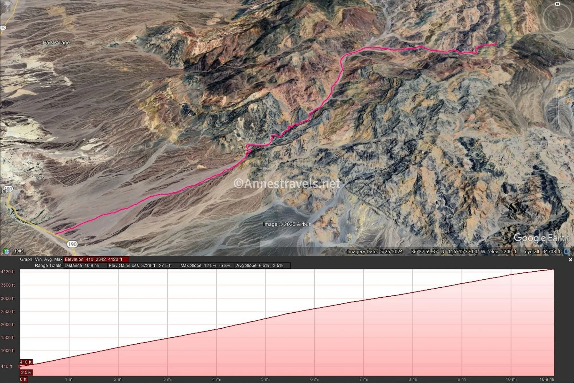
Round Trip Road Length: 19 miles out & back to the Inyo Mine or 21.8 miles out & back to the end of the road
Elevation Gain: 3,729ft. up, 27.5ft. Down (410ft. to 4,120ft.)
Facilities: Campsites (must be reserved in advance)
Fees: $30/vehicle to enter Death Valley National Park; valid 7 days. America the Beautiful National Parks & Federal Public Lands Passes and Death Valley Annual Passes are accepted.
Road Notes: The conditions of the road can change quickly, especially after storms. Check with the visitor center if possible for current conditions. The biggest issue for 2WD vehicles is the deep gravel in the narrows of Echo Canyon, so keep up your momentum safely if possible. Bicycles and street-legal motorcycles are welcome to use the road. ATVs, OHVs, and dirt bikes are not allowed (even if they are street legal). Horses and pets may also use the road – I’ve suggested to dog owners that a hike through Echo Canyon with Rover is a great way to see the national park while taking your pet along! The upper part of the Echo Canyon Road was once the bed for a tramway or railway; however, I’ve been unable to find anything about it beyond being marked on old topo maps.
Road 
![]()
![]()
![]()
Signs ![]()
Scenery
Would I go 100 miles out of my way for this?
Overall Rating: ![]()
GPS Coordinates for the Echo Canyon Road
Beginning of the Echo Canyon Road: 36.437606°, -116.824091° (36°26.25636′, -116°49.44546′ / 36°26’15.3816″, -116°49’26.7276″) (0.0) (410ft.)
Enter narrows: 36.459006°, -116.772748° (36°27.54036′, -116°46.36488′ / 36°27’32.4216″, -116°46’21.8928″) (3.4) (1,610ft.)
Eye of the Needle Arch: 36.466585°, -116.759831° (36°27.99510′, -116°45.58986′ / 36°27’59.7060″, -116°45’35.3916″) (4.75) (2,140ft.)
Sign (Schwab Townsite Road): 36.497130°, -116.732554° (36°29.82780′, -116°43.95324′ / 36°29’49.6680″, -116°43’57.1944″) (7.75) (3,145ft.)
Lee’s Camp Road (Road to Amargosa): 36.496308°, -116.710683° (36°29.77848′, -116°42.64098′ / 36°29’46.7088″, -116°42’38.4588″) (9.5) (3,737ft.)
Inyo Mine Parking Area: 36.493320°, -116.703885° (36°29.59920′, -116°42.23310′ / 36°29’35.9520″, -116°42’13.9860″) (9.5) (3,737ft.)
End of road: 36.495815°, -116.684620° (36°29.74890′, -116°41.07720′ / 36°29’44.9340″, -116°41’04.6320″) (10.9) (4,120ft.)
The gpx file for Echo Canyon Road can be downloaded – please note that this and the GPS Coordinates are for reference only and should not be used as a sole resource when hiking this trail.
Download GPX File size: 130.9 KB Downloaded 350 times
(Note: I do my best to ensure that all downloads, the webpage, etc. are virus-free and accurate; however, I cannot be held responsible for any damage that might result, including but not limited to loss of data, damages to hardware, harm to users, from use of files, information, etc. from this website. Thanks!)
Getting to the Echo Canyon Road
From the Furnace Creek Visitor Center, drive east on CA-190 (toward Badwater). Pass by the Badwater Road. After 3.4 miles, the Echo Canyon Road will go off on the left.
From Death Valley Junction, drive CA-190 toward Death Valley National Park. After 26.8 miles (1.4 miles beyond Zabriskie Point), the Echo Canyon Road will go off on the right.
A Good Guide to Death Valley
One of the premier guides to Death Valley, this fourth edition includes includes a wealth of information about the roads, hikes, history, and more in the park. Buy your copy here.