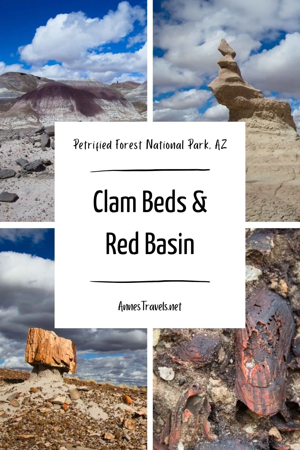
The Clam Beds and Red Basin Loop is the longest of the official off-trail hiking routes in Petrified Forest National Park. It’s also one of the most amazing (the Wilderness Route wins as the best off-trail route IMO, but the Calm Beds & Red Basin has more variety in scenery and less petrified wood deposits). Along the way, you’ll get to see fossils, badlands, petrified wood, rock formations, and much more. It’s hard to pick a favorite part of the hike because it was all so beautiful! I did take an extra off-trail adventure beyond Red Basin to more views, which I’ll talk about briefly.
Quick Stats
This post contains affiliate links. I may receive a small commission if you click on or buy something at the links. There is no extra cost to you.
Note that there is a dirt road for maybe half of the hike. The remainder has no trail whatsoever. I’m used to off-trail travel and was confused a few times, especially in Red Basin. I highly recommend picking up an official printout for the hike from the visitor center or the Rainbow Forest Museum, as it contains helpful photos and directions.
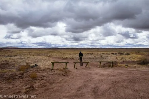
0.0 Gravel parking area along the Blue Mesa Road (5,513ft.). This is unmarked but on the left (west) side of the road where the Blue Mesa Road splits into a one-way loop (an informational sign is for “Change in Climate” beside where you park). After enjoying the views at the parking lot, walk down the road (back toward the main park road) until you see the “authorized vehicles only” signs on the wooden barriers blocking a dirt road on the left (east) side of the paved road. (34.930426, -109.760492)
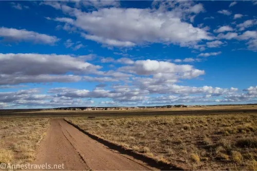
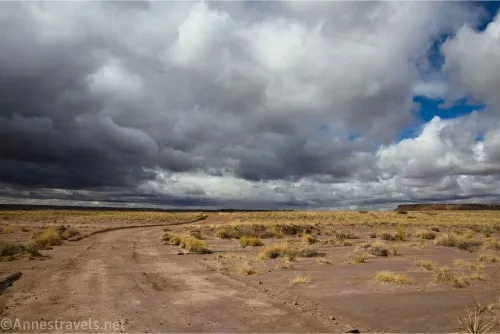
0.4 Beginning of the dirt road (5,471ft.). Travel east on the dirt road. There are great views in this area; especially look left (north) toward the cliffs and rock formations below Blue Mesa. Note that this part of Blue Mesa is off-limits to hikers, as it is closed for restoration (you’ll be fine as long as you stay on or close to the road). (34.925190, -109.762750)
2.0 Road split (5,470ft.). Take the left fork. Some old metal junk is near this junction. (34.927648, -109.737915)

2.1 Road Split (5,474ft.). Again, take the left fork to travel north and a little east. (34.928715, -109.736669)
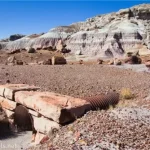
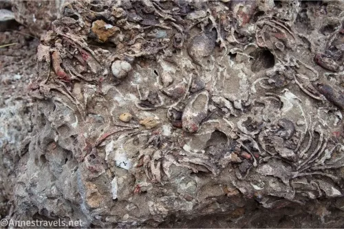
2.4 Wash (5,485ft.). Turn right (northeast) here just after the road makes a sharp curve to the northwest (left – if the road starts traveling west and/or enters Billings Gap, you’ve gone too far). You want to travel east and a little north up this wash to the far side of the first butte. The clam beds area a little hard to find, but once you’re there, you’ll know by the many rocks with fossils. (34.932351, -109.734702)
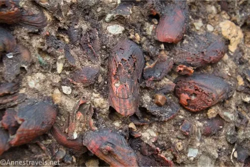
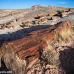
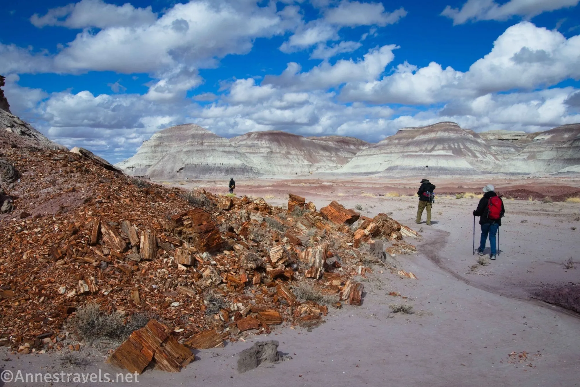
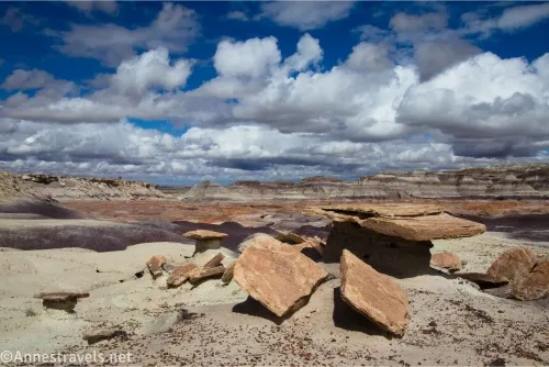
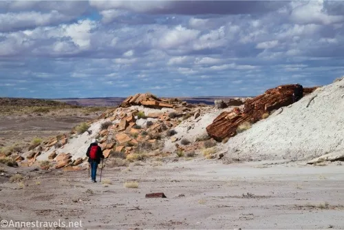
2.5 Clam Beds (5,498ft.). The clam beds extend for some distance north along the side of the butte, so explore to your heart’s content as long as you 1) stay safe, and 2) leave no trace (do not collect, touch, or otherwise move or alter the fossils!) From here, if you want to continue to Red Basin, turn and look south/southeast. Walk so as to pass a butte on its right (western) side, then turn left to travel east toward some low, sandy hills with a lone juniper tree on it. Ascend the sandy hill to the saddle located to the left (north) of this lone tree (approx. 3.1 miles; 34.930606, -109.725566). The “Sand Castle” formations should be visible near the white plain below; cross the vegetated plain between the saddle and the Sand Castles, approaching the Sand Castles from the right. (34.933484, -109.732967)
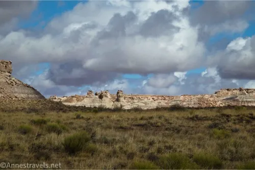
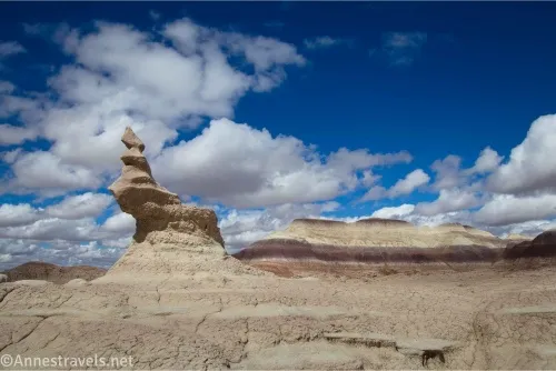
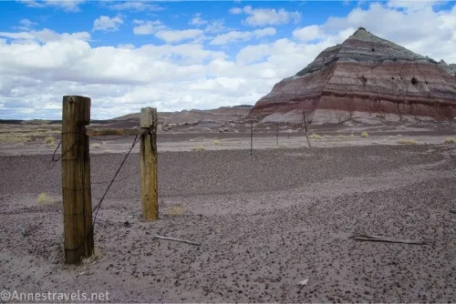
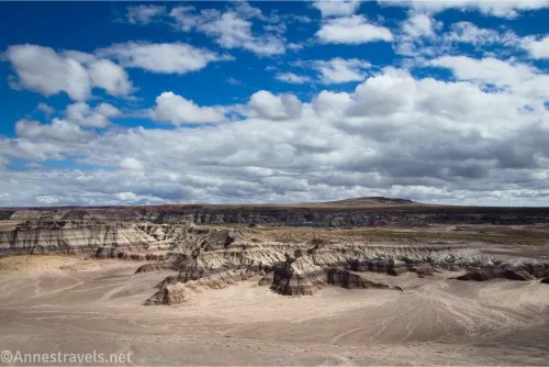
I encountered rock formations almost as soon as I approached Red Basin. I decided to do a bit of adventuring, so instead of following the official directions (I’ll pick up the official route below as though I didn’t go off the route), I walked along the white upper end of Red Basin, generally heading east and not dropping into any of the major washes (you may have to go a bit to the right to avoid steep drops into arms of the wash). I walked through the remains of a fence and kept heading east and a little north until I encountered rock formations and badlands, passing just to the left (north) of a fun little formation.
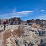
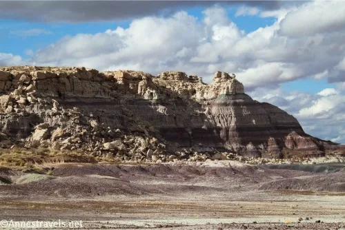
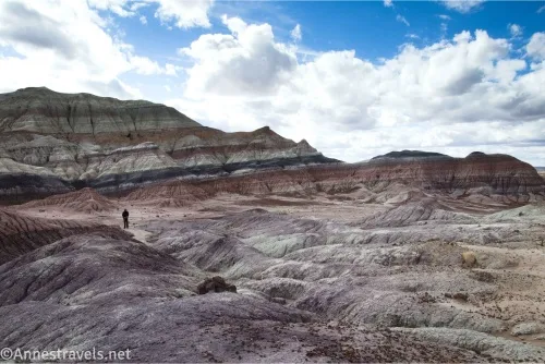
From here, I headed up into the badlands (I followed a wash east and then north from 34.931294, -109.717432). This took me up on top of the badlands. I followed badland tops (it’s too dangerous to try and descend and reclimb between badland ridges – besides being way too steep with ball bearing type gravel, in places, the badland is very thin with washed out caves… you don’t want to fall into them). I headed north and then quite a distance east and found myself looking down into another badland valley. The views were just gorgeous!
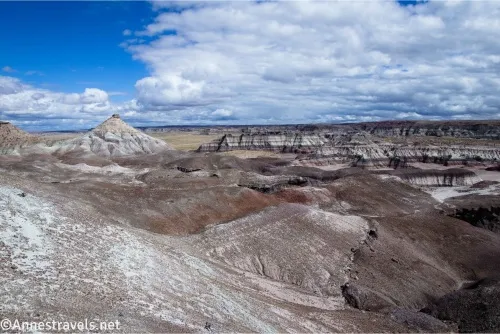
I really wanted to get a view of Red Basin, so I wiggled and waggled my way west (which meant north, too) and didn’t really get a good view. But I tried! From there, I tried to go back down a different way, which didn’t work very well. Those badlands are crazy steep, and I slipped and scraped my knee quite nicely at one point. But I did get back down to the coordinate (above) where I’d started up into the badlands. From there, it was a simple trek back across the white area to the main wash, turning right to descend into it (not the easiest, but it worked), and then continuing down into Red Basin. (Remember, I’m picking up below as though I didn’t go off the official route, which added about 1.5 miles to the route.)
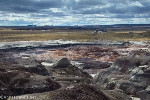
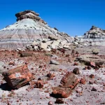
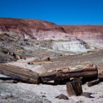
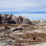
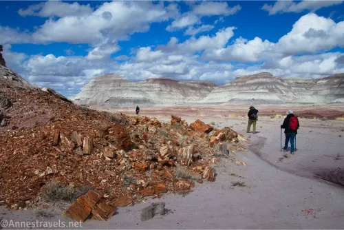
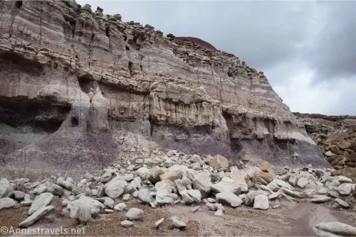
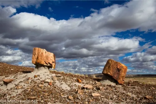
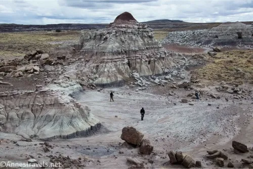
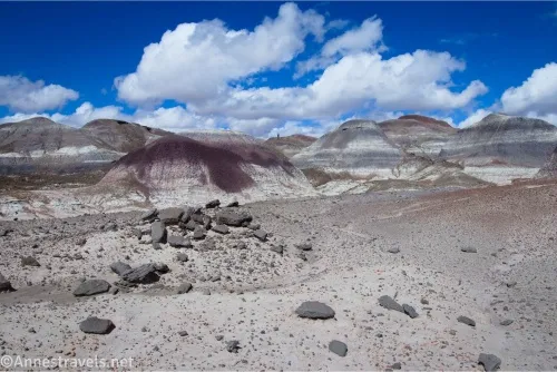
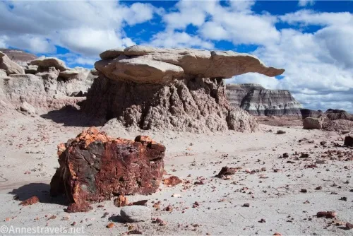
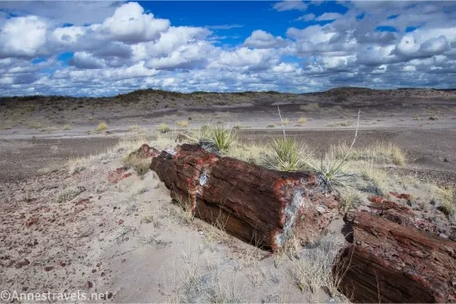
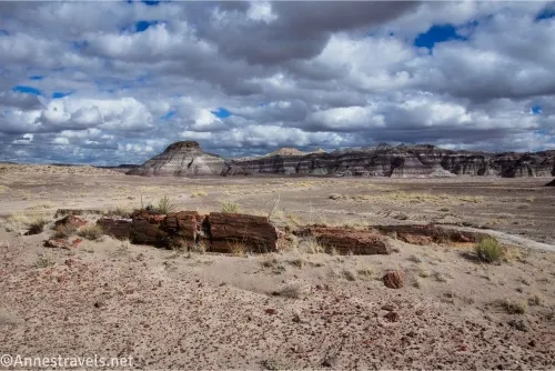
3.25 Red Basin Area (5,513ft.). The basin is white at its upper end; you want to descend into the deep wash in the bottom of Red Basin. Maps generally suggest swinging right (south) for a short distance, then following one of the sidewashes down into the deeper main wash – this may take some scouting, as some of the washes have dryfalls or very steep, deep, narrow channels that are difficult to navigate. (The NPS printout is not helpful here, so do your best.) Once down in the main wash, it twists and turns with little in the way of views for a while (be careful of mud after a rain). After a while, the wash opens up so you can see the lower part of Red Basin. There is petrified wood and a fun little wing-like formation in the lower basin. (34.929980, -109.722522)
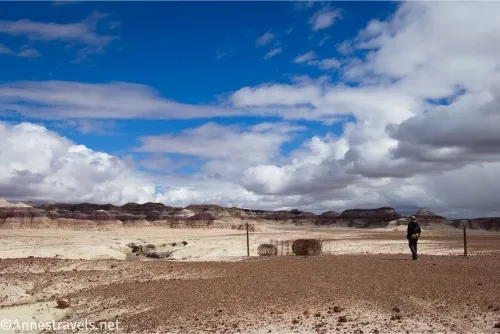
3.75 Exit Red Basin (5,472ft.). There is another very large petrified log at the end of Red Basin, just as you exit the hills. Walk out onto the plain, then wrap left (west) following the washes at the base of the hills on the left (south), which are often covered in rock formations. I would have loved to explore this area more, but besides having gotten a late start and having already spent quite a bit of time exploring, the sun went under and made the landscape less interesting than if the sun had been on it. There is one area (approx. mile 4.3; 34.939849, -109.729216) that requires you to take an easy scramble down into the next wash area. The badlands beyond this are quite nice. Keep the hills on your left as you turn south into Billings Gap at approximately mile 4.5. (34.934297, -109.722524)
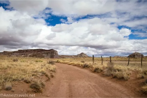
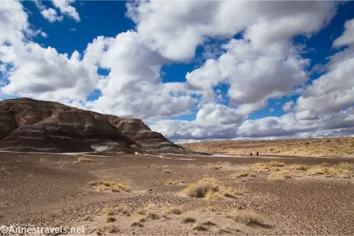
4.75 Billings Gap (5,438ft.). This is a beautiful area with rock formations high on the cliffs. The Billings Gap Overlook is high on the right (west) cliff wall. Pick up the road (the gate in the fence down the middle of the gap is a good indicator of where the road goes) and continue southward. At the end of the gap (approx. 5.2 miles; 34.934756, -109.737585), you have a choice. First, you can turn right to work your way below the cliffs of Blue Mesa, following a wash back down to intersect the dirt road on which you started your hike at about 34.923398, -109.748680. The benefit of this hike is a slightly different view perspective, closer views of the nearby rock formations, and some petrified wood; however, the walking is extremely difficult over uneven terrain and unfriendly plants, and there are unmarked areas where access is prohibited (mostly below the rock formations in Blue Mesa). Second, you can continue down the road to meet up with where you turned off to the clam beds. This guide takes the second course and stays on the road (though the GPX file takes the first route along the bottom of the mesa). Reconnect with where you turned off about mile 5.4, then turn right at the two road splits (mile 5.75 and mile 5.8). Follow the road westward back to the main park road. (34.939787, -109.734661)
7.4 Beginning of the dirt road (5,471ft.). Turn right back up the paved road toward where you parked your vehicle. (34.925190, -109.762750)
7.8 Gravel parking area along the Blue Mesa Road (5,513ft.). (34.930426, -109.760492)
This route took us pretty much all day – and I was very tired and ready for a rest by the time we got back to the van!
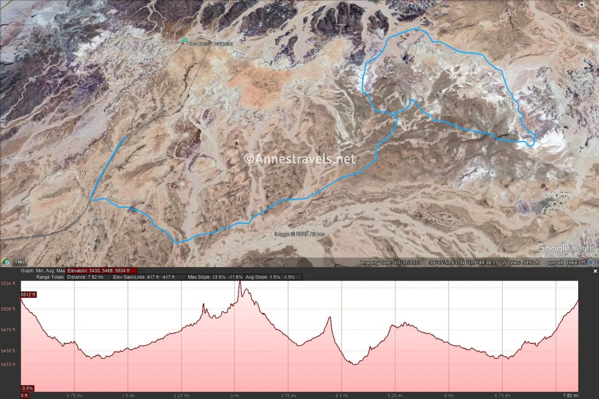
Round Trip Route Length: I hiked 10.1 miles with all my exploring; the more traditional route is 7.8 miles
Elevation Gain: With all my exploring, I climbed 724ft. (5,434ft. to 5,619ft.). The more traditional route without exploring is 417ft. (5,433ft. to 5,534ft.)
Facilities: None
Fees: $25/vehicle to enter Petrified Forest National Park. America the Beautiful National Parks & Federal Public Lands Passes and Petrified Forest Annual Passes are accepted.
Trail Notes: The entire route between the Calm Beds and Billings Gap is off-trail, and the Clam Beds to Red Basin definitely has some interesting wayfinding. I’d recommend a way to follow GPS coordinates (GPS, phone map with offline maps) and familiarity using the system before attempting the route. Phone signal is more or less non-existent out here.
Trail 
![]()
![]()
![]()
Road ![]()
Signs ![]()
![]()
![]()
![]()
Scenery
Would I go 100 miles out of my way for this?
Overall Rating: 
![]()
GPS Coordinates for the Clam Beds and Red Basin Route
Parking: 34.9305870°, -109.7604430° (34°55.83522′, -109°45.62658′ / 34°55’50.1132″, -109°45’37.5948″) (5,514ft.) (0.0)
Gate: 34.9252120°, -109.7626040° (34°55.51272′, -109°45.75624′ / 34°55’30.7632″, -109°45’45.3744″) (5,471ft.) (0.41)
Road junction: 34.9276540°, -109.7379040° (34°55.65924′, -109°44.27424′ / 34°55’39.5544″, -109°44’16.4544″) (5,470ft.) (2.04)
Leave road: 34.9321220°, -109.7342700° (34°55.92732′, -109°44.05620′ / 34°55’55.6392″, -109°44’03.3720″) (5,486ft.) (2.54)
Clam beds: 34.9334920°, -109.7329720° (34°56.00952′, -109°43.97832′ / 34°56’00.5712″, -109°43’58.6992″) (5,499ft.) (2.67)
Top: 34.9334500°, -109.7144540° (34°56.00700′, -109°42.86724′ / 34°56’00.4200″, -109°42’52.0344″) (5,616ft.) (4.50)
Billings Gap: 34.9398010°, -109.7346710° (34°56.38806′, -109°44.08026′ / 34°56’23.2836″, -109°44’04.8156″) (5,438ft.) (7.08)
Return to the dirt road: 34.9233980°, -109.7486800° (34°55.40388′, -109°44.92080′ / 34°55’24.2328″, -109°44’55.2480″) (5,452ft.) (8.84)
End: 34.9305570°, -109.7604470° (34°55.83342′, -109°45.62682′ / 34°55’50.0052″, -109°45’37.6092″) (5,514ft.) (10.16)
The gpx file for the Clam Beds and Red Basin Loop (including my explorations) can be downloaded – please note that this and the GPS Coordinates are for reference only and should not be used as a sole resource when hiking this trail.
Download GPX File size: 269.7 KB Downloaded 235 times
(Note: I do my best to ensure that all downloads, the webpage, etc. are virus-free and accurate; however, I cannot be held responsible for any damage that might result, including but not limited to loss of data, damages to hardware, harm to users, from use of files, information, etc. from this website. Thanks!)

Getting to the Clam Beds and Red Basin Route Trailhead
The parking area is unmarked, but it’s located 1.75 miles up the Blue Mesa Road from the Main Park Road, at the place where the Blue Mesa Road splits into a one-way loop. The Blue Mesa Road is located 15.3 miles from the visitor center (up by the Painted Desert and the northern entrance) and 12 miles north of the Rainbow Forest Museum. The gravel lot has space for several vehicles.

Explore Petrified Forest and Beyond
There’s so much to see in Arizona, and this guide covers many of the best hikes… including in Petrified Forest! Buy your copy here.