
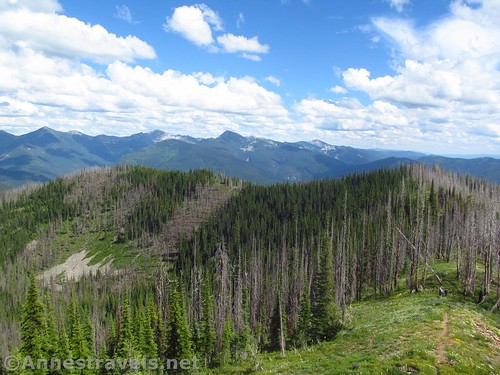
Of all the hikes I did in the Cabinet Mountains last summer, Berray Mountain was my favorite. It might have been the far-reaching views to green mountains fading into the blue of summer haze. It might have been the fun abandoned fire at the top that you can actually climb. But I think it was hiking through the sometimes chest-high wildflowers that really made the hike special. At only a little over 4 miles RT, it’s definitely worth the trek up there… as long as your vehicle has high clearance and can make it up the road!
Quick Stats

There are two trails up Berray (pronounced “berry”) Mountain. The Berray Mountain Trail begins from a paved road and is accessible year-round from what I’m told. (If you want to hike the traditional Berray Mountain Trail, click here though I got my data from here.)

The second – the one that I took – is the Berray Mountain West Trail and begins at the end of a somewhat questionable dirt/gravel road high on the mountainside. But since the West trail is 3.8 miles shorter with almost 2,500ft. less elevation gain, you can see why I chose the Berray Mountain West Trail!

As of summer 2019, the Berray Mountain West Trail begins on an unmarked path in an unmarked parking area. My GPS said we were here, so we started hiking and hoped for the best. (Actually, the parking area has some pretty good views, too.)
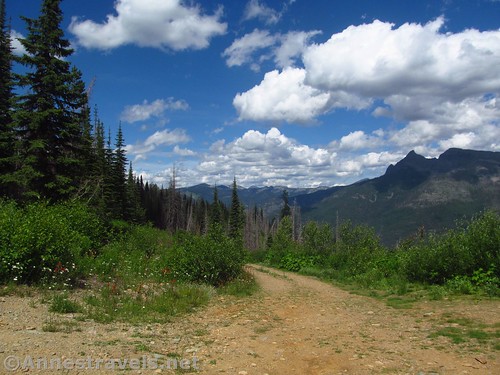
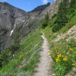
The path heads steeply uphill from the start (you’re gaining almost 1,400ft. in 2 miles), snaking its way up the side of the ridge through a burned-out forest. Watch for falling trees; you don’t want to be caught by one!

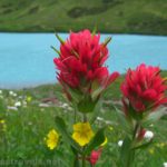
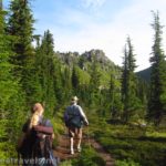
The wildflowers in this section in mid-July are out of this world. I can’t describe what it’s like to feel like you’re wading through chest-deep wildflowers, but that’s what it was like at times. The path is kept open by hikers, but at times the brush overhangs the path a little bit. The trail isn’t as heavily used as most of the trails in, say, Glacier National Park, but it’s not difficult to follow.

After about 1.3 miles, the trail reaches the ridgeline for a second, then plunges down to cross a saddle to another ridgeline. You can begin to see the fire tower through the trees (not quite so burned) on the ridge to the right of this ridgeline.

At almost 1.7 miles, the Berray Mountain West Trail T’s into the regular Berray Mountain Trail. Turn right and continue to ascend through the thinning forest. After another 0.3 miles, the trail will suddenly break out of the trees in the saddle just below the lookout.

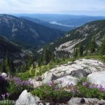
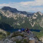
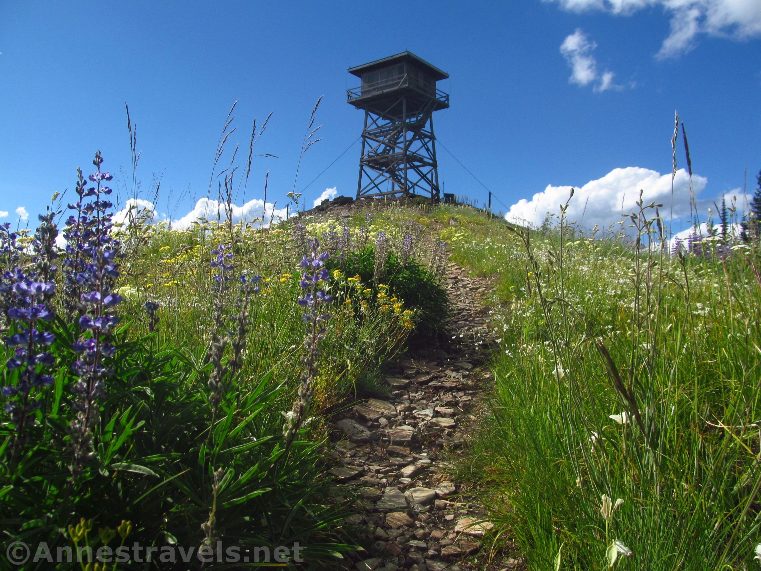
From there, it’s just a skip up the trail to the base of the lookout. The views from the mountaintop are spectacular, especially when the wildflowers and beargrass are blooming on the peak.

The fire tower is no longer in use, but it also has not yet been condemned. It’s safe enough to climb if you use common sense. (For example, the panel that swings upward to let you climb the stairs onto the platform around the room atop the tower makes a hole you could walk right through if you leave it open and continue all the way around the platform). The views from the top are even better than from the bottom. So beautiful!

Chances are you’ll have the peak to yourself. I didn’t see a single other person on the trail up or at the fire lookout (other than my group members, but I expect to see them everywhere I go!)
We went back down to the parking area for supper. It was a beautiful, peaceful hike and one I’d do again in a heartbeat if I happened to be in the area!

Round Trip Trail Length: 4.1 miles
Elevation Gain: 1,392ft. (5,073ft. at the parking area to 6,190ft. atop the fire tower)
Facilities: None
Fees: None
Trail Notes: Use care in the fire tower as it’s a little splintery. The tower was made for practicality, not for safety per se, so use common sense. You can go inside; there are a few items in the room at the top of the tower. I’d imagine this would be a good snowshoe, too, but only if you could access the trailhead.

Trail 
![]()
![]()
Road ![]()
Signs ![]()
![]()
![]()
Scenery ![]()
Would I go 100 miles out of my way for this? ![]()
Overall Rating: 
![]()

GPS Coordinates for the Berray Mountain West Trail
Trailhead: 48.1518833°, -115.8115500° (N48° 09.113′ W115° 48.693′ / 48°09’06.7800″, -115°48’41.5800″) (5,073ft.) (0.0) (end 4.14)
Top of Ridge: 48.1444000°, -115.8144833° (N48° 08.664′ W115° 48.869′ / 48°08’39.8400″, -115°48’52.1400″) (5,694ft.) (0.62)
Trail Junction: 48.1366333°, -115.8236667° (N48° 08.198′ W115° 49.420′ / 48°08’11.8800″, -115°49’25.2000″) (5,984ft.) (1.67)

Lookout (base): 48.1391500°, -115.8288000° (N48° 08.349′ W115° 49.728′ / 48°08’20.9400″, -115°49’43.6800″) (6,161ft.) (2.06)
Top of Lookout: 48.1391667°, -115.8287667° (N48° 08.350′ W115° 49.726′ / 48°08’21.0000″, -115°49’43.5600″) (6,190ft.) (2.10)
Spring Junction: 48.1375000°, -115.8272167° (N48° 08.250′ W115° 49.633′ / 48°08’15.0000″, -115°49’37.9800″) (6,086ft.) (2.28)

The gpx file for the Berray Mountain West Trail can be downloaded – please note that this and the GPS Coordinates are for reference only and should not be used as a sole resource when hiking this trail.
Download GPX File size: 73.5 KB Downloaded 517 times
(Note: I do my best to ensure that all downloads, the webpage, etc. are virus-free and accurate; however, I cannot be held responsible for any damage that might result, including but not limited to loss of data, damages to hardware, harm to users, from use of files, information, etc. from this website. Thanks!)

Getting to the Berray Mountain Lookout
From Noxon, cross over to the north side of the reservoir. Turn left and drive 5 miles to turn right onto MT-56N. After 8 miles, turn right onto NF-407 following the sign for E. Fk. Bull R. and Historic R.S. (the sign is just after mile marker 8). Drive 1.3 miles and turn left to stay on NF-407 (if you get to the Bull River Ranger Station, you’ve gone too far). After 2 miles, continue left on NF-407, then drive another 4.2 miles. The road (which is pretty much passible by most vehicles in dry weather) climbs up into the mountains and crosses over Snake Creek Pass. Just about exactly 6.2 miles after turning off the road to the ranger station, at the end of a switchback, turn left onto NF-2272 for 6.1 miles of steep uphill switchbacks that become narrower and narrower (and rougher and rougher) and require high clearance to the end of the road. The trail begins to the right near the wooden post.

From Libby, head west on US-2. After 15 miles, turn left onto MT-56S for 18.7 miles. Turn left onto the S Fork Bull River Road/NF-410 following the sign for National Forest Access South Fork Bull River. After 1.3 miles, turn right to stay on NF-410; continue on NF-410 for another 5.9 miles. At the end of a switchback (if you’ve gone over the pass and are heading down the other side, you’ve gone too far), turn right onto NF-2272 for 6.1 miles of steep uphill switchbacks that become narrower and narrower (and rougher and rougher) and require high clearance to the end of the road. The trail begins to the right near the wooden post. Note: You can also take MT-56S for 26.5 miles and turn left onto NF-407 and access the trailhead as described in the “From Noxon” section.

The parking area is small, with room for 3-4 cars (6 if they park each other in).

Zoom map out to browse nearby hikes & places of interest
This Week’s Featured Product!
It’s not necessarily easy to find out about the trails in the Cabinet Mountains. This book, while it covers several mountain ranges in the area, also showcases nearly 20 hikes in the Cabinets.