

I almost didn’t hike to Cracker Lake high in a mountain canyon above Many Glacier in Glacier National Park, Montana. It seemed like such a long hike. Friends told me there was a long section of forest. And at the end of the trail, we were going to see nothing more than a lake. If I want a lake, I can walk from my house to a lake bigger than any you’ll find in Montana!
Quick Stats
(Affiliate links are present on this page.)
But the pictures were so beautiful. And we’d been hiking long enough I thought we could do the 12.2+ miles as a pretty good day hike. The weather didn’t sound great, so the forest sections wouldn’t matter. And so, we set out on what became one of my favorite hikes in Glacier.

The trailhead is located to the right of the corrals behind the Swiftcurrent Lodge (parking was an issue even at 8am) and is marked simply as the “Cracker Lake Trailhead”. The fact that it’s near the corrals should make you nervous, and if you hate horses, the path to Cracker Lake is definitely not for you. Early in the morning, when we set out, the only horse evidences were left over from yesterday’s trail rides, so it wasn’t bad, only a little dusty. Coming back between rainstorms, the lower part of the trail was a thick stew of mud and horse manure. And of course, my pants are long enough that they dragged in the stew!
But if you can deal with horse-stuff: Almost immediately, the trail splits between the Cracker Lake Trail (left) and the path to the Piegan Pass Trailhead (right – this is the same Piegan Pass that can also be accessed from Siyeh Bend on the Going-to-the-Sun Road). Turn left toward Cracker Lake.

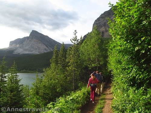
The next 1.5 miles are heavily traveled by horses, as the concessionaire takes riders on the path multiple times a day in the summer months, and the trail looks like it. (Always give way to horses.) Tiptoe among the horse evidences and expect either dusty or muddy conditions. There are also some pretty good views over Lake Sherburne and up to the cliffs above the trail.
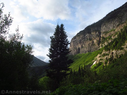
At the horse loop junction, turn right, then, at mile 1.8, turn right on the Cracker Lake Trail. You’ll leave behind much of the horsiness of the trail at this point (yay!) but trade it in for a set of steep switchbacks. You’re in the forest, proper, here, but keep an eye and ear out for a tall waterfall high above the trail (there’s really no good place to get a good photo of it). Horses do come up here; full-day trail rides are often to Cracker Lake. But that means you’ll only see the horses once or twice over the whole day (or less).

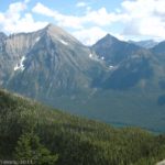
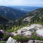
Continue upward through the thinning forest with occasional views of the cliffs and peaks above the mountainous canyon that you’re climbing. One of the great things about the Cracker Lake Trail is that it goes in a totally different direction than most of the trails in Many Glacier, so you’re seeing scenery you won’t see elsewhere.

At 4.0 miles from the trailhead, a bridge spans Canyon Creek. When I hiked the path, the harder part was getting to the bridge – boulders and the creek blocked the way to it. Some of us scrambled to the right around the boulders, others of us rock-hopped up the creek to the left of the boulders. We all made it (with mostly dry feet) so take your pick and cross the bridge.

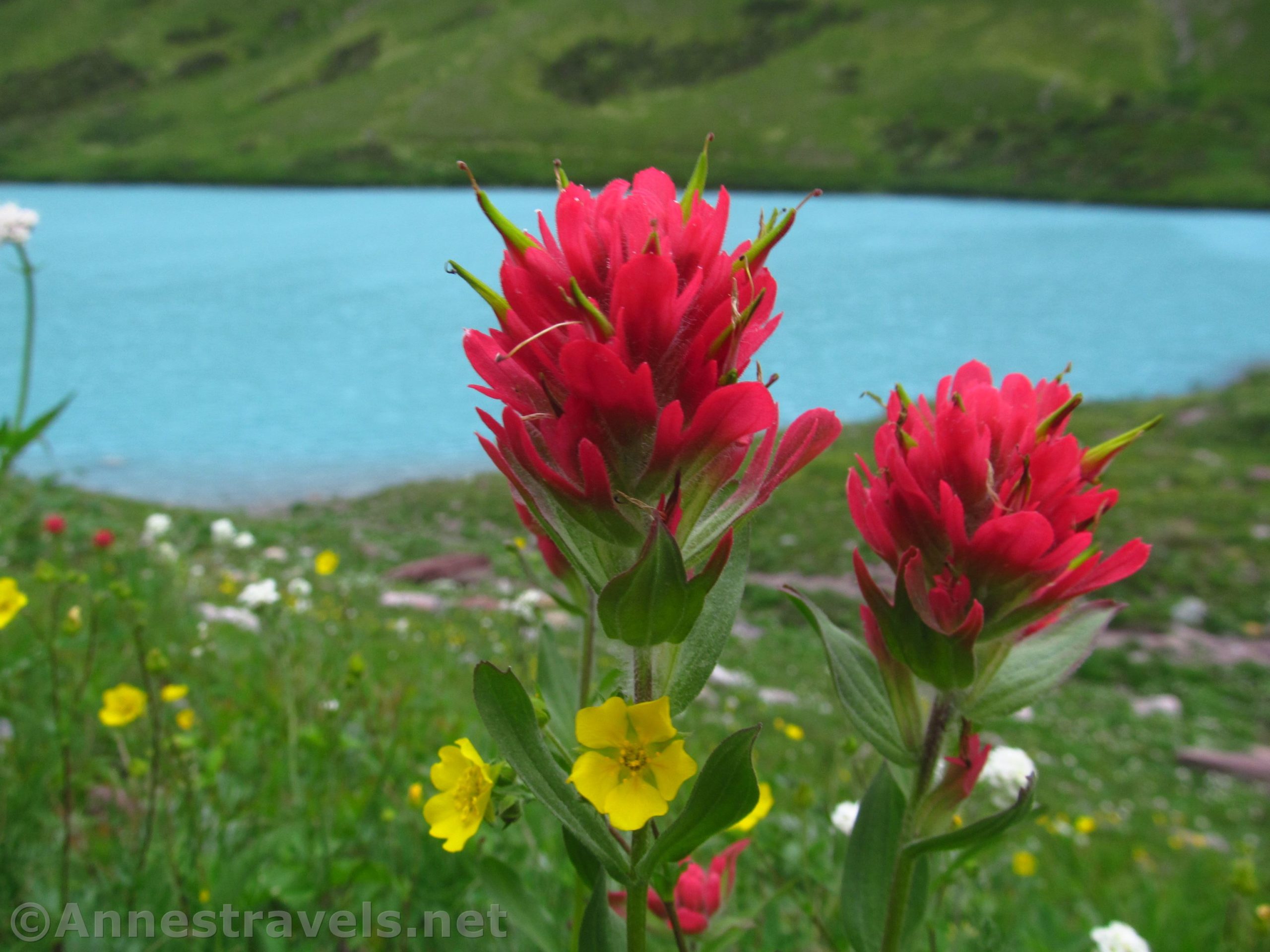
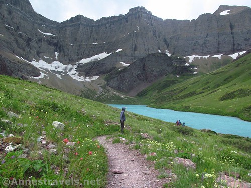
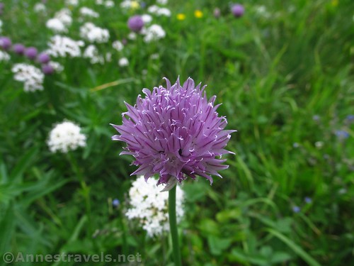
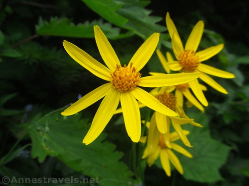
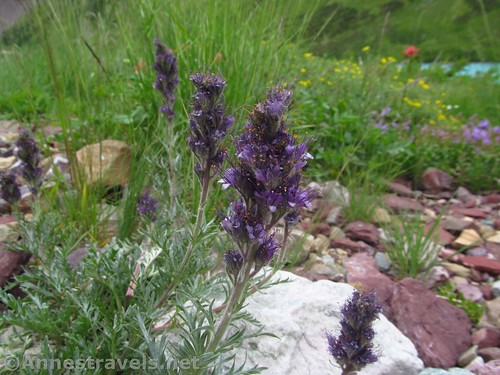
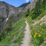
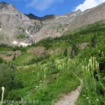
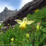
If the trail before wasn’t “pleasant” to me (and it was), this next section really was enjoyable. You’re still mostly in the forest, but wildflowers bloomed in profusion along the trail, and the forest often opens up enough to see the canyon around you. Wow! It’s pretty amazing to see cliffs like that!
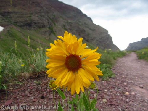
The trail eventually breaks out of the forest altogether and wanders through open meadows – which are also a profusion of wildflowers in the summer. I have no idea how many varieties I saw, but it was just about every species mentioned by the NPS on an informational signboard at the Many Glacier Ranger Station, plus a bunch more. It was beautiful!

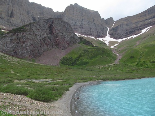
At 6.1 miles, we arrived at the first overlook of Cracker Lake. If the pictures had been spectacular, then the lake in person was well beyond spectacular. Its color is absolutely turquoise; pictures just don’t do it justice!

Sadly, the sun more or less didn’t come out while we were at the lake (only a little while we were at the first overlook). So my pictures aren’t the best. But believe me, this is a sight worth seeing, sun or no sun.

We took pictures at the overlook, then continued down the trail, hunkering down in a drainage to eat some lunch. Then we continued on to the almost Icelandic-looking rock outcrop about halfway along the lakeshore – it seemed to be where the majority of people were going.

We arrived at the junction up the rock about mile 6.7, but instead of turning up onto the rock, we kept walking past the junction down to the campground (approx. mile 6.75) and on to some of the old mine tailings about a tenth of a mile later, leftover from the old Cracker Mine. Trails branched up to other old mine sites and down toward the lake – eventually, we made it to the head of the lake and a whole lot of old mining machinery about mile 7.1.

The views are pretty neat from this end of the lake, too. Not quite as beautiful as the turquoise lake beneath the soaring cliffs, but still very nice. The lake’s inlet is anything but clear, and it’s easy to believe you’re in Iceland or Norway or another Nordic country.

We took the path near the lakeshore back up to the campground (mile 7.4) and then up to the rock outcrop (mile 7.5). The views are good here, but I personally prefer the views from either end of the lake.

And then we knew we had to head back – we had 6.7 miles to get us back to the parking area! (And it only rained on us about four times on the way back down, including one thunder-booming storm where we hid under the lowest trees we could find!)
Round Trip Trail Length: To the first overlook and back is about 12.2 miles. To the machinery and back is closer to 14.2 miles.
Elevation Change: 1,222ft. (4,826ft. along the lower reaches of the trail to 6,048ft. on the mine tailings)
Facilities: A single primitive restroom to the left of the horse corral; a few picnic tables by the horse corral; nearby services include a lodge, boat rental, guided horse rides, restaurant, etc.
Fees: $35/vehicle/week. National Park & Federal Lands Passes and Glacier National Park Annual Passes are also accepted.
Trail Notes: This is a long trail with some definite elevation gain (though nothing like most trails in Glacier). You’ll want to be in top-notch shape before attempting it as a day hike, though the grade is gentle enough that I didn’t find it as hard as many long day hikes. Stock is allowed on the trail, but no stock is permitted in the campground. No fishing is allowed in Cracker Lake.
Trail 
![]()
![]()
Road ![]()
Signs
Scenery
Would I go 100 miles out of my way for this?
Overall Rating: 
GPS Coordinates for the Cracker Lake Trail
Trailhead: 48.7954500°, -113.6560000° (N48° 47.727′ W113° 39.360′ / 48°47’43.6200″, -113°39’21.6000″) (4,926ft.) (0.0) (end ?14.2)
Trail Junction (go left): 48.7949333°, -113.6560000° (N48° 47.696′ W113° 39.360′ / 48°47’41.7600″, -113°39’21.6000″) (4,929ft.) (300ft.)
Horse Loop Junction: 48.7897000°, -113.6336000° (N48° 47.382′ W113° 38.016′ / 48°47’22.9200″, -113°38’00.9600″) (4,826ft.) (1.52)

Horse Junction #2: 48.7890667°, -113.6275500° (N48° 47.344′ W113° 37.653′ / 48°47’20.6400″, -113°37’39.1800″) (4.920ft.) (1.85)
Bridge: 48.7686167°, -113.6210500° (N48° 46.117′ W113° 37.263′ / 48°46’07.0200″, -113°37’15.7800″) (5,462ft.) (4.03)
Overlook: 48.7477167°, -113.6384500° (N48° 44.863′ W113° 38.307′ / 48°44’51.7800″, -113°38’18.4200″) (5,971ft.) (6.11)
Campground Junction: 48.7417000°, -113.6431000° (N48° 44.502′ W113° 38.586′ / 48°44’30.1200″, -113°38’35.1600″) (6,030ft.) (6.77)

Mine (Tailings): 48.7407667°, -113.6441333° (N48° 44.446′ W113° 38.648′ / 48°44’26.7600″, -113°38’38.8800″) (6,048ft.) (6.87)
Machinery: 48.7398667°, -113.6471667° (N48° 44.392′ W113° 38.830′ / 48°44’23.5200″, -113°38’49.8000″) (5,917ft.) (7.12)
Campground: 48.7416500°, -113.6442833° (N48° 44.499′ W113° 38.657′ / 48°44’29.9400″, -113°38’39.4200″) (5,977ft.) (7.4)
Rock: 48.7421500°, -113.6438500° (N48° 44.529′ W113° 38.631′ / 48°44’31.7400″, -113°38’37.8600″) (6,029ft.) (7.53)

The gpx file for the Cracker Lake Trail can be downloaded – please note that this and the GPS Coordinates are for reference only and should not be used as a sole resource when hiking this trail.
Download GPX File size: 351.3 KB Downloaded 469 times
(Note: I do my best to ensure that all downloads, the webpage, etc. are virus-free and accurate; however, I cannot be held responsible for any damage that might result, including but not limited to loss of data, damages to hardware, harm to users, from use of files, information, etc. from this website. Thanks!)

Getting to Cracker Lake
From St. Mary, drive north on US-89N for 8.5 miles. Turn left in Babb, following signs for Many Glacier. After 7.5 miles, enter Glacier National Park and the road will improve. Drive another 3.9 miles and turn left, following the sign for the Many Glacier Hotel. A short distance down the road, turn left and take the road up to the hiker parking by the corrals (if in doubt, follow the signs for the corrals).
From the north, drive about 10 miles south of the Canadian border to the town of Babb. Turn right, following the sign for Many Glacier, and follow the directions above to the trailhead.
Road note: As of summer 2019, the road to Many Glacier is one of the worst I’ve seen as a thoroughfare into a national park. It’s literally riddled with potholes. So slow down and use care; the people around you will be swerving to try and avoid the gaping holes in the road.

Zoom map out to browse nearby hikes & places of interest
This Week’s Featured Product!
This was one of the guides I used for our trip to Glacier. It has a ton of hike suggestions, as well as practical and cultural information.

3 responses to “The Beautiful Water & Wildflowers of Cracker Lake”
[…] along Cracker Lake in Glacier National Park, […]
[…] trails, but similar scenery) so we drove back up to Glacier. I had been toying with hiking to Cracker Lake for most of the trip, but 12+ miles gave me pause. I finally fell off the fence on the side of […]
[…] Fleabane near Cracker Lake in Glacier National Park, […]