

Despite beginning only 2.25 miles below the famous Logan Pass, the Siyeh (pronounced Sigh-ee) Pass Trail is nowhere near as crowded as the nearby Highline Trail or Hidden Lake Trail. That’s not to say you won’t meet people (this is Glacier National Park, after all), but at least you won’t be swamped with waves of tourists. Still, Siyeh Pass offers some pretty fantastic views, very different – but no less spectacular – than the views from Logan Pass. I ended up doing it as an out-and-back (more on that later), but you can also hike the trail as a shuttle if you have two vehicles or don’t mind waiting for a park shuttle to have space to pick you up and take you back to your vehicle.
Quick Stats

We started out from Siyeh Bend very early in the morning in early July. The trail is signed for Piegan Pass, which is also up this way. It may be a little tricky to find the trail at first; go to the brown sign for Piegan Pass and scramble down toward the river. When the well-worn trail turns upstream, follow it – you’re on the right path.

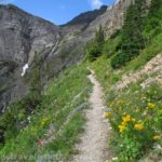
The sun hadn’t reached Siyeh Bend yet and it was cold and cloudy, not very nice at all! Still, it was predicted to be the nicest day all week, so we started up the trail. Later in the day, this section of the path is simply gorgeous – beargrass in meadows along the stream. But it was just cold and clammy right then.

The trail fairly quickly begins switchbacking upwards into the forest. It’s steep but doable. At 1.2 miles from the trailhead, turn left to follow the sign pointing toward Piegan Pass and Siyeh Pass, among other destinations.

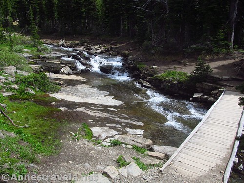
About 1.25 miles later, you’ll be able to hear a small waterfall on the left. You can check it out if you want to. A bridge goes over the creek about a tenth of a mile later with another waterfall close by.
A second trail junction 2.8 miles from the trailhead is the trail split for Piegan Pass (left) and Siyeh Pass (right). It really is the meeting of the waters, so to speak, since it’s where a lot of people go one way or the other. I’d heard that Siyeh Pass was more impressive (not necessarily true, but it’s what I’d heard), so we turned right toward Siyeh Pass.

The trail before and after this junction passes through short pines and small meadows with very occasional views. The second week of July, the meadows were sometimes filled with glacier lilies.

The next excitement (it’s exciting all right!) is the stream crossing just before you enter the more open section of Preston Park (one of the most beautiful sections of the trail IMHO) at mile 3.6. The stream is wider than it is deep, but the rocks aren’t terribly stable and more than one of us got our toes damp while crossing. The good news is that it’s not swift, so even if you fall in you’re in little danger of drowning.

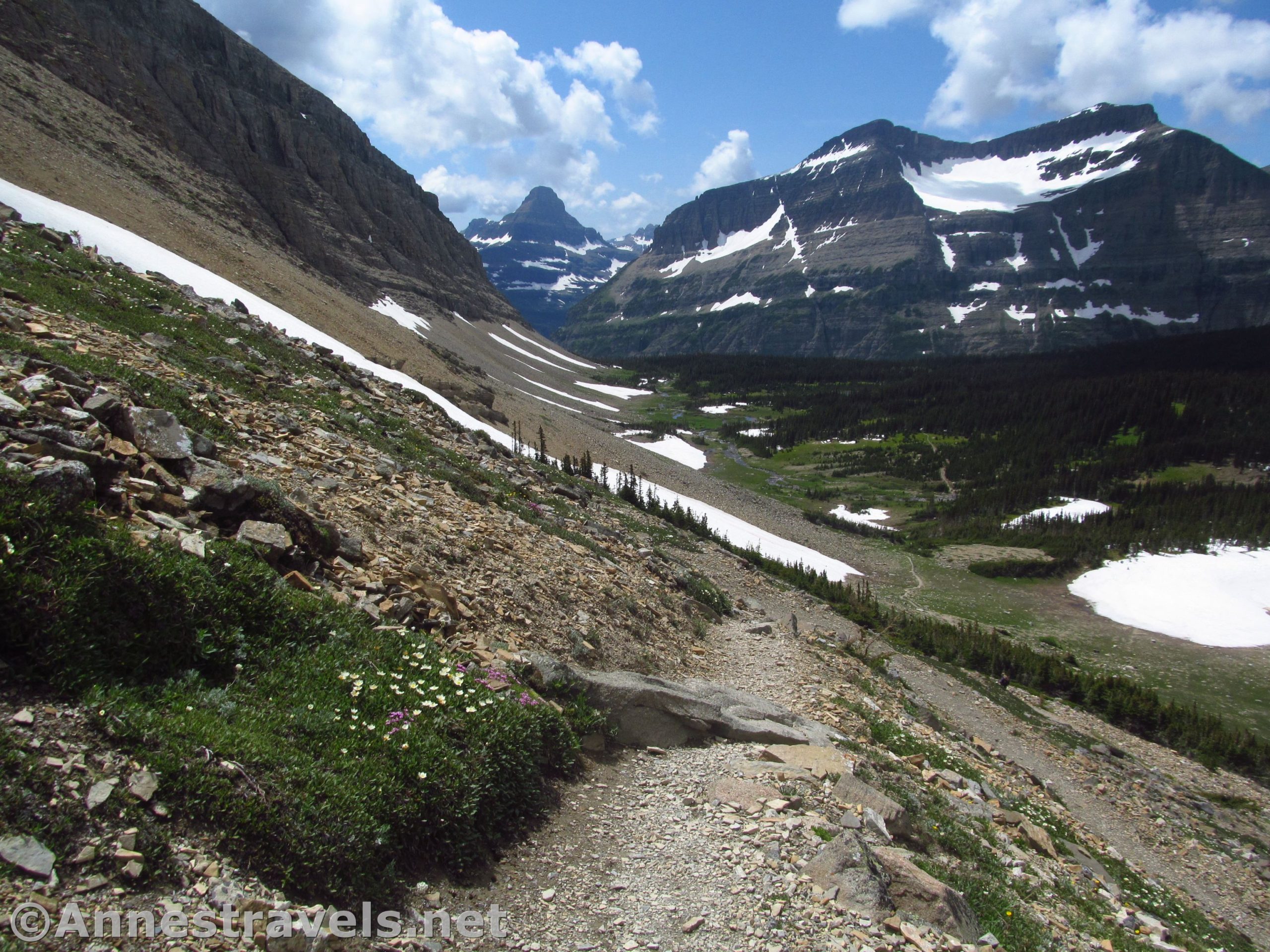
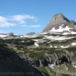
Once on the other side of the stream, you’re in Preston Park proper (actually, you’ve probably been hiking through it since the trail junction with the Piegan Pass Trail, but at this point you can actually see the park for the meadows). Views begin to open up almost immediately toward Reynolds Mountain above Logan Pass and of the peaks surrounding the park (Mount Siyeh to the north and Matahpi Peak to the south).

The trail also begins to climb. You’re not heading for the pass just to the right of Mount Siyeh, instead, you’re heading up around the shoulder of Matahpi Peak to a pass that is currently out of view. Be sure to look back down on Preston Park; the views are outstanding!

At last, when the trail seems to be able to not go any higher without having to descend to the pass below, the path turns sharply to work its way along a cliff face. It’s classic Glacier, cut right out of the cliff (like the Highline Trail and the Swiftcurrent Pass Trail). I can’t say I was too excited to walk on it, but it is the way to Siyeh Pass. Still, I tried not to pass anyone while I was on the narrow ledge of rock that is the trail.

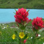
Views open up down the Boulder Creek Valley to the left (north), which is very nice with its red canyon walls, green valley, and a blue lake.

At last the trail passes over Siyeh Pass (mile 5.0) and heads down toward Sunrift Gorge in very steep switchbacks. It seemed to be the trail most people were taking – you can make it a loop with a shuttle vehicle or by taking the park shuttle back up to Siyeh Bend (people often wait 3 hours or more to get back up to Siyeh Bend, so be forewarned).

I had actually planned to hike the loop backwards – I’d much rather hike uphill than downhill when it comes to my knees – but I’d made the mistake of mentioning my plan to a ranger. In her “let’s keep these crazy tourists safe” mode, she was certain I was out of my mind and assured me there was way too much snow on the trail to want to do that (a far exaggeration, especially since she had no qualms about me going the opposite direction). But she succeeded in convincing me not to do it. I’m not altogether sorry I didn’t do the shuttle hike; the Siyeh Pass Trail is enough in itself and I could see much of the trail as it zigzagged out of the pass and then tumbled downward through green meadows – it didn’t seem too much more scenic than what we’d already done.

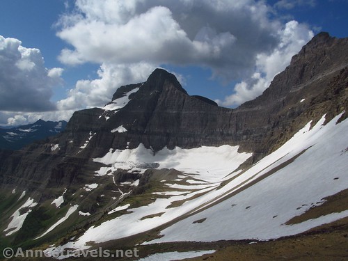
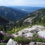
Probably the best part about Siyeh Pass is being able to see the Saxon Glacier over to the right. I’m not sure it’s an official “glacier” anymore, but it’s still cool. There are also great views out toward the peaks of southern Glacier National Park.
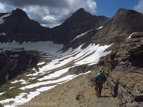
We ate lunch on the south side of the pass, and then some of us decided to scramble up the ridgeline to the east (toward UN8490). There is a light social trail, but be aware before you begin that this is not for the faint of heart or for the non-stable-of-foot: the exposure on this part of my hike was more than I would have liked in multiple places.

Still, if you can do it, the views are outstanding. The “trail” such as it is winds its way up along the side of the ridge (both sides, one or the other side, whatever works, though more often on the north (left) side). Views open up into the Boulder Creek Valley (complete with an Iceland-style waterfall!):

…and down toward Sunrift Gorge:

Not to mention the cliffs and peaks around Siyeh Pass. Totally beautiful!

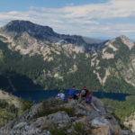
We finally came to a place none of us were comfortable crossing (a gap between the rocks in the ridgeline). One of my group members had already stayed behind for the last trek along the edge of the cliff/ridgeline because of the exposure, so we took a few photos and went back to her.

Back in Siyeh Pass, we headed back down to Preston Park. There was a lot more traffic on the trail at 2pm than at 8am (to be expected I guess!) but it wasn’t overwhelming. The sun came out, which made the hike more pleasant from a view-standpoint.

Down by Siyeh Creek (not far from Siyeh Bend), the views were fantastic! I took way too many photos of the stream.

And then you’re back at the Siyeh Bend Trailhead. Oh my! Gone is the wilderness and welcome to the crowds! Oh well… it was nice while it lasted!
Round Trip Trail Length: To Siyeh Pass and back is 10.0 miles. Adding in what I did up the ridgeline to the east, I clocked in at 11.45 miles.
Elevation Gain: 3,120ft. elevation gain (5,840ft. to 8,258ft.)
Facilities: None at the trailhead. Try Logan Pass (before 8:30am) or the Glacier National Park Visitor Center down by St. Mary.
Fees: $35/vehicle/7 days. National Parks & Federal Lands Passes and Glacier Annual Passes also accepted.
Trail Notes: Except for the one section cut out of the cliff, Siyeh Pass is a fairly family-friendly hike if the kids are good hikers. For an easier hike, you might want to cross over the stream, hike a little further to see the views, and then return for a 6.5-ish mile RT hike with about 1,600ft. of vertical gain. The exposure on the ridgeline section (social trail) of my hike made the scrambling Class 3-4.

Trail 
![]()
![]()
Road ![]()
Signs
Scenery
Would I go 100 miles out of my way for this?
Overall Rating: 

GPS Coordinates for Siyeh Pass
Beginning: 48.7015333°, -113.6673333° (N48° 42.092′ W113° 40.040′ / 48°42’05.5200″, -113°40’02.4000″) (5,505ft.) (0.0)
End: 48.7011833°, -113.6670333° (N48° 42.071′ W113° 40.022′ / 48°42’04.2600″, -113°40’01.3200″) (5,872ft.) (11.45)
Trail junction: 48.6924500°, -113.6601667° (N48° 41.547′ W113° 39.610′ / 48°41’32.8200″, -113°39’36.6000″) (6,277ft.) (1.20)

Waterfall: 48.7072333°, -113.6557833° (N48° 42.434′ W113° 39.347′ / 48°42’26.0400″, -113°39’20.8200″) (6,888ft.) (2.44)
Waterfall Bridge: 48.7075000°, -113.6554167° (N48° 42.450′ W113° 39.325′ / 48°42’27.0000″, -113°39’19.5000″) (6,904ft.) (2.54)
Trail junction: 48.7121167°, -113.6555000° (N48° 42.727′ W113° 39.330′ / 48°42’43.6200″, -113°39’19.8000″) (6,994ft.) (2.85)
Stream crossing in Preston Park: 48.7150333°, -113.6424833° (N48° 42.902′ W113° 38.549′ / 48°42’54.1200″, -113°38’32.9400″) (7,156ft.) (3.67)

Siyeh Pass: 48.7165000°, -113.6256667° (N48° 42.990′ W113° 37.540′ / 48°42’59.4000″, -113°37’32.4000″) (8,048ft.) (5.05) (returned 6.29)
Turn around near pass: 48.7150500°, -113.6241167° (N48° 42.903′ W113° 37.447′ / 48°42’54.1800″, -113°37’26.8200″) (7,957ft.) (5.21) (says to subtract 0.1 after this)
Peak 1 (on ridge): 48.7152000°, -113.6229000° (N48° 42.912′ W113° 37.374′ / 48°42’54.7200″, -113°37’22.4400″) (8,047ft.) (5.46)
Peak 2 (on ridge): 48.7163500°, -113.6173167° (N48° 42.981′ W113° 37.039′ / 48°42’58.8600″, -113°37’02.3400″) (8,291ft.) (5.75)

The gpx file for my hike up Siyeh Pass and the ridgeline can be downloaded – please note that this and the GPS Coordinates are for reference only and should not be used as a sole resource when hiking this trail.
Download GPX File size: 227.1 KB Downloaded 411 times
(Note: I do my best to ensure that all downloads, the webpage, etc. are virus-free and accurate; however, I cannot be held responsible for any damage that might result, including but not limited to loss of data, damages to hardware, harm to users, from use of files, information, etc. from this website. Thanks!)

Driving Directions to Siyeh Bend
From St. Mary, take the Going-to-the-Sun Road into the park. After passing through the entrance station, drive 14.5 miles up the road to Siyeh Bend, about 2.2 miles below Logan Pass; the trailhead is marked for Peigan Pass. Park where available. The parking area can become crowded before midday but it’s not as bad as Logan Pass.

From West Glacier, turn off of US-2 to pass under the railroad bridge, following signs for Glacier National Park. Pass through the entrance station and continue to the four-way stop. Turn right following the sign for the Going-to-the-Sun Road and drive 30.0 miles to the top of Logan Pass. Continue another 2.25 miles down to Siyeh Bend and the trailhead marked for Peigan Pass. Park where available. The parking area can become crowded before midday but it’s not as bad as Logan Pass.

This Week’s Featured Product!
For even more hikes in Glacier National Park, check out this guide to hiking in the park. From short trails to overnight backpacking treks, the book covers nearly 60 hikes on 850 miles of trails.
2 responses to “Spectacular Views near Siyeh Pass!”
[…] next day we decided to tackle Siyeh Pass. I had originally wanted to start at Sunrift Gorge, hike up to the pass, then come back down […]
[…] below Siyeh Pass, Glacier National Park, […]