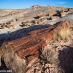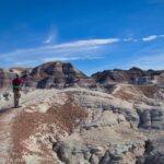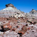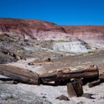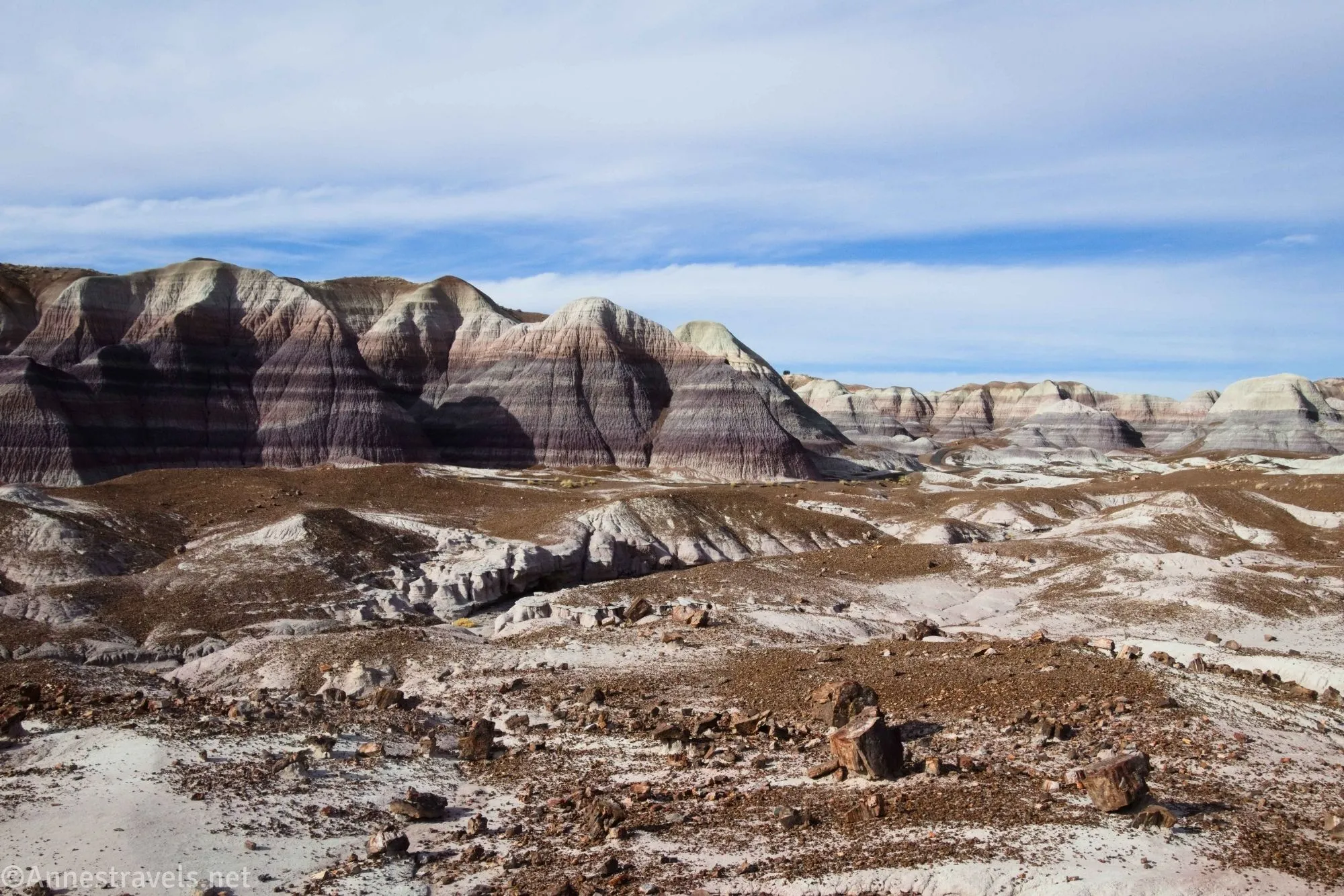
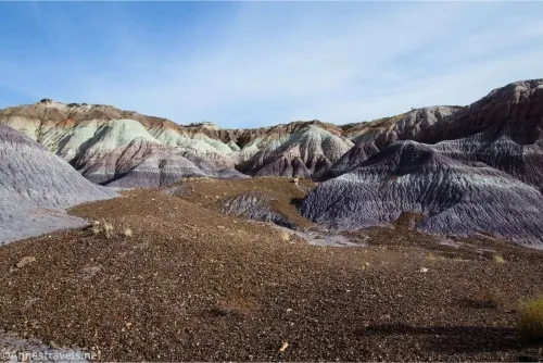
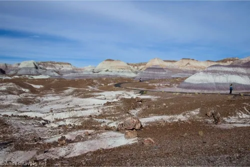
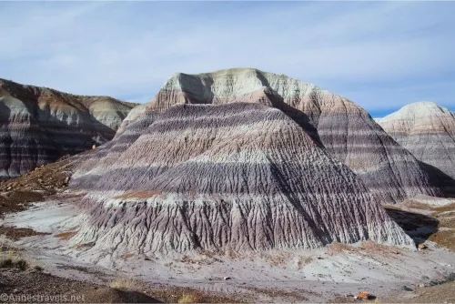
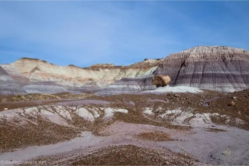
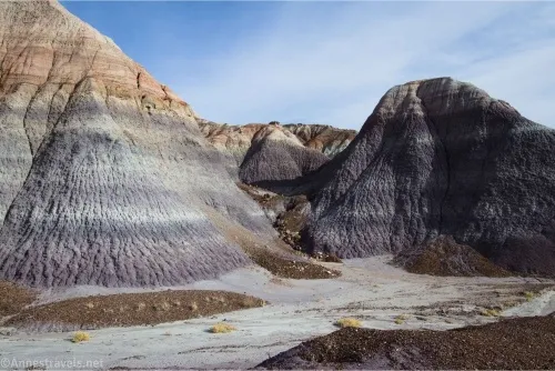
The Blue Mesa Trail is an overlooked gem in central Petrified Forest National Park. Because it’s off on a sideroad – plus it’s away from the main areas of the Painted Desert and the Rainbow Museum – fewer people drive up to see it. But the area is gorgeous, with striped badlands and some nice (if not spectacular) petrified wood. It’s well worth a 1 mile hike if you happen to be in the area and it’s not 80+F outside.
Quick Stats
Once again, I’ll be using the slightly shorter form of writing I’m testing on some of my posts. Hopefully, this will give you a more user-friendly experience, especially when trying to hike the trail.
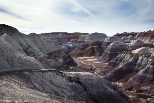
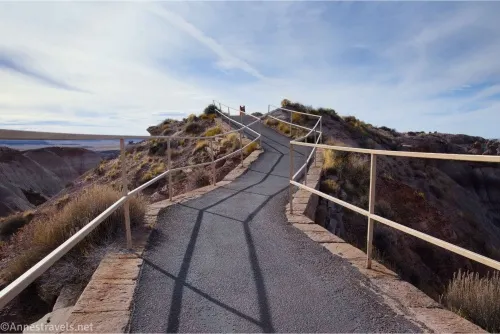
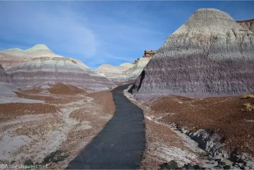
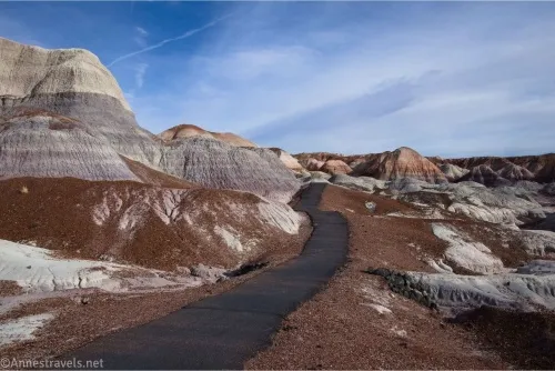
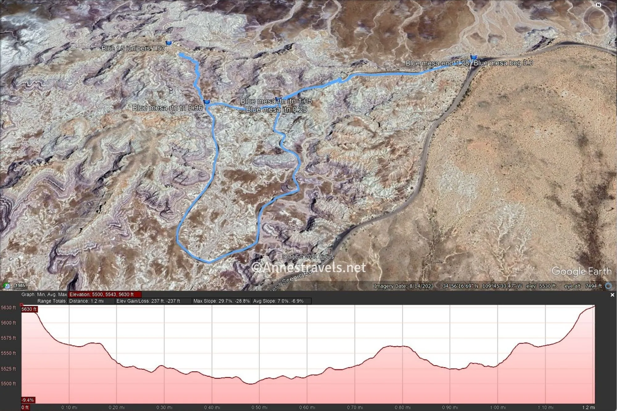
0.0 Blue Mesa Trailhead (5,626ft.). Descend the stairs or ramp, then take the paved path on a gently sloping downward projection between railings. After about 0.1 miles, the slope becomes much steeper, winding its way down into the Blue Mesa badlands area. Use care in this section, as the paved path is heaving in places, and it would be easy to trip on the downhill. (34.939453, -109.756250)
0.2 Loop split (5,531ft.). I turned left, though you’re welcome to take the loop in either direction. The path winds (fairly though not completely level) through the badlands and past caches of petrified wood. Signs occasionally talk about the history and geology of the area. (34.938754, -109.759836)
0.75 Return to loop split (5,531ft.). Turn left (or right, if you turned right before) to reascend the steep trail to the parking area. (34.938754, -109.759836)
1.0 Blue Mesa Trailhead (5,626ft.). (34.939453, -109.756250)
One funny story: When I was little, we hiked the Blue Mesa Trail. My mom decided, since the path was paved, she’d put my little sister in the stroller that up to this point had resided on the roof of our station wagon, well-secured with some twine. It was intended for the San Diego Zoo in another week, but why not use it a bit early? Well, the Blue Mesa Trail was too much for an ancient stroller that probably should have gone in the garbage before whoever gave it to us was done using it. Said stroller landed in the trash can by the trailhead. And we had to carry my little sister for more than half the trail, and we had no stroller for the San Diego Zoo. But hey, that’s what adventures are made of… right?!?
Round Trip Trail Length: 1.0 milestone
Elevation Gain: 237ft. (or a little less) (5,630ft. to 5,500ft.)
Facilities: There might be a picnic area in the shelter near the trailhead
Fees: $25/vehicle, valid 7 days. America the Beautiful National Parks & Federal Public Lands passes and Petrified Forest Annual Passes are accepted.
Trail Notes: The trail is paved, but it is not even close to wheelchair accessible. The asphalt is cracked and heaving in many places, and that first hill is steep! Please stay on the trail and refrain from touching, moving, or (worse) collecting the petrified wood. The “Return to the Trail” coordinate below is where the Blue Forest Route comes into the Blue Mesa Trail – note that this end of the route is vague from this side, and to get up to the rest of the route requires a steep climb up a sketchy slope. The rangers don’t recommend it, so you’ve been warned!
Trail 
![]()
Road ![]()
Signs ![]()
![]()
Scenery ![]()
Would I go 100 miles out of my way for this? ![]()
Overall Rating: ![]()
GPS Coordinates for the Blue Mesa Trail
These are the coordinates I took while I was hiking the trail, so it may vary a little from what I did above.
TH: 34.9394330°, -109.7562420° (34°56.36598′, -109°45.37452′ / 34°56’21.9588″, -109°45’22.4712″) (5,626ft.) (0.0)
Loop junction: 34.9387910°, -109.7598320° (34°56.32746′, -109°45.58992′ / 34°56’19.6476″, -109°45’35.3952″) (5,532ft.) (0.72)
Return to the trail: 34.9387490°, -109.7611180° (34°56.32494′, -109°45.66708′ / 34°56’19.4964″, -109°45’40.0248″) (5,530ft.) (0.96)
Return to the loop junction: 34.9387880°, -109.7598340° (34°56.32728′, -109°45.59004′ / 34°56’19.6368″, -109°45’35.4024″) (5,532ft.) (1.05)
End: 34.9394340°, -109.7562510° (34°56.36604′, -109°45.37506′ / 34°56’21.9624″, -109°45’22.5036″) (5,626ft.) (1.28)
The gpx file for the Blue Mesa Trail can be downloaded – please note that this and the GPS Coordinates are for reference only and should not be used as a sole resource when hiking this trail.
Invalid download ID. File size: 49.6 MB Downloaded 138,042 times
(Note: I do my best to ensure that all downloads, the webpage, etc. are virus-free and accurate; however, I cannot be held responsible for any damage that might result, including but not limited to loss of data, damages to hardware, harm to users, from use of files, information, etc. from this website. Thanks!)
Getting to the Blue Mesa Trailhead
From the entrance to Petrified Forest National Park shortly after the visitor center in the north part of the park, drive 15.3 miles on the main park road. Turn left onto the Blue Mesa Scenic Drive; after 2.7 miles, the pulloff/parking area will be on the right.
From the Rainbow Museum, drive 12 miles north on the main park road. Turn right onto the Blue Mesa Scenic Drive; after 2.7 miles, the pulloff/parking area will be on the right.
More Trails in Arizona
Explore some of the best trails Arizona has to offer, including several in Petrified Forest. Buy your copy here (affiliate link – there is no extra cost to you).