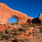
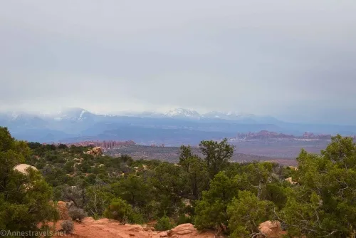
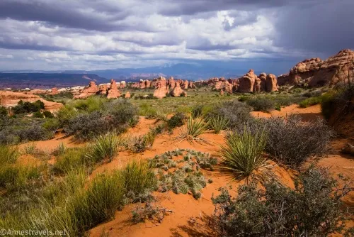
If you can only do one full-day hike in Arches National Park, I’d vote for Devils Garden. No, it doesn’t showcase the famous Delicate Arch (well worth the time in its own right!), but it does have a minimum of 8 impressive arches, fantastic views, and a great (did you say somewhat natural?) hiking experience! You’ll be climbing slickrock fins, walking through desert canyons, and following dry washes as well as hiking on a good trail. Believe me, the effort is worth it!
Quick Stats
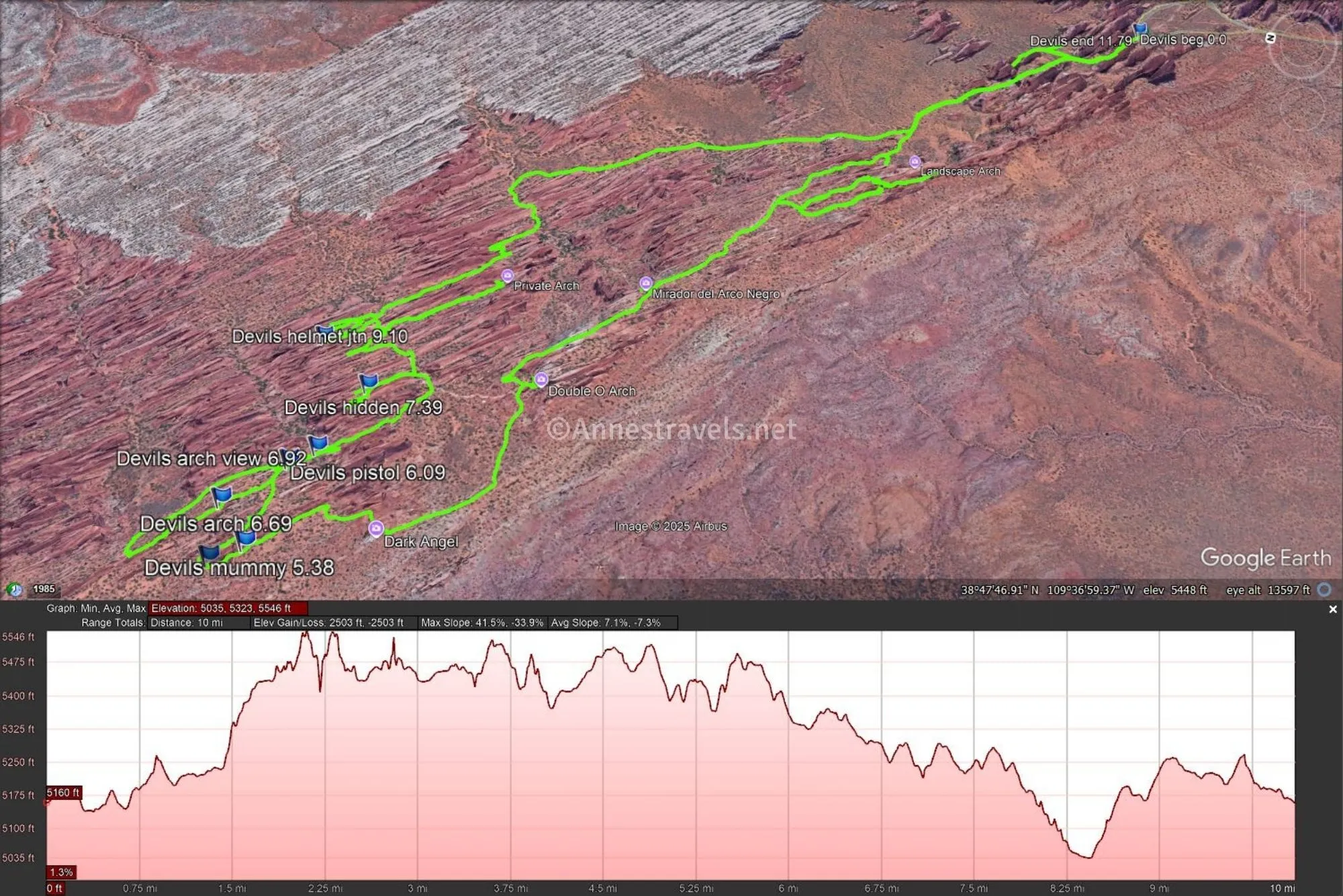
Many people online have already documented the Devils Garden Trail in detail. So I’m going to take a slightly different approach, trying to make it as simple to follow as possible (there are so many junctions, it can get confusing quickly if I try to describe it in text). Plus I’ll also include a bit about an exploration I did out beyond the Dark Angel (because an 8 mile trek over questionable terrain under threatening skies isn’t enough adventure for one day – right?)
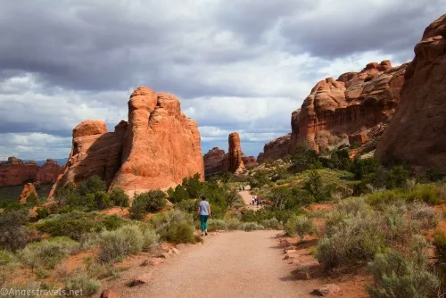
0.0 Devils Garden Trailhead (5,232ft.) The trailhead has primitive restrooms and a water fountain. The latter is especially nice; the only other trailhead in the park with water is Broken Arch (right next to the campground restroom, which is outfitted with flush toilets and, therefore, water). Start out by walking the almost-paved path between the fins. The path will rise beyond the fins (after passing a sand dune, which is the favorite of many a child) with a taste of the views to come. (38.7829490°, -109.5951060°)
0.25 Pine Tree Arch/Tunnel Arch Spur Junction on the right(5,197ft.). While an optional trek with significant elevation loss/gain, it’s worth the extra mileage to turn right here and descend the hill. (38.7853560°, -109.5976120°)
0.3 Pine Tree Arch/Tunnel Arch Junction (5,161ft.). Turn right here to visit Tunnel Arch. (38.7855333°, -109.5963667°)
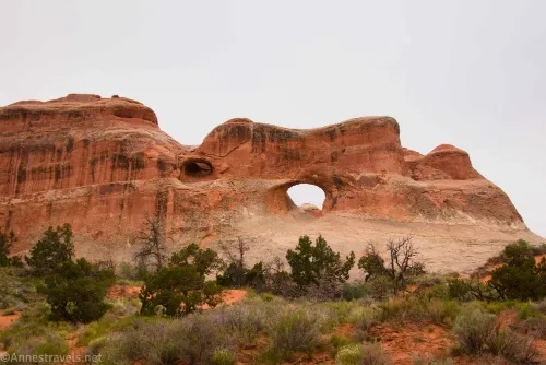
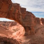
0.35 Tunnel Arch Viewpoint (5,517ft.). The arch is high on the cliff. Look to the left to see East Tunnel Arch, as well. Walk back to the Pine Tree Arch/Tunnel Arch Junction, turn right, and walk down to Pine Tree Arch. (38.7855333, -109.5963667)
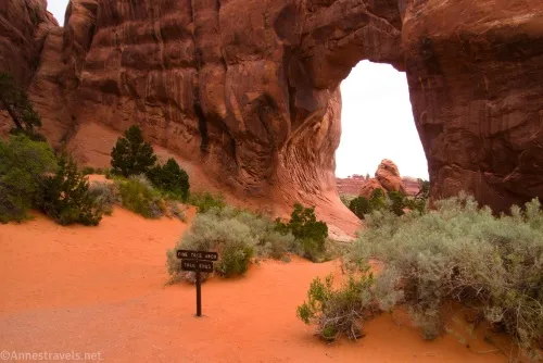
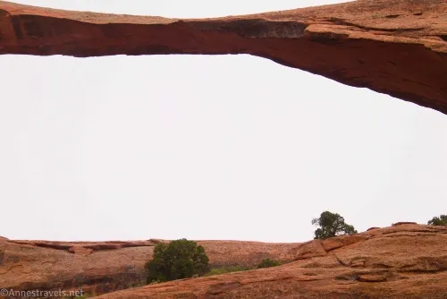
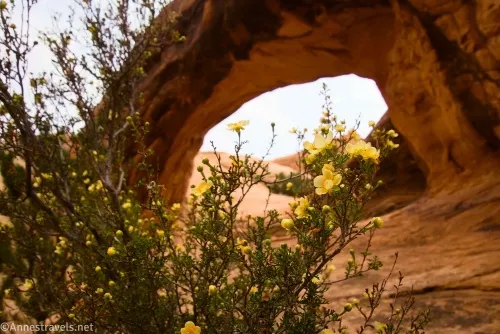
0.5 Pine Tree Arch (5,204ft.). A pine tree near the arch gave it its name. I enjoyed the views through the arch, as well as the arch, itself Retrace your steps up the hill and back to the main path. Turning right (away from the trailhead), the path rises between some fins, then descends gently with great views to the right (north/east). The paved path ends at some stairs at the Primitive Loop Junction, which looks like little more than a wash. Landscape Arch is visible from here, and the signs about the arch are shortly before the wash (be sure to read about the rock which fell in 1991!) (38.7874770°, -109.5987440°)
1.3 Primitive Loop Junction (5,233ft.). If you look right here, you’ll see a sign in the wash saying “No trail” – the Primitive Loop exits the wash just before this sign. However, we want to stay on the main trail at this point and get to the Landscape Arch Viewpoint, so turn left up the wash on the main trail, which rises out of the wash after a short stroll. Keep your eyes open for Partition Arch, high on the cliff to the right of Landscape Arch. (38.7905420°, -109.6044260°)
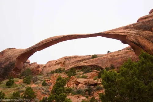
1.4 Landscape Arch Spur on the left (5,240ft.). Turn left toward Landscape Arch. Many years ago, you could walk all of the way under Landscape Arch and beyond – this was where the tourists were standing when the rock fell from the arch in 1991 (video here; the rock falls about 1:14). Even when I first visited in 1997, we were allowed to go quite a bit closer than the current viewing area. Now, any hint of a social trail is marked with a “not a trail” sign, and you’re not allowed to explore off-trail in this area. As you walk up to the viewpoint, look across the valley to the left, and you might spot the boulder with Coke Oven Arch. (38.7911550°, -109.6061470°)
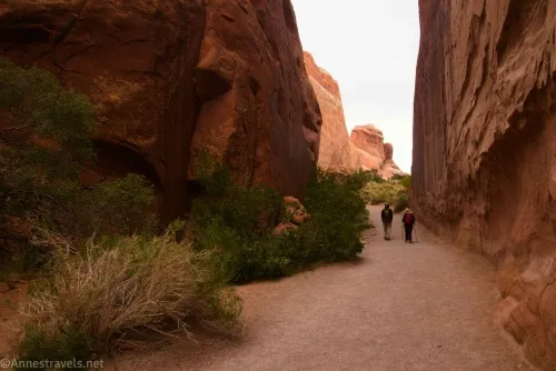
1.5 Landscape Arch Viewpoint (5,249ft). The arch is very impressive from here. This is where most people turn around, as the trail becomes more rugged almost immediately. If you’ve had enough adventures, retrace your steps to the parking area. For more adventures, return to the main trail and turn left. The trail rises steeply via a slickrock slope between two fins, passing (without any sign) the former site of Wall Arch on the left. The scramble up the fin is rugged, but at the top, the path moderates slightly. (38.791151, -109.606948)
1.8 Navajo Arch / Partition Arch Spur on the left (5,443ft.). This spur takes you to one of my favorite photo ops in Devils Garden, so I’d say the spur is worth the (mostly flat) hike (well, flat except for the route up to Partition Arch!) The trail wanders between the ends of two sets of fins. (38.7941770°, -109.6102780°)
1.9 Navajo Arch / Partition Arch Junction (5,445ft.). Turn left to view Partition Arch first. It’s a light scramble up to the arch; the path may be a little obscure in places, but since you’re between two fins, it’s hard to get too lost. (38.7934740°, -109.6105570°)
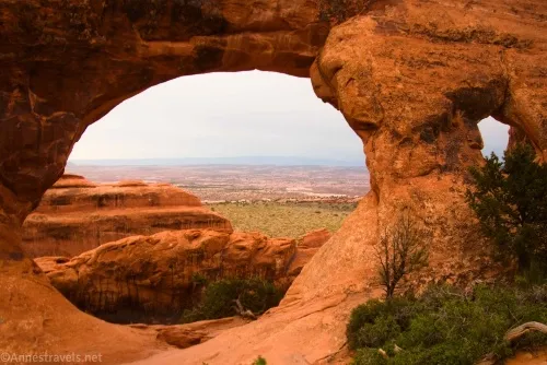
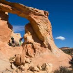
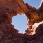
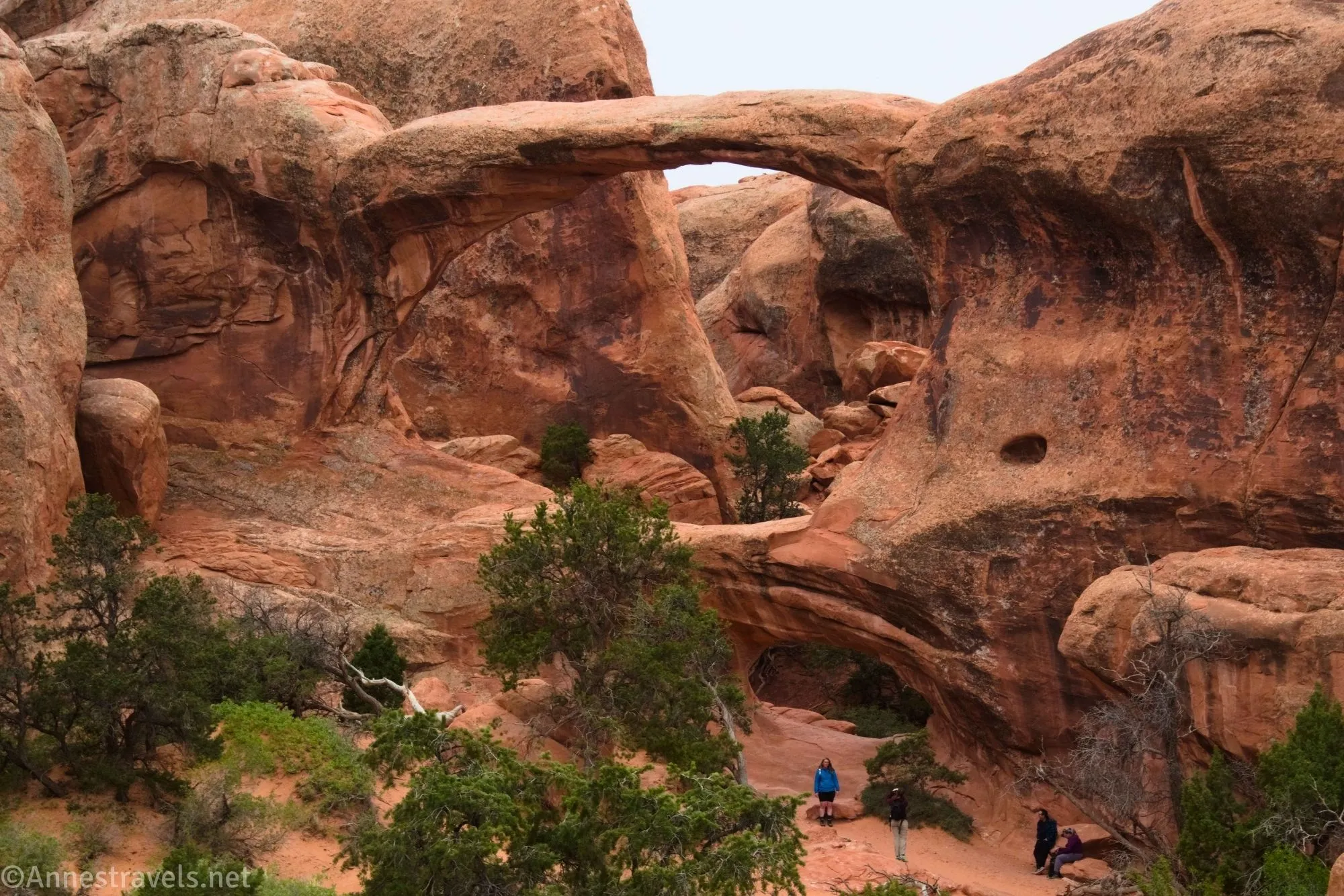
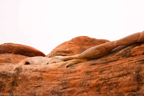
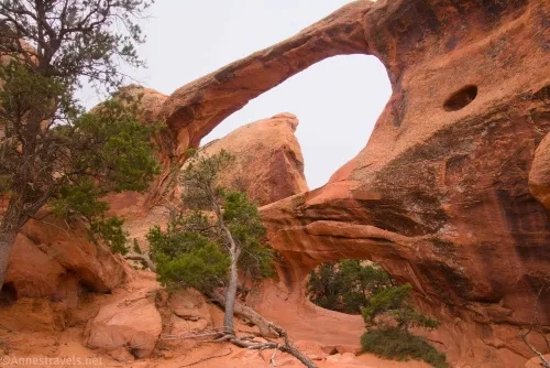
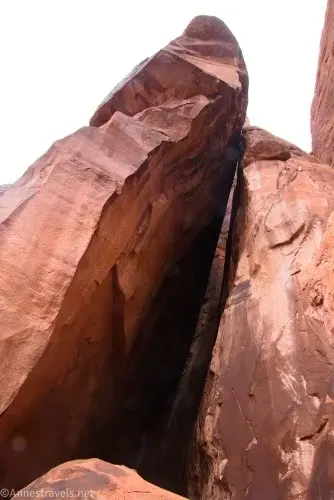
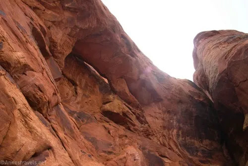
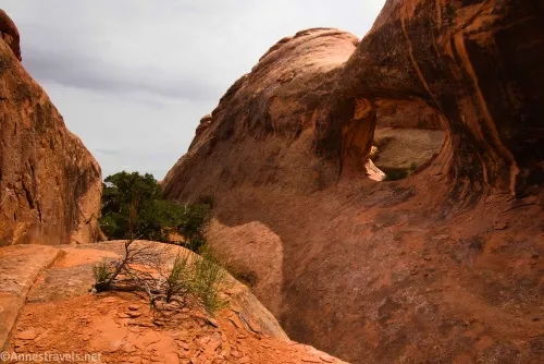
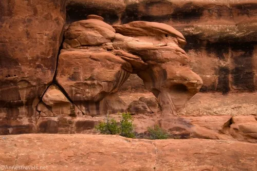
2.0 Partition Arch (5,482ft.). The arch was named for the “partition” of rock that separates the larger opening from the smaller one. Views are great down to the plain below. It was a pity the day I visited was so cloudy, but at least it didn’t rain on us (much). By turning around and scrambling a little bit above the viewing area, I found Magpie Arch on the rock above my head (it’s two small openings and not very exciting), scrambling up toward where the two fins drop into the valley below, you might glimpse Landscape Arch far below. Return to the Navajo/Partition Arch Trail and turn left toward Navajo Arch. (38.7917070°, -109.6084690°)
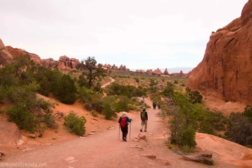
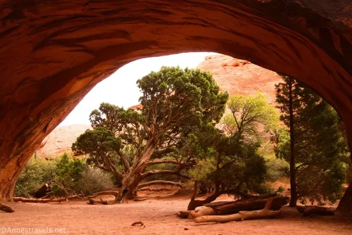
2.4 Navajo Arch (5,480ft.). You can walk through the arch and to the other side. One of my favorite photo ops on the trail is of the juniper tree beneath the arch. I saw a picture of it on Flickr years ago and thought, “I’m going to take a picture just like that next time I’m in Devils Garden!” So I did, and I love it. Return to the main trail and turn left toward Double O Arch. It was at this point that we began to meet people coming up behind us (the faster hikers). I knew Devils Garden was a busy place, and we saw many dozen other hikers before the day was out! (38.7912000, -109.6090333)
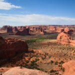
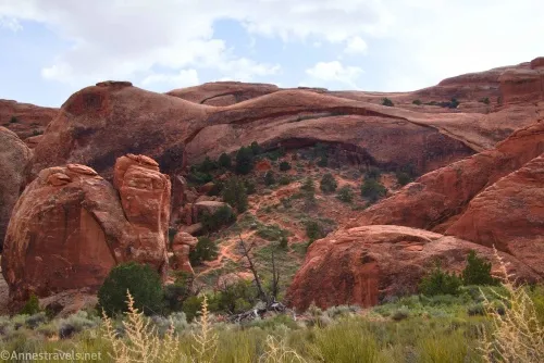
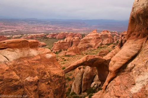
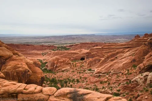
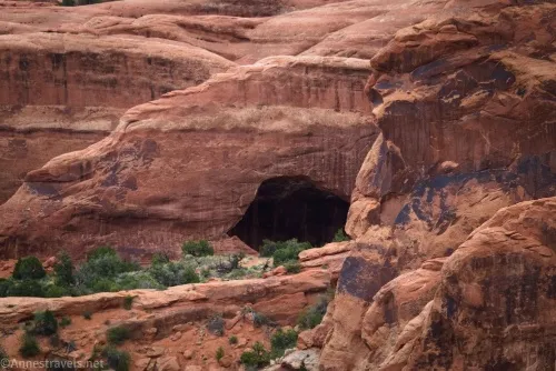
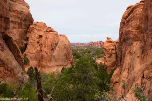
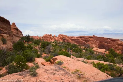
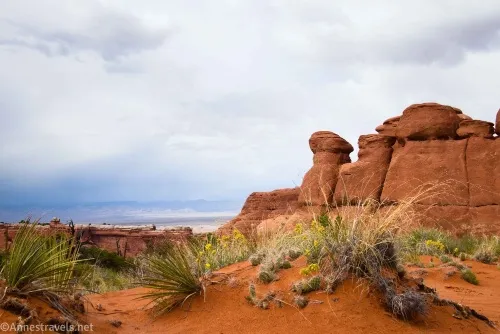
3.1 Black Arch Overlook Spur on the right (5,449ft.). Take the short spur trail to the viewpoint, which is an opening in the fin which allows views down into Fin Canyon and to an arch with desert varnish behind it, then continue on the main trail. This is possibly the most exciting part of the hike, as the trail travels along the top of a sandstone fin. Light scrambling is required to descend in a few places – keep your eyes open for cairns, and you should be fine. While descending, keep your eyes open for Double O Arch – this is a unique and fun angle on the arch. Shortly after regaining solid sandy ground, the trail will arrive at a junction – Double O Arch is to the left of this junction. (38.797019, -109.616086)
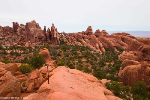
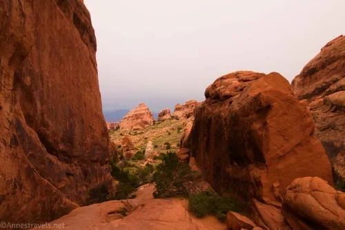
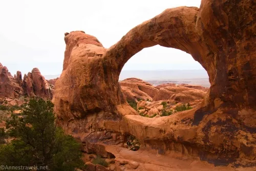
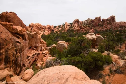
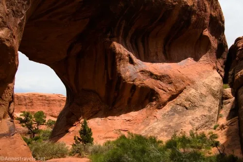
3.6 Double O Arch/Dark Angel Junction (5,488ft.). Scramble left through the opening of Double O Arch to view it from its most impressive side (per me). Return to the main trail and turn left toward the Dark Angel. Few people take this part of the trail, so it’s likely you’ll have it to yourself. It’s also likely that the trail is narrower and less-traveled as it works its way through a tangle of boulders. (Actually, most people turn around at Double O Arch, so you’ll find a lot more solitude for the rest of this hike.) (38.7992833°, -109.6210167°)
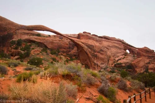
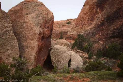
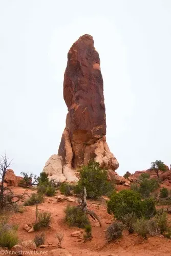
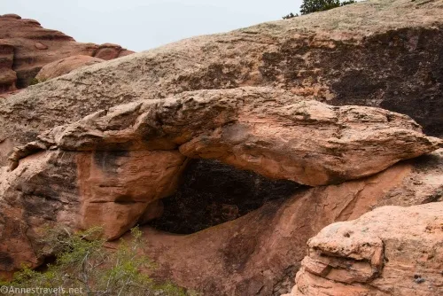
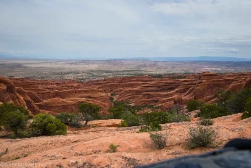
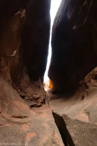
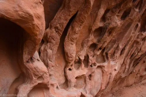
4.0 Dark Angel Viewpoint (5,480ft.). The Dark Angel isn’t a crazy impressive formation, but once you’ve seen it and know what it looks like, you’ll see it from a lot of other places in the park, too! From here, I decided to do a bit of exploring. I’d even pulled some GPS coordinates for rarely-seen arches off the internet. Alas, these coordinates were nothing short of wrong. We scrambled around, were very hot, enjoyed the sun coming out from behind the clouds, rested in the shade, and finally gave up. Along the way, we did find two arches and lots of views. We then scrambled back to the main trail without returning to Dark Angel (not an easy feat; the area is extremely rugged off the trail). However, for the sake of mileages, I’m going to pretend we didn’t take this little side-excursion. Once we found the Primitive Loop again, we turned left down the wash. Fairly quickly, we came to the unmarked turnoff for Hidden Arch (mile 6.4 if you don’t count my explorations). If you don’t mind an adventure, this is a great sidetrip. Turn up between two fins about 0.2 miles from the turnoff for Dark Angel and just downstream from where the path goes right and the wash goes left (go left in the wash). There is no path, so try not to step on vegetation as you work your way up the sandy hill between the fins, ducking under the dead juniper trees (which like to catch hair and backpack straps, BTW). At the top of the sandy hill, look to the left and you’ll see the huge opening of Hidden Arch. Wow! We scrambled into the arch (no easy feat – coming down was easier), and behind the arch, we found a really neat cave where two rock fins almost meet overhead. Fascinating! When you’re finished looking at Hidden Arch, scramble back down to the main trail of the Primitive Loop and continue downstream (note that the mileage to Hidden Arch is not included in the mileage here – it’s not more than 0.25 or maybe 0.4 miles RT, anyway). (38.8012320°, -109.6273020°)
4.9 Private Arch Spur on the right (5,262ft.). At the marked junction, turn right toward Private Arch. The trail travels quietly between two sandstone fins before suddenly turning left to the arch – it’s hard to lose the trail. (38.8038050°, -109.6191320°)
5.2 Private Arch (5,229ft.). Again, you can walk through it if you want and see the back side. Return to main path (wash) and turn right. Continue to follow trail and cairns in the wash and around various dyrfalls. As you hike, keep your eyes open to the left to catch a good view of Top Story Window. You may also see both Helmet Arch and Helmet Arch 2 along the way. (38.8012030°, -109.6160570°)
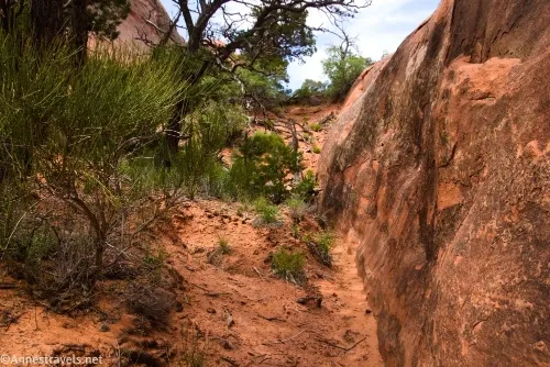
6.1 Leave wash (5,034ft.). The trail turns right here to leave the wash (it’s well-cairned and signed). For a bit, it travels high above the wash, then it enters a world of fins above Fin Canyon. I lost the trail a couple of times in this section, but thankfully there were plenty of cairns to set me straight. After traveling down the wash of Fin Canyon for a short distance, the path rises via a sandy, easy-to-follow route with great views down to other rock formations before dropping into the wash at the Primitive Loop Junction once again. (38.8023450°, -109.6101100°)
7.2 Primitive Loop Junction (5,233ft). Turn left on the main trail toward the parking area – chances are by this time of day, you’ll have plenty of company again! (38.7905420°, -109.6044260°)
8.0 Devils Garden Trailhead (5,232ft.). (38.7829490°, -109.5951060°)
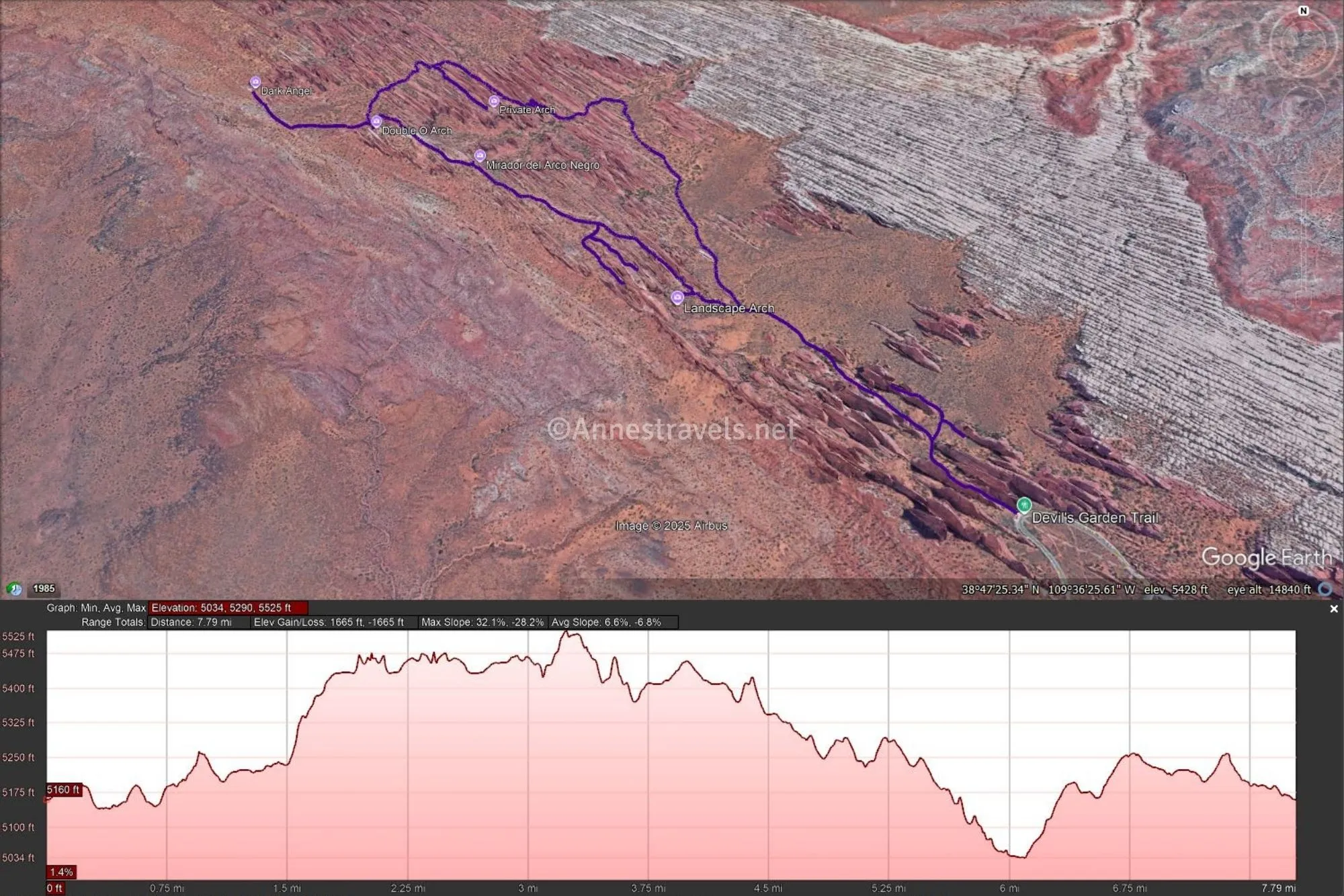
Round Trip Trail Length: 8 miles if you only do the Primitive Loop (with all the official spurs); I went a total of 10+ miles that day
Elevation Gain: My hike was 2,503ft. elevation gain (more or less… the fins make it hard for my programs to accurately read my GPS files) (5,035ft. to 5,546ft.). Just doing the loop with spurs is more like 1,665ft. (5,034ft. to 5,525ft.)
Facilities: Primitive restrooms and water at the trailhead. Picnic areas are nearby.
Fees: $30/vehicle, valid 7 days. America the Beautiful National Parks & Federal Public Lands Passes are accepted, as are Southeast Utah Parks Annual Passes.
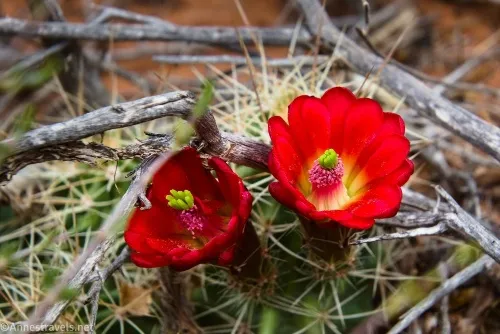
Trail Notes: This is not an easy 8 miles. Scrambling is required in multiple places, walking in washes saps your energy (sand), it’s very hot and exposed most of the year, and wayfinding can be interesting in Fin Canyon. That all said, it’s an incredibly rewarding trek – just be ready to be tired by the end of the day! Of course, you can do only part of the trek (which is what most people do) if you aren’t feeling energetic. Bring plenty of water, snacks, and sunscreen. While sunshine is of course nice, the area is still impressive under clouds (I’ve done it at least twice on cloudy days).
Trail 
![]()
![]()
Road ![]()
Signs
Scenery
Would I go 100 miles out of my way for this?
Overall Rating: 
GPS Coordinates for Devils Garden
TH: 38.7829490°, -109.5951060° (38°46.97694′, -109°35.70636′ / 38°46’58.6164″, -109°35’42.3816″) (5,232ft.) (0.0)
Pine Tree Arch/Tunnel Arch Junction: 38.7853560°, -109.5976120° (38°47.12136′, -109°35.85672′ / 38°47’07.2816″, -109°35’51.4032″) (5,197ft.) (0.25)
Pine Tree Arch/Tunnel Arch Junction: 38.7861580°, -109.5970520° (38°47.16948′, -109°35.82312′ / 38°47’10.1688″, -109°35’49.3872″) (5,161ft.) (0.3)
Tunnel Arch: 38.7855333°, -109.5963667° (38°47.13200′, -109°35.78200′ / 38°47’07.9199″, -109°35’46.9201″) (5,5175ft.) (0.35)
Pine Tree Arch: 38.7874770°, -109.5987440° (38°47.24862′, -109°35.92464′ / 38°47’14.9172″, -109°35’55.4784″) (5,204ft.) (0.5)
Primitive Loop Junction: 38.7905420°, -109.6044260° (38°47.43252′, -109°36.26556′ / 38°47’25.9512″, -109°36’15.9336″) (5,233ft.) (1.3)
Landscape Arch Spur: 38.7911550°, -109.6061470° (38°47.46930′, -109°36.36882′ / 38°47’28.1580″, -109°36’22.1292″) (5,240ft.) (1.4)
Landscape Arch Viewpoint: 38.7911510°, -109.6069480° (38°47.46906′, -109°36.41688′ / 38°47’28.1436″, -109°36’25.0128″) (5,249ft.) (1.5)
Navajo Arch/Partition Arch Spur: 38.7941770°, -109.6102780° (38°47.65062′, -109°36.61668′ / 38°47’39.0372″, -109°36’37.0008″) (5,443ft.) (1.8)
Navajo Arch/Partition Arch Junction: 38.7934740°, -109.6105570° (38°47.60844′, -109°36.63342′ / 38°47’36.5064″, -109°36’38.0052″) (5,445ft.) (1.9)
Partition Arch: 38.7917070°, -109.6084690° (38°47.50242′, -109°36.50814′ / 38°47’30.1452″, -109°36’30.4884″) (5,482ft.) (2.0)
Navajo Arch: 38.7912000°, -109.6090333° (38°47.47200′, -109°36.54200′ / 38°47’28.3200″, -109°36’32.5199″) (5,480ft.) (2.4)
Black Arch Overlook Spur: 38.7970190°, -109.6160860° (38°47.82114′, -109°36.96516′ / 38°47’49.2684″, -109°36’57.9096″ (5,449ft.) (3.1)
Double O Arch/Dark Angel Junction: 38.7992833°, -109.6210167° (38°47.95700′, -109°37.26100′ / 38°47’57.4199″, -109°37’15.6601″) (5,488ft.) (3.6)
Dark Angel Viewpoint: 38.8012320°, -109.6273020° (38°48.07392′, -109°37.63812′ / 38°48’04.4352″, -109°37’38.2872″) (5,480ft.) (4.0)
Private Arch Spur: 38.8038050°, -109.6191320° (38°48.22830′, -109°37.14792′ / 38°48’13.6980″, -109°37’08.8752″) (5,262ft.) (4.9)
Private Arch: 38.8012030°, -109.6160570° (38°48.07218′, -109°36.96342′ / 38°48’04.3308″, -109°36’57.8052″) (5,229ft.) (5.2)
Leave Wash: 38.8023450°, -109.6101100° (38°48.14070′, -109°36.60660′ / 38°48’08.4420″, -109°36’36.3960″) (5,031ft.) (6.1)
Primitive Loop Junction: 38.7905420°, -109.6044260° (38°47.43252′, -109°36.26556′ / 38°47’25.9512″, -109°36’15.9336″) (5,233ft.) (7.2)
Devils Garden TH: 38.7829490°, -109.5951060° (38°46.97694′, -109°35.70636′ / 38°46’58.6164″, -109°35’42.3816″) (5,232ft.) (8.0)
GPS Coordinates for my exploration beyond the Dark Angel (plus Hidden Arch and Helmet Arch-ish)
Mummy rock formation: 38.8039970°, -109.6285590° (38°48.23982′, -109°37.71354′ / 38°48’14.3892″, -109°37’42.8124″) (5,517ft.) (5.38)
Arch (I think Cat Eye Arch): 38.8046190°, -109.6291840° (38°48.27714′, -109°37.75104′ / 38°48’16.6284″, -109°37’45.0624″) (5,476ft.) (5.46)
Pistol Arch? (it’s not): 38.8040440°, -109.6255560° (38°48.24264′, -109°37.53336′ / 38°48’14.5584″, -109°37’32.0016″) (5,437ft.) (6.09)
Arch: 38.8050200°, -109.6273620° (38°48.30120′, -109°37.64172′ / 38°48’18.0720″, -109°37’38.5032″) (5,480ft.) (6.69)
Arch view: 38.8036230°, -109.6248060° (38°48.21738′, -109°37.48836′ / 38°48’13.0428″, -109°37’29.3016″) (5,402ft.) (6.92)
Hidden Arch: 38.8031790°, -109.6221480° (38°48.19074′, -109°37.32888′ / 38°48’11.4444″, -109°37’19.7328″) (5,439ft.) (7.39)
Helmet Junction: 38.8050040°, -109.6202910° (38°48.30024′, -109°37.21746′ / 38°48’18.0144″, -109°37’13.0476″) (5,317ft.) (9.10)
The gpx file for Devils Garden, including all of my off-trail scrambling, can be downloaded – please note that this and the GPS Coordinates are for reference only and should not be used as a sole resource when hiking this trail.
Download GPX File size: 161.4 KB Downloaded 175 times
Also, here’s a gpx file of just the Primitive Loop without any off-trail adventures.
Download GPX File size: 212.9 KB Downloaded 202 times
(Note: I do my best to ensure that all downloads, the webpage, etc. are virus-free and accurate; however, I cannot be held responsible for any damage that might result, including but not limited to loss of data, damages to hardware, harm to users, from use of files, information, etc. from this website. Thanks!)
Getting to the Devils Garden Trailhead
From the Arches National Park Visitor Center, drive 17.6 miles to the end of the road. Park in the parking spaces along the road (there are many, but they fill up quickly – do not park in the picnic area or in the campground unless you have reservations to stay overnight) and follow the sidewalk to the trailhead.
Today’s Featured Book!
Sixty-four hikes are packed into this book that covers both Arches National Park and Canyonlands National Park. Arches, viewpoints, and much more are covered as it discusses the best hikes in the area, complete with maps and photos. Buy your copy here.