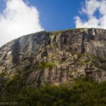
Eagle Falls and Vikingsholm was a surprising and delightful discovery when I visited Lake Tahoe. In fact, it was so amazing that we decided to go back the next day after hiking Castle Rock when we weren’t able to hike the trail I’d originally planned for the day (some roads just need 4×4). We ended up hiking around the top of the falls in the evening, then hiking down to Vikingsholm the next day. Both are very fun, though the trail down to Vikingsholm and then up to the base of the falls is very steep!
Quick Stats
This post may contain affiliate links. If you click a link and purchase something, I may get a small commission. There is no extra cost for you.
Funny but true story: We wouldn’t have found Eagle Falls at all, but we were looking for trash cans. We’d had supper at a lakeside picnic area, and the beef stew containers smelled strongly. We did not want to keep them in the van overnight, but the area seemed devoid of trash receptacles. Mile after mile, not a trash can in sight.

Finally, in desperation, we pulled into the Eagle Falls Trailhead – and found someone had pushed their salad bowls and other trash under a bush not 50 feet from two very real trash cans. Ugh for litterers, yay for no more smell in the van. While we were stopped, we decided to explore Eagle Falls. It turns out one of my companions had made a very beautiful piece of artwork using a photo atop the falls for inspiration about a month before. Who would have guessed he would see the very sight of his artwork ever, let alone so soon?
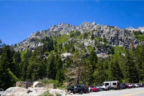
On that first visit in the evening, after disposing of our trash, we parked in the lot for Eagle Falls and the Desolation Wilderness (38.9519465015°, -120.11305816°). There is also additional parking along the road. These are all free. Just up the road is the parking area for Emerald Bay State Park (38.95427388, -120.11052778) – this is closer to the Vikingsholm Trailhead, but it also has a parking fee. On a summer afternoon, every single one of these parking areas can be full, so plan accordingly.
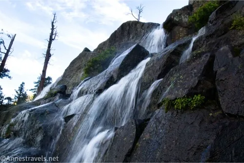
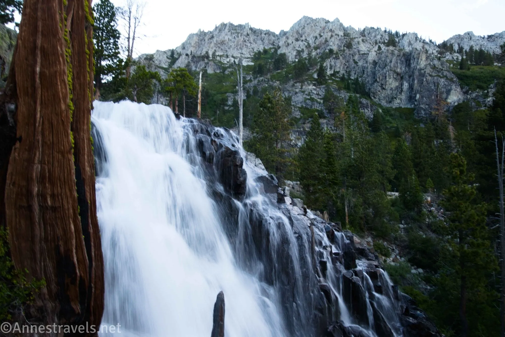
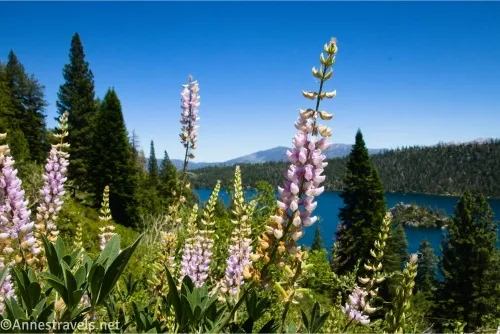
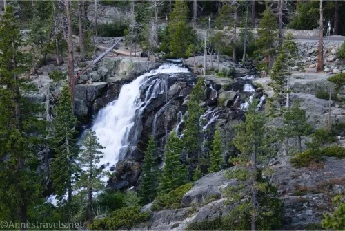
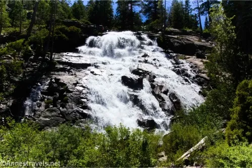
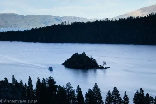
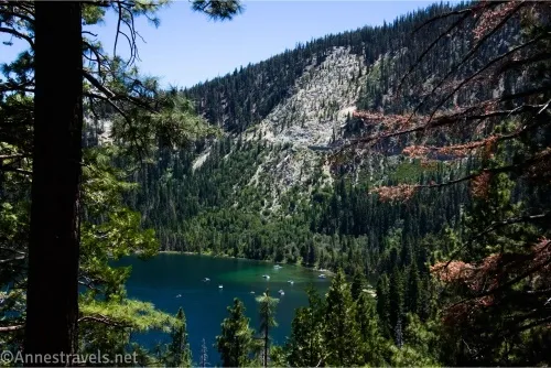
Back to the first visit, we crossed the road (carefully!) from the parking area. The stream here has some good views down onto Emerald Bay. You can continue to walk along the right side of the stream to a place where you can see the falls. It’s probably the most impressive view of the falls I saw…
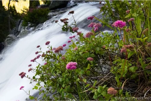
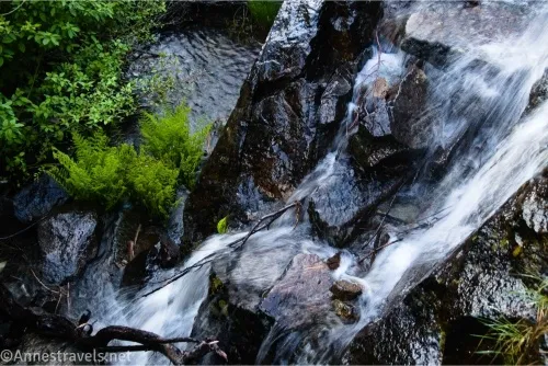
…except for maybe if you (carefully) cross the stream (above the falls) and walk on the rocks out to where you can see a slightly distant view of the falls.
But that’s all exploring, so now I’ll explain how we hiked to Vikingsholm and the lower viewpoint of Eagle Falls. We ended up parking about a quarter mile south of where we’d parked the night before in a semi-official pulloff along with plenty of other people who were doing similar things. From there, we walked along a social trail and the road a quarter mile to the entrance to the Eagle Falls Parking Area, then another 0.05 miles to where a very official trail leaves on the right. This is what I called the “Trailhead.”
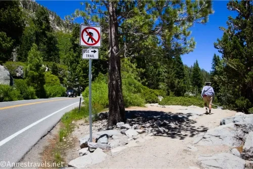
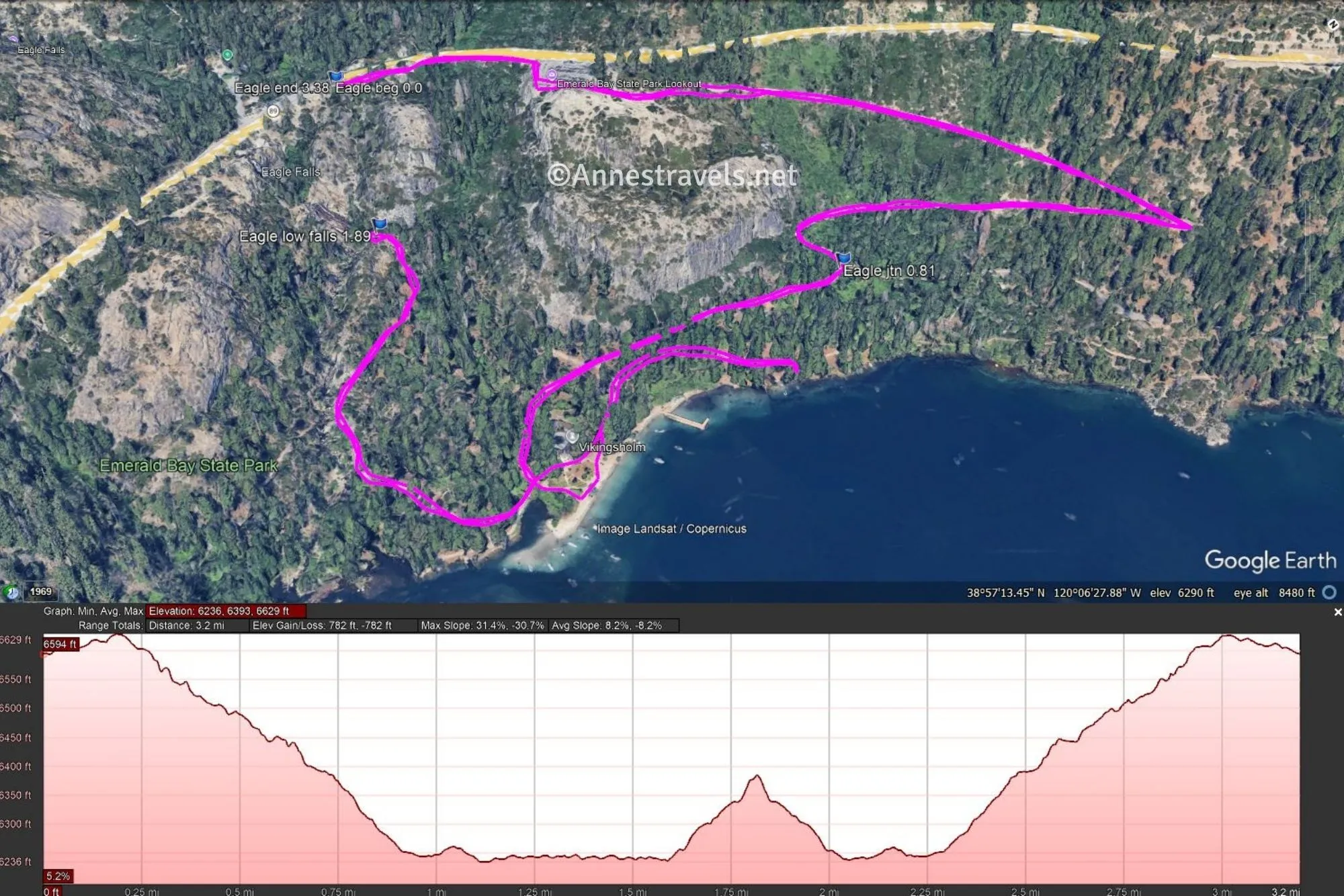
0.0 Trailhead (6,591ft.). As I said, this is not really the trailhead, it’s just the beginning of an official trail. The path travels near but not beside the road through the thin forest (not much in the way of shade) for 0.15 miles to the Emerald Bay State Park parking area. Walk across or around the parking area to its far right corner near the pay machines (they’re a little hard to miss). (38.9526290°, -120.1121500°)
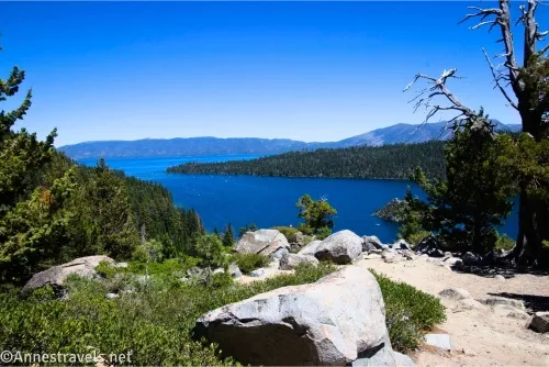
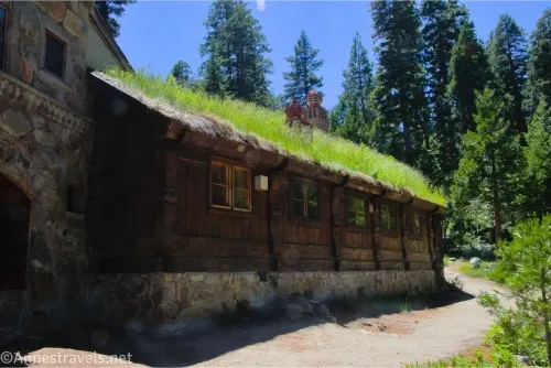
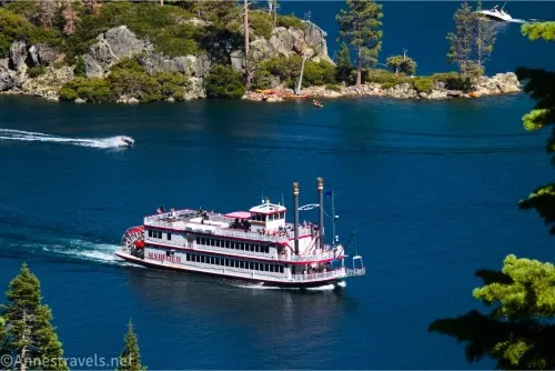
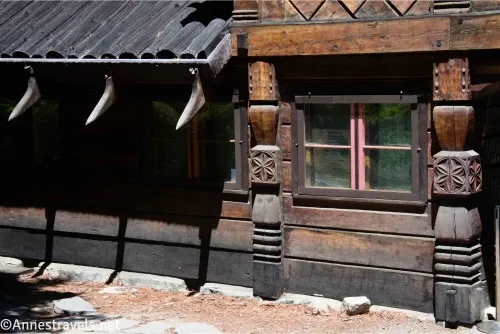
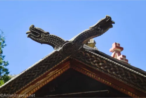
0.2 Emerald Bay State Park Trailhead (6,628ft.). Follow the very obvious trail as it begins its slow downhill descent. It gradually becomes steeper, and believe me, coming back up will remind you why you don’t want to hike in California in the summer! The path takes one switchback, then winds down toward Emerald Bay. At mile 0.8, stay right, as the left trail would take you down to the lakeshore further east than you want to be. At the bottom, things get a little weird. The one stable part of the landscape is Vikingsholm, a summer mansion created in the Scandinavian style. If you like architecture, it’s definitely worth walking around the building to enjoy the carved wood, grassy roof, and more. Tours ($) are sometimes offered. We ended up turning left and taking a trail along the lakeshore for a while, turned around, returned to visit the beach (where families were having a grand time swimming and playing and picnicing), and then followed the signs up to Eagle Falls (in all wasting about 0.4 miles). The trail is just slightly strenuous, with stone stairs and a steep grade. (38.9542825°, -120.1100942°)
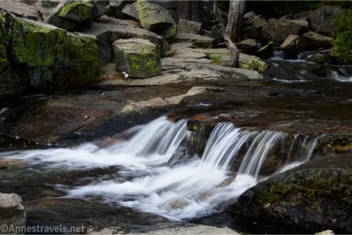
1.9 Lower Eagle Falls Viewing Platform (6,381ft.). I was definitely disappointed with how little of the falls you can see, but what you can see is impressive (especially if it’s not afternoon and the sun isn’t silhouetting the falls so badly they’re just a dazzle of reflected light off the spray of the falls). Still worth the trek up to see if you’re already at Vikingsholm, but I wouldn’t do it just to see the falls – the views are better from up top. When you’re finished, retrace your steps back up – up – up to your vehicle! (38.9521830°, -120.1102210°)
Round Trip Trail Length: I went a total of 3.4 miles not including walking from where I parked to the “trailhead.”
Elevation Gain: 782ft. (6,629ft. to 6,236ft.)
Fees: None if you park somewhere else than Emerald Bay State Park. The state park charges $10/day or $3/hour to park in their parking area.
Facilities: Vault toilets at both the Eagle Falls Parking Area and Emerald Bay State Park parking areas as well as at Vikingsholm.
Trail Notes: The trail is steep, and on a hot afternoon, it is not much fun to climb back up, especially after a refreshing dip in Lake Tahoe. The trail is open all year, though snow can make the hike a bit exciting in the winter. The house does offer tours ($) from Memorial Day weekend through September 30. Trails at the bottom are super confusing, but there are only three basic destinations: The lower falls, the beach, and heading along the coast (four if you count the trail back up to the road). So sooner or later, you’ll end up on one of these three trails if you walk far enough!
Trail 
![]()
Road ![]()
Signs ![]()
![]()
Scenery ![]()
Would I go 100 miles out of my way for this? ![]()
Overall Rating: ![]()
GPS Coordinates for Eagle Falls & Vikingsholm
TH (along the road): 38.9526290°, -120.1121500° (38°57.15774′, -120°06.72900′ / 38°57’09.4644″, -120°06’43.7400″) (6,591ft.) (0.0)
Emerald Bay TH: 38.9542825°, -120.1100942° (38°57.25695′, -120°06.60565′ / 8°57’15.4170″, -120°06’36.3391″) (6,628ft.) (0.19)
Junction: 38.9550960°, -120.1070160° (38°57.30576′, -120°06.42096′ / 38°57’18.3456″, -120°06’25.2576″) (6,294ft.) (0.81)
Lower Falls: 38.9521830°, -120.1102210° (38°57.13098′, -120°06.61326′ / 38°57’07.8588″, -120°06’36.7956″) (6,381ft.) (1.89)
End: 38.9526420°, -120.1121380° (38°57.15852′, -120°06.72828′ / 38°57’09.5112″, -120°06’43.6968″) (6,591ft.) (3.38)
The gpx file for Eagle Falls & Vikingsholm can be downloaded – please note that this and the GPS Coordinates are for reference only and should not be used as a sole resource when hiking this trail.
Download GPX File size: 44.8 KB Downloaded 29 times
(Note: I do my best to ensure that all downloads, the webpage, etc. are virus-free and accurate; however, I cannot be held responsible for any damage that might result, including but not limited to loss of data, damages to hardware, harm to users, from use of files, information, etc. from this website. Thanks!)
Getting to Eagle Falls and Vikingsholm
From I-80, take Exit 185 for CA-89S. Make sure you continue on CA-89S through two traffic circles (take the 3rd exit and then the 1st exit). Another traffic circle will appear after 13.3 miles; take the 1st exit to continue on CA-89S; repeat taking the 1st exit to CA-89S 0.3 miles later in yet another traffic circle. Drive 18.3 miles. Park in one of the established parking areas – pay attention and don’t violate the no parking signs.
From where CA-89 meets US-50 near South Lake Tahoe, turn north on CA-89 for 8.5 miles. Park in one of the established parking areas – pay attention and don’t violate the no parking signs.
Make the most of your time in Lake Tahoe
Explore the top trails of the region with this book. With 59 trails to choose from, you’re sure to find exactly the length and difficulty you want – along with some really great scenery! Buy your copy here.