Hiking the Fiery Furnace in Arches National Park requires a permit – but it’s well worth the cost and effort! The scenery is spectacular, the area is uncrowded (because of the permit system), and there are arches and rock formations galore. It took me 27 years to finally visit (I always seemed to have little siblings with me who were less than the required 4 years of age), but now that I’ve gone, I’ll share some tips and tricks for hiking the Fiery Furnace without a guide – and especially how to see all of the arches along the way! (Well, maybe not all of the arches, but quite a few of the impressive ones!)
Quick Stats
There are two different permits for the Fiery Furnace: 1) a guided tour with a ranger, and 2) a self-guided tour where you’re basically allowed to explore to your heart’s content (within reason). Most people will recommend taking the guided tour, and I can support that. It’s just that I’ve explored many dozens of miles of trail that are rougher and more confusing than the Fiery Furnace, so I didn’t feel the need to follow a ranger. I also really like to explore on my own. If you’re waffling between taking a guided tour or doing the self-guided tour, ask yourself questions like this: Have I hiked off-trail through the desert many times before? Do I like scrambling slickrock? Am I ok getting lost and then finding my route again, or does the thought of getting lost scare me?
Here’s how the Fiery Furnace permit system works:
1) Secure your reservation (which is not your permit) on Recreation.gov. When I visited (May 2024), the reservations opened up at 8am local time, 7 days before your visit. During busy seasons, reservations usually sell out by 8:05am, so you want to get your permit as soon as they become available. During the winter, permits can be reserved up to two days in advance. We were literally driving I-70 through far western Colorado as I made my reservations… wow, how mobile data has changed our travels! As of Spring 2026, the cost of a self-guided adventure is $10/person, while a ranger-led tour is $16/person.
2a) For self-guided adventures: The day before your adventure (or the day of), you’ll need to pick up your permit at the visitor center during regular visitor center hours (limited hours during the winter). Every member of your group must be present to pick up the permit, and you all must watch the video about hiking in the Furnace (and take the simple verbal test).
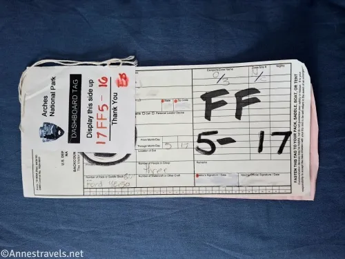
2b) For ranger-led adventures: Ranger-led Fiery Furnace tours are offered from spring through September, depending on ranger availability. The day before your adventure (or the day of), you’ll need to pick up your permit at the visitor center during regular visitor center hours. Don’t forget to give yourself enough time to pick up your permit as well as to drive up to the trailhead!
3a) For self-guided adventures: The day of your adventure, you can enter the Fiery Furnace anytime between sunrise and sunset. (If you visit during a season with timed-entry, the permit will allow you to enter the park at any time of the day on the day of your adventure without having to also purchase a timed entry permit – I did it, and it works just fine). A ranger may be stationed at the trailhead to check your permit.
3b) For ranger-led adventures: You will need to arrive 5-10 minutes before your tour time (arriving 15 minutes before the tour time is advisable – it can take 45 minutes to drive from the visitor center to the trailhead).
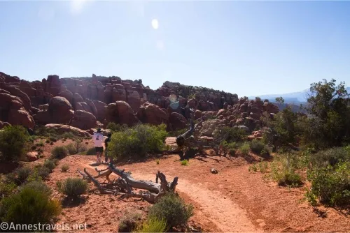
4a) For self-guided adventures: Explore to your heart’s content! Just be sure to stay in washes and on slickrock (not too difficult), and stay off sand dunes and arches. I spent all day and felt like I did a reasonable job of exploring, but I was spent – that terrain is challenging!
4b) For ranger-led adventures: Follow the ranger; the tour will take about 2 hours to cover 2 miles of very tricky terrain.
Things to think about, whether you’re exploring on your own or with a ranger:
Be sure to wear good footwear
Take plenty of water
Sun can make it into the canyons, so wear sunscreen
The canyons between the fins radiate cold in the winter and heat in the summer, so come prepared
OK, so all of the practical stuff is out of the way!
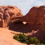
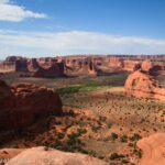
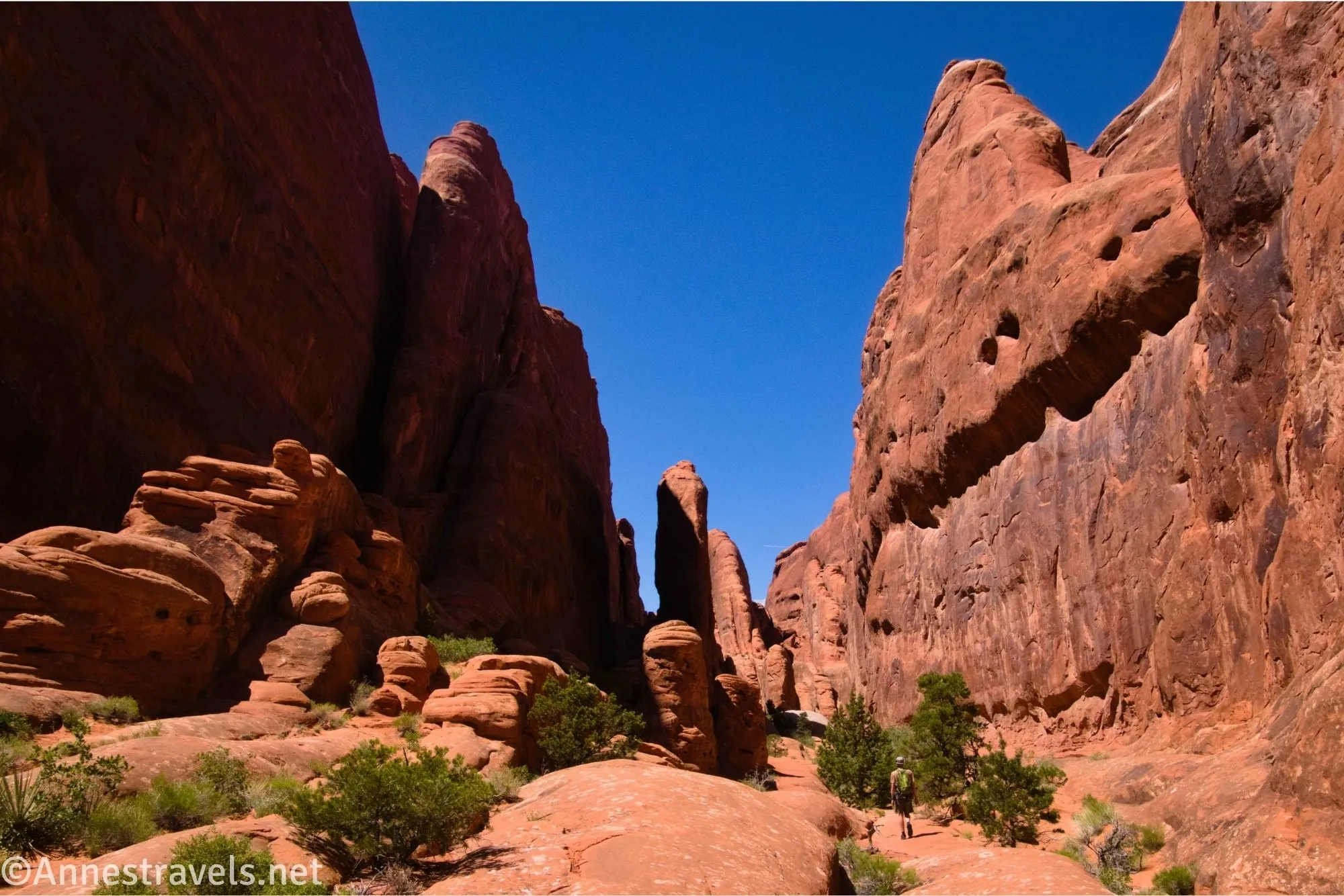
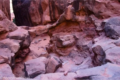
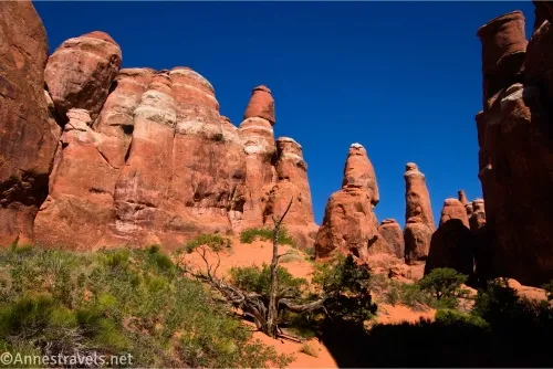
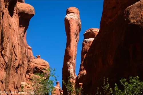
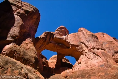
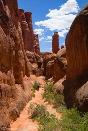
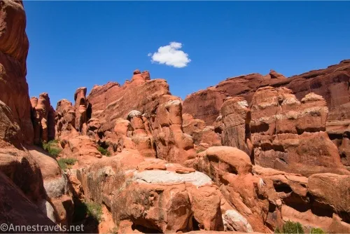
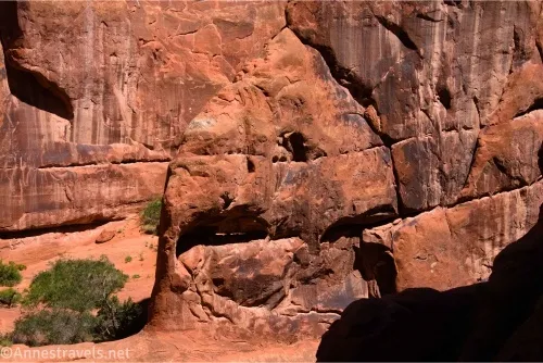
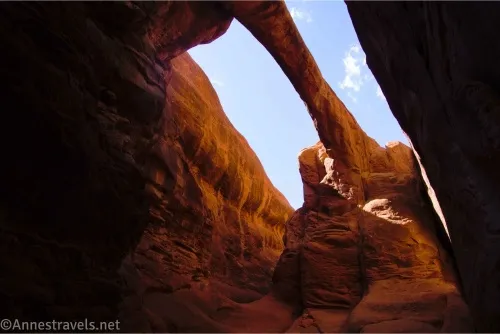
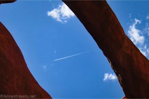
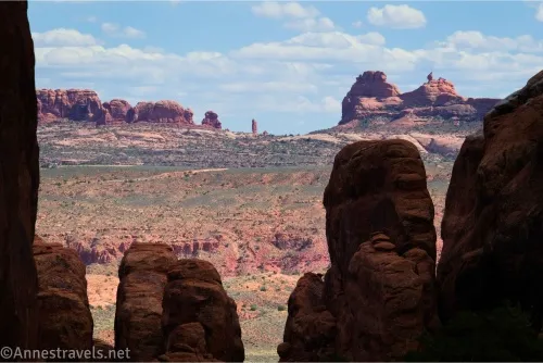
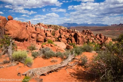
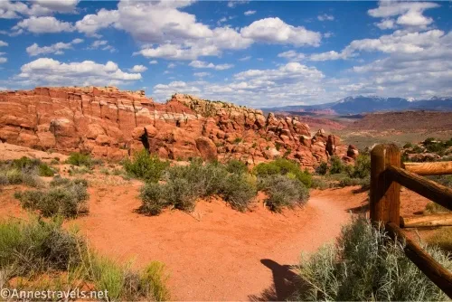
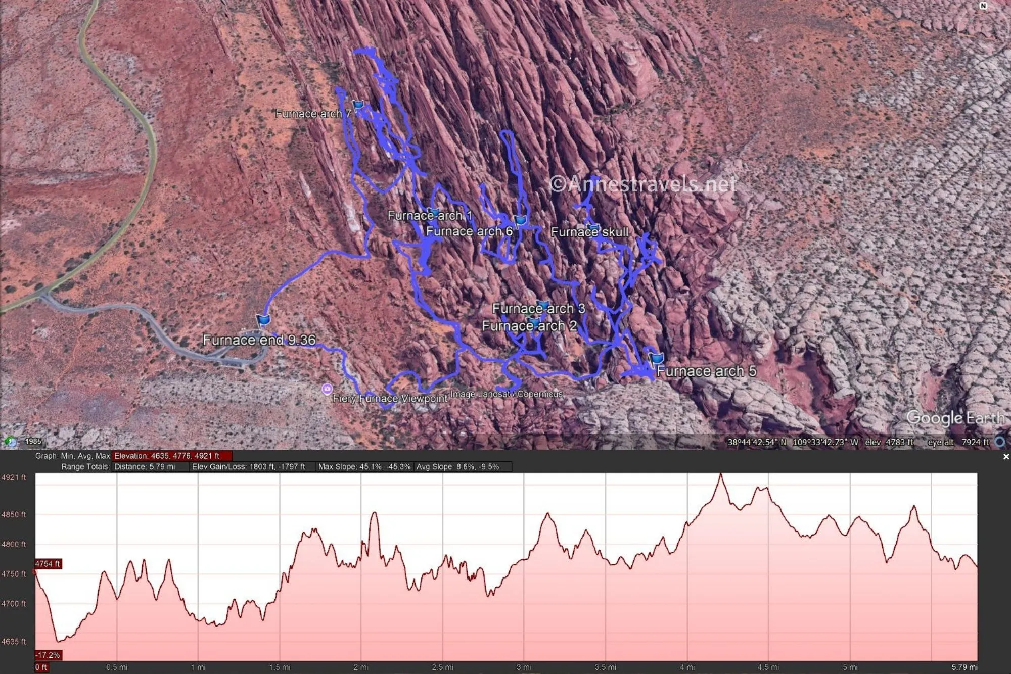
I will not give you a blow-by-blow trip through the Fiery Furnace. I don’t even claim that the GPS coordinates at the end of this post are accurate, as my GPS is amazing, but even it gets confused in narrow canyons. What I will say is this: The trail goes down into the right-hand side of the Fiery Furnace (the return trail exits through the left-hand side). The first part of the hike is not that impressive. Maybe it was just the time of day, but towering canyons didn’t really describe it, nor did amazing rock formations. It was more like a jumble of rocks. I did spot an arch fairly quickly, which turned out to be Flatiron Arch (sometimes called Flat Iron Arch).

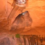
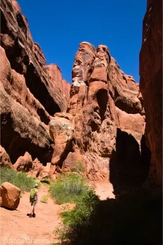
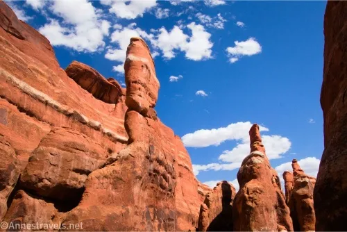
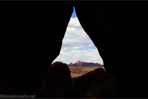
We gave up exploring pretty quickly and just followed some of the canyons. There was so much to see, especially as you got further into the Fiery Furnace! Quick tip: If you see a brown sign that says “Dead End” or something similar, definitely follow it… there’s sure to be an arch down that sidecanyon.
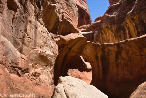
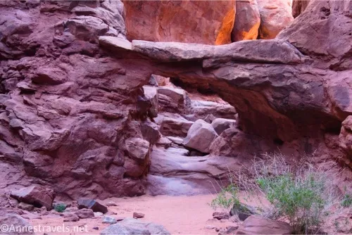
One fun thing we did was to follow the canyon (Lomatium Canyon) beyond Skull Arch (Twin Arch or Arch 4). Most people turn around at the arch, but there was an impressive dryfall at the end of the canyon. We also followed the canyon beyond Walk Through Arch and found another arch for which I haven’t been able to track down a name!
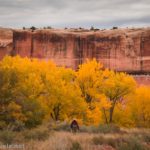
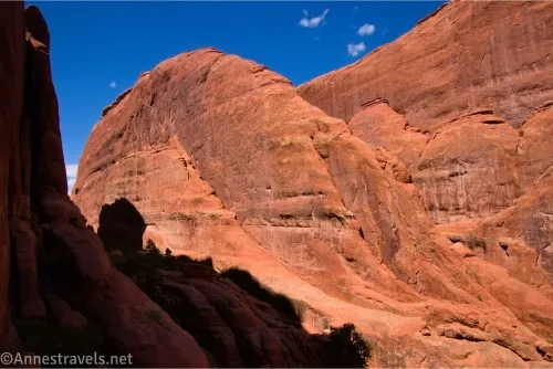
We explored from about 9am (we wanted an early start, but we needed ice for the cooler and had to make a trip out to Moab before we could begin) to about 5pm, with an hour or two off in the middle of the day, hiding in the shadow of the sandstone fins, cooling off. I found the afternoon sun to be the best for photography, at least in May. By the end of the day, we were all exhausted. Who knew that scrambling up and down slickrock slopes, searching for hidden pathways, and getting lost a dozen times over could be so tiring?
If you get super lost, there are a few tiny brown signs with white arrows. Use them as a last resort, as you’re not supposed to follow the official ranger-led hiking route (nor are you supposed to follow any other group… this is a self-guided exploration, after all). However, at least once, those signs got us out of a pickle when my group and two other groups were all turning in circles trying to figure out which way to go near Kissing Turtles Arch.
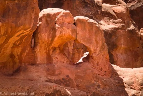
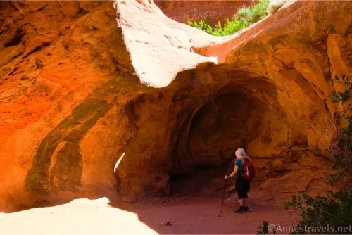
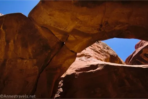
Exploring upcanyon from Kissing Turtles Arch took us to Surprise Arch. One of my group members was tired and decided not to go on that exploration, but we took one look at Surprise Arch and went running back to fetch her. It was probably my favorite arch all day!
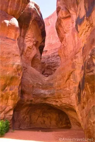
The final part of the hike is down a few narrow canyons that might as well be caves. So fun! We finally exited the labyrinth of slots, canyons, caves, and more – but what a fun day, and when we came out of the Fiery Furnace, we didn’t even smell like smoke!
Round Trip Trail Length/Elevation Gain: My GPS claims I went 5.8 miles and 1,803ft. elevation gain (4,635ft. to 4,921ft.). Meanwhile, my GPS also told me that I went 9.4 miles at the end of the day. Soooo… let’s just say that GPS units don’t work very well in the Fiery Furnace, so neither one is probably very accurate, as I’m pretty sure the track climbs the walls frequently when I stayed in the canyon bottom.
Facilities: None
Fees: $30/vehicle to enter Arches National Park, valid 7 days. America the Beautiful National Parks & Federal Public Lands Passes and Southeast Utah Parks Passes are accepted.
Trail Notes: I’ve put a lot of trail notes in this post, but the biggest one is this: If you’re going to do a self-guided exploration, be sure you’re prepared for it! Good shoes, sunscreen, and lots of water are all musts, along with a decent sense of direction, a great sense of adventure, and willingness to get lost and find yourself again. Previous experience going off-trail and exploring in the desert (especially in desert canyons) is appreciated. Don’t try this one in the summer, as it was brutally hot even in May. I spent a lot of time exploring, so your visit will likely be shorter than my 8-hour trek.
Trail 
![]()
![]()
![]()
![]()
Road
Signs ![]()
![]()
![]()
Scenery
Would I go 100 miles out of my way for this?
Overall Rating: 
![]()
GPS Coordinates for the Fiery Furnace (Accuracy Disputable)
The canyons of the Fiery Furnace make following coordinates pretty much impossible. But I’ve included the coordinates for your convenience, anyway.
TH: 38.7432120°, -109.5656810° (38°44.59272′, -109°33.94086′ / 38°44’35.5632″, -109°33’56.4516″) (4,758ft.)
Arch 1 (Flatiron Arch): 38.7452910°, -109.5632120° (38°44.71746′, -109°33.79272′ / 38°44’43.0476″, -109°33’47.5632″) (4,877ft.)
Arch 2 (Walk-through Bridge): 38.7433580°, -109.5614270° (38°44.60148′, -109°33.68562′ / 38°44’36.0888″, -109°33’41.1372″) (4,744ft.)
Arch 3 (beyond Walk-through Bridge): 38.7436740°, -109.5612600° (38°44.62044′, -109°33.67560′ / 38°44’37.2264″, -109°33’40.5360″) (4,783ft.)
Skull Arch (Arch 4/Twin Arch): 38.7449510°, -109.5603030° (38°44.69706′, -109°33.61818′ / 38°44’41.8236″, -109°33’37.0908″) (4,852ft.) (The canyon beyond Skull Arch is Lomatium Canyon)
Arch 5 (Inner Sanctum Arch): 38.7427020°, -109.5595140° (38°44.56212′, -109°33.57084′ / 38°44’33.7272″, -109°33’34.2504″) (4,788ft.)
Arch 6 (Kissing Turtles Arch): 38.7450820°, -109.5616260° (38°44.70492′, -109°33.69756′ / 38°44’42.2952″, -109°33’41.8536″) (4,783ft.)
Arch 7 (Surprise Arch): 38.7476130°, -109.5649390° (38°44.85678′, -109°33.89634′ / 38°44’51.4068″, -109°33’53.7804″) (4,874ft.)
End: 38.7432740°, -109.5658330° (38°44.59644′, -109°33.94998′ / 38°44’35.7864″, -109°33’56.9988″) (4,763ft.) (9.36)
I’ve decided not to post my GPS track for the Fiery Furnace. It’s supposed to be an exploration, not trying to follow a map on your phone. So I’ll honor that and leave the arch-finding up to you!
Getting to the Fiery Furnace Trailhead
Don’t forget to get your permit before driving to the trailhead!
From the Arches National Park Visitor Center, drive 14.0 miles on the Main Park Road. Turn right, following the sign for the Fiery Furnace (Permit Required). Park in the first lot if possible. (The turn off the Main Park Road is 2.7 miles north of the road to Delicate Arch and 2.1 miles south of the Sand Dune Arch Trailhead.)
More Hikes in Arches National Park
Arches National Park has some of the best short trails to amazing features! This book tells you about many of them. Buy your copy here.