
I’m what might be considered a newbie on the GPS scene. We got a road GPS (Garmin) a few years ago, and it certainly made our travel lives easier – set it for the destination and go – no more missing exits! However, it wasn’t good at all for hiking. Besides having almost no battery life, it didn’t show terrain or trails, which often left us more confused than helped by it. I used it a few times to take coordinates, but otherwise I used maps.
(Affiliate links are present on this page.)
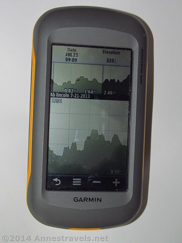
Then, about a year ago, we got a trail GPS – a Garmin Montana 600. Our goal was to get a device that would take coordinates, show trails, having tracking, etc., but that wasn’t crazy fancy or crazy expensive. (Ok, $500 ain’t cheap, but it’s also not as expensive as some models.) I used it while hiking over 200 miles last summer around the US and found it to be so incredibly useful – I wouldn’t want to go on a trip without it anymore!
Pros of the Garmin Montana 600:
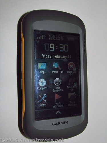
1. Nice, large (4” / 10 cm) screen that’s readable in sunlight and in dim situations.
2. Flexible battery options – both a rechargeable lithium battery or AA batteries can be used. I like this because if the lithium runs out while I’m hiking, I can just stick three extra camera batteries in and I’m good to go. (A single charge of the lithium battery lasts about 3 times longer than the AA batteries, by the way – on an all-day hike, a good set of rechargeable AA batteries may need to be replaced after 8 or 10 hours of use, while I can usually use the fully-charged lithium batteries for 3 or 4 days of hiking before having to recharge.)
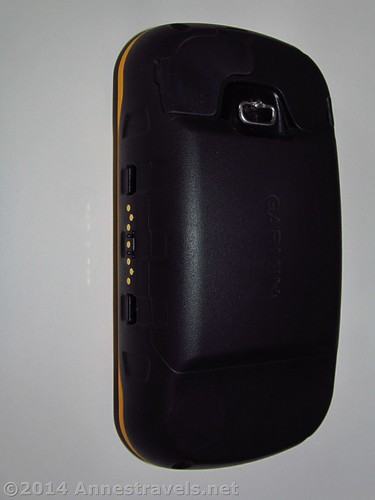
3. Flexible recharging options. The lithium battery can be recharged via a USB connection or a wall socket. (Note that the wall socket is faster – but USB may be faster than the power inverter that plugs into the cigarette lighter in your vehicle. Source: My experience.)
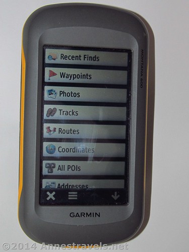
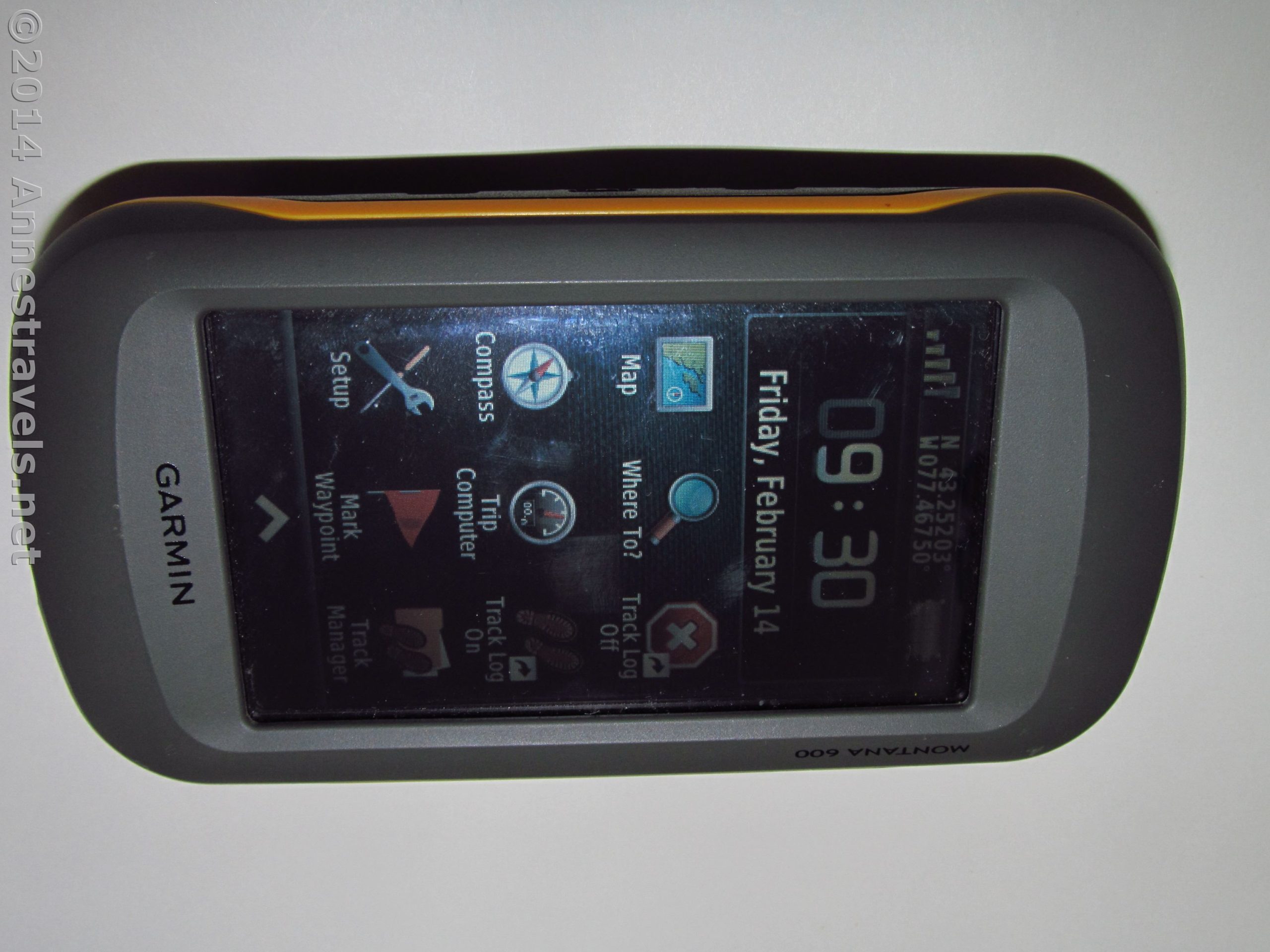
4. Customizable “home screen” – you can put what you use most where you can find it easily.
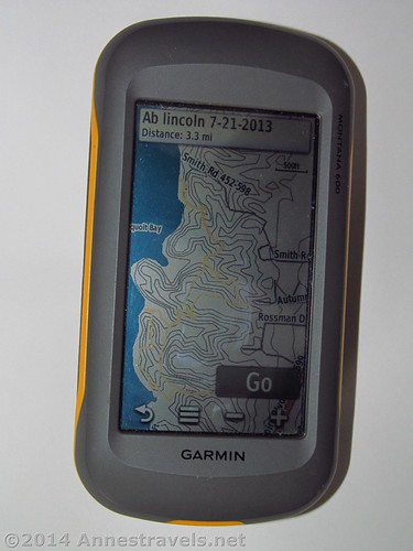
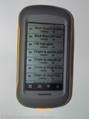
5. Tons of features on the device. Like, tracking with various track color options, a compass, waypoints (both you can record a waypoint and you can say, “take me to this waypoint”), elevation plot options, a route planner, wireless sharing opportunities, boating features (such as proximity alarms, a man-overboard option to help you navigate back to where you lost your passenger, and the “best” times to hunt and fish), a calculator, sun and moon/ sunrise sunset features, a stopwatch, an alarm clock, an area calculation feature, a calendar, unit options (feet and Fahrenheit vs. meters and Celsius, for example), position format options (0000.00000 vs. 0000°00.000’ vs. 000°00’00.0” as well as many national grids, including (but by no means limited to) the Austrian grid, British grid, and German grid), an altimeter, geocaching assistance (for example, a chirp when you’re near one), ANT paring options…and so on. I think that’s most of the main features.
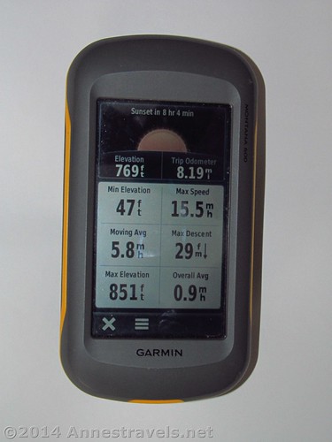
6. Many options for customizing your user experience. For example, in my map, I like to have things like my speed, compass heading, and elevation showing, rather than things like time of day or hours until sunset. The trip computer is great with customization as well; it’s so nice that, at a tap on the touchscreen, I can view my min elevation, max elevation, current elevation, max speed, average speed…and so on. This view is customizable, so you can get various other options at a tap of the screen.
7. So far it’s durable, reliable, etc. It’s lasted three trips very, very well, and although I took some care, I wasn’t exactly giving it red-carpet treatment. Supposedly, the device is waterproof, which I haven’t tested, but it’s nice to know when I’m out in the rain.
8. Generally it has excellent reception. The only caveat to this was that when I’ve explored narrow canyons I’ve had some issues (like, walking under ledges in Coyote Gulch or in the Dry Fork Slots – I had no trouble at all in the Grand Canyon). The problems were mostly in the track being a bit funky – the coordinates were still ok.
9. Easy to add new maps and custom maps from a computer. Plug it in, start up the software (with some wifi available) and you can add maps. I’ve actually done this on the road at one point because we ended up in a different place than I’d originally planned.
Cons of the Garmin Montana 600:
1. Size. This is probably the second biggest issue I have with the GPS. It’s a whopping 5.5” x 3” x 1.5” (14 x 7.5 x 3.8 cm)– that’s larger than my largish point-and-shoot camera!
2. With size comes weight. I had to get a new bag to carry both my camera and the GPS and the strap – while fine for a camera – was never made for quite that much weight. I’m working on finding a way to make the strap a bit wider to spread out the weight.
3. The absolute biggest problem I’ve had with the Garmin Montana 600 is with the touch screen being “touched” while in my camera bag (in a different pocket than the camera). Several times early on, I’d pull the GPS out halfway through a hike and realize the tracking had been turned off a mile or more earlier. So now I always leave it in my bag in the picture viewer mode – I figure the worst that can happen is that the pictures of Garmin headquarters can be deleted…!
4. The lithium battery takes a while (at least a couple hours) to charge from 0% to 100%. It’s not a huge issue, but be aware.
5. No picture taking capabilities. Of course, if this was really important to me, I’d have gotten a different device 🙂 That said, there’s a picture viewer, which I’m really not sure why it was included…
Overall, I like the Garmin 600 very much; I just wish it was a bit lighter and maybe a hair smaller (though there’s a lot to be said for a 4” (10 cm) screen). It has done me very well so far, and I hope to use it for several more years and report that Garmin has a very quality product!
Quality 
Ease-of-use ![]()
![]()
Usefulness
Customizable
Worth the Price ![]()
Overall Rating: 
Buy the Garmin Montana 600 GPS Here!
More Related Posts:
 Gear Review: Coleman Sportster Dual Fuel One-burner Campstove
 Book Review: John Fielder’s Best of Colorado
 Gear Review: Nalgene HDPE Water Bottle
 Kayak Review: Lifetime Lancer 100, Sundolphin Aruba 10, L.L. Bean Manatee 100
 Kayak Review: Lifetime Lancer vs. Lifetime Zenith
 Gear Review – Garmin GPSMAP 67i Hiking GPS
One response to “Gear Review: Garmin Montana 600 Hiking GPS”
[…] 5. GPS. Beyond liking to get all the data for blog posts, it’s a safety measure…Take me back to the parking area! (For a review of my GPS, click here.) […]