
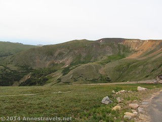
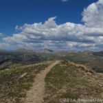
How about a short hike this week with an awesome view? Sound good to you? Because the trail up Huffers Hill (as it is informally known) is only 0.5 miles (0.8 km) RT yet offers outstanding views of the Never Summer Range and good views of some of the peaks in the Mummy Range, as well. The trailhead is also accessible: the trail leaves from the parking lot of the Alpine Visitor Center in Rocky Mountain National Park. No dirt roads, no difficult trails – just the paved and famed Trail Ridge Road and a multitude of steps to the top of the peak. If you just want to stretch your legs, or you want good views but aren’t used the peak’s 12,020ft. (3,665 m) altitude, what could be better?
Quick Stats
(Affiliate links are present on this page.)
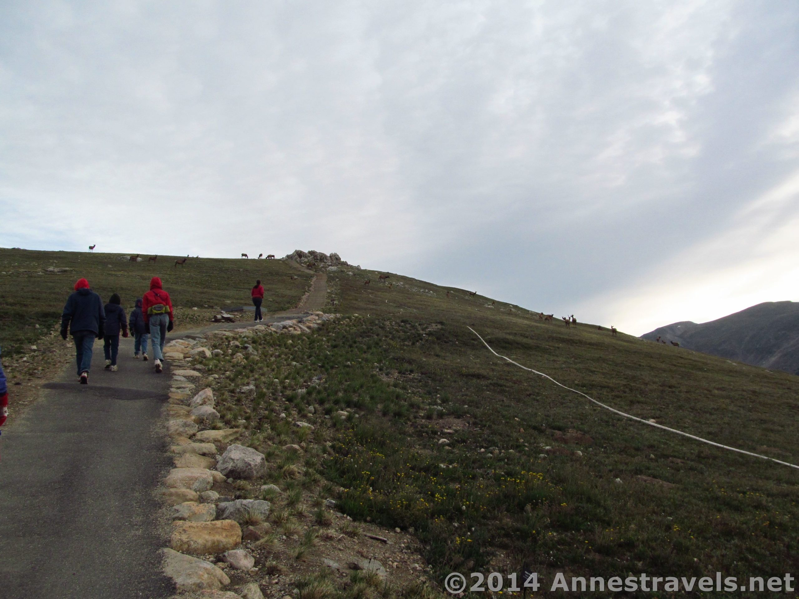
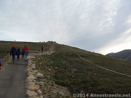
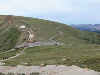
The trail begins on the far side of the parking area from the Alpine Visitor Center, to the right of the primitive restrooms and to the left of the Fall River Road. It immediately begins climbing via a set of steps, and it doesn’t stop climbing the entire way up the peak. FYI, the trail is known as the “Alpine Ridge Trail”, but as no signs mark the trail, you wouldn’t know that unless you read the park newspaper and have some pretty good intuition. Anyway, to make a short trail stay short, the steps continue to climb…and climb…and climb…
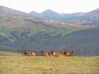
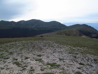
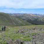
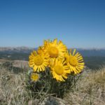
We visited very early in the morning (hoping to catch some sunrays on a day that was supposed to be cloudy – it somewhat worked, too) and there were massive elk herds along the trail. None were close enough to be dangerous, but it was still an interesting thing to watch while catching our breath, and we had to “chase” a heard or two off the trail (they moved away as we came closer). (Us lowlanders take some time to get used the elevation, I think!) Because we were so early, we were also the only ones on the trail…something you won’t find the rest of the day, as the trail is very popular with drivers of the Trail Ridge Road.
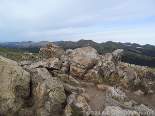
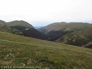
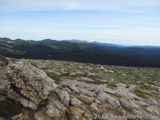
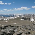
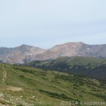
At the top we had a little bit of a disappointment. The sign stating the elevation and that we were “higher than Oregon’s famed Mt. Hood” had been removed. I suppose we hadn’t been up the peak (due to trail construction, etc.) in about 15 years, but we had this dream of reenacting a photo next to the sign. Still, the view was worth the climb, even if the pictures had to be limited to us and the view. The Trail Ridge Road, Fall River Road, Never Summer Range, Mummy Range, Sundance Mountain, and more were easy to see and enjoy. Actually, if you’re planning on hiking or have hiked the Mount Chapin, Mount Chiquita, and Ypsilon Loop Trail, this is a good place to look at the route…those mountains are front-and-center from Huffers Hill!
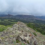
We descended to find that the second set of hikers were just beginning up the trail. It was getting cloudy by this point, so we decided we’d do a short walk on the Ute Trail West before heading out of the park…but heading out didn’t quite work either, since we ended up meeting some volunteers on the trail who insisted we’d enjoy Never Summer Ranch (Holzwarth Historic Site), which we did and enjoyed immensely!
Round Trip Trail Length: 0.5 miles (0.8 km)
Starting Elevation: 11,601ft. (3,535 m)
Ending Elevation: 12,023ft. (3,664 m)
Net Elevation Gain: 422ft. (128 m)
Facilities: Restrooms, snack shop, visitor services, etc. at the Alpine Visitor Center
Fees: $20 fee to enter Rocky Mountain National Park, valid 7 consecutive days. America the Beautiful (Interagency), Senior (Golden Age), Access (Golden Access), Volunteer, Military, and Rocky Mountain Annual Passes also accepted.
Trail 
![]()
Road ![]()
Signs ![]()
![]()
![]()
![]()
Scenery
Would I go 100 miles out of my way for this? ![]()
Overall Rating: 
![]()
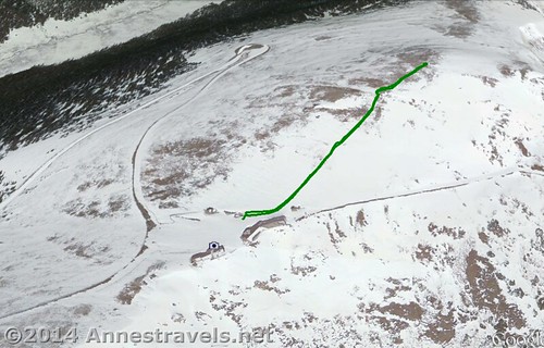
Key GPS Coordinates for the Alpine Ridge Trail (Alpine Visitor Center)
Trail beginning: 40.44150N / -105.75417W (40° 26′ 29.3994″ / -105° 45′ 15.012″) (11,601ft.; 3,535 m)
Trail summit: 40.44463N / -105.75017W (40° 26′ 40.6674″ / -105° 45′ 0.6114″) (12,023ft.; 3,664 m)
The gpx file for the Alpine Ridge Trail / Huffers Hill can be downloaded – please note that this and the GPS Coordinates are for reference only and should not be used as a sole resource when hiking this trail.
Download File size: 16.2 KB Downloaded 588 times
(Note: I do my best to ensure that all downloads, the webpage, etc. are virus-free and accurate; however, I cannot be held responsible for any damage that might result, including but not limited to loss of data, damages to hardware, harm to users, from use of files, information, etc. from this website. Thanks!)
Getting to the Huffers Hill / Alpine Ridge Trail Parking Area
From the Beaver Meadows Entrance Station (the main entrance on the East (Estes Park) Side of Rocky Mountain National Park), continue straight on US 36 and US-34 (Trail Ridge Road) for 20.1 miles to the Alpine Meadows Visitor Center, on right. Park in the Alpine Meadows Visitor Center Parking Area. The visitor center is also 9 miles beyond Rainbow Curve.
From the Grand Lake Entrance Station (West Side entrance to Rocky Mountain National Park), drive 20.2 miles on US-34 (Trail Ridge Road) to the Alpine Visitor Center, on the left side of the road. Park in the Alpine Visitor Center Parking Area.
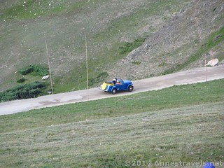
Note that the Alpine Visitor Center parking area fills up quickly, especially on summer weekends. When we first arrived, probably about 6am, the parking area was empty. By the time we left around 10am we were giving our spot to someone else, and it would only get worse as the day went on. And this was a Wednesday! The good news is that people leave fairly often, so keep driving in circles and a spot should open up.
Zoom map out to browse nearby hikes & places of interest
This Week’s Featured Product!
Looking for more hikes in Rocky Mountain National Park? This guide is popular with hikers, especially those who want to expand their hiking beyond the national park trail guides. Both newcomers and those who hike often in the park find it useful in planning and hiking the trails.
One response to “The Alpine Ridge Trail: Topping Huffers Hill!”
[…] Huffers Hill (Alpine Ridge Trail), Rocky Mountain National Park, Colorado. While we’re on the topic of breathtaking trails, it wouldn’t do to leave out the Alpine Ridge Trail, which begins at well over 11,000ft. above sea level and tops out, 400ft. of elevation later, at over 12,000ft. above sea level. Four Hundred Feet in a quarter mile would be breath-intensive at any elevation, but this high…well…take your time! The view over the Never Summer Range and Mummy Range make the 0.5 mile (RT) trail worth the trek! […]