

Hiking to UN 12812 just above Independence Pass was a life saver. Well, ok, that’s too strong, but it did meet a need rather nicely – and spectacularly. I needed a short hike near Independence Pass – and one above 12,000ft – that had nice views. The next day we planned to hike Mount Elbert, and we wanted to stay in shape while not wasting a day. Free Wi-Fi to the rescue! On Summit Post I read about a guy who climbed UN 12812 – and it (and the pictures) sounded good to me. He also climbed over to “Igloo Peak” (UN 13060) and said he’d have liked to continue along the ridge to UN 13198, but we didn’t want to go that far due to not wanting to wear ourselves out just before Mt. Elbert. (I’m planning on returning someday to hike those other two peaks, too!) To UN 12812 was only 1.9 miles (3 km), and the views are stunning the entire way, which makes the hike very worth doing!
Quick Stats
(Affiliate links are present on this page.)
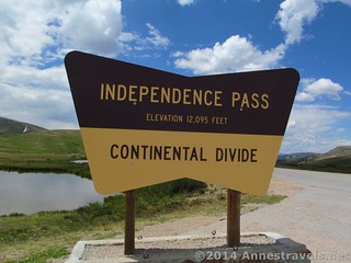
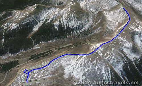
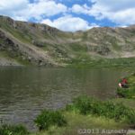
We arrived at Independence pass early in the morning – in fact, early enough to secure a parking space with no trouble at all. (During the summer, the pass is very busy, so parking can be an issue. People leave fairly often, though, so just wait a minute and take a space when someone leaves.) The paved path left the parking area between improvised railings; nothing that would stop you from climbing over, but certainly enough to keep pedestrians on the trail. We walked along the paved path for about 0.1 miles (0.l km) just to the end of the railings. Then we turned off the pavement onto a well-worn (if unmarked) trail on the right that seemed to ascend the mountains in the not-so-distant distance.
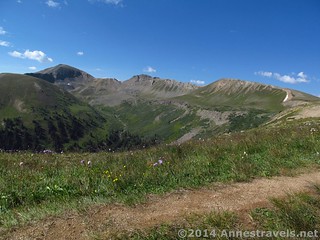
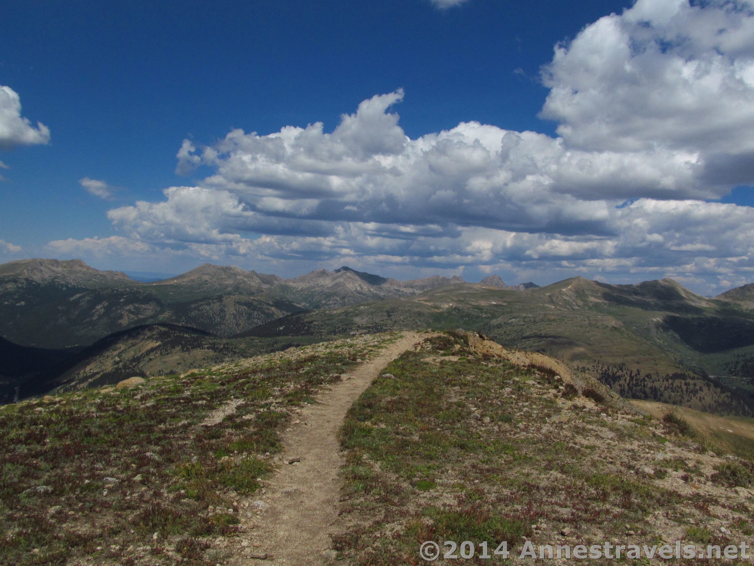
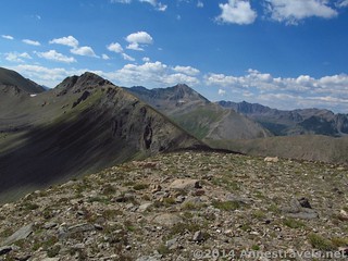
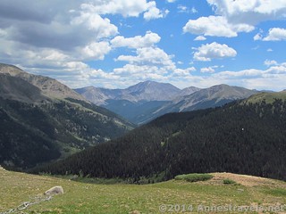
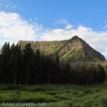
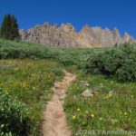
The trail appeared to be an old road, rising gently but steadily at first across the tundra toward a ridge of mountains. UN 12812 is on the right, then “Igloo Peak” (an unofficial name) to the left of UN 12812, then UN 13198 to the left of Igloo Peak. The picturesque valley below is Mountain Boy Park – which seemed like an amusing name to me, but memorable. Behind you, La Plata Peak raises its large bulk down the valley we’d driven up from Twin Lakes to the pass. There are many, many mountains in this area – the majority are over 13,000ft. (4,000 m)– so if you like identifying mountains you might want to bring along a good topo map.
After passing by some old windbreaks (or something like that), the trail begins to ascend in earnest. The trail also becomes rockier, but it’s still a fairly good trail. The last mile (2 km) is especially steep. Take it slow; the entire hike is over 12,000ft. (3,600 m) and it’s no shame to be out of breath at that height!
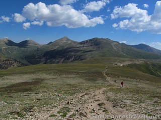
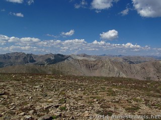
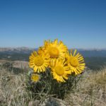
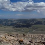
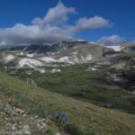
Then, quite a bit faster than I would have guessed, we summited UN 12812. This is just a somewhat level area of tundra before the “trail” (which immediately becomes vaguer) descends over the other side down toward the saddle between UN 12812 and Igloo Peak. The views are stunning, even in August when the snow didn’t cling to the surrounding mountains as much as it would slightly earlier in the season. You are literally surrounded by mountains, most towering over you, but you still feel like you’re on top of the world. I think I counted 7 14ers and at least 25 13ers (not to mention all the peaks that don’t even have unofficial names!)
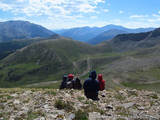
We would have loved to go further – maybe over to Igloo Peak or even to UN 13198 – but Mount Elbert was calling (ok, we knew better than to wear ourselves out too much!) and some members of the group weren’t feeling very well that day, so we decided to return the way we’d come. Just for fun, after returning to the paved path, we turned right (away from the parking lot) to join the hordes of sightseers at the viewpoint at the end of the paved path. And, what do you know, but the view was pretty good from there, too!
Round Trip Trail Length: 4.1 miles (6.5 km)
Starting Elevation: 12,106 ft. (3,690 m)
Ending Elevation: 12,812 ft. (3,905 m)
Net Elevation Gain: 706 ft. (215 m)
Facilities: Primitive restrooms at the parking area (be ready for a long line in the summer)
Fees: None
Trail 
![]()
![]()
Road ![]()
Signs ![]()
![]()
![]()
Scenery
Would I go 100 miles out of my way for this?
Overall Rating: ![]()
Key GPS Coordinates for UN12812
Independence Pass Parking: 39.10818N / -106.56417W (39° 6′ 29.4474″ / -106° 33′ 51.012″) (11,938ft.; 3,638 m)
Independence Pass Trailhead: 39.10822N / -106.56416W (39° 6′ 29.592″ / -106° 33′ 50.976″) (12,106 ft.; 3,690 m)
Leave the Trail: 39.10703N / -106.56404W (39° 6′ 25.308″ / -106° 33′ 50.544″) (12,124ft.; 3,695 m)
UN 12812: 39.09234N / -106.58604W (39° 5′ 32.424″ / -106° 35′ 9.7434″) (12,812 ft.; 3,905 m)
Viewpoint at the end of the paved path: 39.10616N / -106.56328W (39° 6′ 22.176″ / -106° 33′ 47.808″) (12,132ft.; 3,697 m)
The gpx file for climbing up UN 12812 can be downloaded – please note that this and the GPS Coordinates are for reference only and should not be used as a sole resource when hiking this trail.
Download File size: 71.8 KB Downloaded 420 times
(Note: I do my best to ensure that all downloads, the webpage, etc. are virus-free and accurate; however, I cannot be held responsible for any damage that might result, including but not limited to loss of data, damages to hardware, harm to users, from use of files, information, etc. from this website. Thanks!)
Getting to Independence Pass (Parking Area for UN 12812)
From Aspen, CO, drive 19 miles (30.5 km) east on CO-82 E to the top of Independence Pass – this is a fairly pretty drive, though not as much as I was expecting. Park in the parking area near the national forest sign indicating the pass on the right side of the road.
Alternatively, from US-24 south of Leadville, turn onto CO-82 W. (CO-82 is about 15 miles (24 km) south of Leadville and 20 miles (32 km) north of Buena Vista. Gas up in either of these towns, because there’s nothing between them and Independence Pass.) Drive 23.5 miles (37.8 km) to the top of Independence Pass and park in the parking area near the national forest sign indicating the pass on the left side of the road. This is a very pretty drive, as CO-82 in this section is winding through the tall peaks of the region. Even US-24 is nice, since there are multitudes of 14ers just far enough away from the highway to be really stunning!
Zoom map out to browse nearby hikes & places of interest
This Week’s Featured Product!
If you love the 14ers, or at least would like to hike a few, this is the cream-of-the-crop when it comes to books detailing the hikes / climbs to the highest peaks in Colorado, as well as trailhead information, GPS coordinates, and topo maps – all recently updated and republished.
2 responses to “A Hike from Independence Pass to UN 12812 – Spectacular!”
[…] for our coats on UN12812…we were in short sleeves in the parking area at Independence […]
[…] Guy has a lot of interesting hikes, including the social trail up Point 12812 at Independence […]