
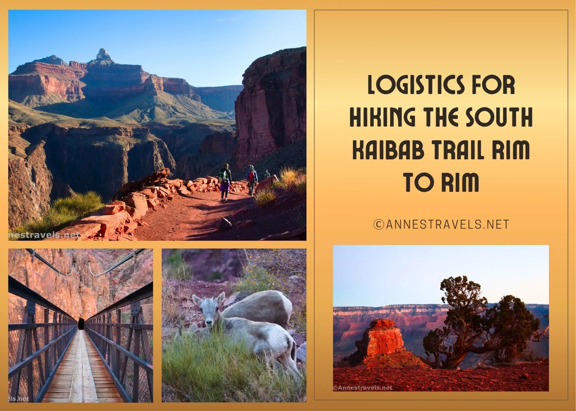
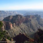
They say not to hike the South Kaibab Trail rim to river to rim in a day. And having done it, I’d say they’re wise to advise against it. But since some of us are in excellent physical condition, very good at our hydration/food intake management, and possibly just slightly crazy, I’d like to make a post about the logistics for hiking the South Kaibab Trail rim to river to rim in a day.
This page may include affiliate links – there will never be an extra cost to you for clicking the links.
Before we begin, this is not legal advice. In fact, it’s not advice at all. It’s simply what worked for me. I hope you can take these ideas and adapt them to your own style. If you want to read about my hike on the South Kaibab Trail, click here since I’m not going to talk about mileage, etc., in this post.
Before Hiking the South Kaibab Trail
My biggest mistake was not deciding to hike the South Kaibab Trail until about 2 months prior to our hike. That’s not really quite enough time to train. Thankfully, I’d already hiked 250 miles in the Mountain West the month before I decided to hike the trail, so I was in great shape. Not all of my group had been able to go on that trip, and one of them was starting from scratch when me made our decision to visit Grand Canyon National Park. We spent many a lovely autumn evening together, running up and down hills in a local park. Then, I took her (and the guys) out to Death Valley for a couple of days of conditioning on rugged terrain.
I chose the week of Thanksgiving for my hike. From a weather perspective, this was just about perfect (a little earlier/warmer wouldn’t have hurt anything, though). However, Thanksgiving week in Grand Canyon is totally overrun – you can’t even get on the shuttles, they’re so full, and parking is pretty full, as well. So the first 2-3 weeks of November would be better timing, though April and mid-October through the first week of December would probably work just fine.
We stopped at Walmart on our way through Las Vegas (remember, we were driving between Death Valley and Grand Canyon) and picked up sandwich fixin’s – French bread, deli ham, and pre-sliced cheese (we already had mayo and mustard in the cooler) for our breakfast. We all wanted a good, filling breakfast, but we also didn’t want to take the time to make (and chew) oatmeal. My one group member who can’t eat bread in the morning (gluten intolerance and struggles with anything bread-like for breakfast) fixed herself a small bowl of cold cereal and ate it while we drove from our campsite to the trailhead.
We made our sandwiches the night before – actually, we each made two sandwiches: one for breakfast while we drove to the trailhead, and the second for another breakfast partway down the trail. We’re crazy about not getting food poisoning, so we weren’t going to let those meyo sandwiches see a ray of sun (yes, my grandmother was a microbiologist). The temperatures were well below freezing that night, so instead of putting the sandwiches in our overloaded cooler overnight, we stuck them in the windshield of the van. I’m pretty sure mine had ice crystals on it when I bit into it for my first breakfast!
In our older age, we’ve finally come to figure out what snacks work for us. I packed tuna packets, pulled pork packets (Walmart – actually quite tasty), tortillas, Cheeze-itz, breadsticks and cheese, Welch’s fruit snacks, cheese-filled crackers, mozzarella sticks, and probably one or two other things that I’m not remembering while I’m typing this. The rest of my group had similar items, but they also brought peanut butter filled crackers, chocolate filled nekot cracker/cookies (Lance’s), Bobo bites (gluten-free), and lots of protein bars (Nature Valley). As you can see, none of us are much on sweet snacks while hiking, so we didn’t bring the Swedish fish and candy bars that keep my friends motivated on the trip back to the top.
We also packed our backpacks the night before. Snacks, headlamps, fresh batteries, and lots of water were all must-haves, along with our phones, cameras, and my GPS.
I can’t say exactly how much water we brought with us, but I know I brought two 32oz. bottles, plus I think I stuck in one or two 16oz. bottles for a total of around 80-96oz of water. I’d have wanted more water in warm weather, though I also carried some of it back to the top because we found a potable water spigot at the bottom of the canyon.
We camped just outside Grand Canyon National Park in the national forest. It would have been even better to stay in the campground if possible.
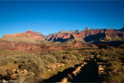
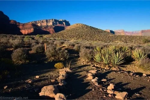
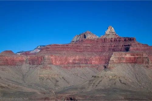
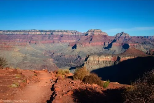
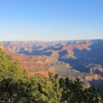
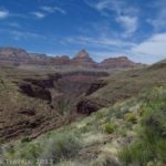
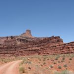
Hiking the South Kaibab Trail
We decided to start about an hour or an hour and a half before sunrise. Days are so short in November that we expected to be hiking down and up in the dark. Headlamps were an absolute must; everyone had their own. I like this one because I can replace the batteries without recharging, but some of my group like the extra functions of this one.
The problem with starting this early was that the shuttles don’t run at such an unearthly hour and you’re not allowed to park at the trailhead in a private vehicle (or even drive there to drop off passengers). We ended up parking in a nearby picnic area (I don’t recommend this, as it’s not really big enough for picnickers, let alone hikers, too) while our driver hiked with us to the trailhead (the access road is exceedingly quiet at 4:30am). When we started hiking, we could have parked along the side of the main road near the access road. Apparently, the park service got wise to us (and everyone else that was doing the same thing), as “no parking” signs appeared sometime before we came back that evening. Oh well. There are a few small pulloffs for overlooks, but this will add considerably to your mileage. In general, unless you don’t mind a bit of extra mileage, you’ll need to take the shuttle.
All of us wore multiple layers. It was very cold when we started, so that included hats, mittens or gloves, ear muffs, winter jackets, lighter-weight jackets (at least two), and either pants or leggings as well as our regular hiking pants/leggings and SPF shirts. We were worried that we might need them all again if we weren’t up to the rim before the sun went down.
I used hiking poles and was very glad for them, especially on the way down. In fact, the only muscles that were stiff the next day were the insides of my elbows – they simply weren’t used to using hiking poles!
We stopped every couple of miles (about every viewpoint or trail junction) to let everyone catch up. If someone was struggling, we wanted to know it. It was common that we’d eat something every 2-4 miles.
We essentially ate two breakfasts (sandwiches), then we ate two lunches later in the day. (“Lunch” in this case was tuna, chicken, or pulled pork on tortillas.) Got to keep that protein up on a hike like this!
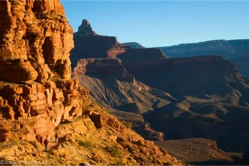
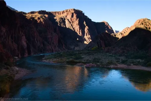
We figured we’d make time when we could, which meant on the downhill portion of the hike. Despite our thoughts of possibly not making it all the way to the bottom due to limited time/daylight, we managed to arrive at the river about 8am. I confess to very nearly running on a few sections (those hiking poles were a great asset!)
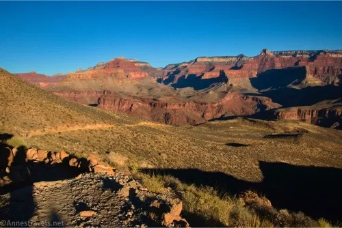
There were four times when we took long breaks: 1) at O’Neill for sunrise/second breakfast, 2) at a picnic table below Phantom Ranch for our first lunch, 3) at the Tipoff lightning shelter… we needed a rest after climbing out of the Inner Canyon, and 4) at O’Neill Butte for our second lunch. By then, we knew we were making good time, so while we certainly didn’t dally, we weren’t in quite as much of a hurry.
Our timings went something like this:
4:30am – Leave the van
4:51am – South Kaibab Trailhead
5:23am – Ooh Aah Point
5:49am – Cedar Ridge
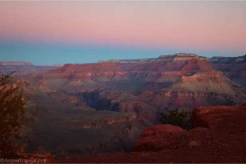
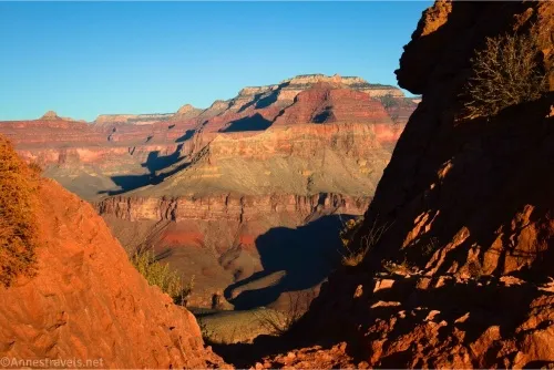
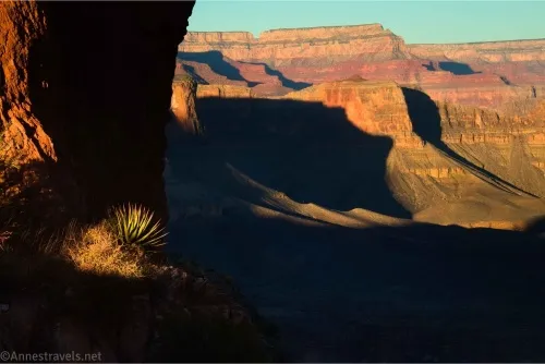
6:23am – O’Neill Butte for sunrise
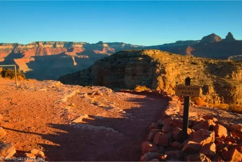
6:45am – Skeleton Point
7:28am – Tipoff/Tonto Trail
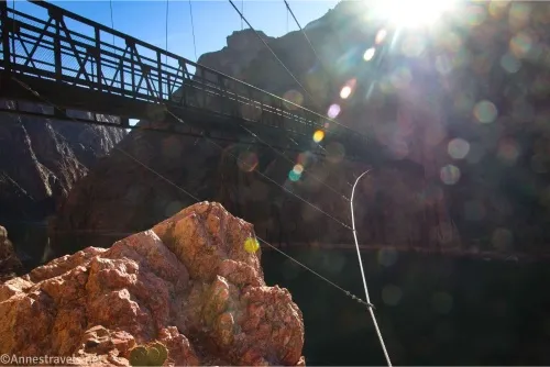
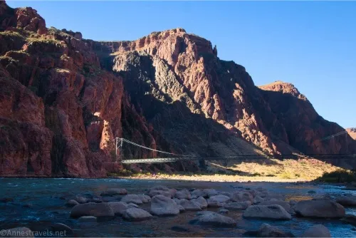
8:39am – Black Bridge over the Colorado River
We spent a fair amount of time at the bottom and didn’t really start back up until about 1:04pm.
5:44pm – South Kaibab Trailhead
I have no expectations that you’ll be able to do that; we made excellent time, and I was super proud of my group for how they pumped out those miles!
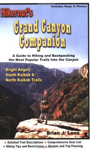
And if you really want the load down on the South Kaibab Trail…
This guide covers the most popular rim-to-rim trails in Grand Canyon with trail descriptions, gear lists, hiking tips, regulations, permits, trip planning, and much more. Buy your copy here.

Pingback: The South Kaibab Trail – Anne's Travels