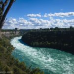
When I was in Massachusetts a few weeks ago, we spent an evening in Plymouth. The town is fairly commercialized, but I still found green spaces to wander. Actually, we started the evening with seafood platters at Wood’s Seafood (according to my friends who have lived in MA for many years, it’s the best, and I have to agree – the two times I’ve eaten there, the food has been amazing!) After stuffing ourselves with haddock, shrimp, and clams with the belly (it’s a New England thing), we set off to wander the waterfront.
Quick Stats
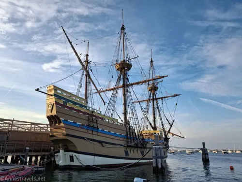
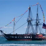
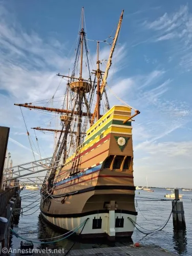
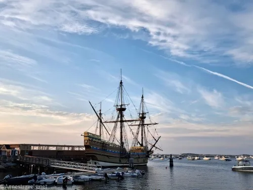
Our first stop was at a dock beside the Mayflower II (after a very nice walk along the waterfront – there is a good sidewalk). I’ve toured it a couple of times before, so we contented ourselves with enjoying the sunset beyond the rigging (not to mention tours close at 5pm and we were well into the evening).
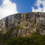
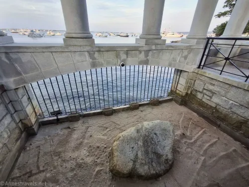
From there, we wandered over to the massive temple surrounding the Plymouth Pebble… er, I meant Plymouth Rock. (It’s a New England thing…) The rock was once much larger, but it broke when they moved it from in front of the town hall back down to the waterfront.
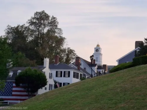
Beyond the temple, the sunset was nice beyond the town as we walked beyond the William Bradford Statue.
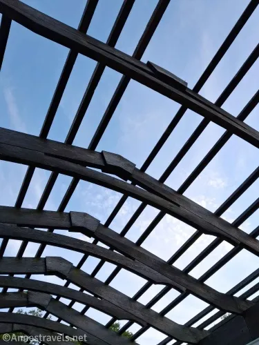
Then we crossed the road, walked under a kind of arbor…
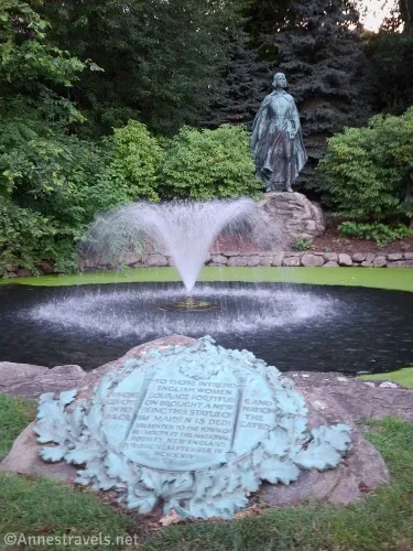
…past the Plymouth Immigrant Memorial and ended up at the Pilgrim Maiden Statue with its lovely fountain. However, I give the plaque designer a D in terms of the design… the words run over both sides of the plaque, and it’s almost impossible to read in order. (I don’t think it’s a New England thing!)
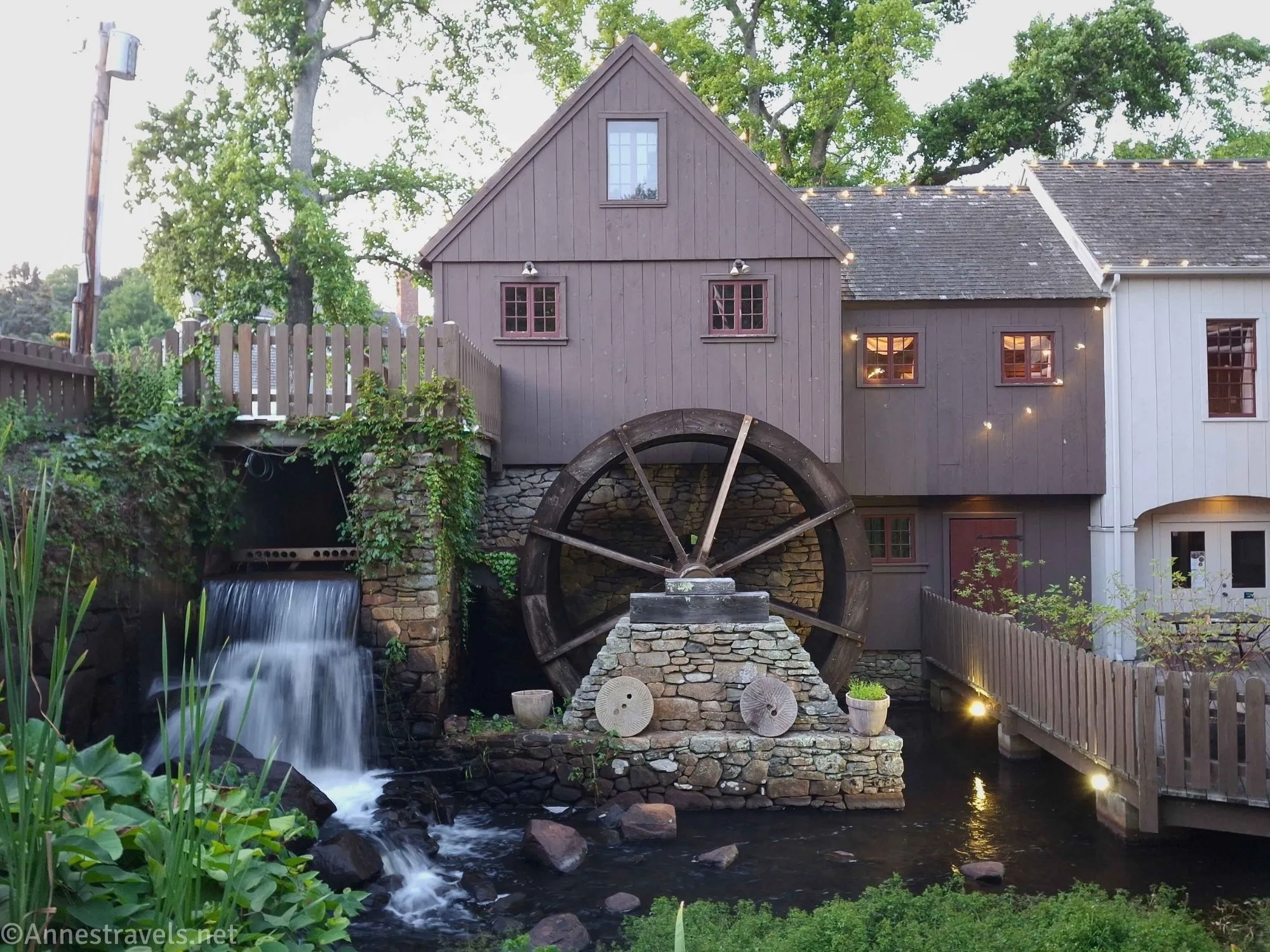
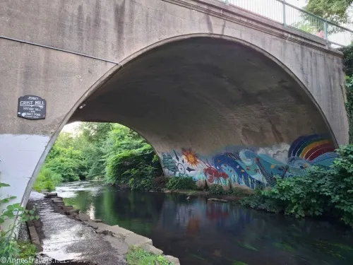
We were having fun and the evening was lovely, so we crossed the bridge and turned right to walk uphill following the sign for the Jenny Grist Mill (also known as the Plimoth Grist Mill – no, I didn’t misspell that). The path passes beneath two streets via a couple of tunnels. One had a nice mural on the other side of Town Brook.
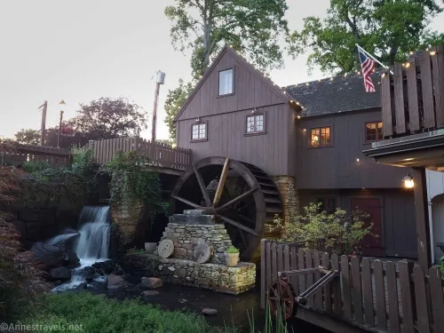
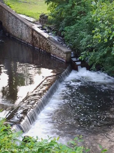
Almost at the top of the hill, the path passes the back side of the Jenny Grist Mill (which as far as I can tell is mostly a restaurant, though it seems to give tours as part of historic Plymouth tours). A viewing area had good views of the end of the flume and another small waterfall.
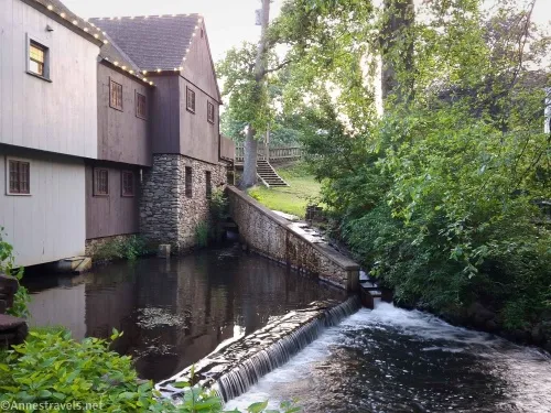
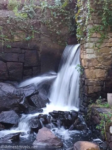
Most of my group headed back at this point, but I wanted to run around the front of the mill and grab a couple of pictures. Well, half the group followed me, so we had a grand time seeing the water wheel (it wasn’t working), looking at the waterfall and the reeds, and working the pump handle to make the mini water wheel spin.
By then we knew we were late, so we raced (not too fast!) back down the hill in the gathering dusk to catch up with the rest of the group!

Round Trip Trail Length: I went about 2.2 miles
Elevation Gain: 298ft. (I expect it’s about half that) (10ft. to 26ft.)
Facilities: There are restrooms, restaurants, and much more along the route
Fees: Parking fee
Trail Notes: The walk is entirely on pavement (sidewalks). The walk along the ocean is nice and flat, a small incline to the Pilgrim Maiden Statue, and then quite a hill up to Jenny Grist Mill. Because the mill was built by the pilgrims, tours are offered; they cost upward of $14 per person.
Trail 
Road ![]()
Signs ![]()
Scenery ![]()
![]()
![]()
Would I go 100 miles out of my way for this? ![]()
![]()
![]()
Overall Rating: 
![]()
GPS Coordinates for my walk through Plymouth
Approximately where I parked: 41.9623841°, -070.6681702° (41°57.74304′, -070°40.09021′ / 41°57’44.5827″, -070°40’05.4127″)
Mayflower II dock: 41.9595965°, -070.6621133° (41°57.57579′, -070°39.72680′ / 41°57’34.5474″, -070°39’43.6078″)
Plymouth Rock: 41.9580598°, -070.6621408° (41°57.48359′, -070°39.72845′ / 41°57’29.0153″, -070°39’43.7068″)
Plymouth Maiden Statue: 41.9555414°, -070.6627759° (41°57.33248′, -070°39.76655′ / 41°57’19.9490″, -070°39’45.9931″)
Jenny Grist Mill (Plimoth Grist Mill) Viewpoint: 41.9536291°, -070.6648537° (41°57.21774′, -070°39.89122′ / 41°57’13.0648″, -070°39’53.4733″)
Jenny Grist Mill (porch area): 41.9534335°, -070.6650937° (41°57.20601′, -070°39.90562′ / 41°57’12.3607″, -070°39’54.3371″)
The gpx file for my walk through Plymouth can be downloaded – please note that this and the GPS Coordinates are for reference only and should not be used as a sole resource when hiking this trail.
Download GPX File size: 11.8 KB Downloaded 295 times
(Note: I do my best to ensure that all downloads, the webpage, etc. are virus-free and accurate; however, I cannot be held responsible for any damage that might result, including but not limited to loss of data, damages to hardware, harm to users, from use of files, information, etc. from this website. Thanks!)

Getting to the public parking in Plymouth
From I-495 near Middleborough, MA, take Exit 6 onto US-44 E. Drive on US-44 about 18 miles. Once through downtown Plymouth and in the traffic circle by the waterfront, take the third exit onto Water Street (the first exit will also be Water Street; don’t take that one). After 0.2 miles, turn right by the parking lots. Looking for other routes? The general GPS coordinates are: 41.96238408, -70.66817019
Hiking in and near Plymouth
If you’re looking to hike around Plymouth, you’ve just found a must-have resource! Covering 70 trails in the greater Plymouth Area, you’re sure to find something to suit your fancy. Buy your copy here. (affiliate link; there is no extra cost to you)