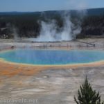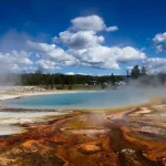

The West Thumb Geyser Basin was one of the most surprising (and yet beautiful!) things I found in Yellowstone National Park. It’s a geyser basin, so I was expecting the typical mix of colorful pools, a small geyser or two, and even paint pots. What I didn’t expect were the stunning views out over Yellowstone Lake. No other geyser basin in the park has views of a blue gem of a hot spring with the deep blue of the lake and Absaroka Mountains in the background!
Quick Stats
(This post contains affiliate links – there is no extra cost to you, but I may receive a small commission if you click and link and buy something.)
Thankfully, the West Thumb Geyser Basin is also a fairly easy walk (it’s wheelchair accessible, though there is a 10% grade on the north side of the loop between Twin Geysers and Abyss Pool). You don’t even have to do the entire thing to get nice views, though you’ll miss out on some truly interesting and fun features if you don’t take the entire loop.

The path begins well to the left of the restrooms – it’s just a boardwalk heading off into the trees with a sign saying that no pets are allowed. Walk downhill on the boardwalk to where it breaks out of the trees at the split to go right and left above Mimulus Pool about 350ft. from the parking area.

I turned left here. Less than 500ft. later, you’ll come to another junction. Turning right here would allow you to do a much shorter loop, still with views down on the lake. However, for the most interesting features, turn left.
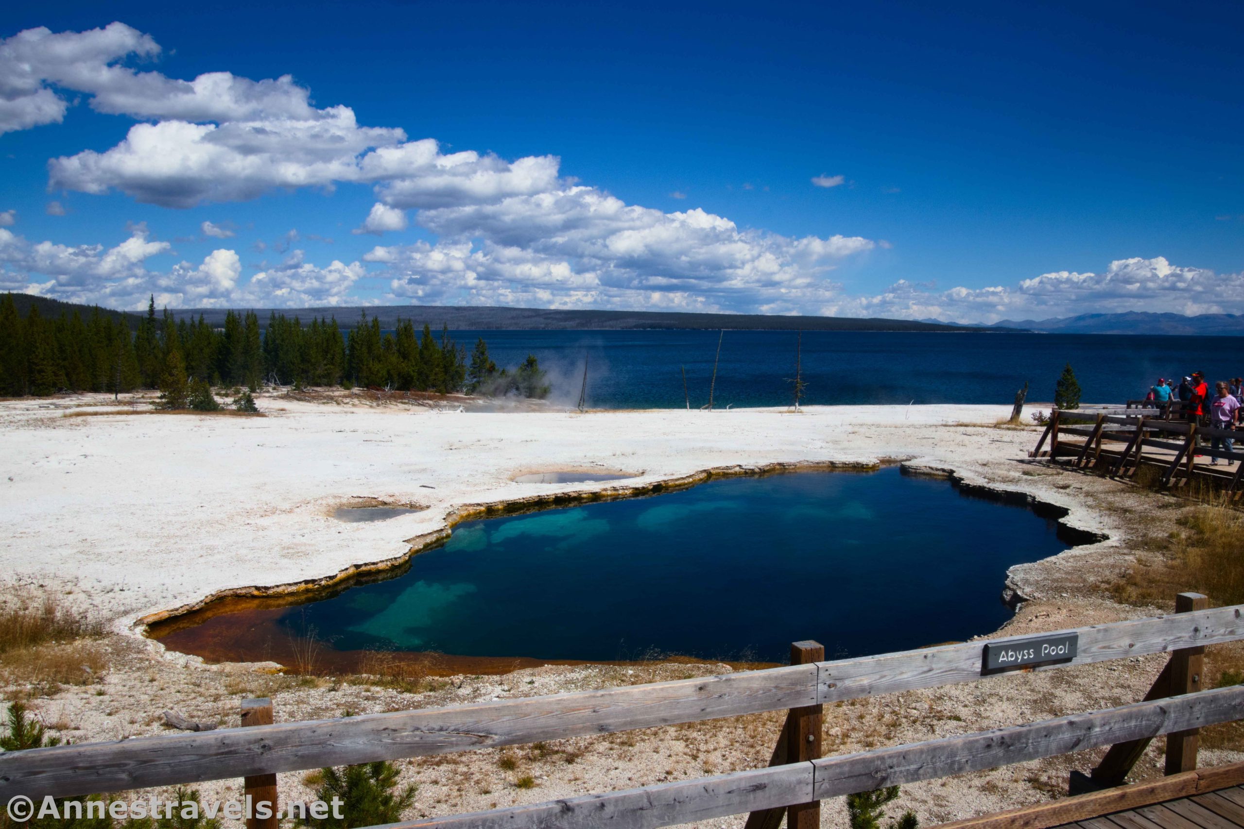
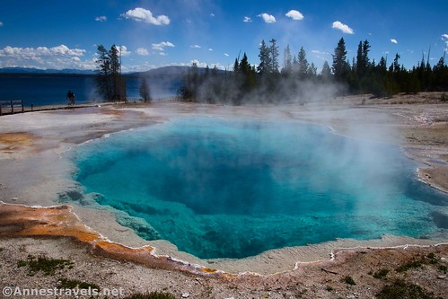
Pass by the boardwalk to the Twin Geysers and then descend steeply to Abyss Pool. This is where the ranger programs start. We weren’t at the right time of day for a ranger program, but the blue waters of this pool are stunning!

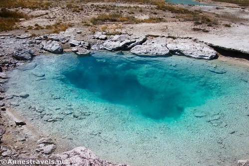
Continue down to Black Pool. This was my favorite feature in the geyser basin; the rich blue and the blue of Yellowstone Lake was truly special.
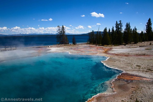
The boardwalk sweeps down from here along the shore of Yellowstone Lake. The next exciting feature is Big Cone. Its “special sauce” is that it’s located right on the rim of the lake.

Fishing Cone is similar, only it’s separated from the mainland, so it’s a bit of an island. Back in the day, people would fish in Yellowstone Lake in this area. As soon as they caught a fish, they’d cook it in the boiling-hot water of the Fishing Cone. While this is no longer permitted, the setting is still pretty.

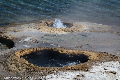
Lakeshore Geyser has a similar setting, but it’s also more active. Its two holes were bubbling and frothing most of the time I was nearby.
Don’t forget to look on the other side of the boardwalk at Lakeside Spring.

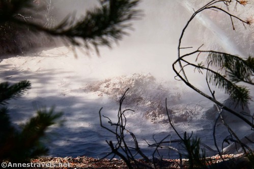
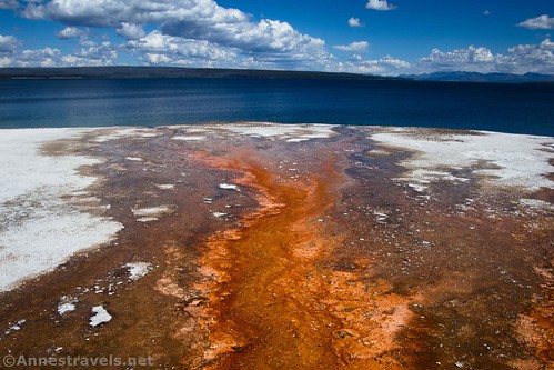
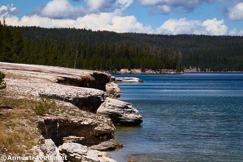
The geothermal features in this area have built up the lakeshore into cliffs. Water still travels over these cliffs, creating colorful channels and small waterfalls.
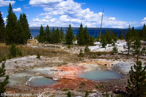
After passing Winter Spring (which was out there somewhere), the boardwalk turns away from Yellowstone Lake to rise up to Seismograph and Bluebell Pools. There are two viewpoints for these pools; it’s hard to say which is nicer. They’re both blue and would be higher on my non-existent list of favorites, but they’re surrounded by trees, making them more difficult to see. In fact, much of the next part of this hike has trees between you and Yellowstone Lake.

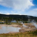
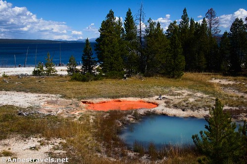
At 0.7 miles from the parking area, you’ll come to another junction. Turn right, as this will take you to the West Thumb Paint Pots. These are so colorful and fun!
Keep walking past several more geothermal features. Most are not terribly exciting, though you can tell why it’s called Collapsing Pool…
…and Ledge Spring.

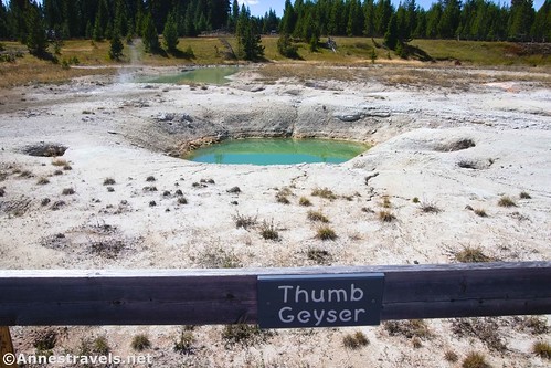
I’d guess that Percolating Spring bubbles and gurgles in wetter times of the year, and that some of the empty springs would similarly be filled in the spring. I looked at the Twin Geysers before heading back to the parking area.
So there you go! Yes, it’s just another geyser basin in Yellowstone. But you can’t beat the setting for this one!

Round Trip Trail Length: 1.0 mile
Elevation Gain: 108ft. (7,794ft. to 7,739ft.)
Facilities: Primitive toilets at the trailhead. There may also be one or two picnic tables, but these are usually filled, since the area is quite popular.
Fees: $35/vehicle, valid 7 days. America the Beautiful National Parks & Federal Lands Passes and Yellowstone Annual Passes are also accepted.

Trail Notes: The trail is wheelchair and stroller accessible; just be wary of up to 10% grades in a couple of places. Pets, food, bicycles, and fishing are prohibited. Be prepared to share the trail with a fair number of other people – while the parking area is large, it still can fill up, especially 10am-3pm in the summer. Ranger programs are held here daily; check the signboard (or a visitor center) for times. Because most of the views from this hike face east, you probably want to visit this hike in the afternoon.
Trail 
Road
Signs ![]()
Scenery ![]()
Would I go 100 miles out of my way for this? ![]()
Overall Rating: 

GPS Coordinates for the West Thumb Geyser Basin
TH: 44.4159110°, -110.5737440° (44°24.95466′, -110°34.42464′ / 44°24’57.2796″, -110°34’25.4784″) (7,790ft.) (0.0)
Short Loop Junction (Mimulus Pool): 44.4164180°, -110.5729340° (44°24.98508′, -110°34.37604′ / 44°24’59.1048″, -110°34’22.5624″) (7,786ft.) (352ft.)
Long Loop Junction: 44.4174020°, -110.5730020° (44°25.04412′, -110°34.38012′ / 44°25’02.6472″, -110°34’22.8072″) (7,780ft.) (0.15)
Abyss Pool: 44.4181140°, -110.5724110° (44°25.08684′, -110°34.34466′ / 44°25’05.2104″, -110°34’20.6796″) (7,760ft.) (0.23)
King Geyser: 44.4183450°, -110.5718860° (44°25.10070′, -110°34.31316′ / 44°25’06.0420″, -110°34’18.7896″) (7,750ft.) (0.32)
Big Cone: 44.4175630°, -110.5706860° (44°25.05378′, -110°34.24116′ / 44°25’03.2268″, -110°34’14.4696″) (7,738ft.) (0.42)
Fishing Cone: 44.4172470°, -110.5703870° (44°25.03482′, -110°34.22322′ / 44°25’02.0892″, -110°34’13.3932″) (7,738ft.) (0.45)
Lakeshore Geyser: 44.4167280°, -110.5699500° (44°25.00368′, -110°34.19700′ / 44°25’00.2208″, -110°34’11.8200″) (7,738ft.) (0.51)
Lakeside Pool: 44.4163750°, -110.5697030° (44°24.98250′, -110°34.18218′ / 44°24’58.9500″, -110°34’10.9308″) (7,740ft.) (0.54)
Winter Spring: 44.4159960°, -110.5696360° (44°24.95976′, -110°34.17816′ / 44°24’57.5856″, -110°34’10.6896″) (7,745ft.) (0.58)
Bluebell Pool: 44.4157000°, -110.5710960° (44°24.94200′, -110°34.26576′ / 44°24’56.5200″, -110°34’15.9456″) (7,780ft.) (0.67)
Long Loop Junction 2: 44.4158960°, -110.5718270° (44°24.95376′, -110°34.30962′ / 44°24’57.2256″, -110°34’18.5772″) (7,784ft.) (0.72)
Thumb Paint Pots: 44.4160500°, -110.5713670° (44°24.96300′, -110°34.28202′ / 44°24’57.7800″, -110°34’16.9212″) (7,779ft.) (0.75)
Collapsing Pool: 44.4164400°, -110.5716100° (44°24.98640′, -110°34.29660′ / 44°24’59.1840″, -110°34’17.7960″) (7,775ft.) (0.?)
End at TH: 44.4159160°, -110.5737170° (44°24.95496′, -110°34.42302′ / 44°24’57.2976″, -110°34’25.3812″) (7,790ft.) (1.05)

The gpx file for West Geyser Basin can be downloaded – please note that this and the GPS Coordinates are for reference only and should not be used as a sole resource when hiking this trail.
Download GPX File size: 26.2 KB Downloaded 482 times
(Note: I do my best to ensure that all downloads, the webpage, etc. are virus-free and accurate; however, I cannot be held responsible for any damage that might result, including but not limited to loss of data, damages to hardware, harm to users, from use of files, information, etc. from this website. Thanks!)
Getting to the West Thumb Geyser Basin
From the south entrance station, drive north on the main park road. After 21.2 miles, turn right following signs for Lake Village, Canyon Village, and Cody, WY (this junction is 1.7 miles north of the Grant Village Road). Only 0.2 miles later, turn right into the parking area for the West Thumb Geyser Basin.

From Canyon Junction, drive south (toward Fishing Bridge). After 15.4 miles, continue straight when the road to Fishing Bridge turns left. Drive another 20.4 miles, enjoying views over Yellowstone Lake. Turn left into the parking area for West Thumb Geyser Basin.

From the Old Faithful area, drive south on US-191 (follow the signs for West Thumb if you’re driving out of Old Faithful). After 17.6 miles, turn left. Only 0.1 miles later, turn right into the parking area for West Thumb Geyser Basin.

Today’s Featured Product!
Explore some of the best trails Yellowstone has to offer with this guide. Choose from short, moderate, and long trails to fit your style and timeframe as you enjoy mountain vistas, geothermal areas, waterfalls, and much more. Buy your copy here!