

From most of what you’d see of Rocky Mountain National Park in the summer, you would think that everywhere you turned you would see crowds of people milling here and there looking at the same scenery you are. However, if you work at it, you can get off the beaten path and still see some nice things. I accidently found one of these lesser-visited places on my last visit to Rocky Mountain. We came in from the west side (which is unusual; usually we come in on the east side), and didn’t know quite what hike to take. However, we saw a trail up Chapin Peak on the park map, and thought we’d give it a try. I’m so glad we did: beyond the fewer number of people on the mountain, the views were absolutely awesome. We could see across the Mummy Range into the Never Summer Range, as well as across the valley towards Longs Peak, and so many other ranges and so many other ranges and peaks that I couldn’t name them all. It was beautiful!
(Affiliate links are present on this page.)

The trail up Chapin Peak begins from the Old Fall River Road, between mile markers 6 and 7. That’s about 6.75 miles from the east end of the road. Because we were coming in from the west, we decided to park at the Alpine Visitor Center and walk the 2.25 miles down the Old Fall River Road (which ends at the visitor center) to the trailhead. You can read about walking down the road in this post. You will want to walk down the road for 2.25 miles; the kiosk is located not very far after mile marker “7”. However, before you hike, be sure to check at the visitor center and see if the road is open: it is usually closed until mid-summer at the earliest. Of the five times I’ve visited Rocky Mountain (twice in June, once each in May, August, and September), the only time the road was open to traffic was when I climbed Chapin Peak (August). Whether or not hikers are allowed when the road is closed to cars will depend on the season; as I said before, check at the visitor center. You can also drive up from the eastern end of the road if you want a shorter hike. A small parking area (really a wide spot in the road) is located across from a kiosk with information about the area. The trail begins to the right of this kiosk. There is more space for parking further up the road; just find a nice wide place to pull over. The trail is 5 miles RT if you hike from the trailhead, and closer to 9 miles RT if you start from the Alpine Visitor Center.

At the beginning, the trail isn’t very interesting. It goes uphill for a while through the trees. It is fairly wide at this point, although you need to watch your step, as the path is laced with tree roots that would be easy to trip over. After 0.25 miles or so you will come to a sign on your right. The wide trail continues straight, towards Chapin Creek, while the other trail begins to climb towards the summits of Chapin, Chiquita (sp?), and Ypsilon Peaks. Turn right. This trail is also fairly wide for a while, until the real climb begins.
The trail rolls over hills for a while (including over a wooden log bridge across a dry creek, where 10 of us could easily have sat down and hung our legs over the edge to eat a snack), and then begins to climb some stone stairs up a hillside. This is where many people turn around, I think, because after this the trail is much narrower. That’s not a problem, as it is still easy to follow, and people turning around means that there will be fewer on the peak :-). Anyway, this is where the climb begins.

The trail will ascend the mountainside for the next half mile or so to a sign that says that the trail isn’t maintained beyond this point. From having walked it, the trail is awfully nice for having not been maintained! Here the trail splits; one trail going right up the side of the mountain, and the other going left into what appears to be a meadow. The sign says that all summits are to the right. Actually, both trails will lead you to a saddle between Chapin and Chiquita Peaks. The right trail makes you ascend sooner, and then levels off a bit to cross many small patches of rocks. I didn’t find this very difficult, as the trail is quite good over these sections, but you do have to watch your step. The left trail is fairly level for a while, and then begins to ascend somewhat steeply. The last short section up to the saddle, however, is extremely steep. As the last part of the trail from the saddle to the top of Chapin Peak is also very steep, take this into consideration before you decide which trail to take. We decided to go right (the way the sign says to go), but opted to take the lower (left) trail on the way back down because we could hear thunder rumbling in the distance, and the lower trail would get us off of the high slopes of the mountain faster. Actually, the whole day was cloudy, which occasional sprinkles of rain, which is why my pictures aren’t as good as they might be. Thankfully, the real rain held off until we were back at the visitor center.

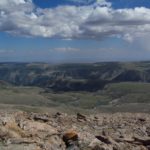
The right trail almost immediately begins to switchback its way somewhat steeply up the side of the mountain. The steepness and elevation—probably around 11,000 feet—was enough to make us stop and catch our breath fairly often. When you stop, look out across the valley—the views are really nice. You can only see part of the Never Summer Range from here, but you can see the visitor center and the ridge that the Trail Ridge Road follows. Also, other mountain peaks are beginning to poke their heads above this ridge. The higher you go, the more you can see.
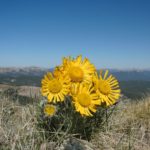
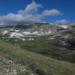
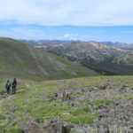
After a while of switchbacking, the trail levels off a little. From here to the saddle, the trail works its way gently upward, crossing patches of rocks between sections of tundra-type grass and other plants. Some of the wildflowers, both up here and down the mountain a ways, where quite nice. I don’t think the wildflowers are usually still out in mid-August, but there had been late snowstorms and later-than-normal slow melt the year we were there, so the wildflowers were later than usual.

Eventually, you will get to the saddle between Chapin and Chiquita Peaks. Actually, just before the saddle, a trail will go off on the right, just about the same place that the lower trail connects to the upper trail. Take this right trail upward. This is very, very steep; much steeper than anything else you’ve climbed today (unless you took the lower trail, at which point it would probably be about the same). It could almost be called a scramble, except that there is too much of a trail and too few large rocks for it to be called that. Cairns occasionally mark the trail, but I lost it in one place because it is a little vague at times. In general, keep heading up towards the peak, and you’ll be fine.
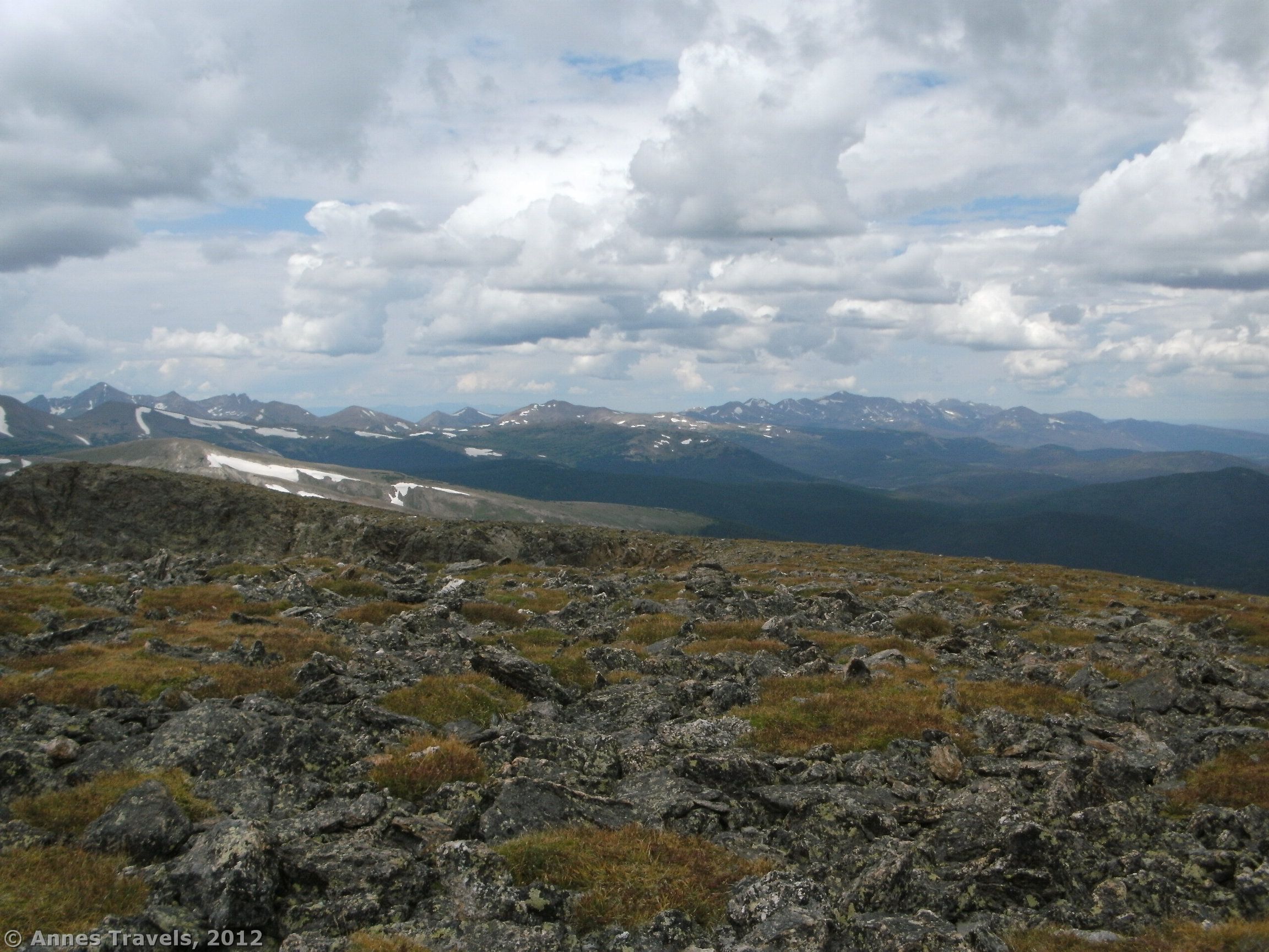
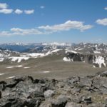
Once you get to the top, a pile of rocks marks the summit. However, if you really want a nice view, go a bit to the right (back towards the visitor center, which you can easily see on the ridge across the valley). Here you have a breath-taking view of the Never Summer Range, the ridge where the Trail Ridge Road runs, Longs Peak, and other peaks and ranges I don’t know the names of. I could even see Flattop and Hallet Peaks, which I had climbed the summer before. You are currently in the Mummy Range, so if you turn around you can see other parts of this range. Take your time to look at the view, but get off the mountain well before the summer afternoon thunderstorms arrive. These usually begin to form between 1 and 3 in the afternoon, and then actually break forth after that. It is recommended that you are off of the peaks by noon.

Return by the way you came, or, as I recommend, go back by the lower trail. This is an easier walk (once you get past the first steep, slippery section), and will get you lower faster if a thunderstorm is brewing.
This trail is not as frequented as many of the other trails in Rocky Mountain. I met about a dozen other people on the entire hike, but the marmots, picas, and other wildlife I saw were obviously not used to people, and kept their distance. This, to me, is the proof that very few people actually use this trail!
And if you want to hike a little further, check out my second visit to Chapin Peak, when I also hiked Chiquita and Ypsilon Peaks as a loop hike!

Round Trip Trail Length: About 5 miles from the trailhead; 9 miles if you hike from the visitor center.
Facilities: Information Kiosk at the trailhead; otherwise, none.
Fees: $20 per vehicle, valid 7 days. Interagency (America the Beautiful), Senior (Golden Age), Access (Golden Access), Rocky Mountain National Park, and Rocky Mountain National Park/Arapaho National Recreation Area also accepted.
Trail 
![]()
![]()
Road ![]()
![]()
Signs ![]()
![]()
Scenery
Would I go 100 miles out of my way for this? ![]()
Overall Rating: 
![]()
This Week’s Featured Product!
Find even more great hikes in Rocky Mountain National Park and beyond in this guide. The hikes are geared toward those who love great views.

4 responses to “Remote Rocky Mountain: Chapin Peak”
Very neat article. Fantastic.
Wow! This could be one particular of the most beneficial blogs We’ve ever arrive across on this subject. Actually Wonderful. I’m also a specialist in this topic so I can understand your effort.
I just want to say I am just newbie to blogs and absolutely enjoyed this web blog. More than likely I’m likely to bookmark your blog post . You certainly come with exceptional article content. Many thanks for sharing your webpage.
[…] imagine my surprise last year when I realized we’d hiked part of the loop – up to Mount Chapin – in 2011. (That’s a story in itself, so I won’t go into it here.) I was looking into […]