I’ve had my eye on Lower Monarch Canyon ever since I first read about it back c.2021. A perennial waterfall in the desert reached via a desert walk and hiking up a canyon? Yes, please! The Monarch Canyon Waterfall in Death Valley National Park is definitely under the radar, and it’s not exactly an easy trek, but it makes a great adventurous day hike after you’ve seen the more popular hikes and routes within the park.
Quick Stats
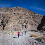
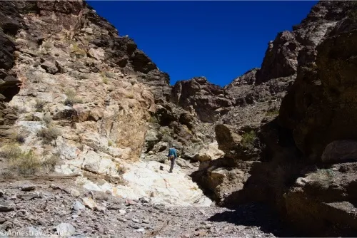
Before I go further, let me explain why hiking to Lower Monarch Canyon is difficult. You’ll park along the Beatty Cutoff Road, then walk across the trailless desert, crossing multiple deep-ish washes, skirting desert plants, and walking on rocks that are (mostly) stable. Then, once you drop into the Monarch Canyon Wash, you’ll follow the wash upstream over unstable rocks, enter the Black Mountains, scramble several small dryfalls (mild Class 3), and finally arrive at the trickle of the lower falls. From here, Class 3 scrambling is required to get up to the middle (and much more impressive) part of Monarch Falls.
I hope I’ve scared you, because while it’s a very worthwhile hike, it’s not easy! Good footwear is a must, quite a bit of off-trail experience in the desert is a plus, a strong desire for adventure is useful, and the willingness to turn around if it doesn’t work out the way you planned is vital.
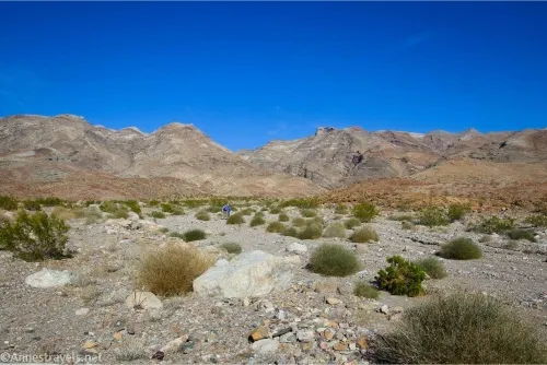
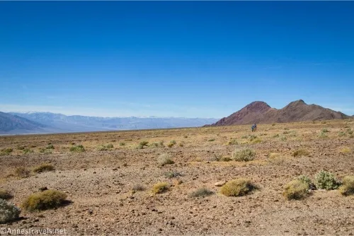
Now that I’ve convinced you not to hike Lower Monarch Canyon, let’s get down to the details about why you should go! The hike begins along the Beatty Cutoff Road a short distance south of Hell’s Gate. There is no parking area. We chose a likely spot (I’m 90% certain we weren’t the first people to start from here), parked the van out of the way of traffic, crossed the road, and headed off across the desert toward the Black Mountains (east and a bit south).
You can see Monarch Canyon from where we parked, but it’s not necessarily obvious that it’s the right canyon until you get closer to the mountains. While hiking cross-country, you’ll want to stray to the right (south). It will be more direct to stray north, but the terrain to the north includes multiple small but deep washes. I came back too far north, and it was no fun at all to go down and up, down and up, down and up, rinse and repeat 20 times or so! Staying south will minimize both the number of washes and the depth of the washes, making your hike much easier.
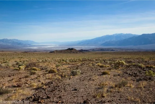
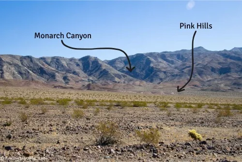
As you’re hiking, keep your eyes open for some low pink hills below a major canyon in the Black Mountains. You’re striking generally for the right end of these pink hills. Also, be sure to look north toward Corkscrew Peak (not a landmark, but impressive).
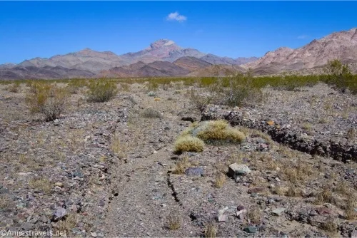
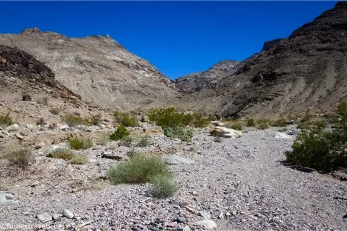
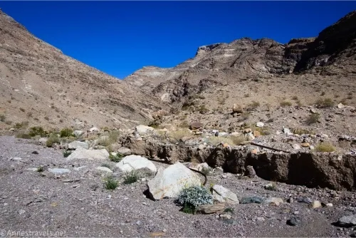
After about 1.25 miles, you’ll reach the right end of the pink hills. Just on the other side of these hills is a major wash; drop into the wash and turn left to walk upstream. This is the Monarch Canyon Wash.
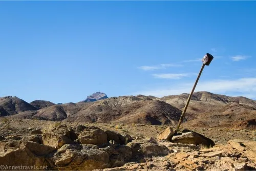
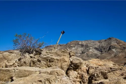
The wash is wide, and the rocks underfoot tend to be loose, so take care. Stay generally right (south), as you’ll want to take the right fork of the canyon about mile 1.8. About 0.4 miles before this, pass a post on a hill with a bucket on top of the post on the right side of the hill. Be sure to look back at the Death Valley Buttes, as they’re especially nice (and massive!) in the morning (sadly, I forgot to take a picture of the Buttes).
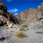
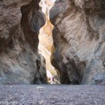
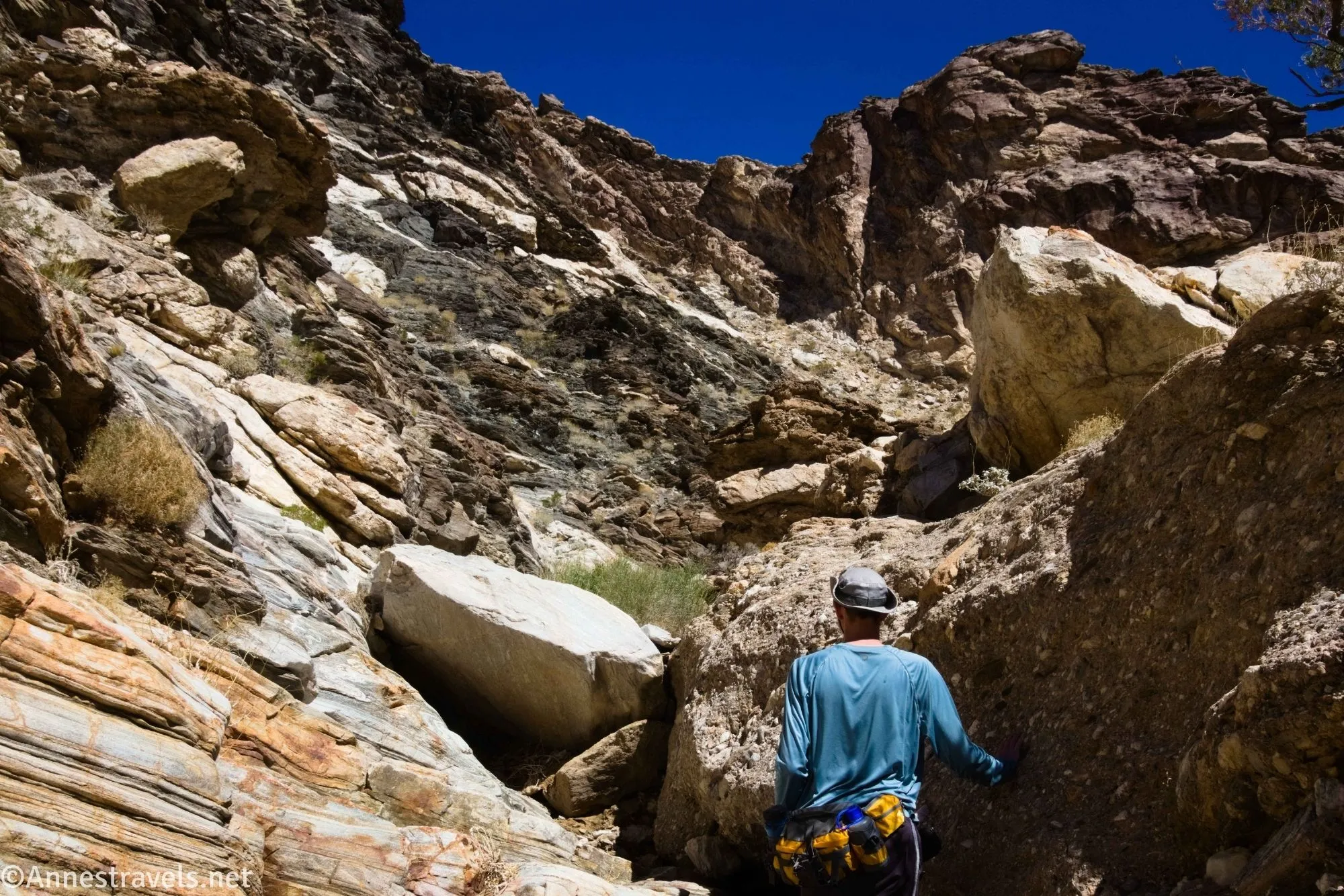
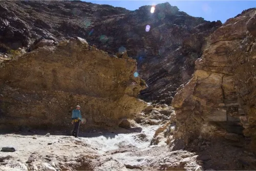
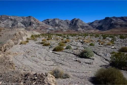
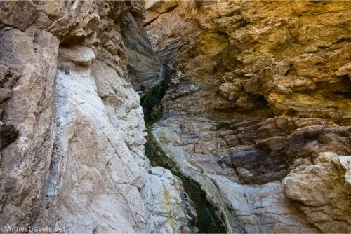
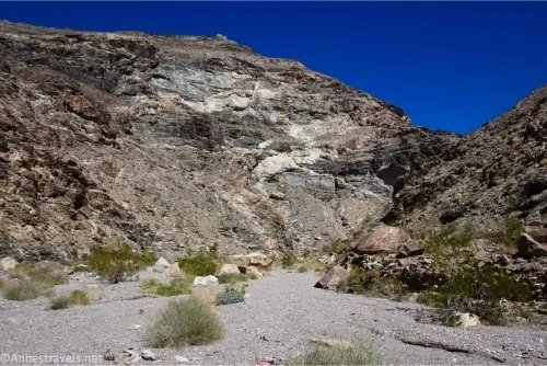
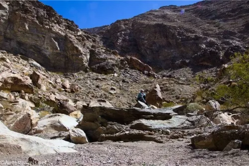
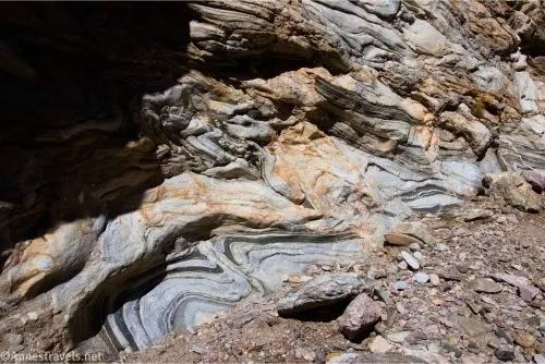
After the wash junction, the wash begins to narrow and the cliffs begin to rise around the riverbed as it becomes a classic Death Valley canyon. This is where things get fun. After about 1.2 miles of winding upcanyon, rocks mark the first easy scramble. Then the twisting wash traverses two chokestones at miles 3.35 and 3.3. Again, these were fairly easy to traverse, but they can require up to light Class 3 scrambling, and you may need to scout around to find the easiest route. There are also some pretty layers in the rocks.
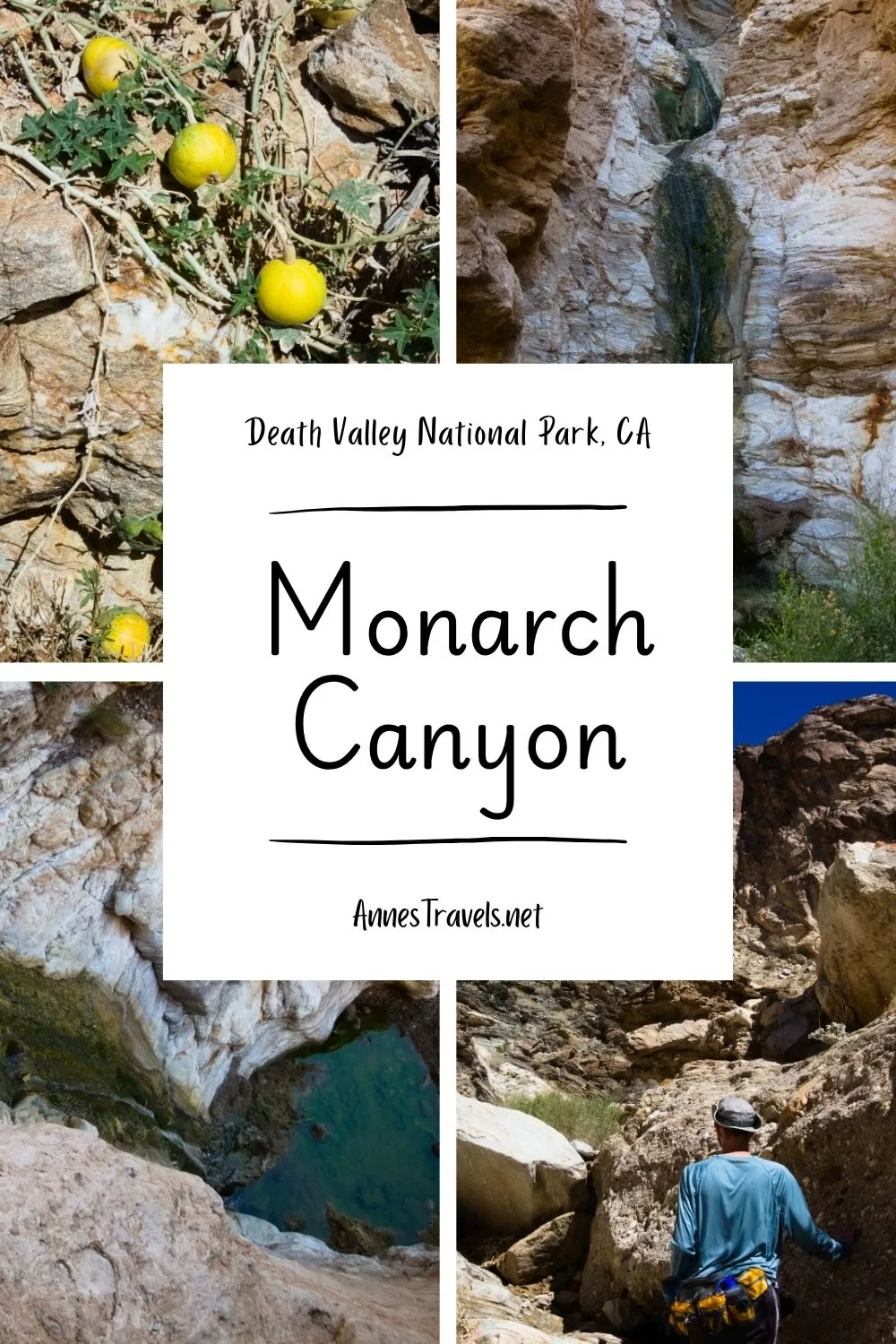
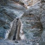
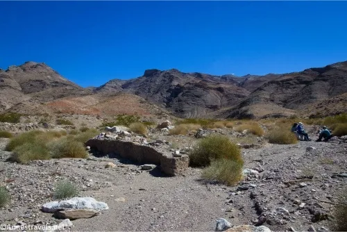
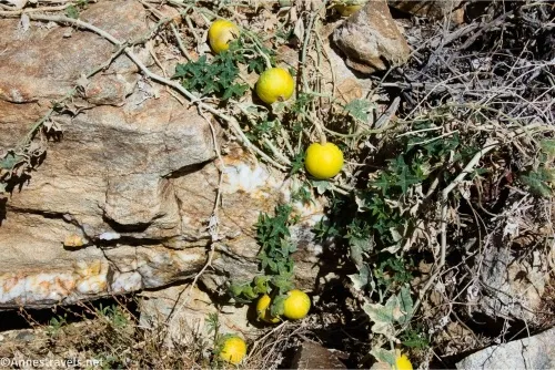
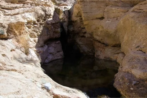
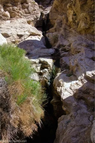
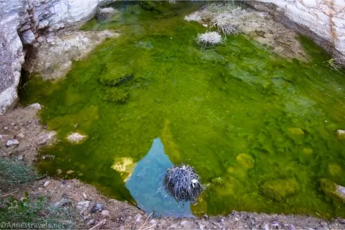
And then, finally, just above the second choke stone, you’ll come to the first falls! Exactly where you’ll find water will depend on the season; I was hiking in mid-March, so there was a fair amount of water. It still wasn’t gushing, but the water descended a short distance below the lower falls, which can be dry by fall. I also found some melon plants on the left side of the lower falls; I figured they were planted by the native inhabitants long ago, but as they’re native to Asia, I’m thinking they may be a bit more modern.
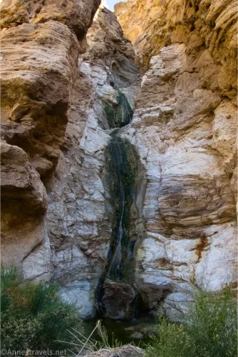
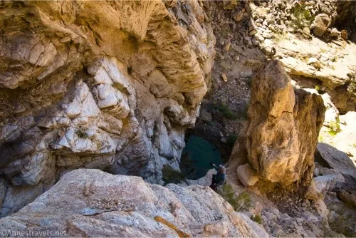
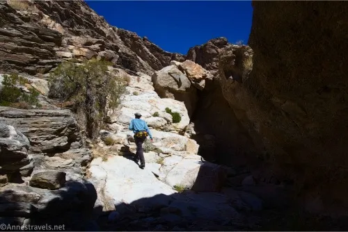
I scrambled up the left side of the Lower Falls. This is perfectly workable, but it’s a little bit of a sketchy Class 3 scramble. For an easier route, backtrack downcanyon for a short distance and climb the rocky shelves on the right side (if you’re looking upcanyon). Again, this is a scramble, but it’s easier than trying to climb near the falls.
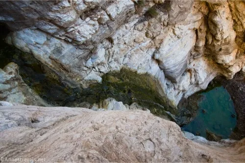
Once on the upper shelf, you can walk up to the pool at the base of the Middle Falls. This is the one very long drop, and it’s quite impressive.
I decided to climb up the left side of the Middle Falls to get a better view. I can’t say I recommend it, as the rock is crumbly, but it’s a solid Class 3 or Class 3+ scramble about halfway up where a break in the rocks allows for a great view both down to the pool below and up toward the Upper Falls (I believe the Upper Falls is still out of view, but you still get to see more than while standing below!)
From there, I made the mistake of trying to climb higher to the next viewpoint. Just don’t! The rock is crumbly, it’s incredibly steep, and I found myself on a Class 4+ scramble. It wasn’t fun at all to come back down, and I was greatly relieved when I made it back to the break in the rock.
When you’re finished exploring, hike back downcanyon and generally retract your steps to the Beatty Cutoff. In the evening, we tried to get to the top of the falls from Upper Monarch Canyon (which is another story since it’s accessed from a completely different place). Besides failing daylight, we never did figure out how to get to the top of the falls. So I don’t recommend trying unless you’re really looking for a scrambling adventure, and definitely not from below!
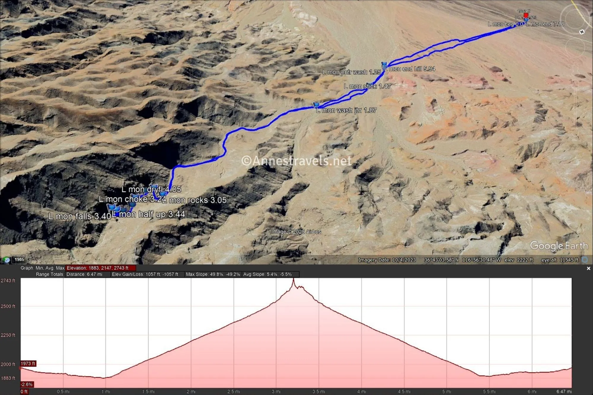
Round Trip Trail Length: 7.2 miles
Elevation Gain: 1,057ft. (1,883ft. to 2,743ft.)
Facilities: None
Fees: $30/vehicle to enter Death Valley National Park; America the Beautiful National Parks & Federal Lands passes and Death Valley Annual Passes are accepted.
Trail Notes: While I’ve already stated why this hike is difficult, it’s not much worse than many other off-trail hikes in Death Valley. I wouldn’t call this canyoneering, since you don’t need ropes, but you will be scrambling some (wear good shoes!) Be sure to take plenty of water with you, as the water in the stream is non-potable. The waterfall is not good for swimming (it may even be illegal), and the pools are disgusting, so don’t plan on a dip before you head back to the road. Looking at the Death Valley Buttes from this vantage point, you might wonder why anyone would try climbing them due to their sheer size. However, I’ve done it (albeit many years ago), and while it’s a climb, it’s not as bad as it looks from here!
Trail 
![]()
![]()
![]()
![]()
Road ![]()
Signs ![]()
![]()
![]()
![]()
Scenery ![]()
Would I go 100 miles out of my way for this? ![]()
Overall Rating: ![]()
![]()
GPS Coordinates for Lower Monarch Canyon
TH: 36.7140210°, -116.9746880° (36°42.84126′, -116°58.48128′ / 36°42’50.4756″, -116°58’28.8768″) (1,988ft.) (0.0)
Enter wash: 36.7138060°, -116.9547700° (36°42.82836′, -116°57.28620′ / 36°42’49.7016″, -116°57’17.1720″) (1,956ft.) (1.25)
Post with a bucket on top: 36.7154060°, -116.9515350° (36°42.92436′, -116°57.09210′ / 36°42’55.4616″, -116°57’05.5260″) (2,026ft.) (1.47)
Wash junction: 36.7158570°, -116.9451250° (36°42.95142′, -116°56.70750′ / 36°42’57.0852″, -116°56’42.4500″) (2,139ft.) (1.87)
Rocks: 36.7197010°, -116.9288880° (36°43.18206′, -116°55.73328′ / 36°43’10.9236″, -116°55’43.9968″) (2,540ft.) (3.05)
Choke stone: 36.7194190°, -116.9269540° (36°43.16514′, -116°55.61724′ / 36°43’09.9084″, -116°55’37.0344″) (2,625ft.) (3.24)
Choke stone: 36.7199770°, -116.9265700° (36°43.19862′, -116°55.59420′ / 36°43’11.9172″, -116°55’35.6520″) (2,655ft.) (3.29)
Falls: 36.7202000°, -116.9258370° (36°43.21200′, -116°55.55022′ / 36°43’12.7200″, -116°55’33.0132″) (2,715ft.) (3.34)
Falls: 36.7200420°, -116.9254450° (36°43.20252′, -116°55.52670′ / 36°43’12.1512″, -116°55’31.6020″) (2,805ft.) (3.40)
Half up: 36.7199630°, -116.9251930° (36°43.19778′, -116°55.51158′ / 36°43’11.8668″, -116°55’30.6948″) (2,877ft.) (3.44)
Dyrfall: 36.7191080°, -116.9278540° (36°43.14648′, -116°55.67124′ / 36°43’08.7888″, -116°55’40.2744″) (2,558ft.) (3.99)
Dryfall: 36.7190670°, -116.9284820° (36°43.14402′, -116°55.70892′ / 36°43’08.6412″, -116°55’42.5352″) (2,557ft.) (4.05)
End of hill: 36.7134010°, -116.9551120° (36°42.80406′, -116°57.30672′ / 36°42’48.2436″, -116°57’18.4032″) (1,938ft.) (5.94)
End: 36.7140550°, -116.9746850° (36°42.84330′, -116°58.48110′ / 36°42’50.5980″, -116°58’28.8660″) (1,990ft.) (7.18)
The gpx file for Lower Monarch Canyon can be downloaded – please note that this and the GPS Coordinates are for reference only and should not be used as a sole resource when hiking this trail.
Download GPX File size: 180.3 KB Downloaded 513 times
(Note: I do my best to ensure that all downloads, the webpage, etc. are virus-free and accurate; however, I cannot be held responsible for any damage that might result, including but not limited to loss of data, damages to hardware, harm to users, from use of files, information, etc. from this website. Thanks!)
Getting to the Lower Monarch Canyon Trailhead
From Furnace Creek Visitor Center, drive toward Stovepipe Wells on CA-190W. After 10.6 miles, turn right onto the Beatty Cutoff Road. About 9.3 miles later, pull over to the side of the road in a place where you can safely get out of the way of traffic. This area is about 0.7 miles south of Hell’s Gate.
More off-the-beaten-path hikes in Death Valley
The premier guide to hiking the lesser-known areas of Death Valley, this is a must-have as you plan treks through the park. Buy your copy here.