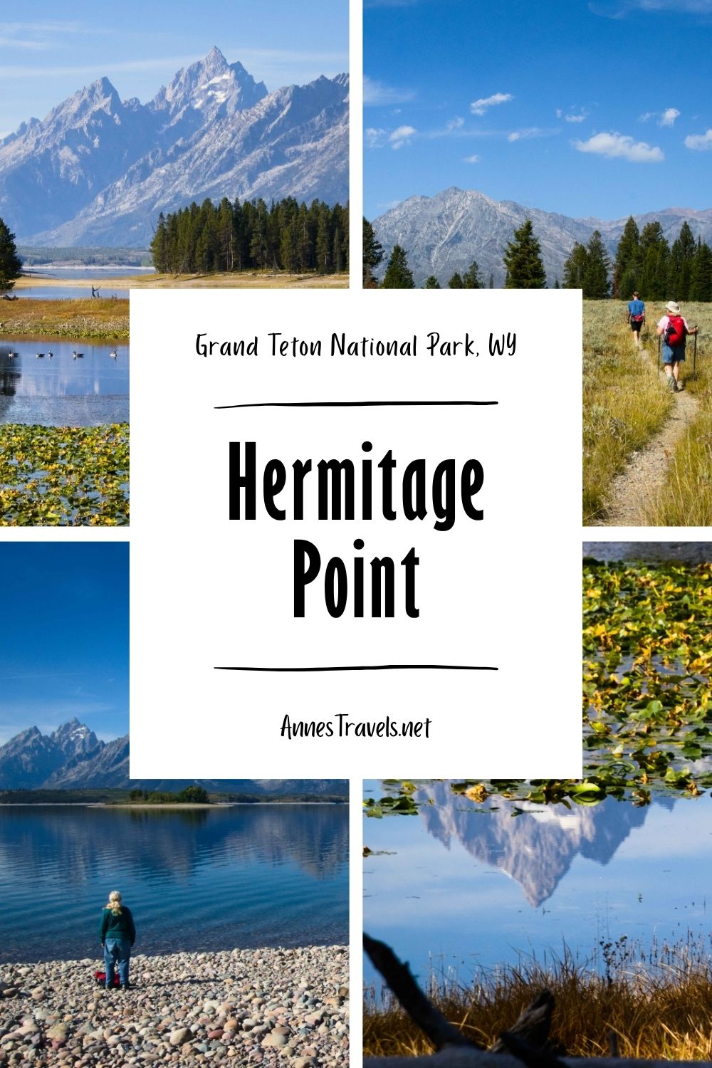
For years, I had my eye on the Hermitage Point Trail in Grand Teton National Park. But it’s a long hike by Grand Teton standards, especially when you can see almost the same view from the Lakeshore Trail, which is a fraction of the length. I finally had a day to kill in Grand Teton (not that it’s so very hard to kill time in the park) and decided to grit my teeth and hike all those extra miles. It turned out to be a really great hike, and while it does share some similar views with the shorter Lakeshore Trail, it also offers quite a few more – and different – views out over Jackson Lake and to the Teton Range. Is Hermitage Point worth the hike? A resounding yes!
Quick Stats
This post may contain affiliate links. If you click one and buy something, I will receive a small commission – without an extra cost for you. Thank you for supporting Anne’s Travels!
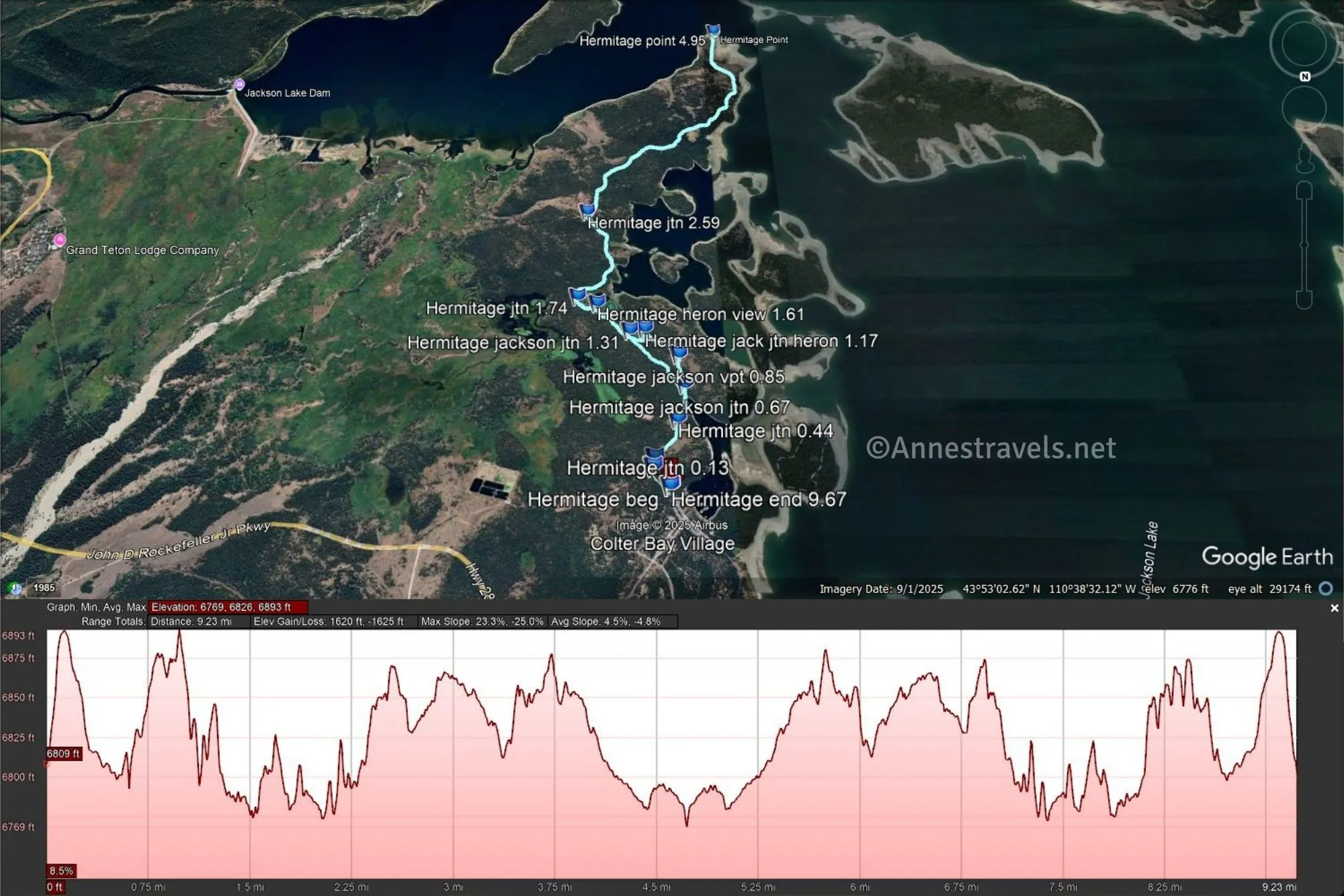
There was some construction happening around the Colter Bay Marina and the Colter Bay Visitor Center, so finding the trailhead was a little strange. But we followed the signs, and it got us to the trailhead. One thing I should warn you about this trail is that it has about a million trail junctions. Trying to describe it is almost impossible, but I’ll do my best.
Head up the unassuming trail to the first junction after 0.1 miles. Turn right toward Swan Lake and Heron Pond; less than a tenth of a mile later, take another right toward the same. About mile 0.4, you’ll come to the junction for Heron Pond (right) vs. Swan Lake (left). The Swan Lake Trail was closed (you can take it as a loop, but I’d recommend doing it on your way back), so I turned right toward Heron Pond.
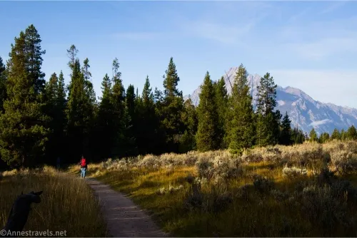
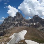
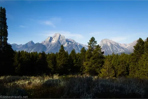
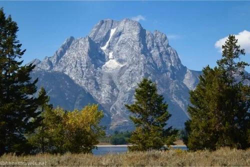
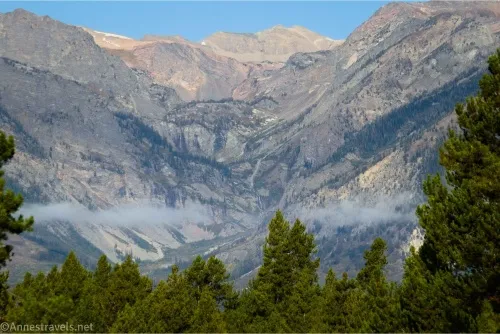
A quarter mile beyond this junction, you’ll come to a sparsely signed junction for the Jackson Lake Ovelrook to the right. It’s worth the extra elevation gain, and I’m glad I took it on the way out, though I did take the easier route on my way back. The path to the overlook climbs 0.2 miles up to a very nice viewpoint of Mt. Moran and nearby mountains… not so much of Jackson Lake.
Keep following the path until you get back to the Heron Pond Trail. There are quite a few trails in this area, but most were closed due to bear activity the morning I visited (actually, by the time I came back, the signs were gone, so I was just up earlier than the park service employees!) Turn left to get back to the main path at mile 1.3 (the Heron Pond Trail travels around the pond, so technically you could also go right, though you’ll miss the reflections by doing so).
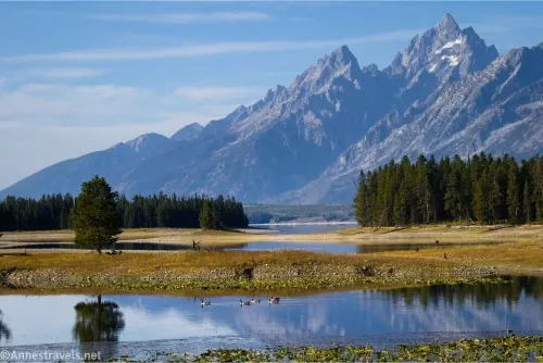
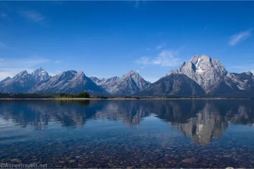
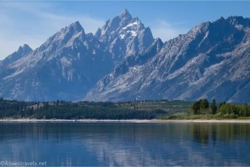
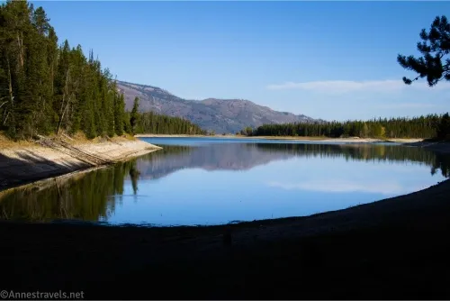
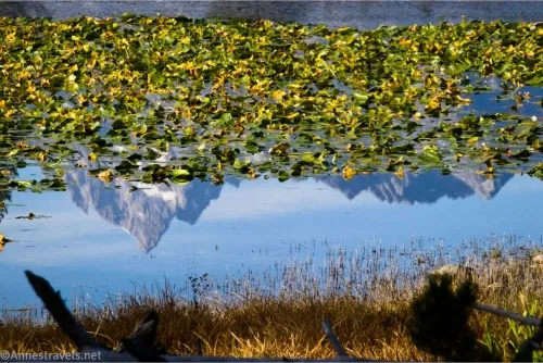
Once at the main path, turn right to travel along the eastern edge of Heron Pond. The views from here are spectacular in the early morning; in fact, it’s worth the hike just to see the reflections. And the pond keeps going and going for some time, so you get lots of time to enjoy the views!
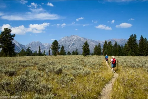
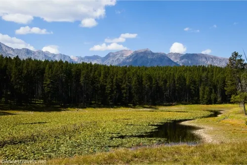
Pass the junction for Swan Lake (on the left) about mile 1.7. Travel along the south end of Heron Pond, then the path turns left to enter the woods. The trail from here is generally not very exciting for the next 2.2 miles out to Hermitage Point – there is a cutoff trail junction about mile 2.6; stay right here so you don’t miss out on the views.
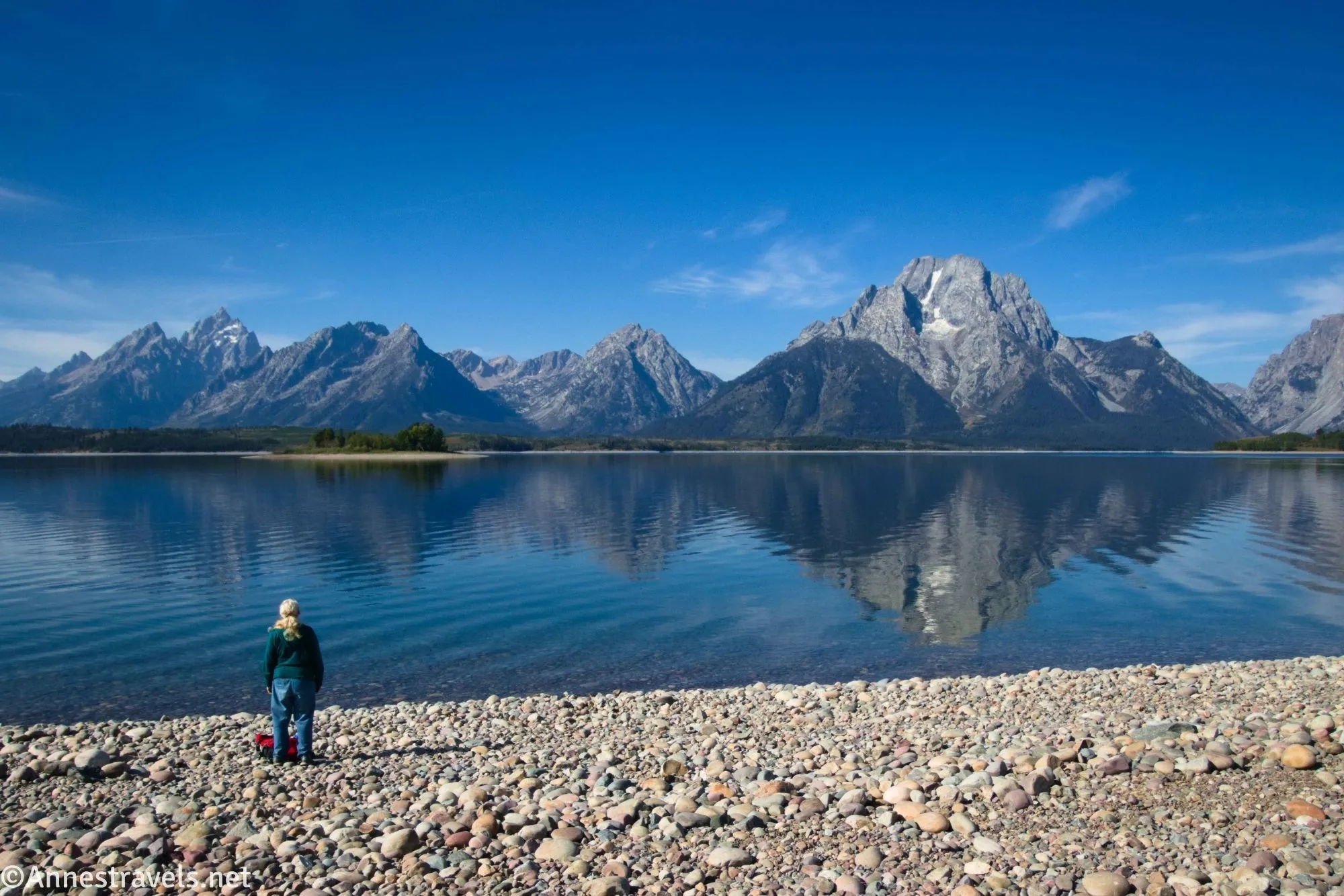
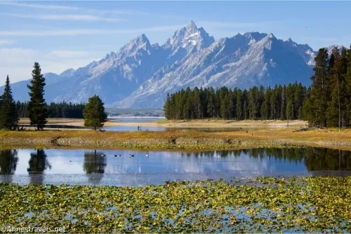
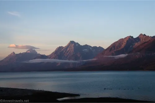
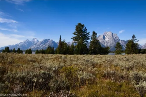
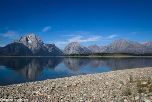
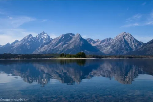
The trees end just before Hermitage Point, with the scenery becoming meadows. Hold your camera, though, until you get out to mile 4.9 where you can follow a small social trail on the right down to the beach on the very end of the point (the main trail here doubles back on itself). Once on the beach, let your jaw drop – the views are amazing!
We spent probably an hour on the beach enjoying the views. It was still early in the morning, so not very many people were out in motorboats yet.
For your return trip, you can retrace your steps, or you can choose to take the loop option – I don’t remember exactly why I decided to retrace my steps, but given how I feel about loops, I’m going to guess the Swan Lake Trail closure made the loop not an option for me. I also believe the loop is a couple of tenths of a mile longer overall.
Round Trip Trail Length: I went 9.7 miles. To make it shorter, stop at Heron Pond about 3.2+ miles (you can even walk all of the way around the pond for more views) and then loop back via Swan Lake (not as good views, but nice if you like “average lakes”).
Elevation Gain: 1,625ft. (6,893ft. to 6,769ft.)
Facilities: Almost everything you could imagine near the trailhead in the Colter Bay complex including restrooms, visitor services, a store, campground, and much more.
Fees: $35/vehicle, valid 7 days. America the Beautiful National Parks & Federal Public Lands Passes and Grand Teton Annual Passes are accepted.
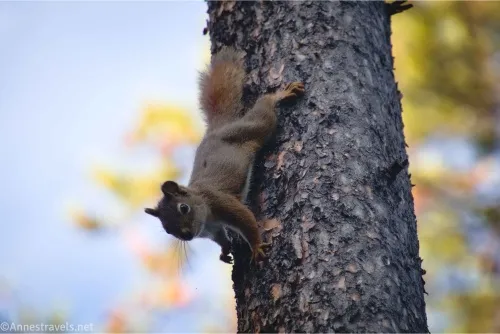
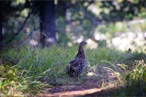
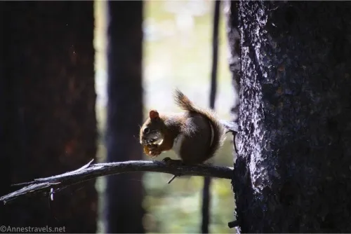
Trail Notes: The trail has some elevation change, but not much, so it’s an easy 9.7 miles. I highly recommend hiking this early in the day, when the views of the Tetons are best and also when there’s the best chance of seeing wildlife. I heard an elk bugle, but the only wildlife I saw were birds (geese, ducks, grouse) and an energetic squirrel who didn’t like me invading his territory.
Trail 
![]()
Road ![]()
Signs
Scenery
Would I go 100 miles out of my way for this?
Overall Rating: 
GPS Coordinates for Hermitage Point
TH: 43.9010460°, -110.6415110° (43°54.06276′, -110°38.49066′ / 43°54’03.7656″, -110°38’29.4396″) (6,797ft.) (0.0)
Trail Junction: 43.8996850°, -110.6400770° (43°53.98110′, -110°38.40462′ / 43°53’58.8660″, -110°38’24.2772″) (6,884ft.) (0.13)
Trail Junction: 43.8989710°, -110.6402360° (43°53.93826′, -110°38.41416′ / 43°53’56.2956″, -110°38’24.8496″) (6,874ft.) (0.18)
Trail Junction: 43.8957540°, -110.6423720° (43°53.74524′, -110°38.54232′ / 43°53’44.7144″, -110°38’32.5392″) (6,806ft.) (0.44)

Jackson Lake Overlook Junction: 43.8928440°, -110.6431600° (43°53.57064′, -110°38.58960′ / 43°53’34.2384″, -110°38’35.3760″) (6,781ft.) (0.67)
Jackson Lake Overlook: 43.8902920°, -110.6426920° (43°53.41752′, -110°38.56152′ / 43°53’25.0512″, -110°38’33.6912″) (6,876ft.) (0.85)
Heron Pond Junction: 43.8877280°, -110.6394480° (43°53.26368′, -110°38.36688′ / 43°53’15.8208″, -110°38’22.0128″) (6,780ft.) (1.17)
Return to Main Trail: 43.8879090°, -110.6380030° (43°53.27454′, -110°38.28018′ / 43°53’16.4724″, -110°38’16.8108″) (6,800ft.) (1.31)
Views across Heron Pond: 43.8850430°, -110.6347210° (43°53.10258′, -110°38.08326′ / 43°53’06.1548″, -110°38’04.9956″) (6,776ft.) (1.61)
Swan Lake Junction: 43.8844350°, -110.6327630° (43°53.06610′, -110°37.96578′ / 43°53’03.9660″, -110°37’57.9468″) (6,802ft.) (1.74)
Trail Junction: 43.8754330°, -110.6334310° (43°52.52598′, -110°38.00586′ / 43°52’31.5588″, -110°38’00.3516″) (6,842ft.) (2.59)
Hermitage Point: 43.8504910°, -110.6487010° (43°51.02946′, -110°38.92206′ / 43°51’01.7676″, -110°38’55.3236″) (6,770ft.) (4.95)
End at TH: 43.9010420°, -110.6415650° (43°54.06252′, -110°38.49390′ / 43°54’03.7512″, -110°38’29.6340″) (6,796ft.) (9.67)
The gpx file for Hermitage Point can be downloaded – please note that this and the GPS Coordinates are for reference only and should not be used as a sole resource when hiking this trail.
Download GPX File size: 137.0 KB Downloaded 313 times
(Note: I do my best to ensure that all downloads, the webpage, etc. are virus-free and accurate; however, I cannot be held responsible for any damage that might result, including but not limited to loss of data, damages to hardware, harm to users, from use of files, information, etc. from this website. Thanks!)
Getting to the Hermitage Point Trailhead
From Moran Junction, drive north on US-191N / US-287N / US-89N, following signs for Jackson Lake and Yellowstone. Pay your fee (or flash your pass) at the Grand Teton Entrance Station 0.2 miles later, and continue north another 9.3 miles. Turn left at a sign indicating Colter Bay Junction and drive 0.9 miles; turn left. Pass the visitor center and park as near to the end of the lot as possible.
Or from the southern entrance to Yellowstone National Park, head south on US-191S / US-287S / US-89S 17.7 miles. Turn right at the sign indicating “Colter Bay Junction” and follow the directions (above) to the parking area.
Explore More of Grand Teton National Park – and Beyond!
With more than 50 trails and 175 trail options, this book is a hiking planner’s paradise! It covers the Teton Range extensively, as well as nearby areas. Buy your copy here.