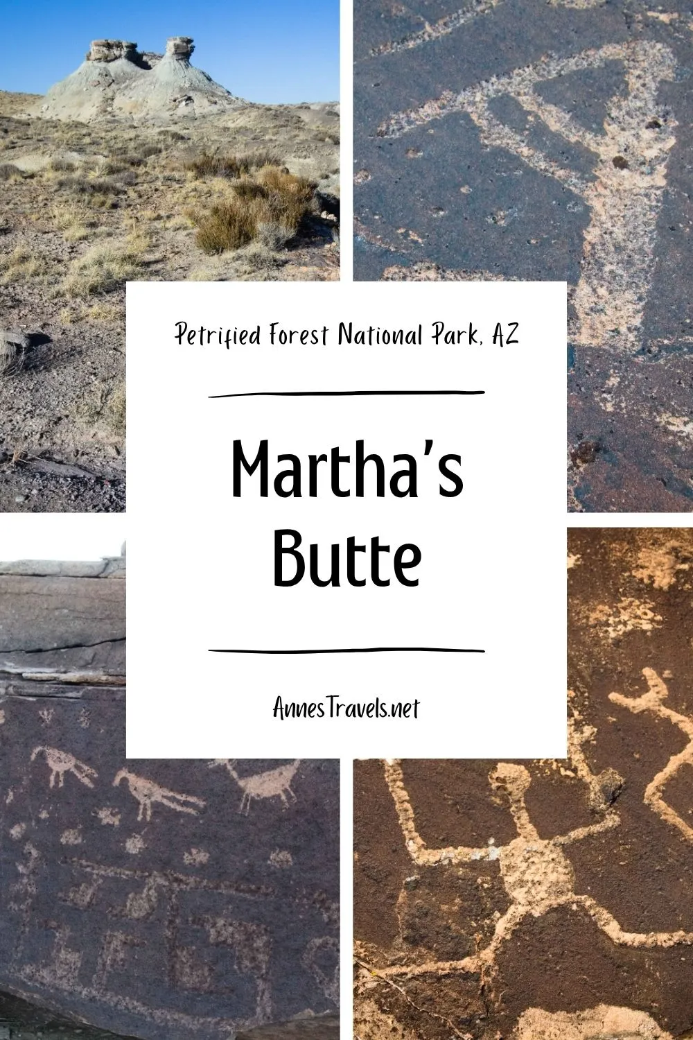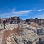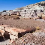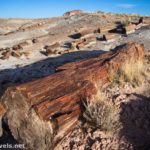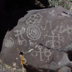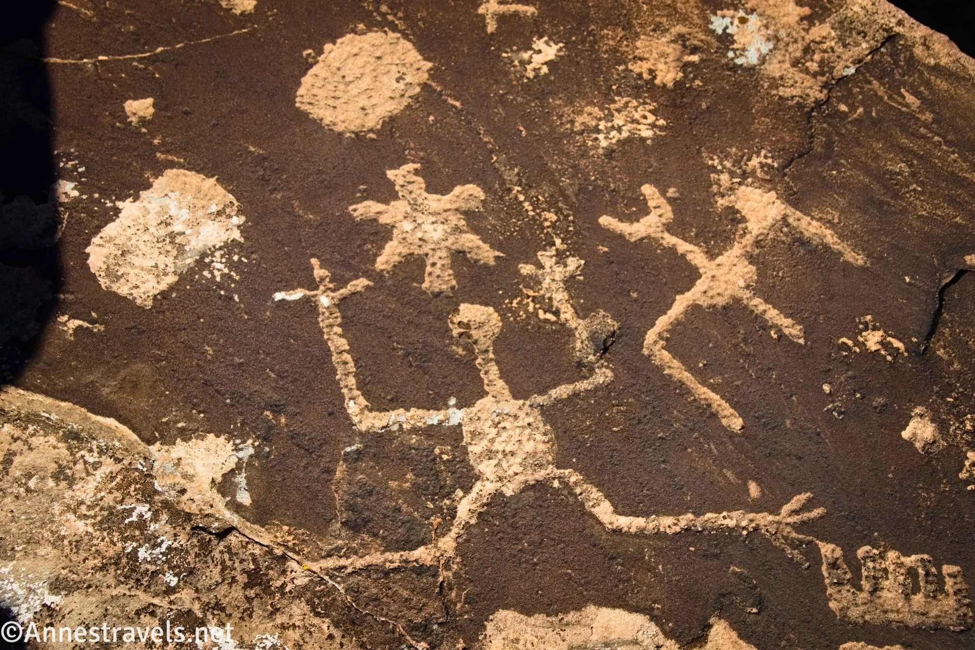
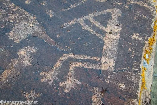
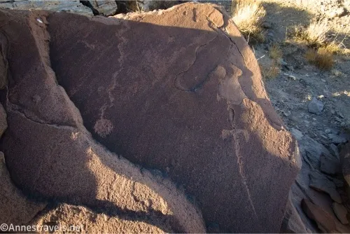
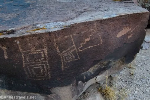
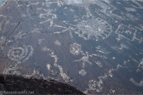
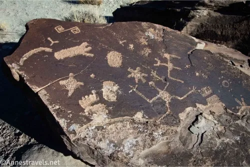
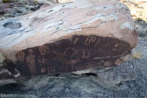
Martha’s Butte is an unofficial hike in the southern part of Petrified Forest National Park. There are several ways to get there and get back, so I did a loop (which included a road walk – you can trade that part for more wash, as I’ll explain later). Boulders around the butte are covered with hundreds of rock art images, some quite imaginative, others geometric, and some so faint it was hard to see them. The views are best in the morning, when the greatest number of rock art panels are in sunshine, but I opted to hike in the late afternoon.
Quick Stats
This post may contain affiliate links, which provide me with a small commission if you buy a product. There is no extra cost to you.
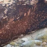
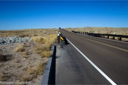
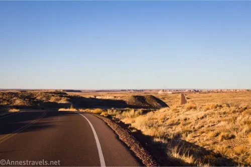
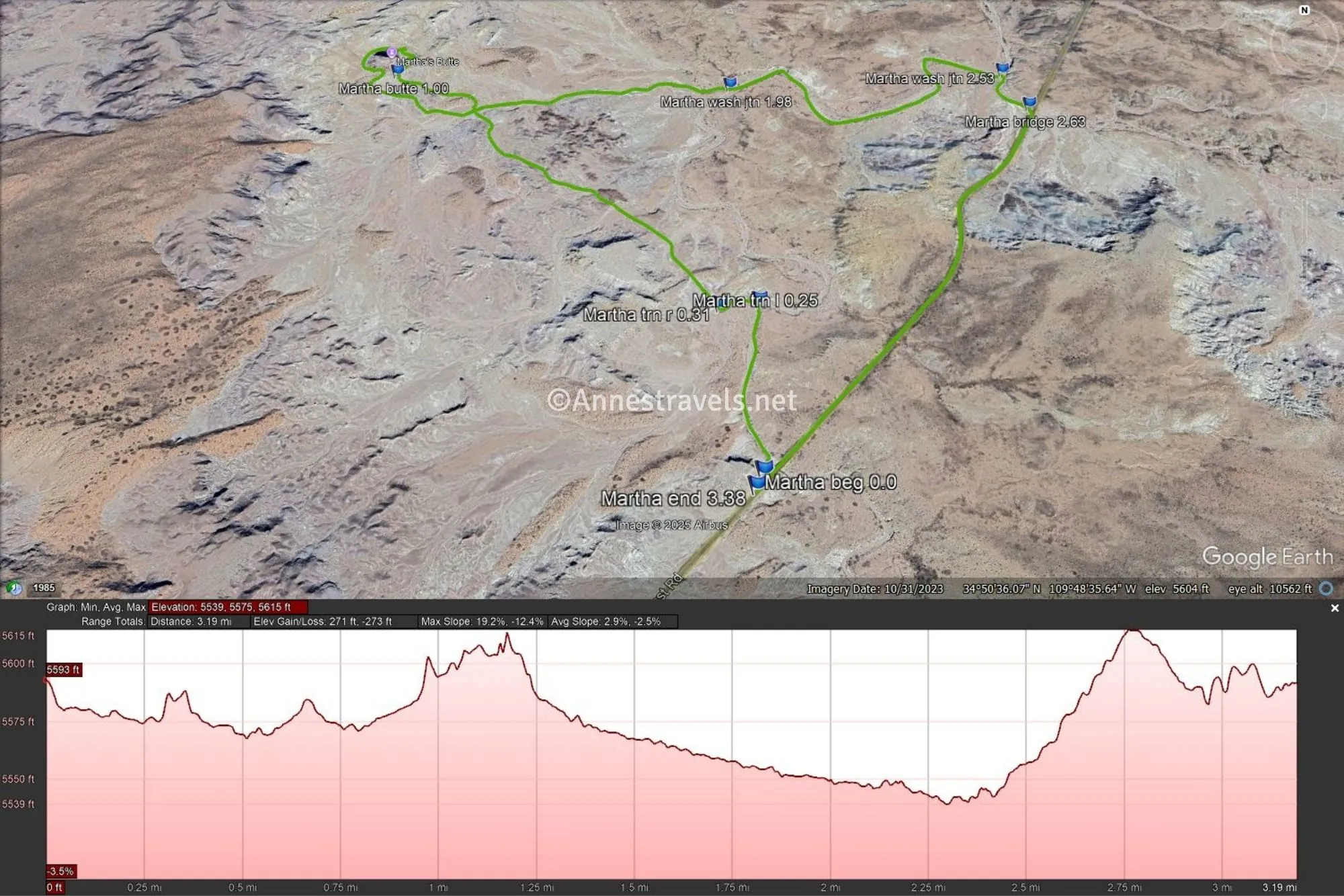
There are two trailheads you’ll find on the internet for Martha’s Butte. Both begin at bridges over various branches of Dry Wash. I started at the southern trailhead, which allowed me to do the Overland Route first. I then returned via the Wash Route to the northern trailhead and walked along the road back to the southern trailhead. Except for a hill between the two arms of the wash, the roadwalk wasn’t bad, and there is a small but real shoulder along the road.
In terms of length, the Overland Route out & back from the southern trailhead is approximately 2.0 miles. The Wash Route from the northern trailhead is approximately 2.4 miles. The Overland & Wash Loop Route would be less than 3 miles, but since I didn’t hike it, I don’t know the exact mileage. Meanwhile, my route (with the roadwalk) was 3.4 miles (you could cut 0.75 miles off of that by having a shuttle vehicle at each trailhead). The mileages below are for my route, including the roadwalk.
Neither trailhead has an official parking area. However, you can probably see where others have pulled off the road and parked. I ended up on the east side of the road, across from where I marked the trailhead.

0.0 Martha’s Butte Trailhead (5,600ft.). Walk to the north (west) side of the road and scramble along the guardrail down into the wash. Turn left (north/west) to follow the wash as it travels north. (34.8398810°, -109.8083170°)
0.25 Turn left up a small sidewash (5,579ft.). Turn left here for a short bit to follow the Overland Route. (34.8432430°, -109.8081730°)
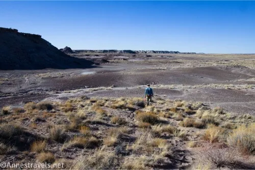
0.3 Turn right (5,581ft.). Turn to scramble up a badland hillside. Once on top, head northwest toward Martha’s Butte, which is fairly obvious unless you’re too low to see it. You’ll cross a rolling badland plain before encountering a wash. Turn left up the wash or continue straight for the butte (actually, there are several washes along the way, so make sure you are heading toward Martha’s Butte in whatever wash you might follow). (34.8431410°, -109.8089510°)
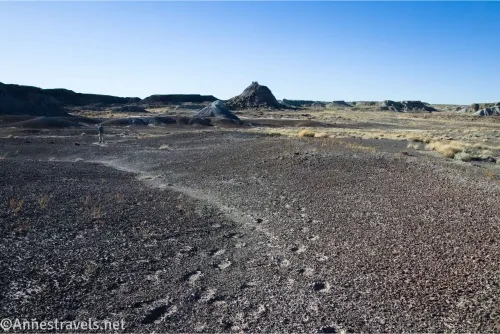
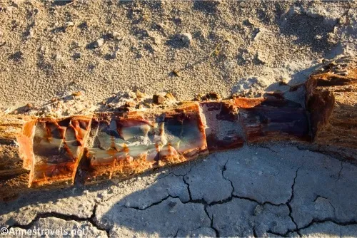
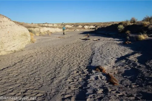
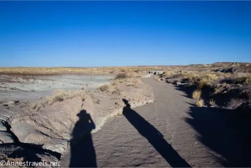
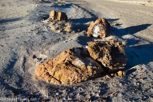
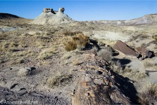
1.0 Martha’s Butte (5,596ft.). Rock art can be found on boulders scattered near the butte. Most of the best rock art is on the southeastern and southwestern sides of the butte, but feel free to wander all of the way around it (I did!). To complete the trail as a loop, walk back down to the wash and turn left (east) to follow the wash. There is some petrified wood in the wash. (34.8494330°, -109.8165030°)
2.0 Wash junction (5,557ft.). Here you have a choice: Turning right will take you down the wash to where you turned left out of it earlier at mile 0.25 (the Overland & Wash Loop Route). This is the quickest way to loop and go back to your vehicle and also probably the simplest. However, I continued straight in the main wash. (34.8491220°, -109.8085110°)
2.5 Wash junction (5,542ft.). The wash enters from the left; turn right to continue south and east to the road bridge. (34.8496760°, -109.8018570°)
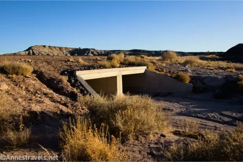
2.6 Road bridge (5,553ft.). Scramble up beside the bridge to access the road; if you have a shuttle vehicle, this is where you would have it parked. Turn right (south) and follow the road back to your vehicle. The road rises over a hill before dropping down to the bridge where you began your trek. Thankfully, the road has a small shoulder, which made it a lot more comfortable with cars driving out of the park for the evening. (34.8485150°, -109.8015030°)
3.4 Martha’s Butte Trailhead (5,598ft.). (34.8396240°, -109.8084530°)
Overall, Martha’s Butte is not the most exciting hike in Petrified Forest National Park. That said, it does offer a change of scenery from wood, wood, and more wood, and if you like rock art, it is a kind of paradise. Remember to leave no trace and don’t touch or pour water in or on the artwork.
Round Trip Trail Length: I did 3.4 miles, but as discussed above, it could be made shorter
Elevation Gain: Up to 273ft. (5,615ft. to 5,539ft.)
Facilities: None
Fees: $25/vehicle, valid 7 days. America the Beautiful National Park & Federal Public Lands passes and Petrified Forest Annual Passes are accepted.
Trail Notes: There is no trail; you should be good at route-finding before attempting this hike. A GPS track is helpful so you can follow it back to the road. If in doubt, head east, and you’ll come to the road sooner or later. The butte does sometimes shade the rock art, so morning may be a better time to visit than evening. Use care walking on the road as there can be a significant amount of traffic. Dogs are allowed on a leash.
Trail 
![]()
![]()
![]()
![]()
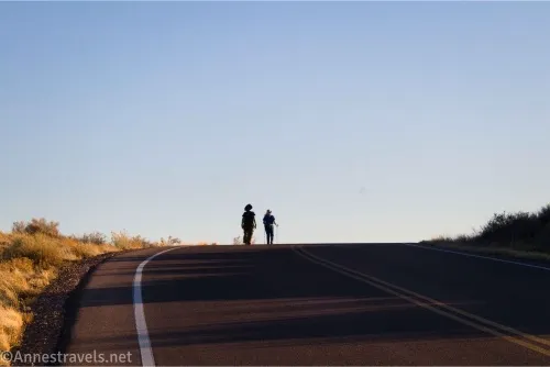
Road ![]()
Signs ![]()
![]()
![]()
![]()
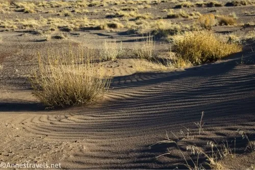
Scenery ![]()
![]()
![]()
Would I go 100 miles out of my way for this? ![]()
![]()
Overall Rating: ![]()
![]()
![]()

GPS Coordinates for Martha’s Butte
TH: 34.8398810°, -109.8083170° (34°50.39286′, -109°48.49902′ / 34°50’23.5716″, -109°48’29.9412″) (5,600ft.) (0.0)
Turn left: 34.8432430°, -109.8081730° (34°50.59458′, -109°48.49038′ / 34°50’35.6748″, -109°48’29.4228″) (5,579ft.) (0.25)
Turn right: 34.8431410°, -109.8089510° (34°50.58846′, -109°48.53706′ / 34°50’35.3076″, -109°48’32.2236″) (5,581ft.) (0.31)
Martha’s Butte area: 34.8494330°, -109.8165030° (34°50.96598′, -109°48.99018′ / 34°50’57.9588″, -109°48’59.4108″) (5,596ft.) (1.00)
Wash junction: 34.8491220°, -109.8085110° (34°50.94732′, -109°48.51066′ / 34°50’56.8392″, -109°48’30.6396″) (5,557ft.) (1.98)
Wash junction: 34.8496760°, -109.8018570° (34°50.98056′, -109°48.11142′ / 34°50’58.8336″, -109°48’06.6852″) (5,542ft.) (2.53)
Bridge: 34.8485150°, -109.8015030° (34°50.91090′, -109°48.09018′ / 34°50’54.6540″, -109°48’05.4108″) (5,553ft.) (2.63)
End: 34.8396240°, -109.8084530° (34°50.37744′, -109°48.50718′ / 34°50’22.6464″, -109°48’30.4308″) (5,598ft.) (3.38)
The gpx file for Martha’s Butte can be downloaded – please note that this and the GPS Coordinates are for reference only and should not be used as a sole resource when hiking this trail.
Download GPX File size: 87.1 KB Downloaded 321 times
(Note: I do my best to ensure that all downloads, the webpage, etc. are virus-free and accurate; however, I cannot be held responsible for any damage that might result, including but not limited to loss of data, damages to hardware, harm to users, from use of files, information, etc. from this website. Thanks!)
Getting to the Martha’s Butte Trailhead
From the Rainbow Forest Museum, drive 3.9 miles north on the Main Park Road. The trailhead is also 6.5 miles south of the Blue Mesa Road. Park out of the way of traffic along the edge of the road near the bridge.
Hike Petrified Forest and Beyond
Covering more than 30 parks, this guide takes you to some of the very best scenery in Arizona – including in Petrified Forest. Buy your copy here.