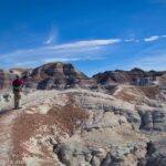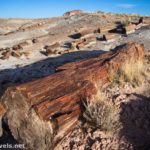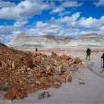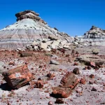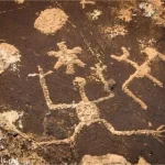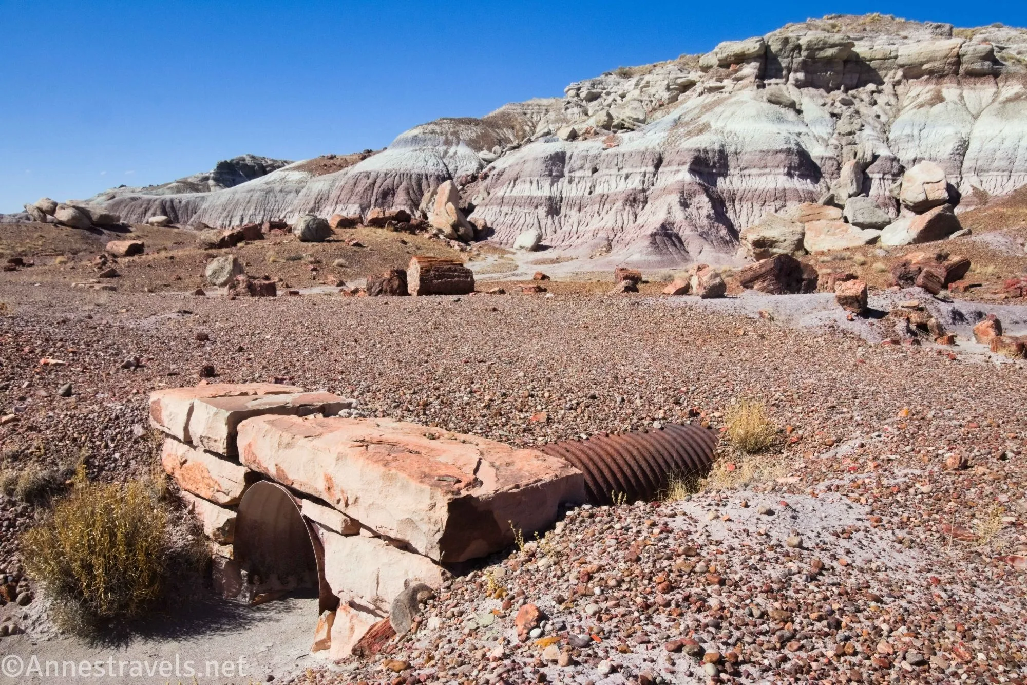
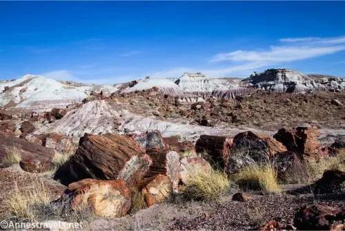
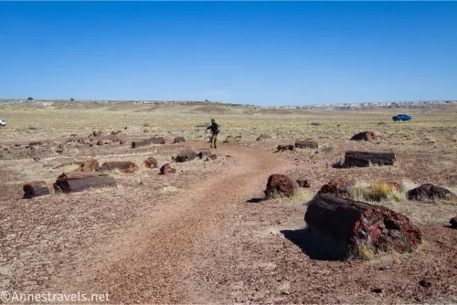
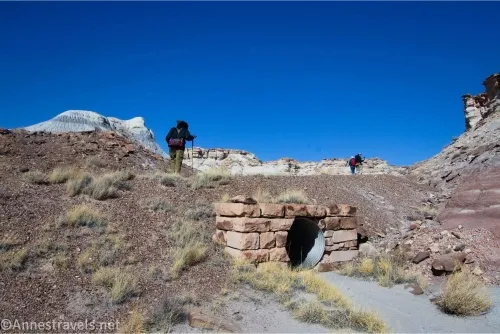
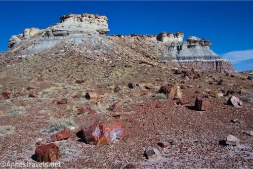
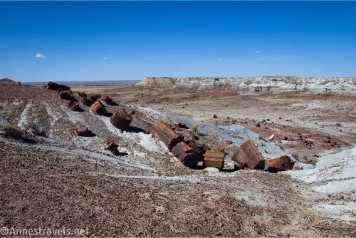
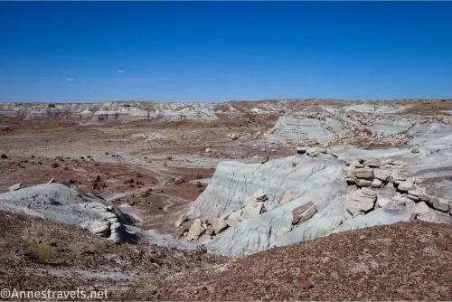
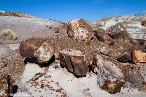
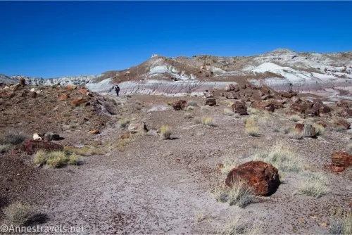
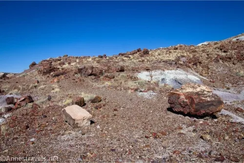
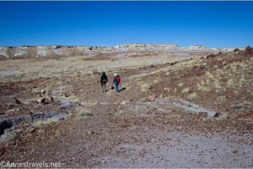
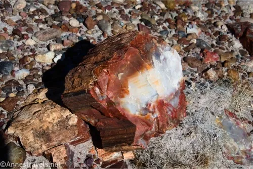
If you want an easy-to-follow official off-trail route to hike in Petrified Forest National Park (or maybe you just love history), the Jasper Forest is a good choice. Sure, there’s no trail, but you’re following an old road for most of the length of the hike, so in general you shouldn’t get (too) lost. Along the way, you get to count and find more than 10 old culverts that once carried runoff under the old road. There are also several collections of petrified wood, badlands, and more to keep your eyes and heart happy as you hike.
Quick Stats
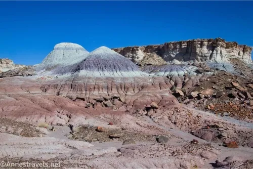
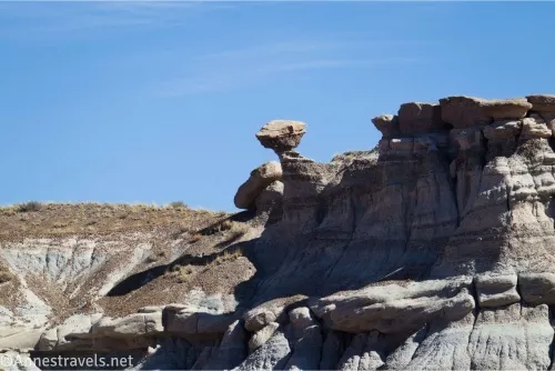
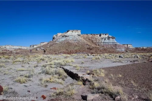
The road to Eagle Nest Rock (sometimes typed Eagle’s Nest Rock) was one of the early side-roads in what is now Petrified Forest National Park. The culverts and road were built by the CCCs and led to a very neat rock formation. Sadly, in the 1940s, the rock formation crumbled, leaving little but a badland hill behind. Because there was nothing there to see, the road was not maintained, and eventually it was closed in the 1960s in an effort to keep looters away from petrified wood. Today, you can follow the old roadbed (which is washed out in many places) from the Jasper Forest Overlook to the remains of Eagle Nest Rock.
I really enjoyed the Jasper Forest route. Off the beaten path yet not truly off-trail, it was quite entertaining to me to look for the old culverts (let alone see all the petrified wood and badlands). People say they typically find half of the culverts on the way out and the other half on the way back, but I had no trouble at all finding every single one (and a couple that aren’t mentioned in official literature) on my way to Eagle Nest Rock.
You can also stop by the visitor center or the Rainbow Forest Museum to pick up a full-color printout that will show you pictures of each culvert and how to hike the trail. The hardest parts are the initial descent to the roadbed and one sharp right turn that will take you to Eagle Nest Rock (the latter really isn’t that hard if you’re paying attention); I’ve added GPS coordinates that should help you find your way (namely, Culverts 1 & 2 to get you down the hill to the roadbed and Culvert 8 to get you around the turn).
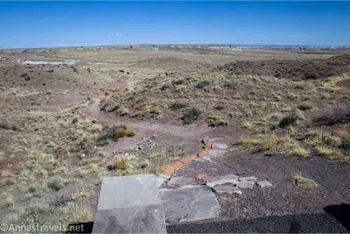
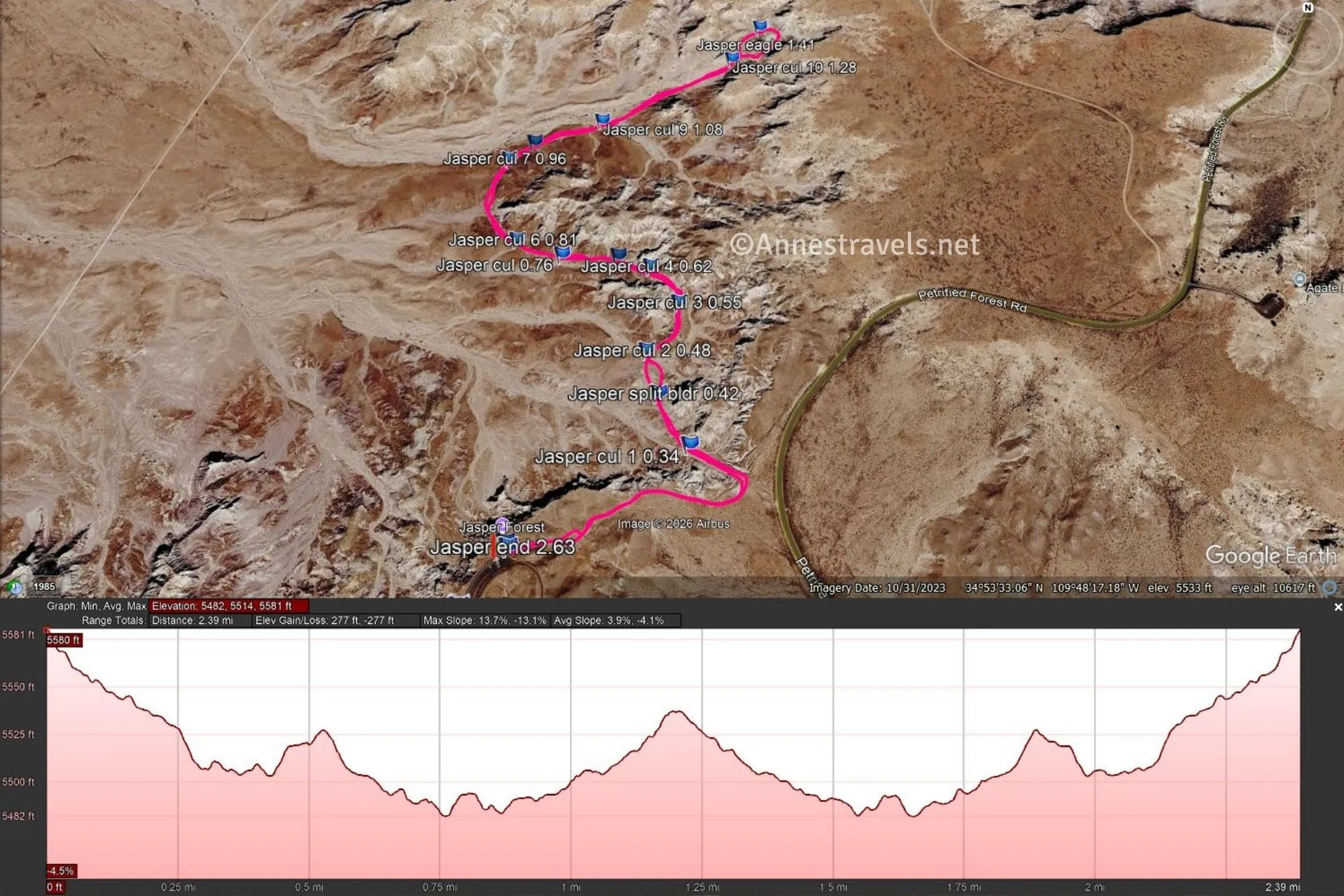
0.0 Jasper Forest Trailhead (5,575ft.). The unmarked “trailhead” is located at the far eastern (northern) end of the parking lot to the right of the trail to the viewpoint (in the way of trivia, the viewpoint was built as a replacement for the road… I wouldn’t call it a 1-to-1 replacement, but it has a good view all the same). At first, the trail is very defined, then it is very undefined. Keep walking downhill with the main park road on your right (thankfully not too close!) until the route turns left (northwest) to descend into a wash. Continue downhill, now with the main park road to your back. (34.888601°, -109.807280°)
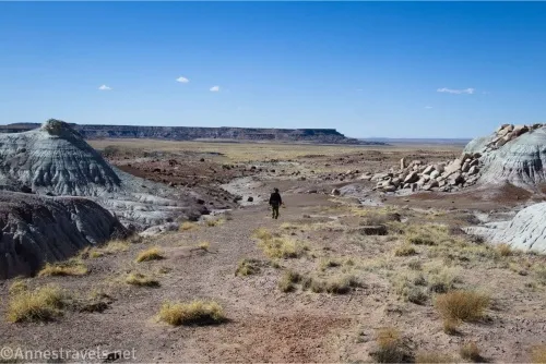
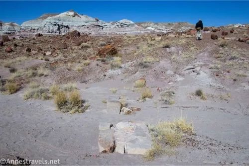
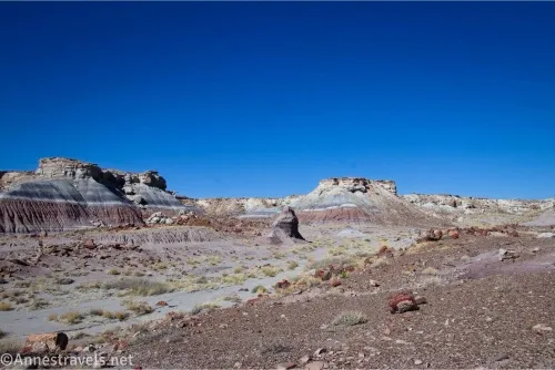
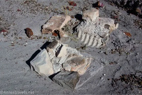
0.3 Culvert 1 (5,509ft.). You’re now on the old First Forest-Eagle Nest Rock Road. Walk north and east following the old roadbed and keeping the cliffs on your right. In many places, the roadbed is easy to find, though at first (and a few points along the way) it has been washed away. The road had quite a few culverts running underneath the roadbed to drain rainwater under the road – today, these range from bits of concrete to pipe set in stone. Here are the coordinates for the culverts along the way, although it’s more fun to try and find them without using the coordinates: (Culvert 1: 34.8901100°, -109.8045090°), (Culvert 2: 34.8915660°, -109.8052220°), (Culvert 3: 34.8923310°, -109.8046720°), (Culvert 4: 34.8929670°, -109.8051710°), (Culvert 5: 34.8931730°, -109.8057550°), (Culvert A (not official): 34.8932170°, -109.8067670°), (Culvert 6: 34.8934980°, -109.8075930°), (Culvert 7: 34.8950570°, -109.8078880°), (Culvert 8: 34.8954090°, -109.8074290°), (Culvert 9: 34.8958380°, -109.8061520°), (Culvert 10: 34.8971290°, -109.8035970°). Just beyond Culvert 3 is an impressive and beautiful collection of petrified wood and badlands. Between culverts 6 and 7, the road turns sharply north to travel northeast up a very broad valley with a wash on the left. The scenery definitely changes here – and for the better in my opinion. Beyond Culvert 10 are two or three more culverts; I’m not sure why they are not counted by the NPS as some are in much better condition than others that are official. (34.8901100°, -109.8045090°)
1.1 Road split (5,522ft.). I turned right here, but you can go either direction to circle the mound that is all that’s left of Eagle Nest Rock. Until the early 1940s, a very impressive 15ft. rock formation towered on top of the mound. Somewhere along the way, eagles did nest on top of the rock. The old road circles the mound, then you can retrace your steps back up the road to the parking area. (34.897297°, -109.803397°)
Round trip trail length: 2.4 miles
Elevation gain: 265ft. (5,580ft. to 5,482ft.)
Facilities: None
Fees: $25/vehicle to enter Petrified Forest National Park, valid 7 days. America the Beautiful National Parks & Federal Public Lands Passes and Petrified Forest Annual Passes are accepted.
Trail Notes: The old road is easy to see at times; at other times, well, not so much. Be ready to search for it or to shoot for the next culvert coordinate. There is quite a bit of petrified wood along the way. I visited on a hot and dry March afternoon, so I probably would have enjoyed it more at a cooler time of day!
Trail 
![]()
![]()
![]()
Road
Signs ![]()
![]()
![]()
![]()
Scenery ![]()
![]()
Would I go 100 miles out of my way for this? ![]()
![]()
Overall Rating: ![]()
![]()
GPS Coordinates for the Jasper Forest Route
TH: 34.8886780°, -109.8073060° (34°53.32068′, -109°48.43836′ / 34°53’19.2408″, -109°48’26.3016″) (5,574ft.) (0.0)
Culvert 1: 34.8901100°, -109.8045090° (34°53.40660′, -109°48.27054′ / 34°53’24.3960″, -109°48’16.2324″) (5,509ft.) (0.34)
Split boulder: 34.8908830°, -109.8050190° (34°53.45298′, -109°48.30114′ / 34°53’27.1788″, -109°48’18.0684″) (5,507ft.) (0.42)
Culvert 2: 34.8915660°, -109.8052220° (34°53.49396′, -109°48.31332′ / 34°53’29.6376″, -109°48’18.7992″) (5,503ft.) (0.48)
Culvert 3: 34.8923310°, -109.8046720° (34°53.53986′, -109°48.28032′ / 34°53’32.3916″, -109°48’16.8192″) (5,517ft.) (0.55)
Culvert 4: 34.8929670°, -109.8051710° (34°53.57802′, -109°48.31026′ / 34°53’34.6812″, -109°48’18.6156″) (5,513ft.) (0.62)
Culvert 5: 34.8931730°, -109.8057550° (34°53.59038′, -109°48.34530′ / 34°53’35.4228″, -109°48’20.7180″) (5,504ft.) (0.69)
Culvert A (not on the NPS printout): 34.8932170°, -109.8067670° (34°53.59302′, -109°48.40602′ / 34°53’35.5812″, -109°48’24.3612″) (5,493ft.) (0.76)
Culvert 6: 34.8934980°, -109.8075930° (34°53.60988′, -109°48.45558′ / 34°53’36.5928″, -109°48’27.3348″) (5,488ft.) (0.81)
Culvert 7: 34.8950570°, -109.8078880° (34°53.70342′, -109°48.47328′ / 34°53’42.2052″, -109°48’28.3968″) (5,489ft.) (0.96)
Culvert 8: 34.8954090°, -109.8074290° (34°53.72454′, -109°48.44574′ / 34°53’43.4724″, -109°48’26.7444″) (5,485ft.) (1.00)
Culvert 9: 34.8958380°, -109.8061520° (34°53.75028′, -109°48.36912′ / 34°53’45.0168″, -109°48’22.1472″) (5,492ft.) (1.08)
Culvert 10: 34.8971290°, -109.8035970° (34°53.82774′, -109°48.21582′ / 34°53’49.6644″, -109°48’12.9492″) (5,520ft.) (1.28)
Eagle’s Nest rock area: 34.8978250°, -109.8030040° (34°53.86950′, -109°48.18024′ / 34°53’52.1700″, -109°48’10.8144″) (5,534ft.) (1.41)
End: 34.8886200°, -109.8072620° (34°53.31720′, -109°48.43572′ / 34°53’19.0320″, -109°48’26.1432″) (5,574ft.) (2.63)
The gpx file for the Jasper Forest can be downloaded – please note that this and the GPS Coordinates are for reference only and should not be used as a sole resource when hiking this trail.
Download GPX File size: 71.2 KB Downloaded 160 times
(Note: I do my best to ensure that all downloads, the webpage, etc. are virus-free and accurate; however, I cannot be held responsible for any damage that might result, including but not limited to loss of data, damages to hardware, harm to users, from use of files, information, etc. from this website. Thanks!)
Getting to the Jasper Forest Parking Area
From the Rainbow Forest Museum, drive 7.6 miles north on the main park road. Turn left toward the Jasper Forest. Park in the lot 0.4 miles later.
From the northern entrance station (Visitor Center), continue along the main park road as it winds above the Painted Desert and then south through the park. After 18.1 miles, turn right toward the Jasper Forest. Park in the lot 0.4 miles later.
Explore More Hikes in Arizona
More hikes across Arizona – including in Petrified Forest National Park – can be found in this book, written by an adventurer in the region. Buy your copy here.