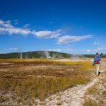
The Calcite Springs Overlook is a quick and easy (and wheelchair-accessible) trek not far from Tower Junction in Yellowstone National Park. I hear the views of the springs are even better from the Yellowstone River Picnic Area Trail, but since that path was closed due to road construction when I visited, I contented myself with the official overlook. All things being equal, it’s not a bad view, and you can’t complain about a long hike!
Quick Stats
This post may contain affiliate links. If you click these links and buy something, I may receive a small commission at no extra cost to you. Thank you for supporting Anne’s Travels!
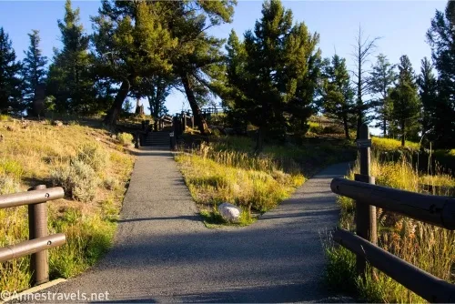
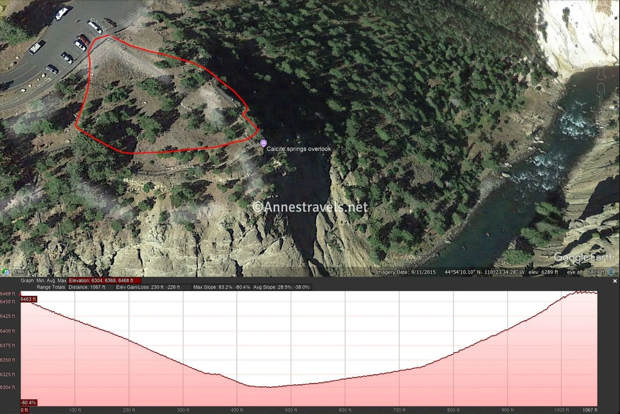
0.0 Calcite Springs Trailhead (6,524ft.). Follow the trail toward the canyon rim. Almost immediately, the trail splits – if possible, take the left trail up the steps (not wheelchair accessible) to the viewing platform (if you can’t do stairs, it’s fine to take the right trail; they arrive at the same place in a minute). (44.901904°, -110.393148°)
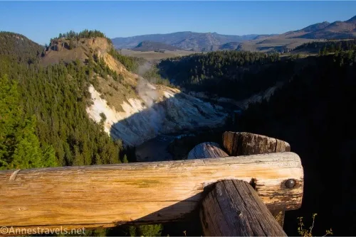
300ft. Calcite Springs Overlook 1 (6,466ft.). At the top of the stairs, enjoy the view and read the signs – I preferred this higher viewpoint, as it gives a great view down into the Calcite Springs area. From here, descend to the lower viewing platform. (44.90241750°, -110.39305921°)
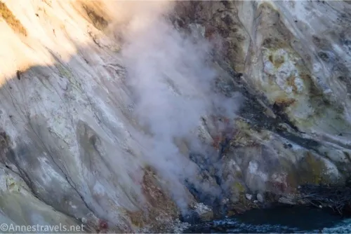
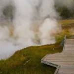
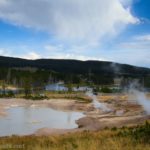
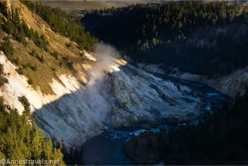
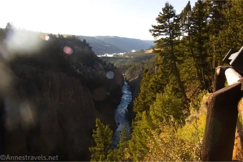
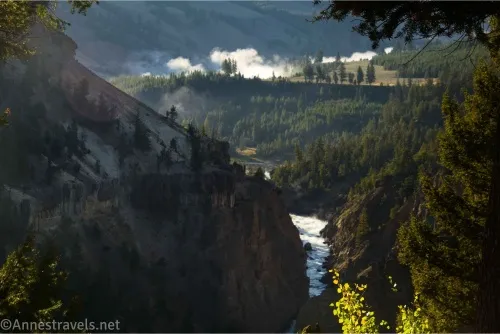
450ft. Calcite Springs Overlook 2 (6,425ft.). This is where the wheelchair-accessible trail comes in. Views are still quite good down into the canyon where you can see the geothermal area of Calcite Springs on the hillside beside the Yellowstone River. The area has many crystals, including white calcite crystals, honey-colored barite crystals, and yellow sulfur crystals. The springs are so hot that they liquefy large quantities of sulfur; at times, the sulfur will ooze to the surface, turning black as it touches the air and flowing downhill like molasses. If you wish (and don’t mind a few stairs), turn to continue down the stairs and along the canyon rim back to the parking area. There are some good views of the Yellowstone River toward Tower Falls (out of sight here) along the way. (44.90254690°, -110.39271751°)
0.18 Return to parking area (6,524ft.). Turn right and walk on the sidewalk to return to the Calcite Spring Trailhead. (44.90169592289175, -110.39276732713091)
0.2 Calcite Springs Trailhead (6,524ft.). (44.901818°, -110.392973°)

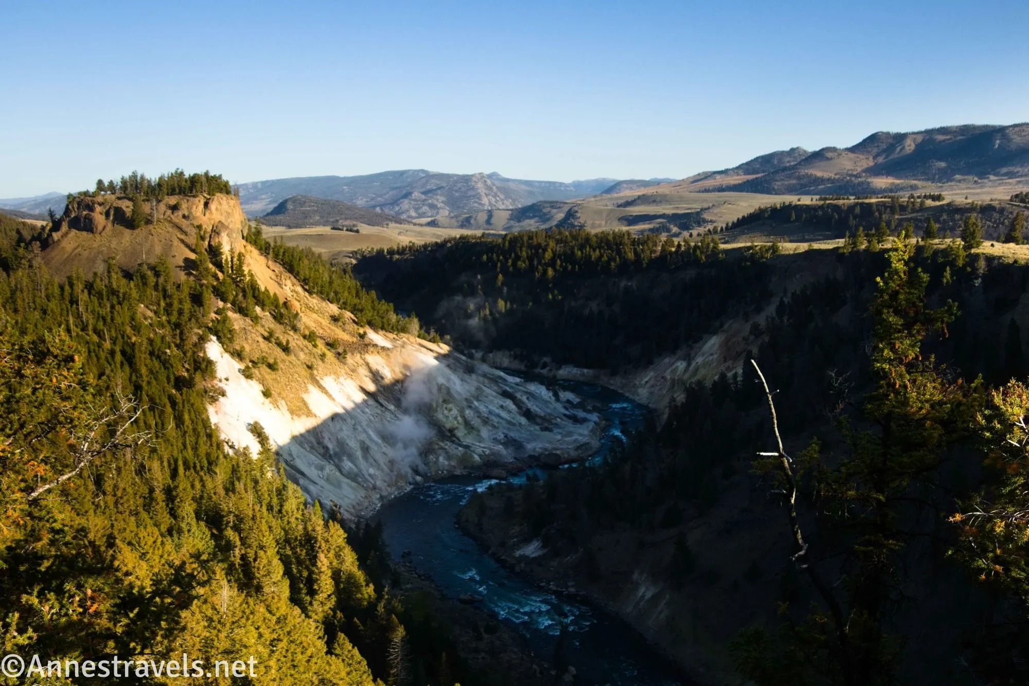
My favorite part of the hike was seeing down into the lower end of the Grand Canyon of the Yellowstone River. It’s nowhere near as impressive here as around the Upper and Lower Falls, but it’s still nice. I visited in the early (very early!) morning, so the shadows were all wrong to get a good view of Calcite Springs. It would be a much better view in the afternoon.
Round Trip Trail Length: 0.2 miles
Elevation Gain: About 100ft. (6,524ft. to 6,425ft.)
Facilities: None
Fees: $35/vehicle, valid 7 days. America the Beautiful National Parks & Federal Public Lands Passes and Yellowstone National Park Annual Passes are accepted.
Trail Notes: Part of the trail is wheelchair-accessible, while other parts have stairs. You can get to the lower overlook in a wheelchair. Views are best in the afternoon, though I did enjoy my morning hike there. You won’t spend much time, and if you’re pressed for time, don’t bother, but if you’re having a leisurely drive between Canyon and Tower, it makes for a great little stop along the way.
Trail 
Road ![]()
Signs ![]()
![]()
Scenery ![]()
![]()
Would I go 100 miles out of my way for this? ![]()
![]()
![]()
Overall Rating: 
![]()
GPS Coordinates for the Calcite Springs Overlook
TH: 44.9017980°, -110.3930790° (44°54.10788′, -110°23.58474′ / 44°54’06.4728″, -110°23’35.0844″) (6,508ft.) (0.0)
TH (end): 44.9019010°, -110.3930600° (44°54.11406′, -110°23.58360′ / 44°54’06.8436″, -110°23’35.0160″) (6,503ft.) (0.37)
The gpx file for Calcite Springs can be downloaded – please note that this and the GPS Coordinates are for reference only and should not be used as a sole resource when hiking this trail.
Download GPX File size: 2.6 KB Downloaded 56 times
(Note: I do my best to ensure that all downloads, the webpage, etc. are virus-free and accurate; however, I cannot be held responsible for any damage that might result, including but not limited to loss of data, damages to hardware, harm to users, from use of files, information, etc. from this website. Thanks!)
Getting to the Calcite Springs Overlook Trailhead
From Tower Junction, drive toward Canyon 1.5 miles, then turn left into a small loop parking lot. Or from Tower Falls, drive north (toward Tower) for 0.8 miles to the parking area, on right.
More Easy Day Hikes in Yellowstone
Yellowstone has so many easy and short hikes, many of which are also wheelchair-accessible. This guide covers some of the best. Buy your copy here.