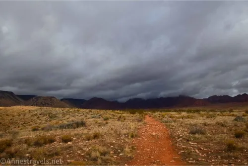
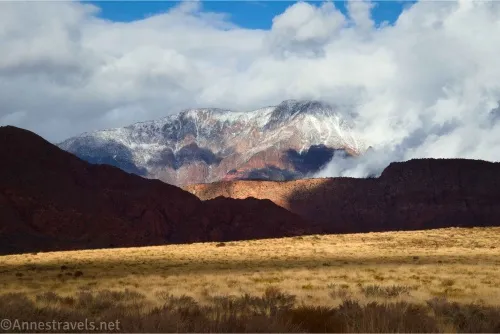
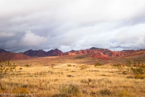
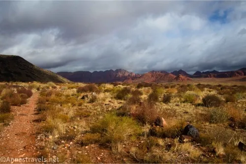
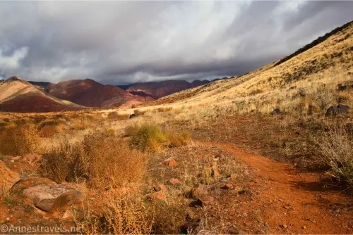
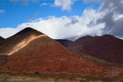
I loved hiking the Mustang Pass Trail outside of St. George, Utah. The views were great, especially after a snowfall on the nearby mountains. The trail also ties into many other trails in the Red Cliffs Conservation Area, so we were able to hike from there over to Elephant Arch. And the best news? It wasn’t too terribly hilly!
Quick Stats
This post may contain affiliate links. If you click a link and purchase something, I may get a small commission. There is no extra cost for you.
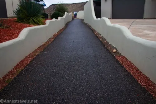
The only thing I didn’t like about the hike was that it’s been more or less cut off from being hikable due to the building of a subdivision. I followed the AllTrails suggestion (at the time) and parked in the designated parking spaces (all two of them) in the neighborhood. Then I had to walk between two houses (talk about feeling like you’re invading someone’s privacy!) to where the desert suddenly began next to a sign kiosk. I’m really glad the trailhead still exists, and all I can hope is that the neighbors don’t complain to the point where they close it off entirely (because I know of no other 2WD way to get to this area of the preserve). Recent research suggests the trailhead may or may not exist anymore, so use consideration when invading the neighborhood. There is a park half a mile south that might be an alternate place to park if the trail, itself, is still open.
Anyway, trailhead tirade aside, let’s get to the views!
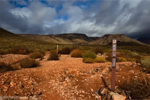
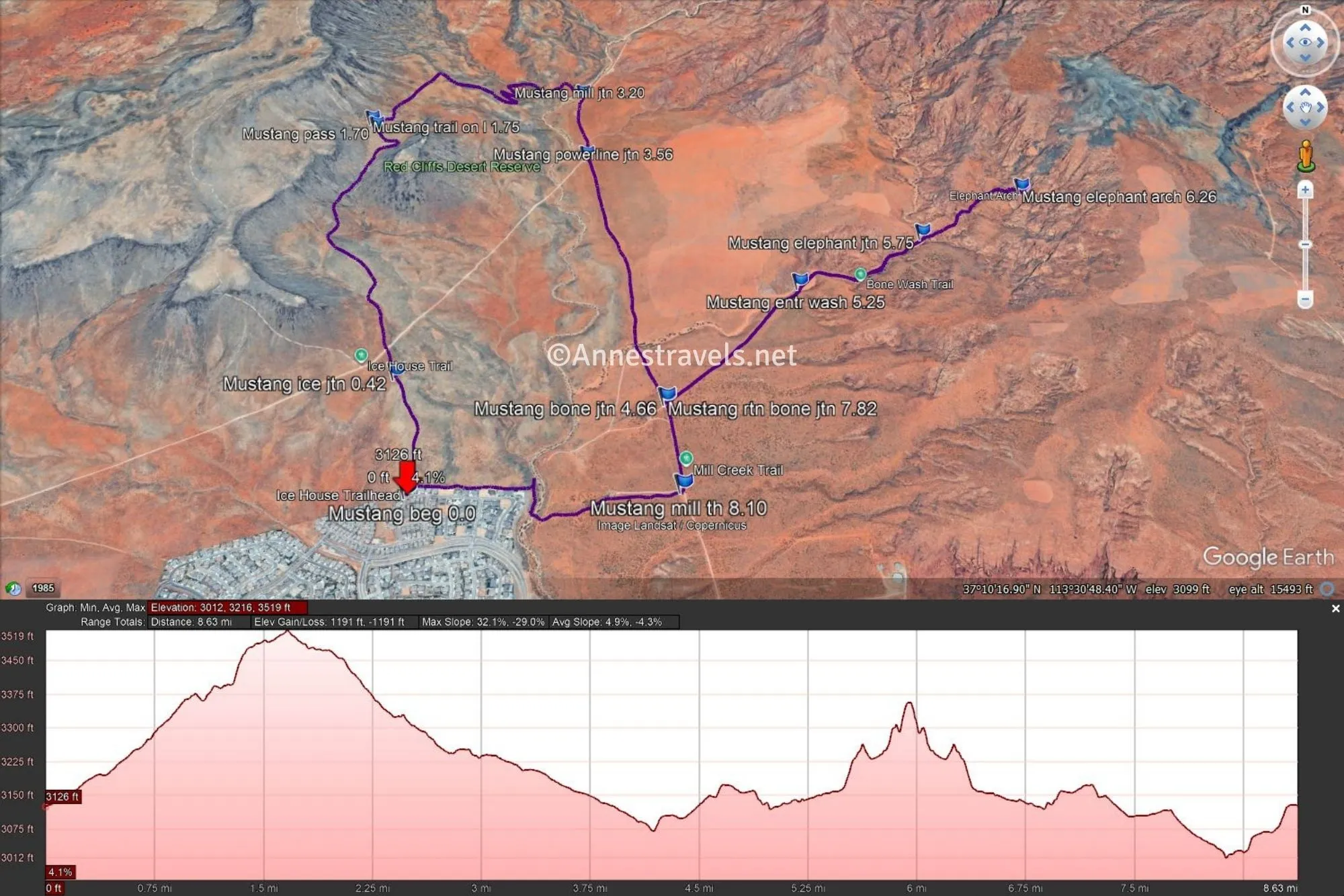
0.0 Mustang Pass (Icehouse Trail) Trailhead (3,130ft.). Park only in designated spaces and not along the side of the road, blocking driveways, or any other annoying parking techniques. Take the paved path between two houses to pop out in the desert beside a sign kiosk. Go straight on the Icehouse Trail out into the desert. (37.1614570°, -113.5250810°)
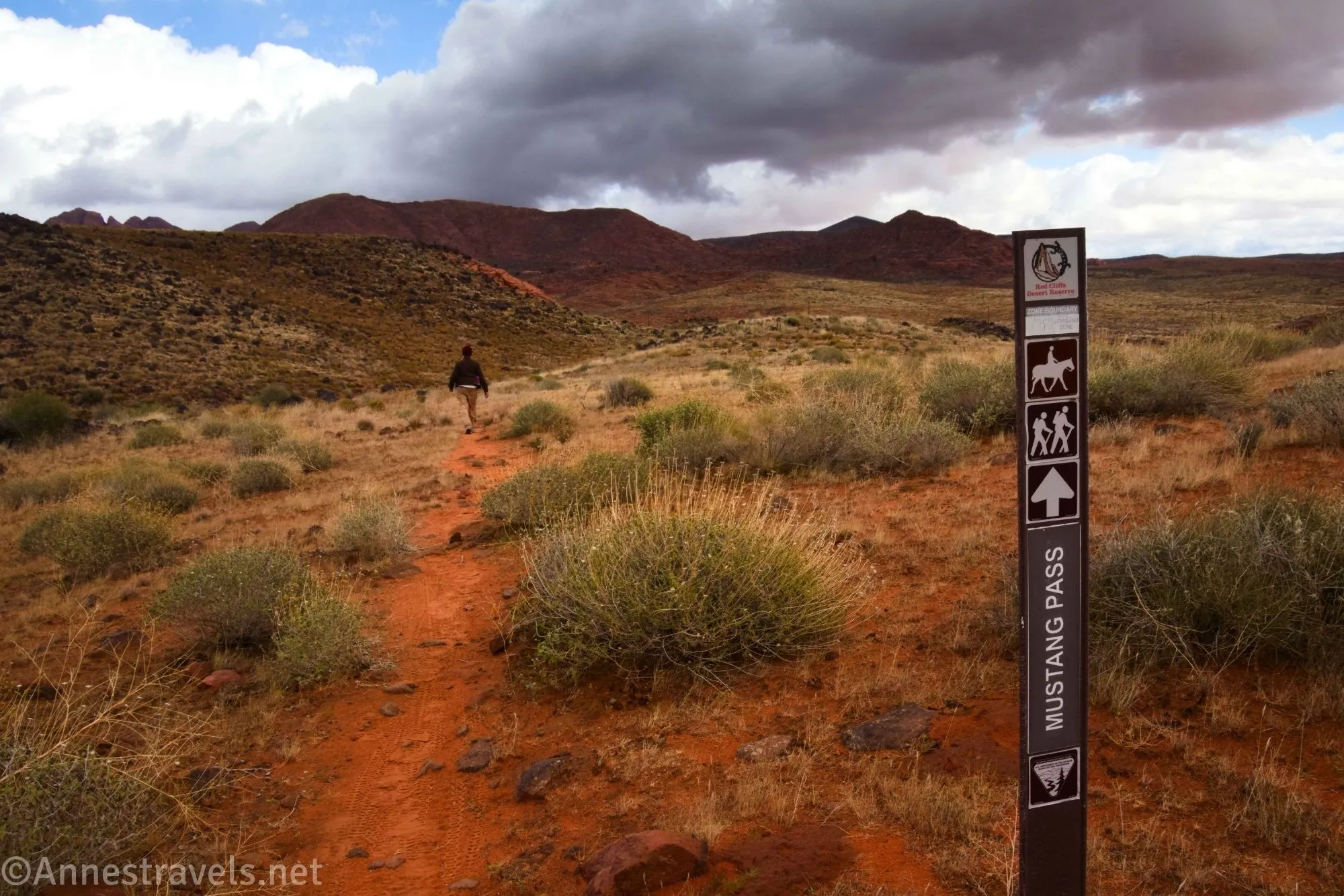
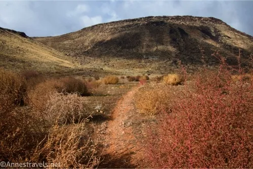
0.4 Icehouse Trail Junction (3,193ft.). Continue straight here to head up into Mustang Pass (left is the Icehouse Trail). I know I said the trail was mostly flat, and by mountain standards, it is flat… it’s just not all flat. The grades are fairly moderate, though. The scenery improves as you climb. (37.1667820°, -113.5266410°)
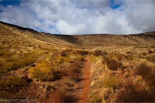
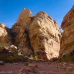
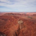
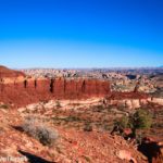
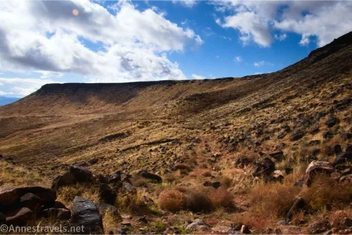
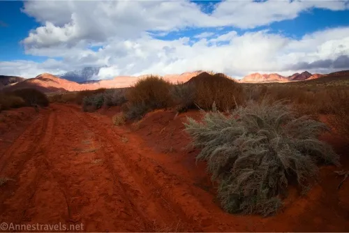
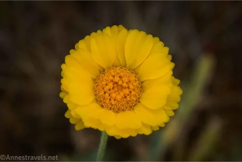
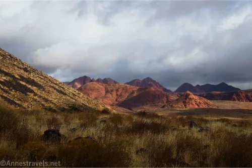
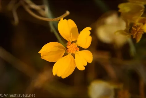
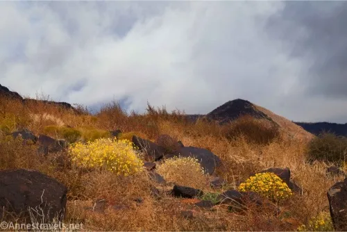
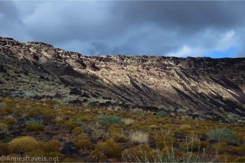
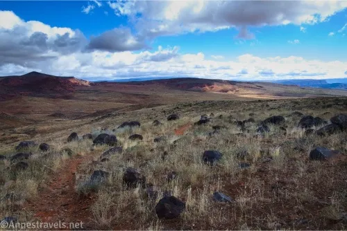
1.7 Mustang Pass (3,513ft.). Views are excellent all through this area. I also enjoyed some leftover wildflowers in late November. There is also a lot of volcanic rocks, which was interesting to me since the area around it is mostly red dirt and rocks. Continue down the trail (or retrace your steps to the trailhead for a 3.4 mile trek). In the pass, you might pass a trail on the left; ignore it to stay on the main path. (37.1813260°, -113.5306340°)
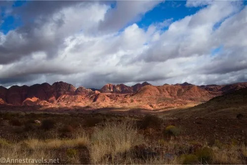
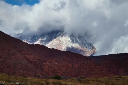
3.2 Mill Creek Trail Junction (3,248ft.). This is a road along the power lines. I turned right since I wanted to get over to Elephant Arch. The views in this section were nice, too, especially back toward the snowy mountains. Pass the Power Line Trail on the right about mile 3.5. (37.1849560°, -113.5189000°)
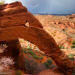
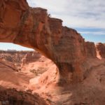
4.6 Bone Wash Trail on left (3,108ft.). I turned left here to Elephant Arch, but I won’t detail that here. Instead, I’ll pretend you continued straight past the junction to the Elephant Arch Trailhead. (37.1657500°, -113.5136770°)
4.9 (8.1) Elephant Arch Trailhead (Mill Creek Trailhead) (3,118ft.). There is no good way to get back to where you parked from here (at least on foot). I turned right to follow a road to some kind of substation, picked up an ATV trail down to a wash, crossed the wash, and then picked up another trail that took me a little north and then turned west along a trail shown on a map. But the neighbors thought it was closed (is a trail closed if there are no signs or any indication that it might be closed? Maybe it’s wishful thinking). This path went along the back of the subdivision to the sign kiosk where you began your trek. Turn left to pass back between the houses and to where you parked. (37.1616950°, -113.5129130°)
6.9 (9.1) Mustang Pass Trailhead (3,130ft.). (37.1615070°, -113.5250920°)
Round Trip Trail Length: With my side-trek to Elephant Arch, I went 9.1 miles. Skipping the sidetrek but doing the loop would be about 7 miles, while and out and back to Mustang Pass would be only 3.4 miles from the Icehouse Trailhead.
Elevation Gain: Mustang Pass Loop: 665ft. (3,012ft. to 3,519ft.). With Elephant Arch: 1,191ft. (3,012ft. to 3,519ft.)
Facilities: None
Fees: None
Trail Notes: You’re required to stay on official trails within the Red Cliffs National Conservation Area, so check the map at the sign kiosk to make sure you know which trails are currently official. I can’t blame the neighbors for not liking total strangers walking along their fences, so use extreme courtesy. I hear there is more parking within the community, possibly around Green Spring Park (37.15504619, -113.5267152), which would add about half a mile each way to the hike, all on quiet roads. In the summer, this would be an outrageously hot and dry hike – as it was, the day I visited was frigid, so there was no fear of heatstroke! The beauty of this hike is rugged and hard for me to pin down – I just thought it was so vibrant and beautiful!
Trail 
![]()
![]()
Road ![]()
Signs ![]()
Scenery ![]()
Would I go 100 miles out of my way for this? ![]()
Overall Rating: ![]()
GPS Coordinates for Mustang Pass
TH: 37.1614570°, -113.5250810° (37°09.68742′, -113°31.50486′ / 37°09’41.2452″, -113°31’30.2916″) (3,130ft.) (0.0)
Icehouse Trail Junction: 37.1667820°, -113.5266410° (37°10.00692′, -113°31.59846′ / 37°10’00.4152″, -113°31’35.9076″) (3,193ft.) (0.42)
Mustang Pass: 37.1813260°, -113.5306340° (37°10.87956′, -113°31.83804′ / 37°10’52.7736″, -113°31’50.2824″) (3,513ft.) (1.70)
Trail on left: 37.1817620°, -113.5309890° (37°10.90572′, -113°31.85934′ / 37°10’54.3432″, -113°31’51.5604″) (3,524ft.) (1.75)
Mill Creek Junction: 37.1849560°, -113.5189000° (37°11.09736′, -113°31.13400′ / 37°11’05.8416″, -113°31’08.0400″) (3,248ft.) (3.20)
Powerline Trail Junction: 37.1801900°, -113.5183620° (37°10.81140′, -113°31.10172′ / 37°10’48.6840″, -113°31’06.1032″) (3,190ft.) (3.56)
Bone Wash Trail Junction: 37.1657500°, -113.5136770° (37°09.94500′, -113°30.82062′ / 37°09’56.7000″, -113°30’49.2372″) (3,108ft.) (4.66)
Enter wash: 37.1719180°, -113.5067720° (37°10.31508′, -113°30.40632′ / 37°10’18.9048″, -113°30’24.3792″) (3,120ft.) (5.25)
Elephant Arch Junction: 37.1748750°, -113.4998570° (37°10.49250′, -113°29.99142′ / 37°10’29.5500″, -113°29’59.4852″) (3,190ft.) (5.75)
Elephant Arch: 37.1773180°, -113.4939970° (37°10.63908′, -113°29.63982′ / 37°10’38.3448″, -113°29’38.3892″) (3,190ft.) (6.26)
Return to Mill Creek Trail: 37.1657070°, -113.5136530° (37°09.94242′, -113°30.81918′ / 37°09’56.5452″, -113°30’49.1508″) (3,108ft.) (7.82)
Mill Creek TH: 37.1616950°, -113.5129130° (37°09.70170′, -113°30.77478′ / 37°09’42.1020″, -113°30’46.4868″) (3,118ft.)) (8.10)
End: 37.1615070°, -113.5250920° (37°09.69042′, -113°31.50552′ / 37°09’41.4252″, -113°31’30.3312″) (3,130ft.) (9.06)
The gpx file for Mustang Pass (and Elephant Arch) can be downloaded – please note that this and the GPS Coordinates are for reference only and should not be used as a sole resource when hiking this trail.
Download GPX File size: 137.7 KB Downloaded 27 times
(Note: I do my best to ensure that all downloads, the webpage, etc. are virus-free and accurate; however, I cannot be held responsible for any damage that might result, including but not limited to loss of data, damages to hardware, harm to users, from use of files, information, etc. from this website. Thanks!)
Getting to the Mustang Pass Trailhead
To get to where I parked, take Exit 10 toward Grn Sprgs Drive. Take a slight right onto Green Spring Drive. After 2.3 miles, turn right onto Jonathon Drive, then take the first left. After 0.1 miles, the road will take a sharp turn to the right. The trailhead is on the left at the curve in the road.
To get to the Millhouse Trailhead (Elephant Arch Trailhead), you’ll need 4×4 due to sand. From I-15, take Exit 13 toward Washington Parkway. At the end of the exit ramp, turn north (right if coming from I-15E (Hurricane) and left if coming from I-15W (St. George)). Just under a mile later, turn right onto a dirt road; cross over the bike path and drive north until the route is blocked by tanks 0.7 miles later. Turn left here to the next major road after 0.4 miles; turn right 0.4 miles to the small trailhead next to the gate. (Do not block the gate.)
Did you know there is a guide to the trails around St. George?
It covers many hikes, trails, and routes not too far from St. George, Utah, making it perfect for those who wish to spend time in the local area. Buy your copy here.