I wasn’t expecting much when it came to the Natural Bridge in Yellowstone National Park. I’m very spoiled with all of the beautiful arches in Utah, and this rarity in a park known for its geysers seemed like it would be little more than a hole in a rock that I might hopefully see through the trees. It turned out to be a very pleasant hike through the forest, plus the views of the natural bridge were actually quite good. So if you happen to be in the area, it’s a great option!
Quick Stats

I took the bike route to the Natural Bridge. The best thing about this route is that it’s slightly shorter than the traditional hiking route. The bad thing about this route is that the parking is extremely limited – we squeezed in my van next to a pickup truck, and there wasn’t room for even another motorcycle! I’ll explain the traditional route from the Bridge Bay Marina parking area and then tell you the way I did it, so that if the bike parking area is full, you can use the Bridge Bay Marina route as a backup.

The traditional route begins at the parking area for the Bridge Bay Marina Store. (Parking area is at 44.5336185°, -110.4385682°, the trailhead is at 44.5340715°, -110.4381648°). Cross over the entrance road to the trailhead; the trail will take you over to the campground (north) before turning left to head north and then west through the trees. This route should be well-signed. Reach the old Natural Bridge Road after 0.8 miles; turn right.
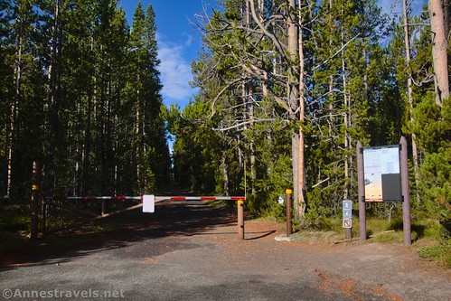
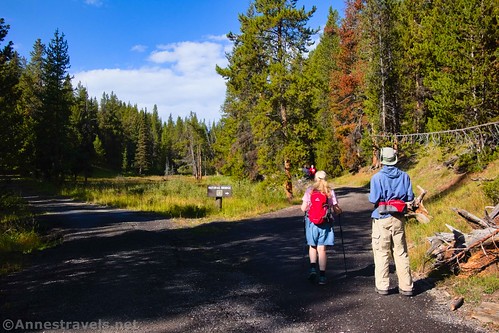
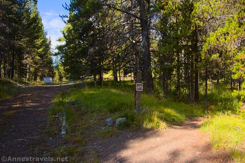
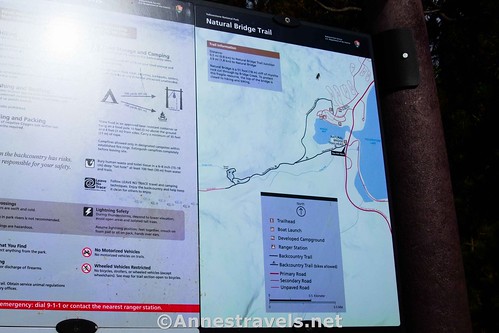
But to begin from the bicycle trailhead, park in the tiny lot across the road from the exit of Gull Point Drive. A sign by the gate shows a map of the area. Walk around the gate and head up the old Natural Bridge Road.
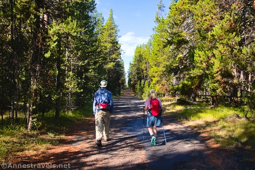
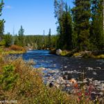
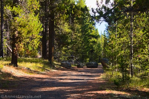
The hike up the road is a pleasant experience, though I expect it could be warm on a summer afternoon. There are no views, as the road travels through a fir forest. Pass the trail from the Bridge Bay Marina on the right at mile 0.5.
The next junction is at mile 0.9; this is the loop junction, but I recommend turning right. Turn right again at another junction 0.1 miles later – this turn will take you off of the road to an old (but still very readable) signboard after less than a tenth of a mile. (Note that bicycles must stay on the old road.)
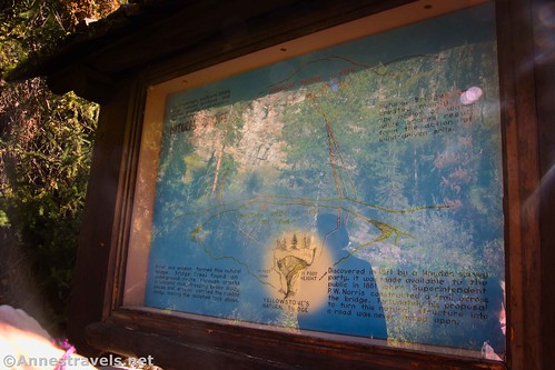
The signboard tells you about the Natural Bridge, a bit of its history, and shows an illustration of this bridge vs. Landscape Arch. Yes, the Natural Bridge is smaller!
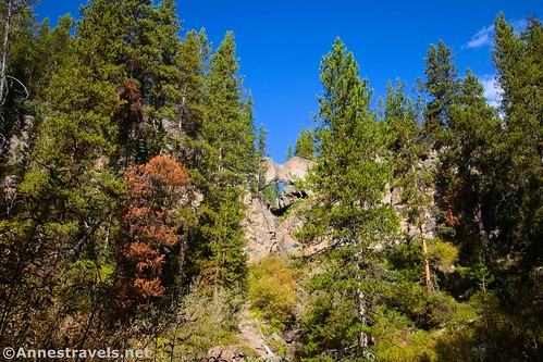
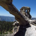
Walk another dozen paces to look up through the clearing on the left to see the Natural Bridge. Wow!
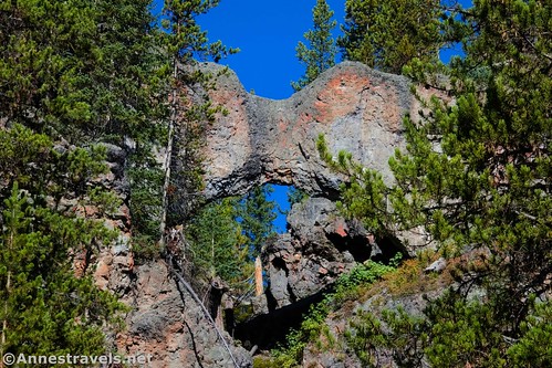
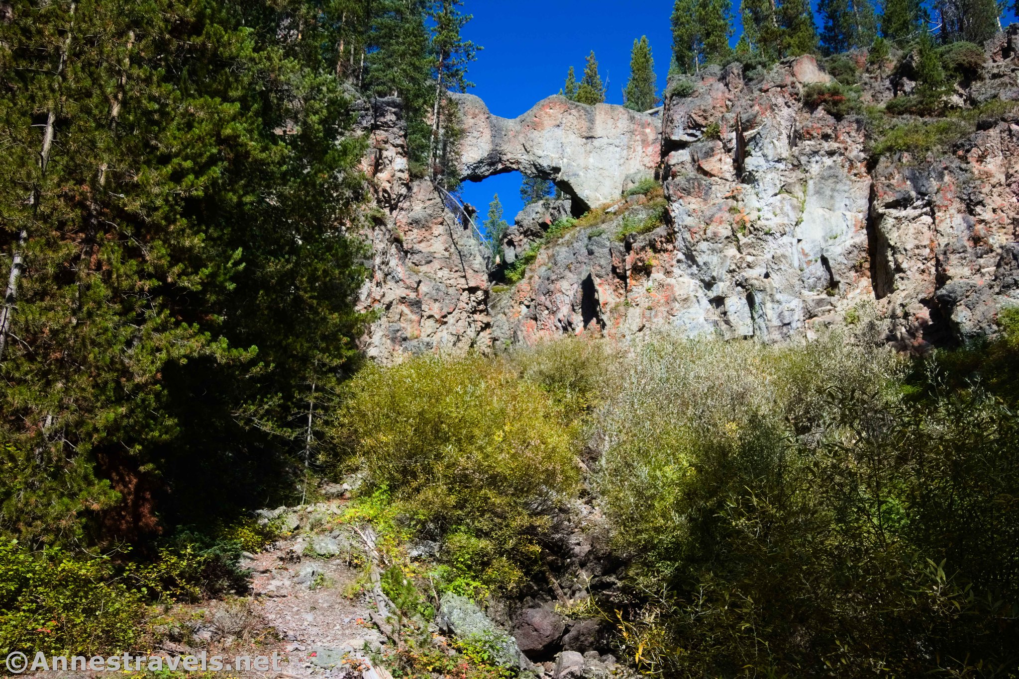
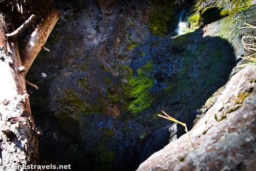
The trail at this point seems to disappear into brush and rocks – and if you’re in this for the stroll, don’t bother going any further. However, if you look carefully, you can pick up where it goes as it ascends the hillside. We scrambled up the trail to stand almost beneath the Natural Bridge, or more like it, along the waterfall that tumbles below the bridge. Views were very cool from here!

From there, we picked up the trail again to continue up the steep switchbacks. For a while, I thought we were on the wrong trail, since it seems to be heading away from the Natural Bridge. Don’t worry; it will get back to where you’re trying to be!
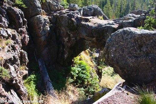
About a quarter mile later, the path crosses the stream just above the Natural Bridge. It’s fun to look through the Natural Bridge from above as well as get a different angle on it.
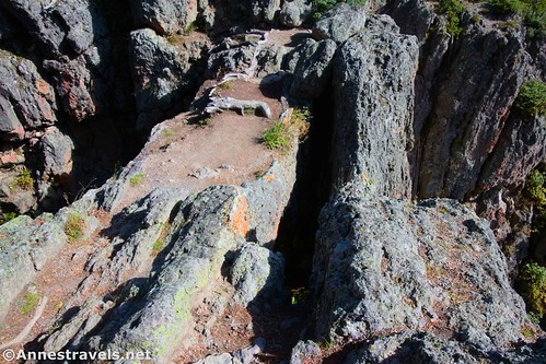
While there’s a well-beaten path out onto the bridge, it’s technically illegal to walk out on it. Not that there are any signs prohibiting it, so I don’t know how they expect you to know better. If it’s any comfort, one of the early superintendents of Yellowstone (the same Philetus W. Norris who built Queen’s Laundry) drew up plans to make a road across the top of the Natural Bridge. His plans were not acted upon (thankfully!), but he did build a trail to the site.

After crossing the stream, scramble up the hill and follow the trail through the woods. It will steeply descend back down to the old road. While the road goes in both directions, the pavement to the right is a service road, always closed to bicycles and often closed to hikers due to bear activity. So you’ll want to turn left, ignoring the crossover road on the left a short distance later, and then returning to the loop junction at mile 1.7. Turn right to retrace your steps to your vehicle (if you came from the marina, be sure to turn at the junction!)
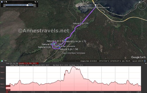
Round Trip Trail Length: From the bicycle trailhead, I went 2.6 miles. It would be about 3.2 miles from the Bridge Bay Marina.
Elevation Gain: 628ft. (7,774ft. to 7,955ft.)
Facilities: None at the bicycle trailhead; the marina trailhead has a marina store, complete with snacks and souvenirs.
Fees: $35/vehicle, valid 7 days, to enter Yellowstone National Park. America the Beautiful National Parks & Federal Lands Passes and Yellowstone Annual Passes are accepted.

Trail Notes: Bicycles are only allowed on the old road, not on the trail to and around the natural bridge. The road/trail is often closed, especially early in the season, due to bear activity in the area (the bears love the fish in the creek). If you don’t want to do the hike up to the Natural Bridge, you can still get a decent view of it from below – making the hike fairly level and easy.
Trail 
![]()
Road
Signs ![]()
Scenery ![]()
![]()
Would I go 100 miles out of my way for this? ![]()
![]()
Overall Rating: ![]()
GPS Coordinates for Yellowstone’s Natural Bridge
TH: 44.5305840°, -110.4362890° (44°31.83504′, -110°26.17734′ / 44°31’50.1024″, -110°26’10.6404″) (7,763ft.) (0.0)
Regular Trail Junction: 44.5278640°, -110.4453600° (44°31.67184′, -110°26.72160′ / 44°31’40.3104″, -110°26’43.2960″) (7,817ft.) (0.50)
Natural Bridge Loop Junction: 44.5260600°, -110.4524350° (44°31.56360′, -110°27.14610′ / 44°31’33.8160″, -110°27’08.7660″) (7,820ft.) (0.90)
Natural Bridge Loop Junction 2: 44.5257790°, -110.4549210° (44°31.54674′, -110°27.29526′ / 44°31’32.8044″, -110°27’17.7156″) (7,841ft.) (1.03)
Under the Natural Bridge: 44.5262700°, -110.4556160° (44°31.57620′, -110°27.33696′ / 44°31’34.5720″, -110°27’20.2176″) (7,898ft.) (1.14)
Top of the Natural Bridge: 44.5263370°, -110.4558630° (44°31.58022′, -110°27.35178′ / 44°31’34.8132″, -110°27’21.1068″) (7,935ft.) (1.35)
Trail Junction: 44.5251450°, -110.4548090° (44°31.50870′, -110°27.28854′ / 44°31’30.5220″, -110°27’17.3124″) (7,849ft.) (1.56)
Return to Loop Junction: 44.5259480°, -110.4524280° (44°31.55688′, -110°27.14568′ / 44°31’33.4128″, -110°27’08.7408″) (7,817ft.) (1.70)
End at TH: 44.5305530°, -110.4363910° (44°31.83318′, -110°26.18346′ / 44°31’49.9908″, -110°26’11.0076″) (7,763ft.) (2.60)
The gpx file for Yellowstone’s Natural Bridge can be downloaded – please note that this and the GPS Coordinates are for reference only and should not be used as a sole resource when hiking this trail.
Download GPX File size: 43.0 KB Downloaded 306 times
(Note: I do my best to ensure that all downloads, the webpage, etc. are virus-free and accurate; however, I cannot be held responsible for any damage that might result, including but not limited to loss of data, damages to hardware, harm to users, from use of files, information, etc. from this website. Thanks!)
Getting to Yellowstone’s Natural Bridge
Bicycle Trailhead
From West Thumb Junction, drive north on US-20 (the main road) toward Fishing Bridge. The parking area for the biking trailhead will be on the left 16.9 miles later, directly across the road from the exit to Gull Point Drive. This parking area is also on the right 3.7 miles south of the junction near Fishing Bridge.
Marina Trailhead (Traditional Trailhead)
From West Thumb Junction, drive north (toward Fishing Bridge) on the main park road (US-20). After 17.2 miles, turn left following signs for Bridge Bay Area and the trailhead for the Natural Bridge. Drive 0.2 miles; turn left into the parking area for the Bridge Bay Marina Store and the trailhead for the Natural Bridge.
From the junction near Fishing Bridge, drive south (toward West Thumb) on the main road. After 3.4 miles, turn right, following signs for the Bridge Bay Marina Area and the Natural Bridge Trailhead. Drive 0.2 miles; turn left into the parking area for the Bridge Bay Marina Store and the trailhead for the Natural Bridge.
Today’s Featured Product
Explore some of the best shorter, easier hikes in Yellowstone National Park with this guide! It covers over 30 paths to geysers, viewpoints, waterfalls, and more. Buy your copy here!