Sandstone Falls is one of the premier attractions in New River Gorge National Park. However, it’s not near most of the rest of the main attractions in the park: I drove a good hour (it felt like more) from the Grandview area and it’s further yet from Fayetteville (New River Gorge Bridge). However, if you’re not in a hurry and you want an easy hike and/or some scrambling opportunities (to really see the falls, it takes some work), Sandstone Falls is a good destination.
Quick Stats

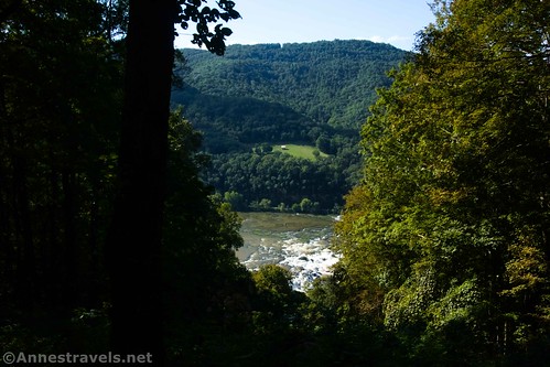
The first thing of note is that the Sandstone Falls Overlook is not Sandstone Falls – far from it. The overlook (which is much closer to the highway and much easier to access) is high on the mountainside. Through the trees, you can peer down at what look like rapids in the New River.
But if you’re keen on seeing it all, park in the pulloff and walk down the short (250ft.), paved trail to the viewpoint. It’s not exciting. But it does give you an idea of what the falls look like from above.
For a better view, continue down the road another 1.8 miles to Brooks Island Overlook. Again, it’s little more than a pulloff, but this one has a payoff. You can see the New River winding between the green hills and a few cottages, etc., without ever leaving your vehicle!
But to really see Sandstone Falls, you’ll have to continue down through the (quite quaint) town of Hinton, across the bridge, and then back up the river to the Sandstone Falls Boardwalk. This is what takes so much time – 8 miles of twisty, winding roads downriver to a bridge and then another 8 miles back again.
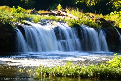
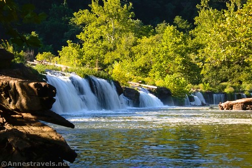
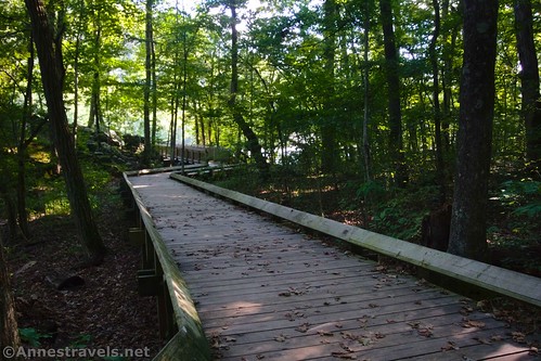
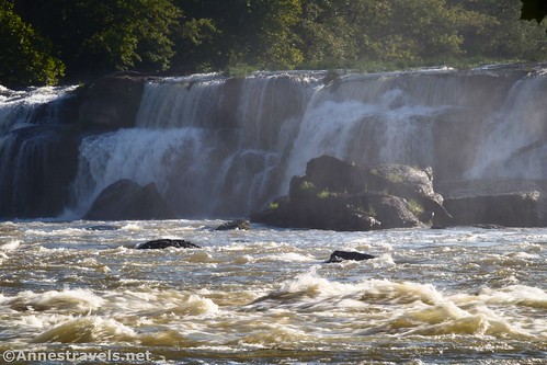
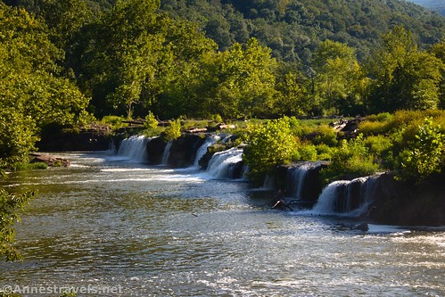
Once you finally arrive, it’s pretty obvious where to start. From the beginning of the boardwalk, it’s an easy stroll over to the Lower Falls Overlook. Sadly, this is one of the best views you’ll see. I say “sadly” because you can’t see much. The Lower Falls isn’t much more than 10ft. high. But it’s a lovely setting, with greenery growing between the various channels of water – so what it lacks in the spectacular factor it makes up for in general prettiness.
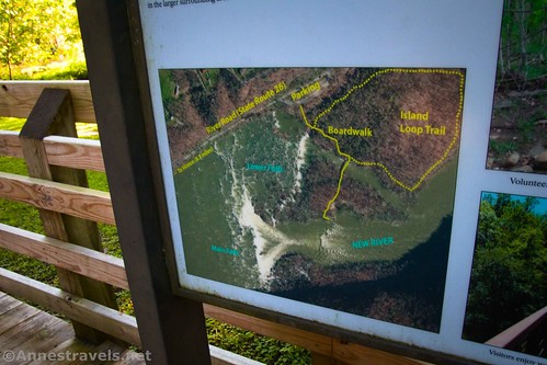
A few feet beyond the Lower Falls Viewpoint, the dirt Island Trail strikes off on the left. Ignore it for now and turn right along with the boardwalk to pass the Island Trail again and cross a large bridge. Beyond the bridge, two sets of steps go off (first on the left and second on the right) the boardwalk. We’ll come back to these in a minute.
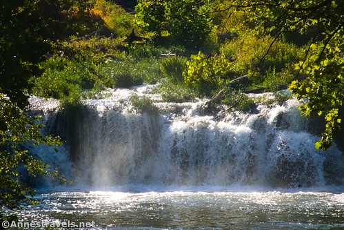
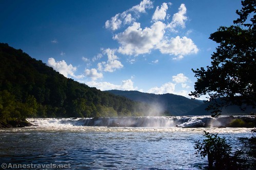
Keep following the boardwalk out to the Upper Falls Viewpoint. The falls are distant enough from here that they’re not terribly impressive, even though they’re up to 25ft. high.
I decided I’d been ripped off (or at least that there were better views to be found), so I went back to the second of the two stairways (first if coming back from the Upper Falls Viewpoint) and dropped down to ground level. From there, I followed social paths, rocky drainage channels, and boulder scrambles generally west and toward the Upper Falls. I was rewarded with views of the Lower Falls along the way.
There were also some nice wildflowers.
I rock-hopped (and avoided a little poison ivy – nothing too terrible) and enjoyed the falls until I came to a place where I would have had to wade across a small stream. I decided wet feet weren’t in my set of goals for the day and worked my way over to where I could get a pretty decent view of the Upper Falls – or at least, it was a lot closer than the overlook on the boardwalk.
If you’re visiting Sandstone Falls for more than a stroll, and if you’re in reasonable physical fitness, I highly recommend trying to get further west, off of the official trail. There are so many beautiful things to see. It’s pretty wild back in there, but you won’t be the only person doing it. Just watch your feet, as the ground isn’t necessarily stable, and current river levels will impact exactly where it’s safe and dry to step.
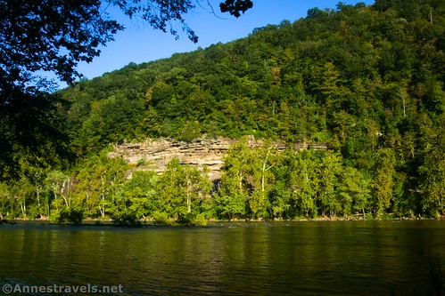
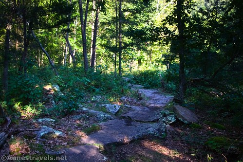
I decided to return via the Island Trail. So, I went back and turned off the boardwalk, following the signs. The Island Trail isn’t all that exciting, but it is much quieter than the boardwalks (which can be rather busy). You also get some nice views across the New River until the trail turns north (inland).
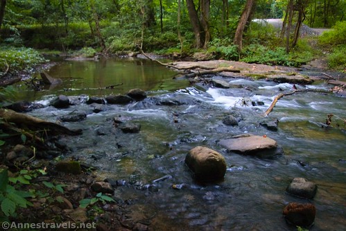
In this portion, it’s just a quiet forest walk. Coming back up along a little stream, you can see the parking area just across the creek that makes the ground you are walking on into an island.
The entirety of the Island Trail is about 0.75 miles. Turn right back toward the parking area, and you have yourself most of what Sandstone Falls has to offer!
Round Trip Trail Length: About 0.5 miles just on the boardwalks. The Island Trail is 0.75 miles. With exploring, I went a total of 1.6 miles.
Elevation Gain: Per my GPS, the boardwalk is about 44ft. elevation gain. I’d say it’s less than that. Total elevation gain per my GPS was 97ft. (1,298ft. to 1,277ft.). Again, I’d say that’s a high estimate.
Facilities: Restrooms and a few picnic tables in the parking area; benches along the boardwalk.
Fees: None
Trail Notes: The boardwalk is wheelchair accessible. The Island Trail is easy enough to follow, but it’s definitely a hiking trail. The best views are from scrambling around to the west (upstream) of the Upper Falls Overlook. While no signs prohibit swimming (and it’s a popular swimming hole), wading and swimming in this section of the New River are discouraged due to dangerous currents.
Trail 


Road 


Signs 


Scenery 


Would I go 100 miles out of my way for this? 


Overall Rating: 


Sandstone Falls Overlook GPS Coordinates
Trailhead: 37.752663,-80.903822 (37°45.15978′, -080°54.22932′ / 37°45’09.5868″, -080°54’13.7592″) (1,902ft.) (0.0)
End: 37.752618,-80.903768 (37°45.15708′, -080°54.22608′ / 37°45’09.4248″, -080°54’13.5648″) (1,909ft.) (490ft.)
Sandstone Falls Boardwalk GPS Coordinates
Trailhead: 37.759198,-80.905132 (37°45.55188′, -080°54.30792′ / 37°45’33.1128″, -080°54’18.4752″) (1,294ft.) (0.0)
Lower Falls Viewpoint: 37.758739,-80.904800 (37°45.52434′, -080°54.28800′ / 37°45’31.4604″, -080°54’17.2800″) (1,292ft.) (166ft.)
Island Trail Junction: 37.758274,-80.903786 (37°45.49644′, -080°54.22716′ / 37°45’29.7864″, -080°54’13.6296″) (1,289ft.) (0.13)
Stairs down: 37.757206,-80.904178 (37°45.43236′, -080°54.25068′ / 37°45’25.9416″, -080°54’15.0408″) (1,282ft.) (0.21)
Stairs down: 37.757082,-80.904492 (37°45.42492′, -080°54.26952′ / 37°45’25.4952″, -080°54’16.1712″) (1,283ft.) (0.27)
Upper Falls Viewpoint: 37.756892,-80.904414 (37°45.41352′, -080°54.26484′ / 37°45’24.8112″, -080°54’15.8904″) (1,277ft.) (0.31)
Island Junction: 37.758265,-80.903765 (37°45.49590′, -080°54.22590′ / 37°45’29.7540″, -080°54’13.5540″) (1,289ft.) (0.87)
End of Island Trail: 37.758749,-80.904762 (37°45.52494′, -080°54.28572′ / 37°45’31.4964″, -080°54’17.1432″) (1,293ft.) (1.54)
End: 37.759174,-80.905161 (37°45.55044′, -080°54.30966′ / 37°45’33.0264″, -080°54’18.5796″) (1,293ft.) (1.58)
The gpx file for my adventures around Sandstone Falls can be downloaded – please note that this and the GPS Coordinates are for reference only and should not be used as a sole resource when hiking this trail.
Download GPX File size: [ddownload_size id=”874814″] Downloaded 145 times
(Note: I do my best to ensure that all downloads, the webpage, etc. are virus-free and accurate; however, I cannot be held responsible for any damage that might result, including but not limited to loss of data, damages to hardware, harm to users, from use of files, information, etc. from this website. Thanks!)
Getting to Sandstone Falls
From I-64, take Exit-139 toward Sandstone and Hinton. At the bottom of the exit ramp, turn left (south) toward Hinton (don’t turn right following the sign for the New River Gorge Visitor Center – unless you want to visit the visitor center; it’s on the right not far from the junction). Sandstone Falls Overlook will be on the right after 2.8 miles. Stop here if you want to and then continue another 1.8 miles down to the Brooks Island Overlook. Continue 5.7 miles into the town of Hinton. When the road pretty much dead ends, turn left onto 2nd Avenue and then take the second right onto WV-20 S aka Temple Street. Cross the Hinton Bridge over the New River and take an immediate right to New River Road. The falls are on the right after 8.3 miles.
This Week’s Featured Product!
Explore nearly 115 trails in New River Gorge with this brand-new guide! It covers many popular and lesser-known hiking and biking trails, with history and other helpful and interesting tidbits thrown in for good measure. Buy your copy here!


