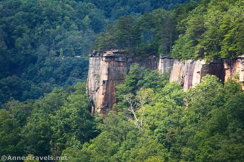
The Endless Wall Trail is the premier hike in New River Gorge National Park. I personally didn’t find it to be the most scenic trail (that award goes to Long Point), but it does have several advantages: It’s near the visitor center, it’s a loop, and it has several viewpoints (instead of just one). It also has very limited views of New River Gorge Bridge (take that as a positive or a negative) and great views of nearby cliffs (the “Endless Wall”) since the path travels on the rim of the wall of rock.
Quick Stats
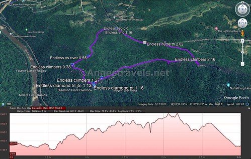
The Endless Wall Trail is a semi-loop – as in it goes between two parking areas. You’re welcome to hike along the road half a mile back to your original trailhead (there are signs, etc., as well as a gravel pathway beside the narrow road) or you can do it as a shuttle.

It doesn’t really matter which trailhead you start at. I began my hike at the Endless Wall Trailhead (closer to the visitor center – it’s also called the Fern Trailhead), but the Nuttall Trailhead is better for larger vehicles (I had trouble with my Ford E150, though a pickup of similar size squeezed in next to me). It also doesn’t matter which direction you hike the loop, but I’ll describe it as though you started at the Endless Wall Trailhead and hiked counter-clockwise.
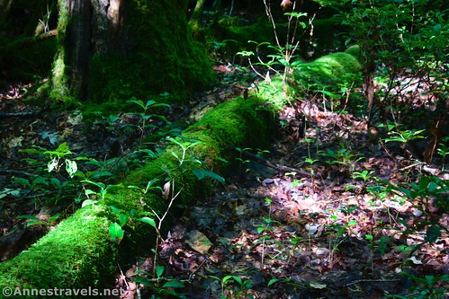
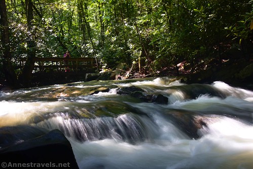
From the Endless Wall Trailhead, the trail immediately enters the trees. It’s a lush forest, made lusher by torrential rains the night before. The path works its way through mossy pines and rhododendrons to cross a small stream (Fern Creek) after 0.5 miles. There is a bridge. The stream was especially full due to the rain.
A Climber’s Trail goes off on the right a quarter mile later, but the real excitement begins 0.3 miles after this at the junction: The spur trail (on the right) that will take you out to Diamond Point. Turn right here.
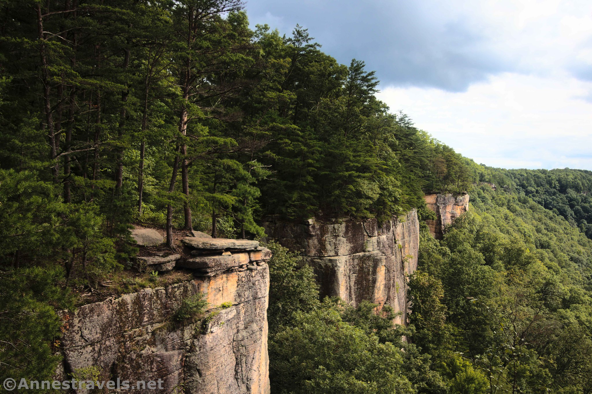
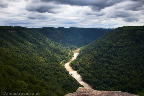
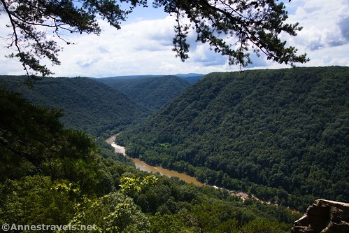
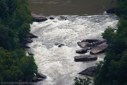
Diamond Point is rightly considered the gem of the Endless Wall Trail. Because it sticks so far out into the canyon, you can see the cliffs of the Endless Wall as well as a good distance upcanyon. Views downcanyon are somewhat limited by another outcrop of rock (that looks like it has a large nose IMO).
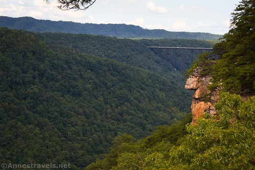
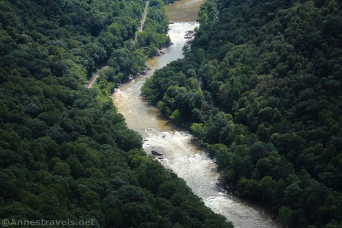
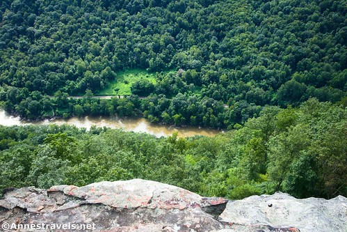
You can also see Grayhound Rapids down on the New River. Use care as you wander around to see the various views, as there are no guardrails.
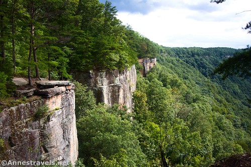
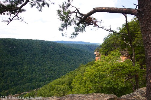
Back on the main trail, another climber’s trail goes off on the right about a tenth of a mile later. A third climber’s trail is 0.9 miles beyond this – the third one was my favorite, as there are places where you can stand right next to the edge and look down, down, down. Also, it has some good views through the trees to the gorge and gives a very different perspective than Diamond Point.
After this, the trail (which has been working its way along the top of the Endless Wall) swings left-ish to make its way back toward the road. We passed a small stream (a branch of Fern Creek) before arriving at the Nutall Trailhead, 2.6 miles from the Endless Wall Trailhead.
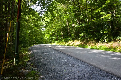
From here, I turned left on the road. The Nuttall Trailhead is much larger and with fewer tight curves, so I’d recommend it if you have a vehicle like a pickup truck, van, or RV. The road walk is pleasant enough if you realize that it is, indeed, a road walk. There isn’t much of a shoulder, but the NPS has put down a gravel “sidewalk” that makes it much safer than if you were trying to walk on the road, itself.
I returned to the Endless Wall Trailhead at almost mile 3.2. It was still mostly full, so I was glad to be able to pull out and give others a chance to park!
Round Trip Trail Length: I went 3.2 miles – you can cut off 0.5 miles with a shuttle vehicle.
Elevation Gain: 684ft. (1,746ft. to 1,965ft.) (I expect that the gain isn’t quite that much… I got too close to the edge at one point (or more), and that made an extra low dip as the GPS thought I’d just stepped over a cliff.)
Facilities: Primitive restroom at the Endless Wall Trailhead
Fees: None

Trail Notes: It looks like the parking areas were ample enough until the area became a national park – and like many areas of the park, these aren’t made for the increased traffic. Please be mindful of others and of “no parking” signs as you try to find a parking space. The Nuttall Trailhead is less popular and has more parking spaces, so that may be your best bet. The Endless Wall Trailhead is sometimes called the “Fern Trailhead.”
Trail 
![]()
![]()
Road ![]()
Signs
Scenery ![]()
![]()
Would I go 100 miles out of my way for this? ![]()
![]()
Overall Rating: 
![]()
GPS Coordinates for the Endless Wall Trail
Endless Wall (Fern) Trailhead: 38.0630730°, -081.0568370° (38°03.78438′, -081°03.41022′ / 38°03’47.0628″, -081°03’24.6132″) (1,771ft.) (0.0)
Cross stream: 38.0579340°, -081.0609270° (38°03.47604′, -081°03.65562′ / 38°03’28.5624″, -081°03’39.3372″) (1,750ft.) (0.55)
Climbers Trail: 38.0563900°, -081.0629060° (38°03.38340′, -081°03.77436′ / 38°03’23.0040″, -081°03’46.4616″) (1,826ft.) (0.78)

Diamond Viewpoint Junction: 38.0537270°, -081.0595550° (38°03.22362′, -081°03.57330′ / 38°03’13.4172″, -081°03’34.3980″) (1,876ft.) (1.13)
Diamond Point: 38.0533250°, -081.0594420° (38°03.19950′, -081°03.56652′ / 38°03’11.9700″, -081°03’33.9912″) (1,811ft.) (1.16)
Climbers Trail: 38.0544670°, -081.0585440° (38°03.26802′, -081°03.51264′ / 38°03’16.0812″, -081°03’30.7584″) (1,854ft.) (1.27)
Climbers Trail: 38.0568370°, -081.0452460° (38°03.41022′, -081°02.71476′ / 38°03’24.6132″, -081°02’42.8856″) (1,961ft.) (2.16)
Nuttal Trailhead: 38.0596080°, -081.0490550° (38°03.57648′, -081°02.94330′ / 38°03’34.5888″, -081°02’56.5980″) (1,886ft.) (2.62)
End: 38.0629120°, -081.0563610° (38°03.77472′, -081°03.38166′ / 38°03’46.4832″, -081°03’22.8996″) (1,766ft.) (3.16)
The gpx file for Endless Wall Trail can be downloaded – please note that this and the GPS Coordinates are for reference only and should not be used as a sole resource when hiking this trail.
Download GPX File size: 47.5 KB Downloaded 349 times
(Note: I do my best to ensure that all downloads, the webpage, etc. are virus-free and accurate; however, I cannot be held responsible for any damage that might result, including but not limited to loss of data, damages to hardware, harm to users, from use of files, information, etc. from this website. Thanks!)

Getting to the Endless Wall Trail
From the New River Gorge Visitor Center, turn left to drive back out to the main highway. Turn right for 0.3 miles, then take the first right onto Lansing-Edmond Road (signs on the highway mark that this junction is coming). Drive for 1.3 miles to the Endless Wall Trailhead on the right. Or continue 0.5 miles (a total of 1.8 miles) to the Nuttall Trailhead, also on the right.
Would you like more hikes in New River Gorge?
Explore some of the best New River Gorge has to offer with these 20 trails. You’ll find great views, creeks, waterfalls, and more within its pages. Buy your copy here!